Tuesday, September 3—Another Blessed Day

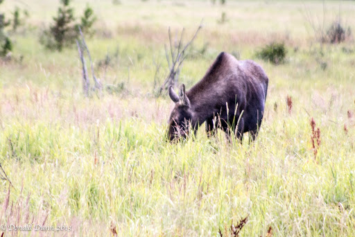
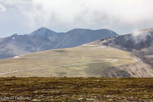
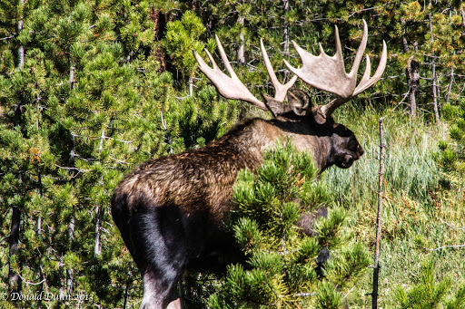
We set aside today to give John and Sandy a road tour of Rocky Mountain National Park, and provide the “girls” some shopping time in Estes Park. The charmed life John and Sandy lead continued today, at least as far as animal sightings go. Just after entering the park, we saw a cow and calf moose adjacent to the road, and then crossing the road right in front of us. A big bull appeared out of nowhere and followed them across the road. Regrettably for us, a truck pulling a fifth wheel AND a boat stopped beside us on Trail Ridge Road, completely blocking our view. At least we saw the tail end of the bull. We stopped at Fairview Curve, Milner Pass, Gore Range, and Forest Canyon Overlooks along the way, marveling at the majestic mountains, deep valleys, and distant hanging lakes left by glaciers. Estes Park seemed a much different town than Sunday, with most of the traffic gone. John and I dropped Sandy and Kay off in Estes Park for some girl time, and we drove the Old Fall River Road, the original road over Rocky Mountain National Park. The Fall River Road was the first road to cross the Rocky Mountains in northern Colorado. Started by Larimer and Grant counties in 1913 before the establishment of Rocky Mountain National Park, the early construction was carried out by state prison inmates. The convicts made little progress and contractors completed the road in 1920. The unpaved mountain road climbed from Horseshoe Park on the east side up the steep Fall River Valley over a series of tight switchbacks to reach Fall River Pass at 11,796 feet; from there, the road continued down the west side of the mountains to Grand Lake. Despite the popularity of the route, the road proved difficult to traverse and maintain. Automobiles had trouble mastering the steep grade and tight curves and avalanches often buried the road forty feet deep. Following the completion of Trail Ridge Road in 1932, the eastern half of Fall River Road became a one-way scenic drive (Old Fall River Road) from Endovalley near Estes Park up to Fall River Pass; the western half was abandoned or overbuilt by the Trail Ridge Road. The road climbed to Fall River Pass on steep grades sometimes reaching 16%. Some early automobiles had to climb in reverse due to their weak engines and gravity-fed fuel system. Motorists had to negotiate sixteen switch-backs with radii as tight as 20 feet. Some vehicles had to turn back and forth repeatedly to make the curves. The road width rarely exceeded 14 feet, too narrow for cars to pass safely. Passing turnouts were provided, but these were few and far between. The roadway was largely built out from the hillside. In the steepest places, multiple switch-backs were stacked one above the other. Few pullouts were provided to allow motorist to stop; some were located on switch-backs, making the curves even more difficult. We found that little has changed; it was one of the most exhilarating drivers I’ve ever made.
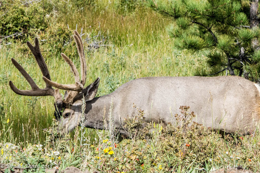
Our one-way drive ended at Alpine Visitors Center; we drove Trail Ridge Road back to Estes Park, met Sandy and Kay, and had lunch at a locally recommended restaurant. The food was okay, even good, but not great. Shortly after leaving Estes Park and entering the east side of Rocky Mountain National Park, we saw a large mule deer buck, still in velvet, nibbling grass alongside a side road. We turned onto the side road and had great close-up views—charmed life!
The ride back up and down Trail Ridge Road to Granby was anticlimactic, despite seeing a bull moose at a distance in Grand Lake.

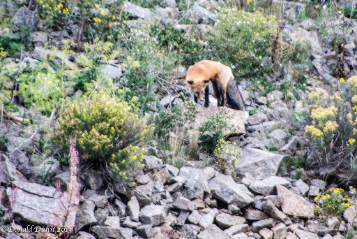
After our WOW day, we ate Rotel cheese dip and Fritos, and called it a night. Oh, by the way, the girls saw the parking lot fox this evening.
Monday, September 2—Our Friends Arrive

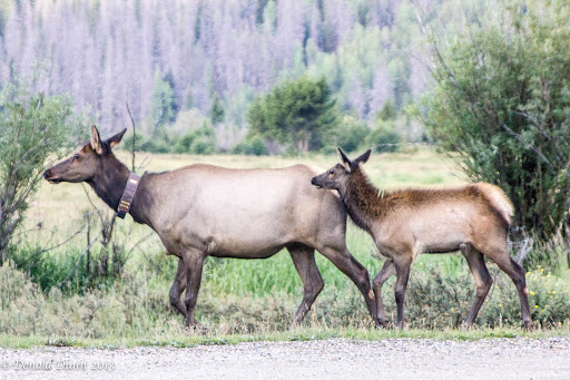
Up early, Kay and I drove into RMNP for a couple short hikes and possible wildlife viewing. Along the way, we saw our first large group of pronghorns near Grand Lake; the absence of seeing these abundant animals on this trip has surprised us and this is only the second group we’ve seen. We drove along Trail Ridge Road hoping to see wildlife, and spotted a cow and calf elk near the Holzwarth Historic Site, and pulled into the parking lot for a better view. They came really close to us, but a truck pulling a flatbed trailer turned around in the parking lot, and the loud banging of the trailer scared them away.

The first hike of the morning was on the flat Coyote Valley Trail. This one mile hike (walk) took us along the edge of a large meadow known as a gathering place for large numbers of elk, but not today. The trail followed the Colorado River, small, shallow, and meandering at this point. There were more birds here along the river than anywhere we’ve been this summer, except at home. And, we saw several species of butterflies and moths.  We really enjoyed this “sunrise” hike, even if it was an hour after sunrise. The second hike was to Adams Falls near Grand Lake, about 2/3 mile round trip. Lots of folks were hiking this trail. The falls appeared pretty innocuous, until one viewed the narrow canyon formed downstream; the erosive action of the water had eaten back into the rock at least a couple of hundred feet. Near the parking lot we met a couple from Massachusetts, and struck up a conversation with them. They had just completed a Roadscholar (formerly Elderhostel) course, and had taken many in the past. We shared our experience with Elderhostel; and after our conversation with them, want to pursue another one.

Our friends, John and Sandy, arrived about 11:00 AM and we immediately started planning the week’s activities. Granby Ranch has 3 miles of private water on the Fraser River, and we called about making reservations. Apparently, there are 5 beats (sections of the river) and when you reserve/contract for that reach you have exclusive fishing rights; we will try to schedule it for Wednesday. After a brief rest, we drove to Grand Lake for ladies “shopping” time while John and I sat on a bench watching people. We ate a great, late lunch at The Rapids Inn, outside on the banks of the Tonahutu River, at the North Inlet of Grand Lake, the headwaters of the Colorado River.

The four of us drove to RMNP and immediately saw a cow moose near the same location as the previous two days. We also saw a few elk along the road before beginning our ascent on the Trail Ridge Road. We stopped at a couple of overlooks on the way to the Alpine Visitors Center; there, we saw large bull elk and his harem in the glacial valley below, and a yellow-bellied marmot sunning itself on a nearby boulder.

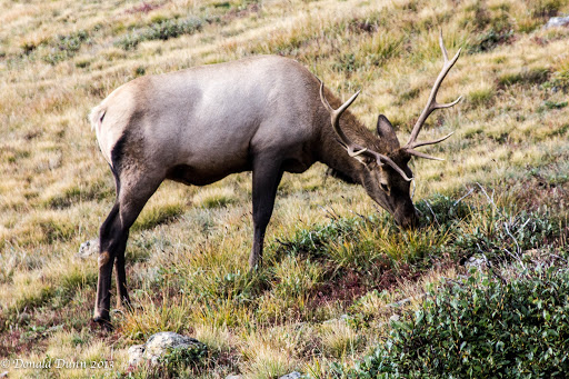
We turned around at the Visitors Center, and beginning the descent, saw a large bull elk and small harem right along the road, and a smaller bull was grazing with the herd. We continued to see more elk as we descended, including a solo bull near the west entrance, and we heard him bugle! John and Sandy must lead a charmed life to see all these animals on their first half day.

After the long afternoon, we enjoyed a nice quiet evening.

Sunday, September 1—Rocky Mountain National Park

In the late 1970s and early 1980s, I visited Rocky Mountain National Park often, and became fascinated by the large numbers of elk, mule deer, and the occasional bighorn sheep. This is where my love for photographing natural landscapes and wild animals began.  A lot has changed since then…

Consequently, our day today was planned to include driving the Trail Ridge Road in Rocky Mountain National Park all the way to Estes Park, stopping at all the overlooks to view the breathtaking mountain scenery, and, of course, looking for wild animals. Fairview Curve, Milner Pass, and Fall River Pass Overlooks all provided vistas of the mountains, glacial valleys, and hanging lakes.

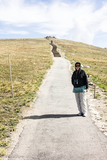
At the Alpine Visitors Center, we climbed several hundred stairs and walked a steep trail to the crest. Back down at the Visitors Center, we saw another bull elk and his harem in a high valley just below the Visitors Center. As we neared the east gate, traffic became noticeably heavier, and Estes Park was bumper to bumper with Labor Day weekend traffic; we stopped only long enough to buy a sandwich, and began our return back up the mountains. At Rock Cut Overlook we climbed the half mile Tundra Communities Trail to a high promontory where we again saw a bull elk and harem in a high valley, several ptarmigan, and a couple yellow-bellied marmots. On the descent on the west side, we saw the cow moose again, and stopped for a few photographs.

With a couple of hours of daylight left, we drove to Tabernash, Fraser, and Winter Park just south of Grandby so Kay would know a little bit about them and where they were located. Hungry from the short, but high breathtaking walks (literally, as they were near or above 12,000 feet), we stopped at the great City Market grocery store (affiliated with Kroger), and bought salads for dinner.

At the condo as we were eating dinner, we saw a large red fox in the parking lot just outside our window—a great way to end the evening.

Saturday, August 31—Moving Day

This morning ended our stay in Salida. We were successful in seeing much of south and west central Colorado, so it’s time to move on—to spend some time in Rocky Mountain National Park.

Looking to see different scenery, we drove north to Buena Vista, then to Fairplay (we fished near here just over ten years ago). And then the drive took us through Breckenridge, which is a great city, with lots going on. This area deserves a separate stay sometime in the future… We stopped at Silverthorne near Keystone and Dillon at an outlet mall, based on info from George, hoping to find some bargains at the Columbia store. The walk to the store was on a walking/bicycle trail along a beautiful stream, with several fly fishers plying their skills. The trail passed under Interstate 70, with outlet stores on both sides of the highway. Kay found a few things she could not live without, and we were on our way north to Granby.

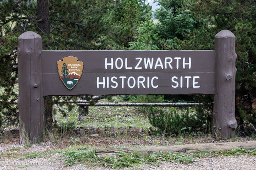
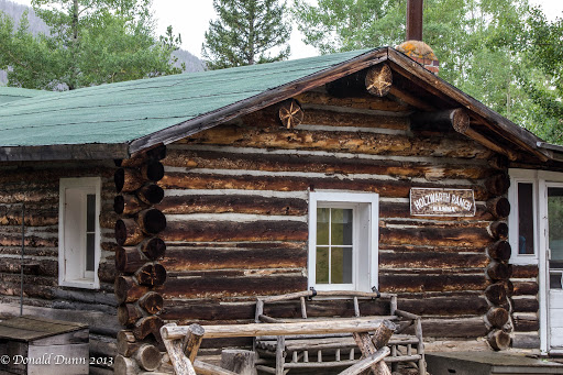
We arrived early, before check-in time, and continued north to historic Grand Lake, and found this small resort town crowded with Labor Day weekend tourists. From there, we drove into Rocky Mountain National Park, and knew an animal was nearby because of the traffic jam. As we got closer, we saw a cow moose grazing along a nearby stream; she was obviously the star of the hour. We parked at the Holzwarth Historic Site parking lot, and walked the half mile to the site (despite occasional lightning and thunder), hoping to see some elk. Now, more about the Holzwarth Historic Site.

The enactment of prohibition in Colorado in 1916 forced John Holzwarth, Sr., then a Denver saloonkeeper, to start over as a subsistence rancher in what is now the western portion of Rocky Mountain National Park. His new homestead was established in 1917. The ranch never materialized but with the completion of the Fall River Road over the Continental Divide in 1920, he joined other valley residents in serving the increasing numbers of mountain travelers. Thus the Holzwarth’s Trout Lodge was born. The Trout Lodge lasted for 10 years before the ranch was converted to a dude ranch that lasted for 4 decades. In 1973, John Holzwarth, Jr., sold the ranch and all the modern buildings were removed. The old buildings have been restored to 1920 status, and the tour led by National Park Service volunteers was well done.

Driving back to Granby to check-in to our condo, Kay saw two bull moose nibbling on Aspen limbs at the edge of Grand Lake—score two for Kay.

In Granby, and more specifically Granby Ranch, we checked-in at Mountainside Inn, drove the short distance to the condo, and unpacked. The condo, procured through Armed Forces Vacation Club, was a bit nicer than expected, with an open kitchen, dining, and living area, two bedrooms down, each with their own bathroom, and a loft with two double beds and a private bath; the master bedroom downstairs even had a large, 4-person hot tub! This is a nice condo.

We drove back to RMNP, and saw a bull elk with a small harem just past the entrance. No more animals showed themselves this evening.
Back in Granby, we stopped at a great grocery store to stock up and returned again to the condo. This wrapped up a full day for us.

– Posted using BlogPress from my iPad

Friday, August 30—Cottonwood Pass and Taylor Park Reservoir

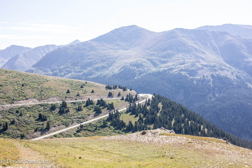
We cleared our schedule today in order to drive to Taylor Park Reservoir. We drove north to Buena Vista, turning west on Chaffee County Road 306. This paved road took us to the summit of Cottonwood Pass, at elevation 12,126 feet, also the Continental Divide, marked at the “saddle point” of  the pass. The area surrounding the pass is mostly forest, with the San Isabel National Forest to the east and the Gunnison National Forest to the west. Near the summit, the road name changes to Gunnison County Road 209 as it continues to the west, becoming gravel as it descends to near Taylor Park Reservoir. The pass is closed seasonally due to heavy snowfall, typically from around October until sometime in May. When open, the pass is one of the few routes through the Sawatch Range accessible in a standard two-wheel drive passenger vehicle. Independence Pass, which we traversed yesterday, is another such seasonal route through this mountain range, while efforts are made to ensure that U.S. 50 at Monarch Pass, which we crossed Tuesday and Wednesday, remains open year-round for all vehicles, barring extreme weather conditions.

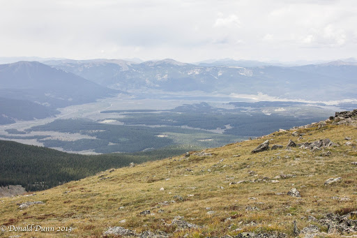
Wayne had told us about a campground, River’s End at Taylor Park Reservoir, and it exceeded his description; the reservoir is shown near the center of the photograph.  He had stayed at one of the great sites along the river, and the upper campsites overlooking both the river and the reservoir were incredible, especially when the cost is $0; wow! It would be a great place to spend the hot months of summer. One negative, however, is that we could not get a Verizon cell signal. While driving around the area, we noticed a lot of ATVs creating lots of dust. Of course, this is Friday of Labor Day weekend. On our return, a drizzle began. The Cottonwood Pass road was bumper to bumper from east to west with cars and trucks pulling trailers loaded to the hilt with ATVs, RVs pulling trailers filled with ATVs, etc. Apparently, a nationally prominent ATV event was happening in the area. With the crowded conditions, we made a quick exit.

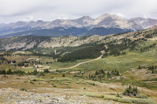
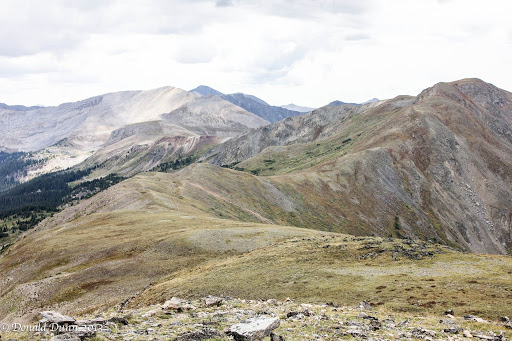
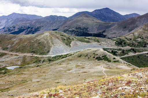
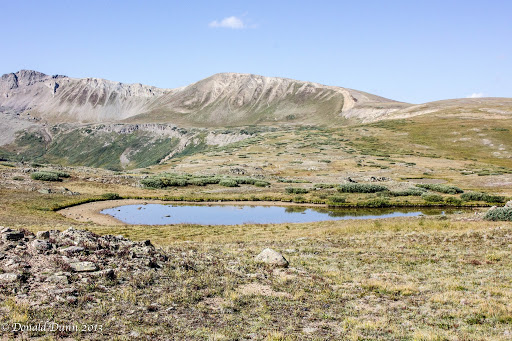
We stopped atop Cottonwood Pass on the return, and I hiked to the summit—Kay partway—of a nearby mountain, reaching almost 13,000 feet with occasional spitting rain mixed with the drizzle. The trail was marked by one switchback after another, and I had to stop often to catch my breath.  The next to last photo was taken atop the mountain, at almost 13,000 feet.  The last photo shows the switchback trail, and Kay near the bottom, is nearly invisible. The descent was much easier and faster.

We drove the rest of the way to Salida, expecting a quiet, peaceful evening. About 8 PM a family checked in across the hall with two pre-teen daughters and a small dog. The girls were in and out of the room every couple of minutes (no kidding), and talked loudly in the hall for the next couple of hours. A request, a rap on the door, and even a call to the front desk did not seem to deter them. We finally fell asleep amidst the noise only to be awakened by the dog about 12 o’clock midnight. Oh, what a night.
– Posted using BlogPress from my iPad

Thursday, August 29—The Maroon Bells

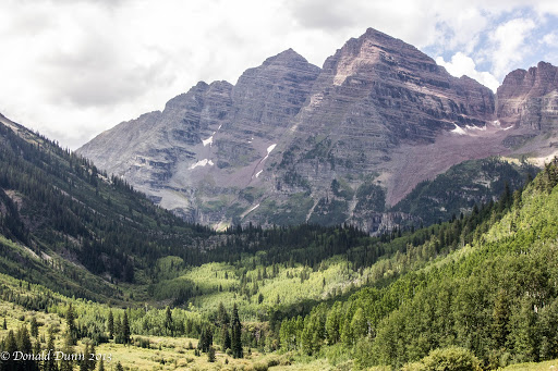
A decent weather forecast for today provided an opportunity to view the Maroon Bells and hike to Crater Lake, an awesome alpine lake where we can have lunch on the shoreline with the Bells in the background.

Our trip to Aspen took us over still another pass, Independence Pass. Independence Pass, at elevation 12,095 feet is on the Continental Divide in the Sawatch Range. The pass is midway between Aspen and Twin Lakes just west of Buena Vista. After Cottonwood Pass to the south, it is the second-highest pass with an improved road in the state, the fourth-highest paved road in the state, and the highest paved crossing of the Continental Divide in the U.S.

A scenic overlook near the pass allows visitors to take in the alpine tundra environment above treeline, and offers excellent views to the east of Mount Elbert, Colorado’s highest peak and the second-highest mountain in the lower 48 states. On the west side, the paved road is one way in several places, with rock overhangs above roadway. We made it up, over, and down without incident.

Vehicular, bicycle, and pedestrian traffic increased as we approached Aspen. Access to the Maroon Bells is now by $6 shuttle bus ride, except early and late in the day, because of the volume of “visitors” to the area. When I last visited, in the late 1970s, it was much less crowded. Anyway, the shuttle bus ran every thirty minutes, and we were unsure of the bus stop location; however, there was good signage, and we arrived, parked, bought tickets, and waited in queue just a short time. The bus filled to capacity with people and dogs–dogs on trails seem to be quite popular this year.

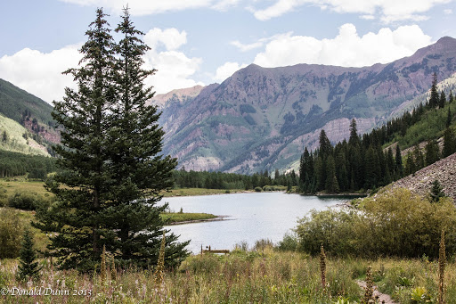
A narrated, sometimes funny bus ride ascended the valley, and dropped us off at Maroon Lake; there were people everywhere. We sought information from a National Forest Service volunteer who politely advised us to forego the hike to Crater Lake because of low water levels in the lane and poor trail conditions. She suggested we hike to the end of Maroon Lake, and then hike the loop trail to a small waterfall. It was an innocuous hike, but did provide some good views of the Maroon Bells.

We hiked along the lake edge looking for a place for lunch, and finally settled on a bench overlooking Maroon Lake and the Maroon Bells.

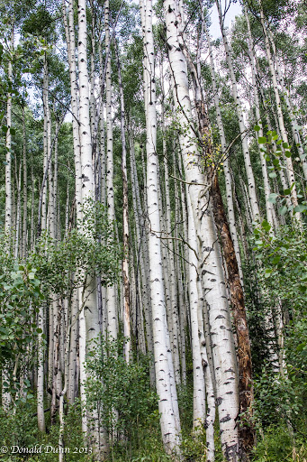
Rather than take the shuttle back down to Aspen, we opted to hike the 3.5 mile creekside trail, Maroon Creek Trail, partially down the valley, and catch the shuttle there for the remainder of the descent. Though downhill, the multi-use trail was more challenging than expected with misting rain and lots of horse manure to walk over, through, and around, making slick conditions even worse. We passed through and by several stands of aspen trees, gently “quaking” at the occasional puff of wind.

At the bus stop, we visited with other trail hikers waiting on the bus, including a family from Dallas, one from Waco, and a couple of young female models from New York. The quick bus ride ended near the parking lot, and we immediately began our drive back to Salida. Our intent had been to drive to Crested Butte, then over a couple of passes to Taylor Park Reservoir, and then back to Salida, but lack of time prohibited this route. Instead, we drove back over Independence Pass, and this time, Kay’s acrophobia got the best of her on a couple of occasions; but she just sat back, closed her eyes, and “enjoyed” the ride as best she could.

Finally down the mountain, we drove to Salida, and then to adjacent campgrounds—one private and one public—along the river that Wayne had suggested we investigate. Though there were some discernible differences, the major difference was price—the private campground was $30+ a night, the public campground was free!

Back in Salida, we saw the twin mule deer fawns again, munching grass next door to the motel.

An early, quiet evening ended the day.

– Posted using BlogPress from my iPad

Wednesday, August 28—Black Canyon of the Gunnison NP


Different town, different hotel, and different bed equals no sleep. Consequently, it was another early morning, enabling us to leave the hotel early.

We drove west, over Monarch Pass at elevation 11, 312 feet.  Monarch Pass is located on the Continental Divide at the southern end of the Sawatch Range, approximately 25 miles west of Salida, our home away from home for the next 4 nights.  The pass can be used by all vehicles under most conditions, with some 7% grades, and is generally open year-round.  It is widely considered one of the most scenic in Colorado, offering a panoramic view of the southern end of the Sawatch Range from the summit.

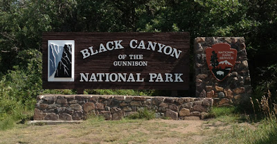
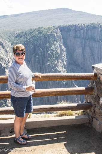
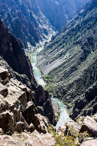
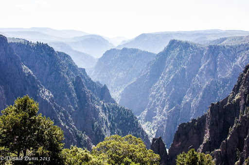
After descending Monarch Pass, we drove through the town of Gunnison, and continued west past  Blue Mesa Reservoir, a beautiful man-made reservoir. It reminded us of Lake Powell in Arizona, with sheer rock walls and beautiful blue water.  From there, we traveled further west to Black Canyon of the Gunnison National Park.  I last visited Black Canyon of the Gunnison NP in the late 1970s, and it was a very quick “take a picture and drive” type of visit. This trip was different—Kay and I hiked every trail to every overlook, totaling well over 3 miles, and at an elevation of 8,500 feet!  Regrettably, photographs, at least those I take, do not do it justice.

The area was established as a U.S. National Monument on March 2, 1933, and made into a National Park on October 21, 1999. The trails and overlooks, and all other infrastructure for that matter, were among the best of any national park or monument we’ve visited.

The Black Canyon is over 2,700 feet at its greatest depth; its narrowest width is 1,100 feet at the rim and only 40 feet at the river. While the canyon is 53 miles long, only 14 miles are within the national Park; the remainder lies under two impoundments, including Blue Mesa Reservoir mentioned above. Average descent over the entire length of canyon is 43 feet/mile, and the greatest decent is 240 feet/mile.

As we were leaving the park, we saw a mule deer doe eating along side the road, getting ready for fall and winter.

We were pooped and hungry after all the hiking, and drove to Montrose for a late lunch/early dinner. Montrose is a much larger city than what we expected, comparing with Jonesboro, Fayetteville, etc.

A long drive back to Salida, over Monarch Pass, got us to the hotel just before dark, where we were greeted by a couple of mule deer fawns munching nearby.

Tuesday, August 27—Great Sand Dunes and South Central Colorado

Changing time zones again—from Central to Eastern to Central to Mountain—we were up earlier than everyone else. Breakfast consisted of items from the food bar at the hotel in Pueblo, Colorado.


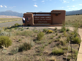
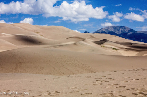
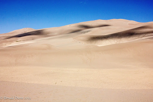
We drove south to Walsenburg, then west to Great Sand Dunes National Park. Yellow wildflowers covered each side of the road long the way, and made for a spectacular drive. The dunes looked so small from afar when compared to the mountains behind them. However, they loomed larger and larger as we drove closer. The Visitors Center was small, and provided the usual National Park Service information including a map and seasonal newspaper.


Leaving the car at the Dunes parking lot, we walked through powdery sand to the base of the dunes, took some photographs, and returned to the car rather than try to climb any of the dunes.

We continued driving west to South Fork, and began to notice evidence of the fires from earlier this summer. From South Fork we drove towards Creede, passing by the entrance of the 4UR Ranch, thinking of our good friends, Ed and Linda, who typically go there every summer.

Past Creede we saw a stopped vehicle along the road and immediately saw a moose cow and calf munching on low hanging leaves along the road.  Their eating was unaffected by us observers on the roadside.

From there we drove over two passes that exceeded 10,000 feet in elevation, before reaching Lake City. Driving north to Gunnison, and then east over Monarch Pass at 11,312 feet, we arrived in Salida about 6:30 PM. Finding a decent restaurant proved difficult, so we checked into the hotel, and drove a short distance to a local Mexican eatery recommended by the hotel owner.

The rest of the evening was spent recovering from the long day.

Monday, August 26—Finally, Colorado

This year we had an opportunity to include a fly and drive trip to Colorado, allowing us to do another life list item.  We left home about 8:30 AM, driving to North Little Rock, where friend Betty took us to the airport.


Our non-stop United Airlines flight departed on time and arrived in Denver about a half hour early. After picking up the checked baggage, we caught a shuttle to the Advantage Rental Car; after confirming the rental a few weeks ago, we read the most horrific reviews regarding Advantage we had ever seen. Consequently, we were very cautious when actually signing the agreement. And, true to the negative reviews, we found long lines and waiting times, the partially-English-speaking employees trying her best to upgrade us beyond what we had asked for, and would not take no for an answer. Nevertheless, we made it through the process relatively quickly, with no additions to our bill, checked car, and loaded our luggage.

There was extremely poor signage exiting the airport, and we wanted to avoid toll roads, as unbeknownst to us the rental agreement included a tremendous charge for electronic tolls. (We’re still not sure that we avoided toll roads, but will find out when we settle up our final bill.) As luck would have it, we began driving south about the same time rush-hour struck the Denver metro area. The combination of rush-hour and construction caused traffic to back up for about an hour between Denver and Colorado Springs. The drive from Colorado Springs to Pueblo was much less stressful, with very little traffic, Though construction activities played havoc with our drive.

We ate dinner at Cracker Barrel, a very reliable restaurant, during which friend Joey called regarding our recent Wisconsin and Michigan trip. Sometimes I underestimate the power of the written word, and have had several comments from people who read the blog who say that they can very easily tell when we like an area, or even dislike an area.  Such was the case for Wisconsin—while we did not particularly care for Copper Harbor, the UP, or Mackinaw City, we really liked Door County, Wisconsin, and Petoskey, Charlevoix, and the Traverse City areas of Michigan; we hope that doesn’t overly influence others who might want to visit those places.

After dinner, we checked into the hotel and called it a night.

Wednesday thru Sunday, August 21-25–TCBY

Home for only 5 days means taking care of business–the motorhome, the house, financial matters, and church–before we leave again.

Wednesday was spent washing and drying the motorhome after its recent 2,600-mile trip, completing unloading, preparing it for some idle time, and attempting a repair on the hood hinge. With higher temperatures than what’ve had experienced in several weeks, an early start during the coolness of morning was necessary. The wash job went quickly, particularly with both of us working. Kay took care of unloading her clothes and the remaining groceries in the pantry and refrigerator/freezer, and preparing the refrigerator/freezer for down time until we use it again. Tire covers were put on to prevent sun damage, but the hood hinge repair failed; Gorilla glue just wouldn’t hold. By the time all these were finished, we were hot and tired. We took advantage of the afternoon for some “personal care” activities and then back home in the chilled air, I worked on photos.

Thursday morning I drove into town to purchase 5-minute epoxy gel for use in another hood hinge repair; this is the adhesive recommended by Lichtsinn RV, the dealership in Forest City, Iowa, where we bought the motorhome. Kay and I spent a couple of hours on Norfork Lake, just floating and drifting alongside the pontoon. After returning home, we mixed the epoxy, applied it to the appropriate surfaces, and clamped the two braces–we’ll see. We used the evening catching up on missed, but saved television programs.

John Simank invited me for fishing the White River on Friday, which I eagerly accepted as I wanted to learn to fish high water. John is the best boat fisher with a fly rod I know, and today proved it again. With varying water discharges and levels, he caught fish when no one else was even getting a bite. I did not fare as well, catching only half a dozen fish. It was hot, and he had prepared a gourmet lunch (mainly for his out of town guests who were fishing with a guide). Friday evening, kay and I joined his guests and he and Sandy for a sumptuous dinner featuring shrimp and scallops smothered in a heavy cream sauce–um good!

We began packing in earnest Saturday morning for our upcoming 12-day trip to Colorado. With checked baggage costing an arm and a leg (actually $25 a bag) and limited to 50 pounds, we are packing conservatively, planning to wash clothes at least a couple times while traveling. But, with a lot of outdoor activities planned, it’s difficult. We took advantage of the warm weather and enjoyed a few hours back on Norfork Lake. The evening just disappeared…

Finally, we were back in church and Sunday school, if only for one Sunday before we leave again. It sure was good hearing Randy preach, and listening to the lively Sunday school lesson about John Wesley, facilitated by Dr. Paul Wilbur. Afterwards, we joined Al and Gaye for an early lunch at Chen’s, one of our favorites. Finishing packing became our priority for the rest of the day.

– Posted using BlogPress from my iPad