Thursday, August 27–Budapest, Hungary (Day 14)

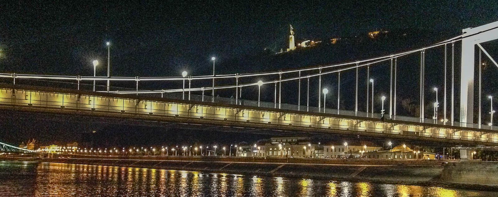
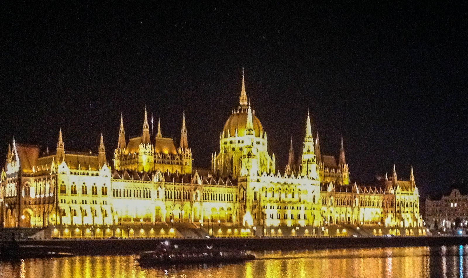
Budapest, as seen from the Viking Gefjon, as we entered the city last night.  It is perhaps the most beautiful night skyline in the world.

Hungary, with a population of almost 10 million people, lies in the heart of Europe, landlocked, and bordered by Austria, Slovakia, Romania, Serbia, Montenegro, Croatia, and Slovenia.  Its size and population were considerably diminished following WW I when it lost about 70% of its territory and half its population.  And again, as part of the defeated Axis powers in WW II, Hungary suffered significant damage, and became a part of the Communist Bloc as a consequence of defeat of Germany and the resulting treaty among the Allied powers.  According to our guide, the people of Hungary suffered significantly under the harshness of Communist rule which ended in 1989.
150827 E 001
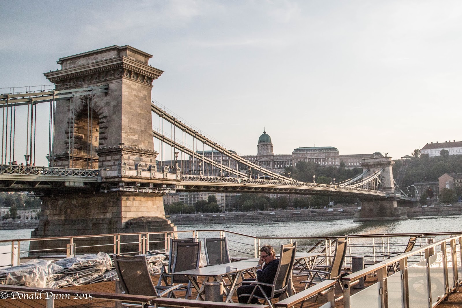
Budapest, pronounced Budapesht, derives its name from buda, meaning hills, and pest (pesht), meaning flatlands.  It has a population of over 1 million people. It’s architecture is of baroque, neoclassical, Art Nouveau, and communist style, the latter being very plain, colorless, and prefabricated.  Notable structures include the Chain Bridge, Hungarian Parliament Building, Buda Castle, and Matthias Church, to name but a few.  The view of the Danube riverfront and the Buda Castle District was named an UNESCO World Heritage Site in 1987.

150827 E 008
Typical of other large European cities, it is very cosmopolitan with a plethora of designer shops, book shops, art and music venues, and coffee shops and sidewalk cafes.  It is home to Dohany Synagogue, the largest in Europe.  Budapest also has some 80 thermal springs, and Turkish baths abound.  Budapest and Hungary are, by far, the least affluent city and country, respectively, that we have visited as wages are about 20% of surrounding countries.  As a consequence, and with now open borders, they are losing many of their young people to Middle and Western European cities.
150827 E 010
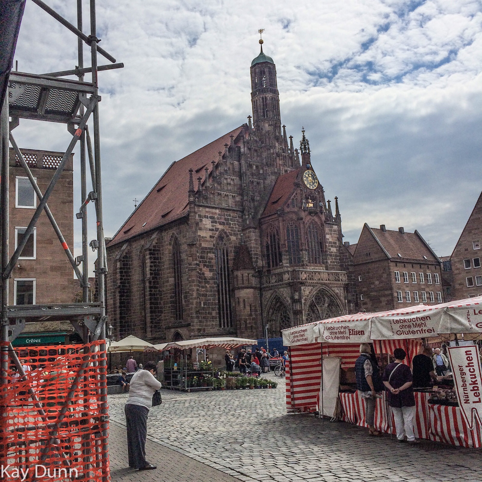
Our combination bus/walking tour took us to both Buda and Pest, through the historic Heroes’ Square, along Fishermen’s Hill to Fishermen’s Bastion, and to Matthias Church–too much and too much to do in the short span of 4 hours.
150827 E 002

150827 E 011

150827 E 005

150827 E 016

Wednesday, August 26—Bratislava, Slovakia (Day 13)

Today, we are in Slovakia, part of the former Czechoslovakia.  A communist state under the control of the Soviet Union, Czechoslovakia underwent a “Velvet Revolution” in 1989 with the fall of communism, and separated into the Slovakia and the Czech Republic in 1993.  Slovakia—bordered by Austria, Czech Republic, Hungary, Poland, and Ukraine—is a member of both NATO and the European Union, and its currency is the euro.  Surprisingly, Kia autos are manufactured in Slovakia as are other automobile brands.  As with most other European countries, school is mandatory until age 14, and then technical school or college (for those who qualify) is free.

150826 E 005

Bratislava is the capital of Slovakia.  It is a typical small European capital city, with a mix of rococo/baroque and contemporary architecture.  Our guide was quite open about her objection to the modern buildings and structures versus the opulent architecture of earlier times.  Our escorted bus/walking tour took us on streets occupied by foreign embassies (according to the Slovakian guide, the US ambassadorship is vacant until a new US president is elected), expensive residences, and the historic city center containing additional embassies. 

150826 E 014

150826 E 012

150826 E 007

150826 E 011

The Viking Gefjon continued sailing downstream on the Danube, through yet another extraordinarily scenic reach of the trip.  This stretch of the Danube yielded a landscape dotted with ruined castles, farms, villages, some vineyards, and a steep forested gorge, among the most scenic areas we have seen on the tour.

And then, after dinner, with darkness overtaking the skies, we sailed into a brightly lit Budapest riverfront about 11 pm, perhaps the prettiest capitol city in Europe.

Tuesday, August 25—Vienna, Austria (Day 12)

150825 E 017

Arriving in Vienna early this morning, the Viking Gefjon tied up along the waterfront, some distance from city center.  Vienna was at one time the seat of the Hapsburg Monarchy and the center of the Holy Roman Empire.  Today, it is home to about 1.5 million people, and has the appearance and feel of the world’s large cities like New York, with many high-end shops and stores.  It is considered one of the world’s greatest centers of art, music (Haydn, Mozart, Beethoven, Liszt, and Strauss) and architecture.  In fact the architecture was quite interesting—and controversial among Austrians—with buildings of rococo, baroque, gothic, and ultra modern style and design adjacent to each other.  Vienna is home to great coffee, pastry, and chocolate, and we did sample the apple strudel and sachertorte, a chocolate cake with apricot marmalade between layers, and both were good.

150825 E 023

There was too much to see and do in Vienna, so we chose a simple guided walking excursion that featured Schonbrunn, the luxurious summer palace of Empress Maria Theresa, yet another UNESCO World Heritage Site.  (Lipizzan stallions are also stabled here.)

150825 E 005

150825 E 004

150825 E 011

One could spend significant time in Vienna, as there are many historic sites and museums, including the Museum of Fine Arts, the Albertina Museum, and the Belvedere Museum. Vienna is also home to Wiener Riesenrad, the world’s oldest Ferris wheel and the tallest from 1920 to 1985.

Fortunately, we returned to the boat after the walking tour as Kay got extremely sick, probably from food poisoning.  A few hours of privacy and sleep, and she bounced back good as new.

150825 E 019

Monday, August 24—Emmersdorf and Krems, Austria (Day 11)

150824 E 025

The Viking Gefjon arrived early at Emmersdorf.  Emmersdorf is best known as the location of 900-year old Melk Abbey overlooking the Danube River Valley.  Melk Abbey dates to the 11th century when it was presented to the Benedictine monks who turned it into a fortified abbey.  Today’s abbey was built in the early 1700s in the baroque style to serve as a royal palace for Maria Theresa with ceremonial courts, guest apartments, grand halls, and a magnificent library containing around 80,000 medieval manuscripts.  Also, a 700-student school run by the monks still exists here.  Black-robed Benedictine monks still stroll amid the marble sculptures and frescoed walls, though we saw none.  While the interior was awesome, I thought the exterior was breathtaking.


150824 E 023

150824 E 006

We departed Emmersdorf at mid-afternoon, sailing downstream to Krems through what is known locally as “the Wachau”, a spectacular river valley surrounded by steep, forested mountains dotted by castles (including the one in which Richard the Lionhearted was held captive), vineyards, medieval villages, and occasional nude sunbathers.  The valley is, of course, a UNESCO World Heritage Site, and was perhaps the most scenic sailing of the trip.

150824 E 029

150824 E 033

150824 E 035

150824 E 037

Nothing was scheduled for Krems, though we caught a shuttle bus from the boat to the city center for a brief, unaccompanied walking tour.  Krems is another village along the Danube of medieval heritage with several cafes and shops in the small city center.  This was the least impressive stop on the Grand European Tour to date.

Sunday, August 23—Passau, Germany (Day 10)

After sailing downstream on the Danube River through the night, we stopped at Passau, a relatively small but historic city (population of 50,000) in southern Bavaria, and our last German city as it lies near Germany’s border with Austria.  Passau was an important medieval city for the salt trade.  The salt, “white gold” as it was called, was mined in the Alpine, and transported to Passau for processing.  The entrepreneurs became very wealthy and powerful.  The salt trade was lost in 1707 when all salt imports to Passau were forbidden.  Fires ravaged the city in the 17th century, but it was rebuilt to reflect the baroque character one sees when walking by the churches and patrician houses.  Passau is also home to St. Stephen’s Cathedral, located on the highest point in Old Town.  Dating back to medieval times, the cathedral is home to the largest “pipe” organ in the world, outside of the US—17,974 pipes, 233 stops, and 4 carillons.

150823 E 022

Passau is known as the “City of Three Rivers” as it lies at the confluence of the Inn, the Danube, and the Ilz Rivers.  Each of the rivers is a different color—the blue Danube, the dark green of the Inn which flows in from the north, and the turbid light brownish gray from the Ill flowing from the Swiss Alps to the south (colored by significant glacial flour).

Once again, bicycles were everywhere.  We were particularly impressed with a free, self-service bicycle repair center.

150823 E 031

Due to its location at the confluence with the three rivers, Passau is subject to severe flooding.  Historic floods have struck the city over the many centuries since records were kept.  Surpassed only by the flood in the 14th century, 2013 flooding devastated the city and much rebuilding is ongoing.  Note the lower right hand corner of the building shown in the photo below, and then the following photo shows flood levels!

150823 E 002

150823 E 003

After leaving Passau, we sailed about 1.8 miles (3 kilometers) crossing into Austria, and saying goodbye to Germany.  Germany was a pleasant surprise, as I expected a heavy industrialized countryside.  Instead, many of the cities we visited were quaint, and abounded with cafes and medieval churches.  Except for the few old cities along the rivers, much of the countryside is rural, and bike paths/trails can be found on at least one side, if not both, of the lands adjoining the rivers, and these are heavily used; also, one sees many bicycles in the cities.  If our health holds, Kay and I are considering a bicycle tour somewhere in Europe.  The Viking Gefjon provided great meals, so we consequently ate on board and not in the cities; however, the umbrella-clad sidewalk cafes looked awesome, and throughout Bavaria, locals enjoyed sausages, beer, wine, pastries, and ice cream.  In total, our experience in Germany was fantastic, and we will return if time and travel priorities allow.

Friday, August 21—The Rhine-Main-Danube Canal

NOTE from Donald: Yesterday’s extensive weather and distance walking resulting in back soreness and sciatica; thus, I opted to remain on board with a few others also too feeble to execute the 5-hour walking tour and free time in Nuremberg. It proved to be fortuitous as I was able to transit the Rhine-Main-Danube Canal and witness firsthand the filling of these locks from concrete storage areas to minimize water loss in the canals.

Last night, Thursday, we sailed from the Main River into the Rhine-Main-Danube Canal, a manmade navigable waterway essentially connecting the North Sea of Western Europe to the Black Sea of Eastern Europe and Asia. A canal of this type was conceived by Charlemagne in 793, but only about 10,000 feet were dug. A second, and successful, attempt to connect Europe via canal was undertaken in 1846, but the logistics of navigating through 100 locks and the advent of the railroad resulted in its abandonment. The current effort was completed in 1992 as one of the largest civil engineering projects ever undertaken. The canal has a total of 16 locks about 40 feet wide, 625 feet long, and up to 100 feet deep. It even passes over a couple of roads along the way, much as a highway overpass. To assist in maintaining water levels in the canal, there are concrete reservoirs adjacent to the locks for recycling and storage of water. The canal reaches a height of more than 1,300 feet south of Nuremberg over the Swabian Alps.


The area is mostly rural, and row crops, mainly corn, abound. A bike path adjoins the canal on either side, sometimes on both sides, and is quite popular with bicyclists and walkers.


– Posted using BlogPress from my iPad

Friday, August 21—Nuremberg, Germany, A City of Multiple Layers (Day 8)

KAY’S TAKE (written by Kay)

We loaded on a bus from the ship for a 30-minute drive into the city of Nuremberg, the second largest city in Bavaria. Bavaria is the largest federal state in Germany. The people here are Franconians. As we drove closer, it appeared to be a very modern city with many tall buildings.


First, we arrived at the Documentation Center and the Nazi Rallying Grounds located on the edge of the city. The center was never completed; it was Hitler’s vision of a large building similar in size to the coliseum in Rome that would honor him. The outside shell was completed; the interior was not. It is located on the site where all Nazi Party rallies were held. Next to this building is the Zeppelin Field where many of the propaganda and grandiose parades and events were held extolling Germany’s return to glory under his leadership. For many years after the war, the history of the Third Reich and the horrors of this regime were quietly ignored. In the 1980’s an honest effort was made to document the propaganda and growth that led to the rise of Hitler and to document the terrible atrocities in order to educate the next generations of Germans so that it would not be forgotten or repeated. Also the German Resistance movement was documented. A museum was completed in part of the documentation center to reveal all that occurred.

On the way in to the walled Old Town, we saw the justice buildings that served as the site for the famous Nuremberg Trials. It was the first time in history that multiple countries—the US, Britain, France, and USSR—worked together to bring war criminals to justice. The three top Nazi leaders committed suicide.

Next, we drove to the historic Old Town and the Imperial Castle which is surrounded by a wall, resulting in a walled city within the modern city. The castle was originally constructed in the 1100’s with multiple buildings added over the centuries up to the 1600’s. It is located on a large hill in the middle of the city with a magnificent view. Under the hill are many caves where beer and other things were stored. When Nuremberg was bombed by the Allies in 1945, approximately 95% of the city was destroyed. Only 50% of the Imperial Castle was damaged, and 50,000 of its residents were unharmed. How? The caves served as their bomb shelter. Roughly 30 years later the city had been rebuilt with help from the Marshal Plan.


A specialty not to be missed is Lebkuchen. Some call it gingerbread—it’s not; there’s no ginger or flour in it. It is a beloved German Christmas cookie, made from many ground nuts. They are available from many market stalls in the market square and in many bakery or specialty shops. I bought ours from the Lebkuchen Schmidt because Schmidt is the name of some of my dear longtime friends.

Nuremberg today is a city of multiple layers—a railway hub, 80 Gothic towers in the visual profile, Mastersingers tradition with an impressive Opera House, many impressive buildings demonstrating the German Renaissance influence, and an active Market Square with many patio bistros lining the quiet lazy River Pegnitz which wanders quietly through the city.

NOTE from Donald: Yesterday’s extensive weather and distance walking resulting in back soreness and sciatica; thus, I opted to remain on board with a few others also too feeble to execute the 5-hour walking tour and free time in Nuremberg. It proved to be fortuitous as I was able to transit the Rhine-Main-Danube Canal and witness firsthand the filling of these locks from concrete storage areas to minimize water loss in the canals.

– Posted using BlogPress from my iPad

Saturday, August 22—Regensburg, Germany (Day 9)

150822 EiP 003

The Viking Gefjon continued sailing through the Rhine-Main-Danube Canal, passing through several more high lift locks (up to 80 feet), before crossing the continental divide early, early in the morning.  We sailed past several castles, picturesque villages, and remnants of the old canal and lock system built in the 1850s.

150822 EiP 002


150822 EiP 004

150822 E 001

Just after lunch, we sailed out of the canal and into the Danube River, our fourth, near Regensburg.  The longboat stopped briefly to allow us to de-board for excursions into Regensburg, home of the former, but still living pope, Pope Benedict XVI.  A relatively large city, Regensburg is home to many churches, including St. Peter’s Cathedral dating back to 700 AD.  The current Gothic-style building was completed in 1320.  The “church” excursion took us to several churches in the city; however, either the guide was walking and talking too fast or masses were being held, prohibiting our seeing much of the insides of the churches (while most of the excursion guides have been good, this one was not).

150822 E 002

150822 E 009

150822 E 024

The city center was full of people enjoying beer, coffee, pastries, or ice cream, but not so much sausage as in the last few cities visited.  People watching proved to be far mor exciting than the tour.  A man was entertaining children, and adults too, creating bubbles in a cafe area.

150822 E 029

150822 E 028

Bicyclists were everywhere. Several wedding parties were being photographed, with beautiful brides, most appearing to be of Italian heritage.  Even a “Bruce Jenner” type was observed.  

150822 E 026

150822 E 038

150822 E 037


150822 E 032

After the two hour walking tour, we walked back to the longboat, now docked near the city center.

Another very good dinner—meals seem to be getting better—was followed by singers entertaining us with excerpts from opera and the Sound of Music.  This provided an excellent conclusion to another good day.

Friday, August 21—Nuremberg, Germany, A City of Multiple Layers (Day 8)

KAY’S TAKE (written by Kay)

We loaded on a bus from the ship for a 30-minute drive into the city of Nuremberg, the second largest city in Bavaria. Bavaria is the largest federal state in Germany. The people here are Franconians. As we drove closer, it appeared to be a very modern city with many tall buildings.


First, we arrived at the Documentation Center and the Nazi Rallying Grounds located on the edge of the city. The center was never completed; it was Hitler’s vision of a large building similar in size to the coliseum in Rome that would honor him. The outside shell was completed; the interior was not. It is located on the site where all Nazi Party rallies were held. Next to this building is the Zeppelin Field where many of the propaganda and grandiose parades and events were held extolling Germany’s return to glory under his leadership. For many years after the war, the history of the Third Reich and the horrors of this regime were quietly ignored. In the 1980’s an honest effort was made to document the propaganda and growth that led to the rise of Hitler and to document the terrible atrocities in order to educate the next generations of Germans so that it would not be forgotten or repeated. Also the German Resistance movement was documented. A museum was completed in part of the documentation center to reveal all that occurred.

On the way in to the walled Old Town, we saw the justice buildings that served as the site for the famous Nuremberg Trials. It was the first time in history that multiple countries—the US, Britain, France, and USSR—worked together to bring war criminals to justice. The three top Nazi leaders committed suicide.

Next, we drove to the historic Old Town and the Imperial Castle which is surrounded by a wall, resulting in a walled city within the modern city. The castle was originally constructed in the 1100’s with multiple buildings added over the centuries up to the 1600’s. It is located on a large hill in the middle of the city with a magnificent view. Under the hill are many caves where beer and other things were stored. When Nuremberg was bombed by the Allies in 1945, approximately 95% of the city was destroyed. Only 50% of the Imperial Castle was damaged, and 50,000 of its residents were unharmed. How? The caves served as their bomb shelter. Roughly 30 years later the city had been rebuilt with help from the Marshal Plan.


A specialty not to be missed is Lebkuchen. Some call it gingerbread—it’s not; there’s no ginger or flour in it. It is a beloved German Christmas cookie, made from many ground nuts. They are available from many market stalls in the market square and in many bakery or specialty shops. I bought ours from the Lebkuchen Schmidt because Schmidt is the name of some of my dear longtime friends.

Nuremberg today is a city of multiple layers—a railway hub, 80 Gothic towers in the visual profile, Mastersingers tradition with an impressive Opera House, many impressive buildings demonstrating the German Renaissance influence, and an active Market Square with many patio bistros lining the quiet lazy River Pegnitz which wanders quietly through the city.

NOTE from Donald: Yesterday’s extensive weather and distance walking resulting in back soreness and sciatica; thus, I opted to remain on board with a few others also too feeble to execute the 5-hour walking tour and free time in Nuremberg. It proved to be fortuitous as I was able to transit the Rhine-Main-Danube Canal and witness firsthand the filling of these locks from concrete storage areas to minimize water loss in the canals.

Friday, August 21—The Rhine-Main-Danube Canal

NOTE from Donald: Yesterday’s extensive weather and distance walking resulting in back soreness and sciatica; thus, I opted to remain on board with a few others also too feeble to execute the 5-hour walking tour and free time in Nuremberg. It proved to be fortuitous as I was able to transit the Rhine-Main-Danube Canal and witness firsthand the filling of these locks from concrete storage areas to minimize water loss in the canals.

Last night, Thursday, we sailed from the Main River into the Rhine-Main-Danube Canal, a manmade navigable waterway essentially connecting the North Sea of Western Europe to the Black Sea of Eastern Europe and Asia. A canal of this type was conceived by Charlemagne in 793, but only about 10,000 feet were dug. A second, and successful, attempt to connect Europe via canal was undertaken in 1846, but the logistics of navigating through 100 locks and the advent of the railroad resulted in its abandonment. The current effort was completed in 1992 as one of the largest civil engineering projects ever undertaken. The canal has a total of 16 locks about 40 feet wide, 625 feet long, and up to 100 feet deep. It even passes over a couple of roads along the way, much as a highway overpass. To assist in maintaining water levels in the canal, there are concrete reservoirs adjacent to the locks for recycling and storage of water. The canal reaches a height of more than 1,300 feet south of Nuremberg over the Swabian Alps.


The area is mostly rural, and row crops, mainly corn, abound. A bike path adjoins the canal on either side, sometimes on both sides, and is quite popular with bicyclists and walkers.