
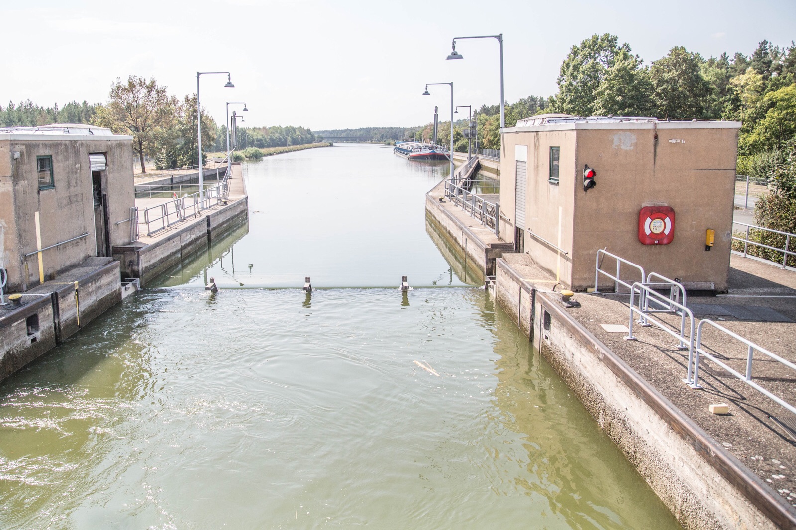
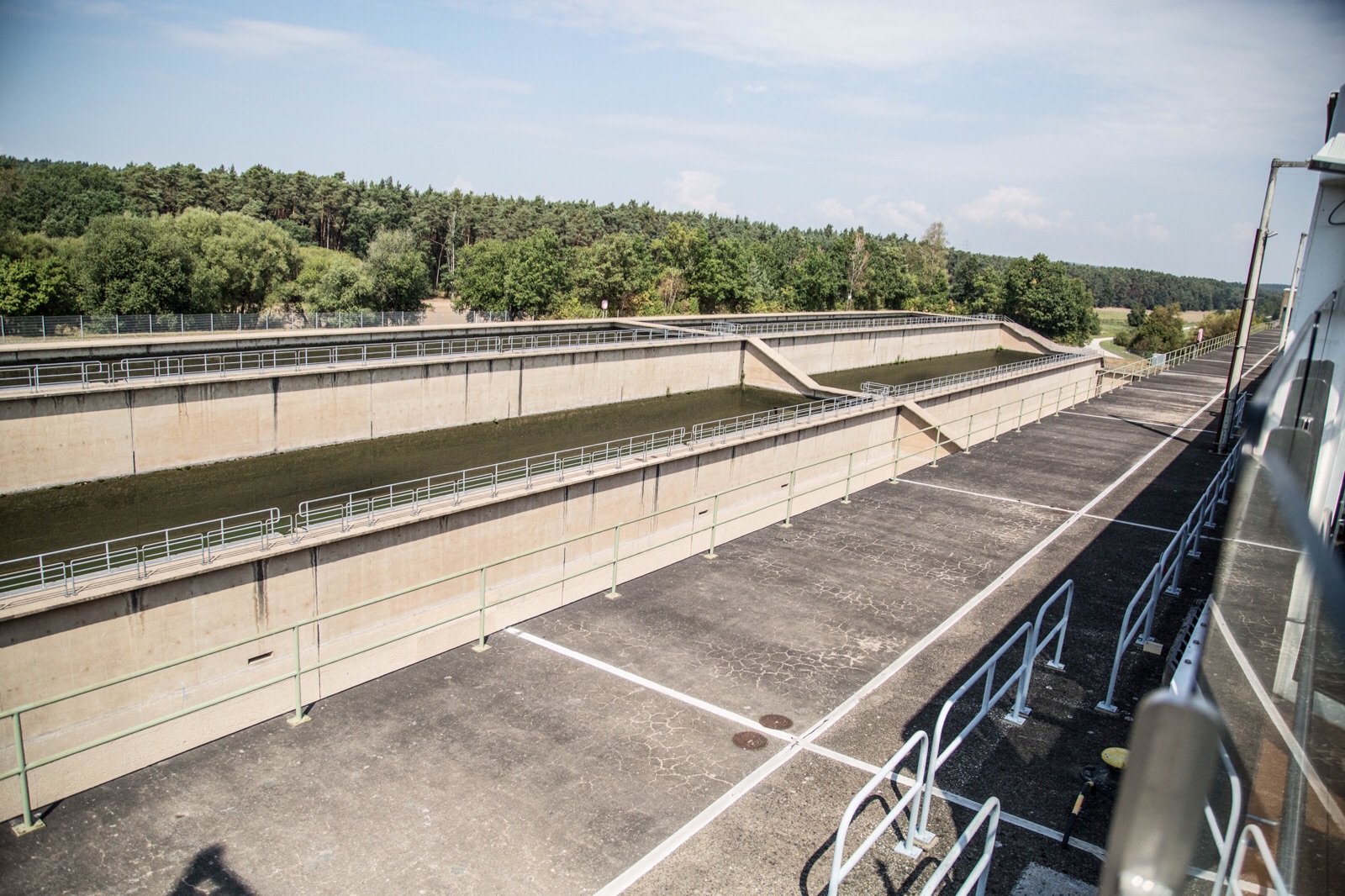
NOTE from Donald: Yesterday’s extensive weather and distance walking resulting in back soreness and sciatica; thus, I opted to remain on board with a few others also too feeble to execute the 5-hour walking tour and free time in Nuremberg. It proved to be fortuitous as I was able to transit the Rhine-Main-Danube Canal and witness firsthand the filling of these locks from concrete storage areas to minimize water loss in the canals.
Last night, Thursday, we sailed from the Main River into the Rhine-Main-Danube Canal, a manmade navigable waterway essentially connecting the North Sea of Western Europe to the Black Sea of Eastern Europe and Asia. A canal of this type was conceived by Charlemagne in 793, but only about 10,000 feet were dug. A second, and successful, attempt to connect Europe via canal was undertaken in 1846, but the logistics of navigating through 100 locks and the advent of the railroad resulted in its abandonment. The current effort was completed in 1992 as one of the largest civil engineering projects ever undertaken. The canal has a total of 16 locks about 40 feet wide, 625 feet long, and up to 100 feet deep. It even passes over a couple of roads along the way, much as a highway overpass. To assist in maintaining water levels in the canal, there are concrete reservoirs adjacent to the locks for recycling and storage of water. The canal reaches a height of more than 1,300 feet south of Nuremberg over the Swabian Alps.

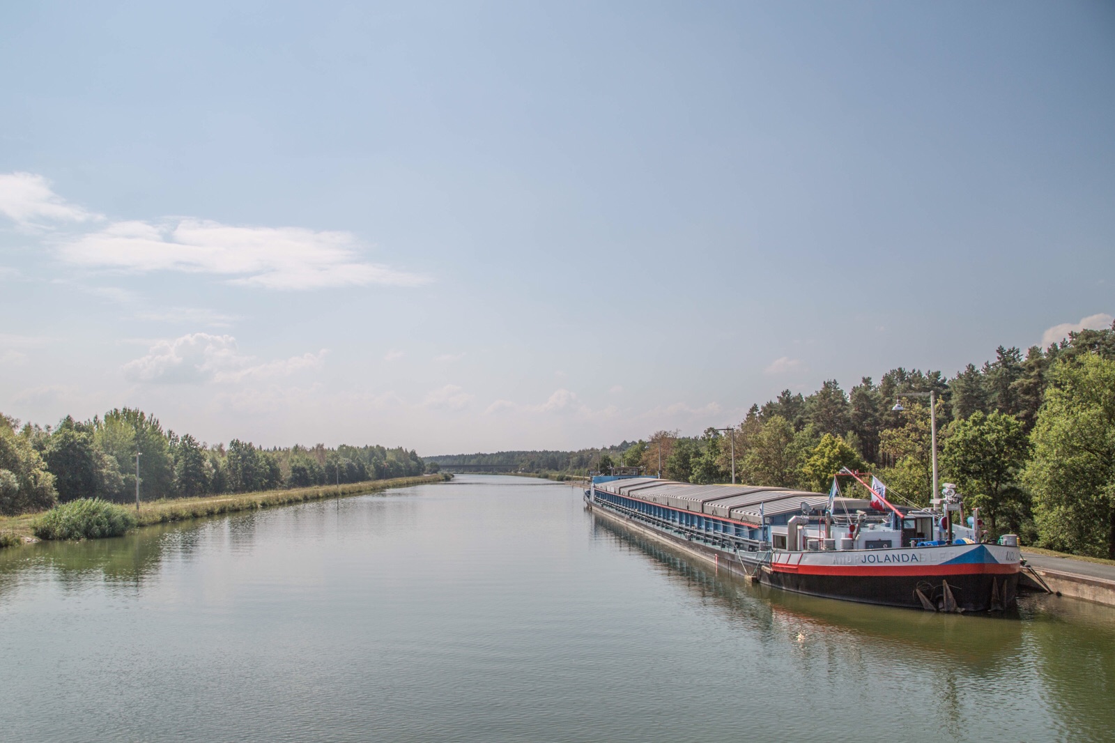
The area is mostly rural, and row crops, mainly corn, abound. A bike path adjoins the canal on either side, sometimes on both sides, and is quite popular with bicyclists and walkers.


– Posted using BlogPress from my iPad
