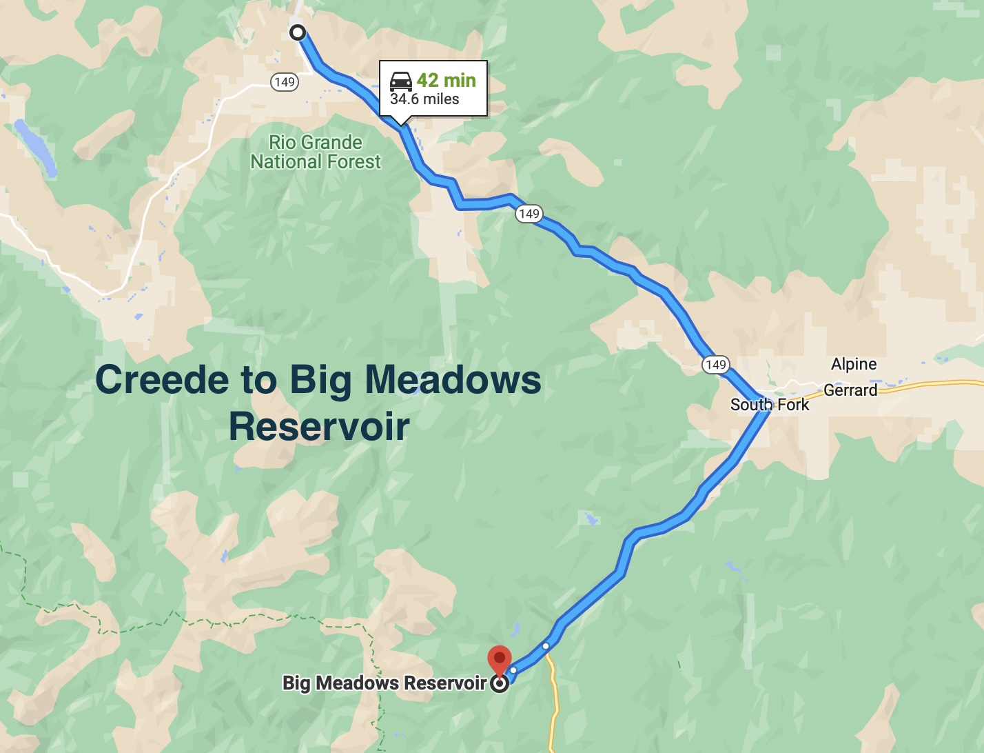
Today, we traveled south to South Fork, then west to near Wolf Creek Pass. The target destination was the Big Meadows Reservoir.
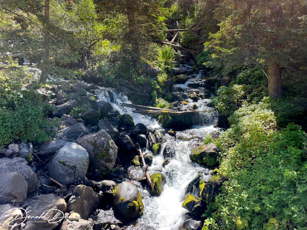
Our goal today was to hike the Big Meadows Reservoir Trail. The trail is a 2.8-mile loop trail around the alpine reservoir.
Big Meadows Reservoir Trail from Alltrails
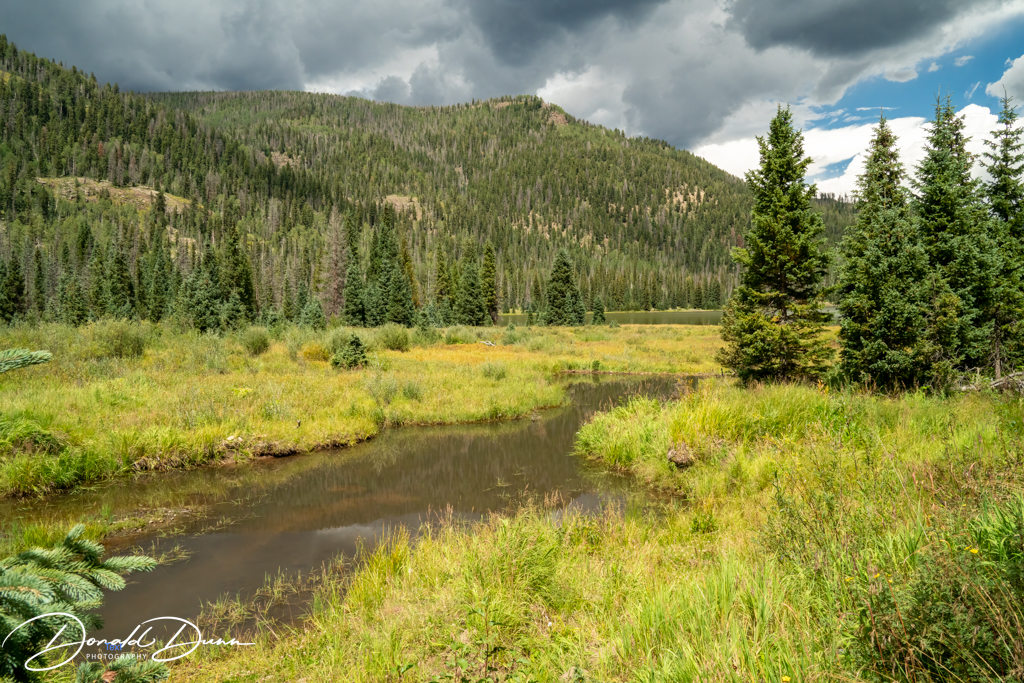
This trail had it all. Beautiful lake views…
Wetlands and beaver dams…
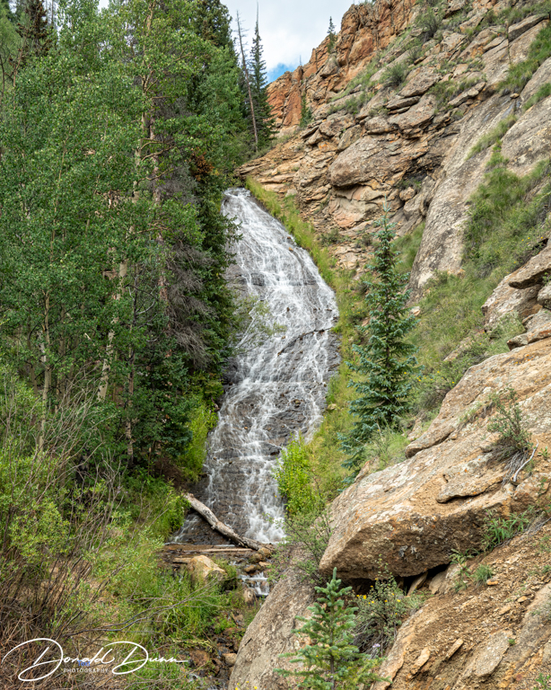
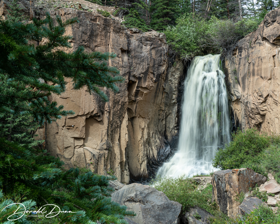
And even a waterfall…
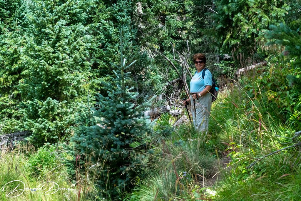
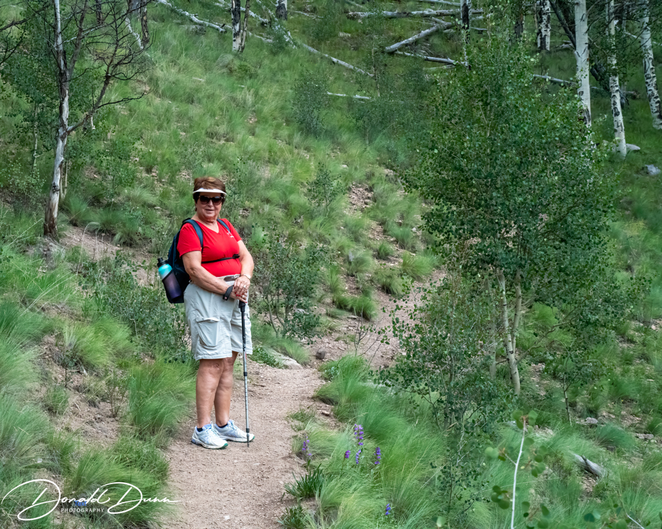
Kay easily out hiked me today, keeping a steady pace, despite a few downed trees crossing the trail—adding to its charm.
Kay on the Big Meadows Reservoir Trail
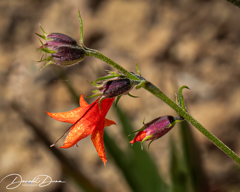
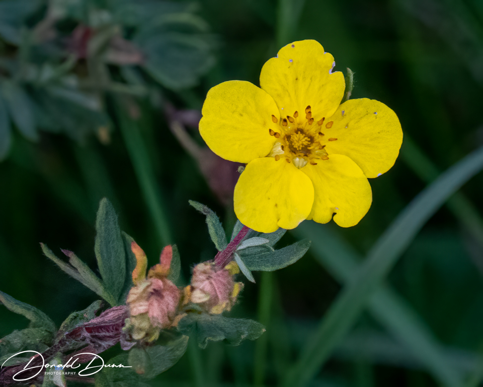
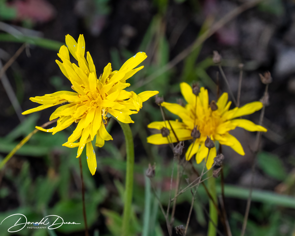
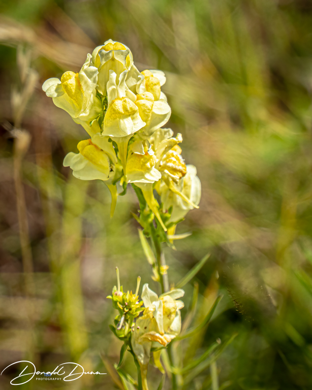
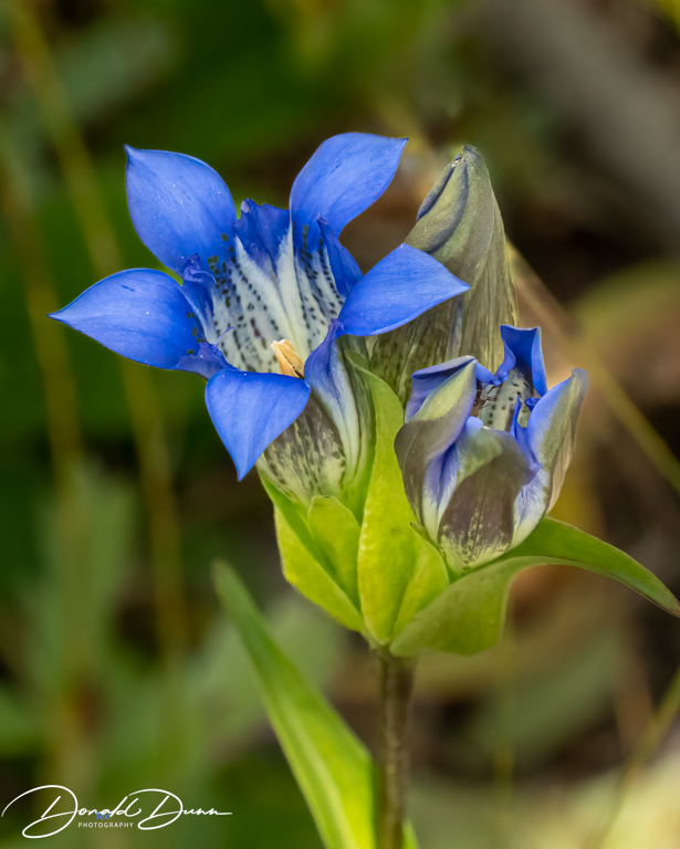
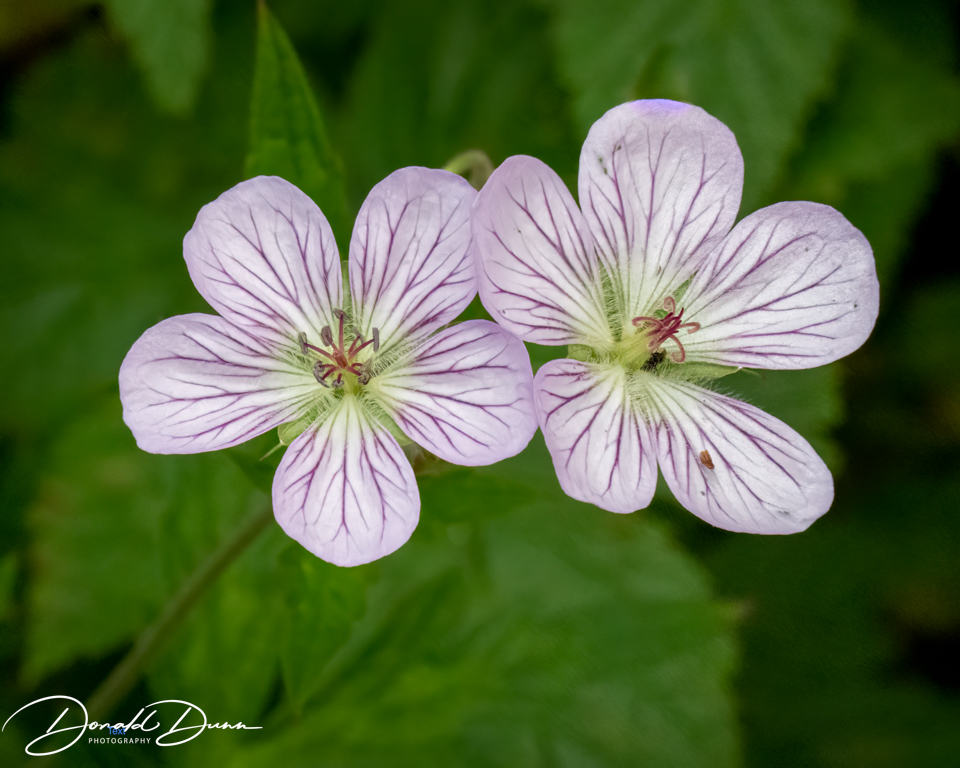
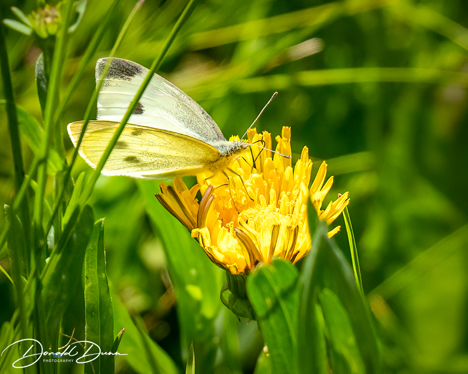
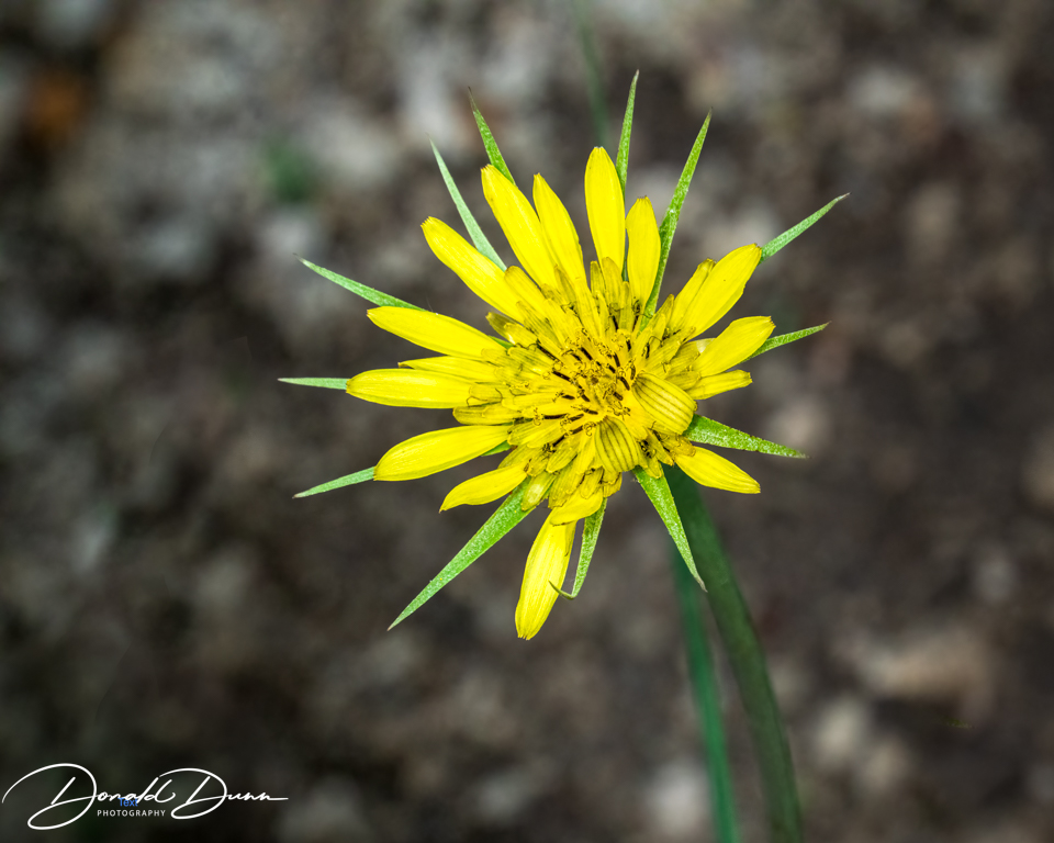
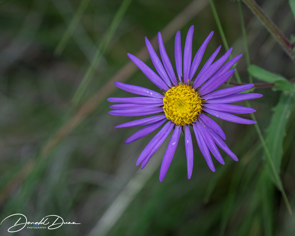
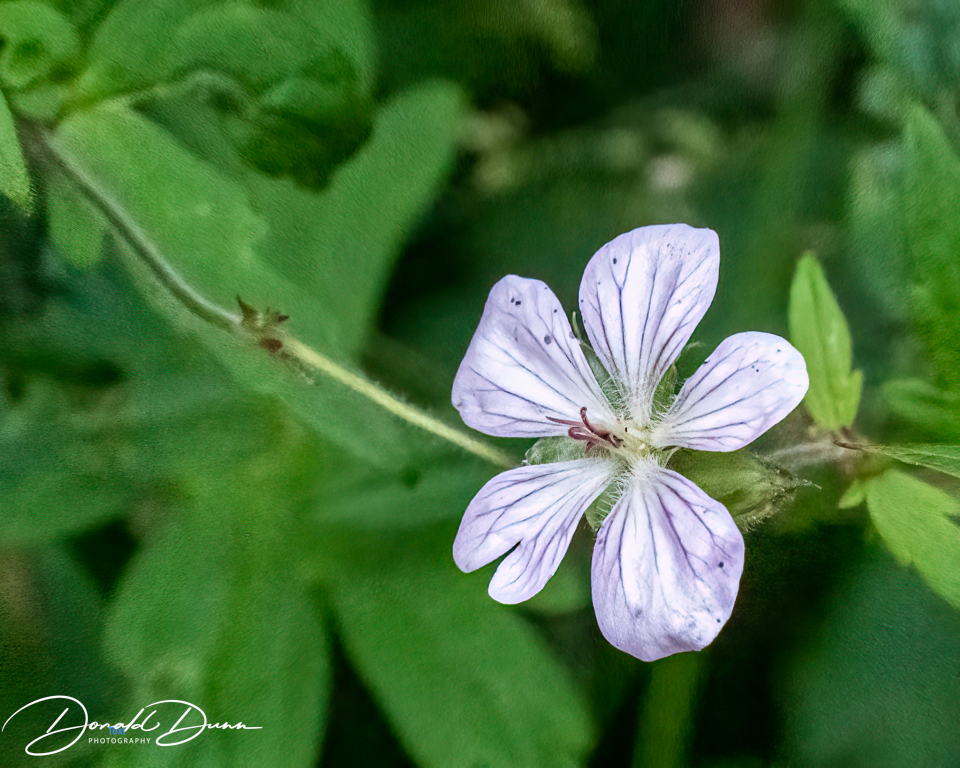
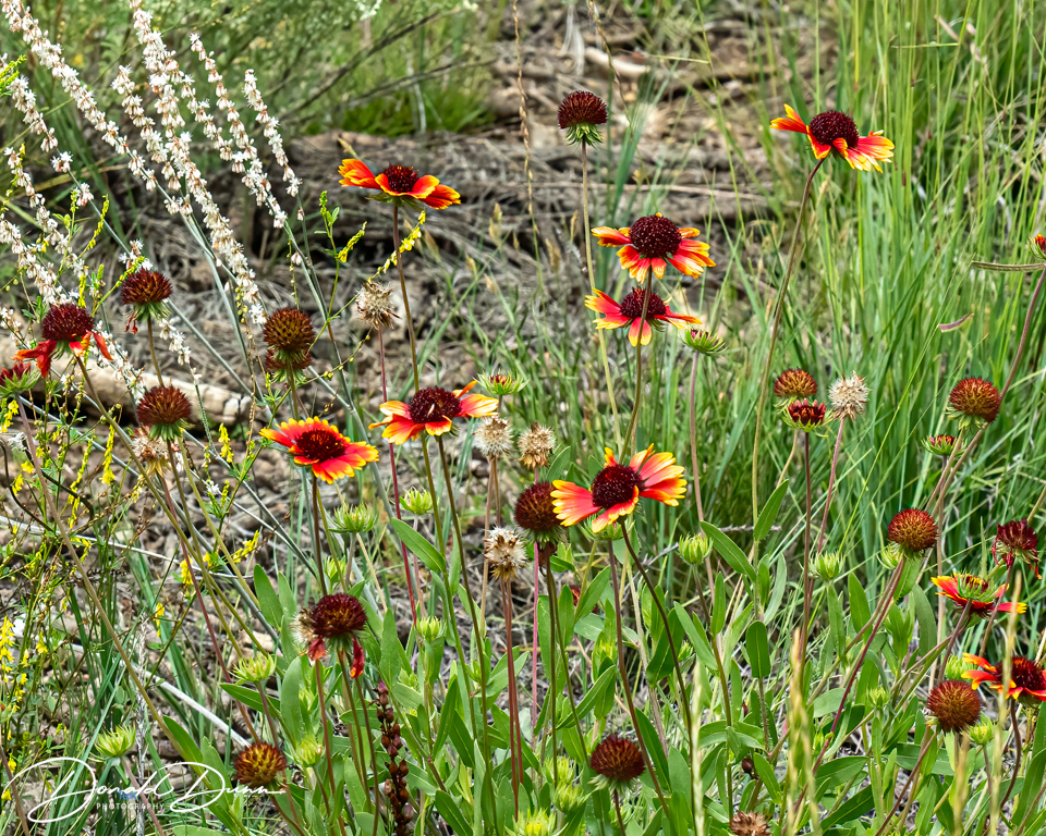
Wildflowers, wild berries, colorful mushrooms, and butterflies were plentiful. There were a few downed trees crossing the trail, but that added to its charm. These wildflowers were plentiful along the alpine lakeshore.
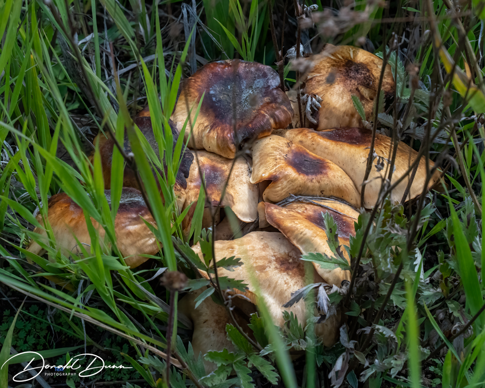
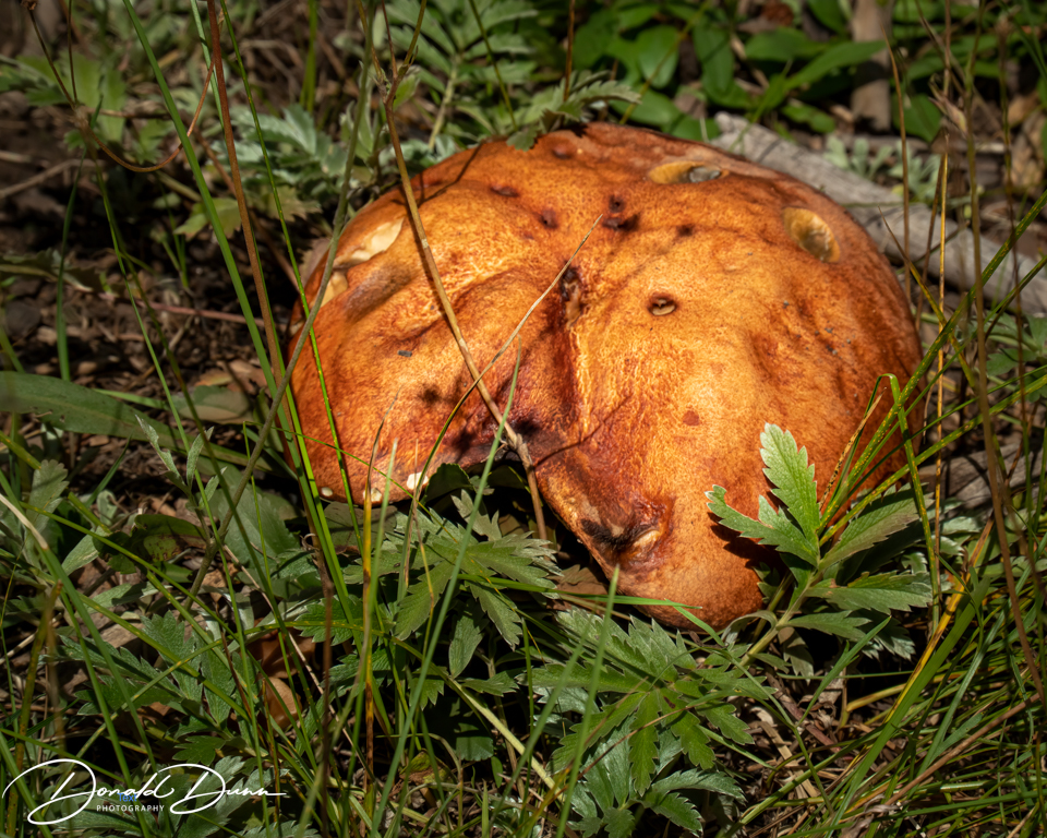
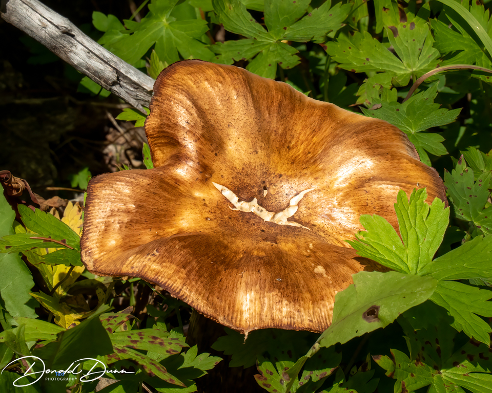
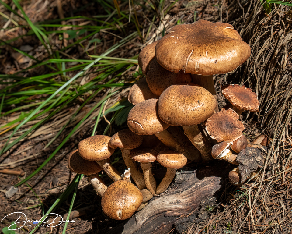
It’s awfully hard to resist photographing mushrooms, and there were many shapes and sizes along the trail.
Mushrooms along the trail
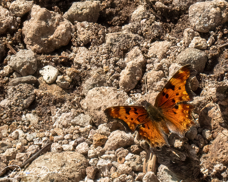
Even a few butterflies were puddling in wet areas, and one would occasionally remain still enough in the wind to photograph.
This squirrel watched us for several minutes.
About a half mile from the end, we got caught in a thunderstorm and light rain, and of course we didn’t bring rain jackets!
It rained hard on the way back to the cabin, with hail completely covering the ground in the Creede area. At the cabin, we doctored sore knees and rested weary bodies. Kay drove into Creede and picked up a couple small pizzas which we enjoyed while watching our favorite YouTube videos.
It rained lightly all day Friday, negating any outdoor activities or photography. Late Friday evening, we attended an Improv Comedy Show in Creede, part of the Creede Repertory Theater summer program. It was only “so so.”
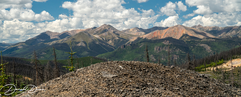
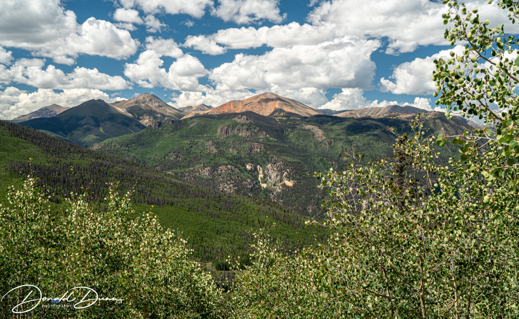
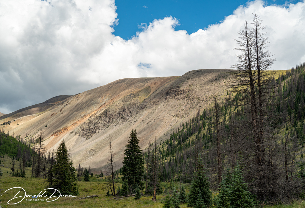
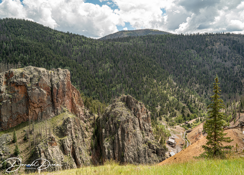
After a late start Saturday morning, we drove the Silver Thread Scenic Byway west to Lake City, stopping on the way to photograph some interesting landscapes.
Among the landscapes was the Slumgullion Earthflow National Natural Landmark. It is a rare example of an earthflow, called mass wasting, was/is a slow moving landslide. About 700 years ago, an area of Mesa Seco, composed of partially decomposed volcanic rock, slid down the mountain and blocked the Lake Fork of the Gunnison River, creating Lake San Cristobal. A second earthflow has been moving continuously for about 300 years over older stable rock. It moves at a rate of about 23 feet per year.
Slumgullion Earth Flow
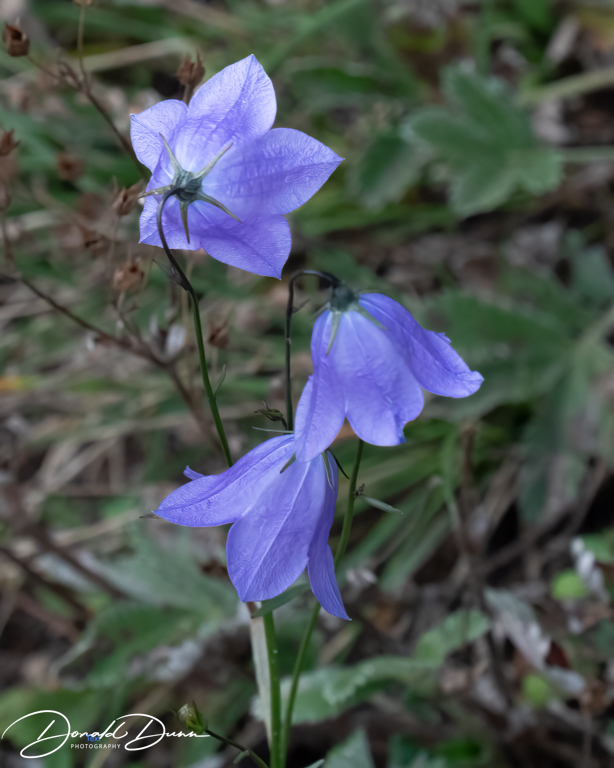
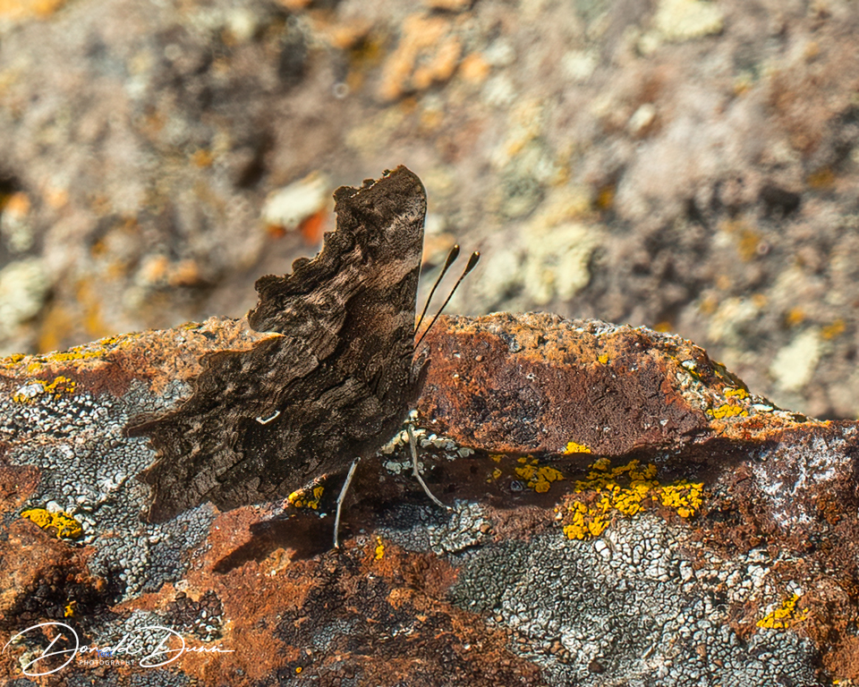
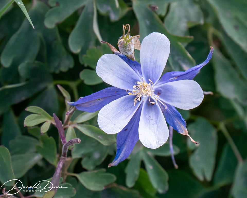
There were also a number of wildflowers blooming at the higher elevations, and even a butterfly was spotted.
The only butterfly photographed
Arriving in Lake City just after lunch, we stopped by the Southern Vittles where we had a delicious lunch last week. I had catfish and Kay had chicken strips. The catfish was not edible—too much dark flesh giving the fillet a bad taste. Kay’s chicken strips were really good. After lunch, Kay witnessed a shooting; actually, it was a reenactment of an old west gunfight.
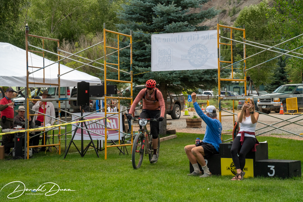
And then, we wandered through the staging grounds (Lake City’s Town Park) for the finish of the Lake City Alpine 50. The Lake City Alpine 50 is an epic, 50-mile, alpine endurance bike race involving around 6,000 feet of climbing. The race includes cycling over both the 12,640 foot Cinnamon Pass and the 12,800 foot Engineer Pass, before making a nearly nineteen-mile fast descent along Henson Creek, and then back to Lake City to finish the race.
Finish line, Lake City Alpine 50
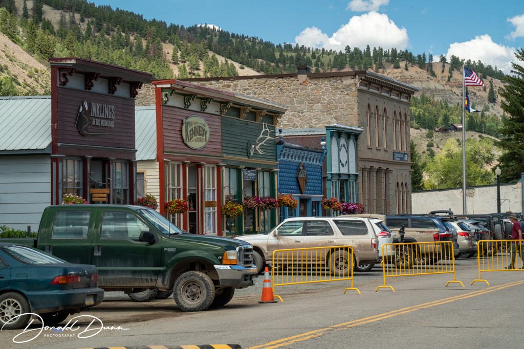
The Lake City National Historic District covers about 142 acres of land in more than 34 blocks and additions, making it one of the largest historic districts in Colorado. It is also one of the oldest, and best preserved, historic districts in the state. The Historic District contains commercial and residential buildings of various sizes and styles. Many commercial structures were built of wood, with front-facing gable and false-front façade. There are also a few masonry buildings located on the Hough, Bank and Finley “blocks.” Residences include chinked-log pioneer cabins, simple miners’ cottages, and the Queen Anne style homes of merchants and mine owners. Most homes have front porches and decorative features. Tall cottonwoods planted by early Lake City citizens are carefully tended today. Fences, boardwalks, and outbuildings are also features of the district.
Historic Lake City, ColoradoHistoric Lake City, Colorado
Kay discovered a hummingbird moth, common name “Whitelined Sphinx Moth,” nectaring on hanging baskets—a real treat for this photographer.
Whitelined Sphinx Moth Whitelined Sphinx Moth
After a busy day, we returned to the cabin to rest before attending a really, really good performance of Steel Magnolias. To top things off, the first producer of the first play of Steel Magnolias, Pamela Berlin, talked briefly before the performance, including the play’s early history. She is now a part time resident of Creede, and has a long history with the Creede Repertory Theater.
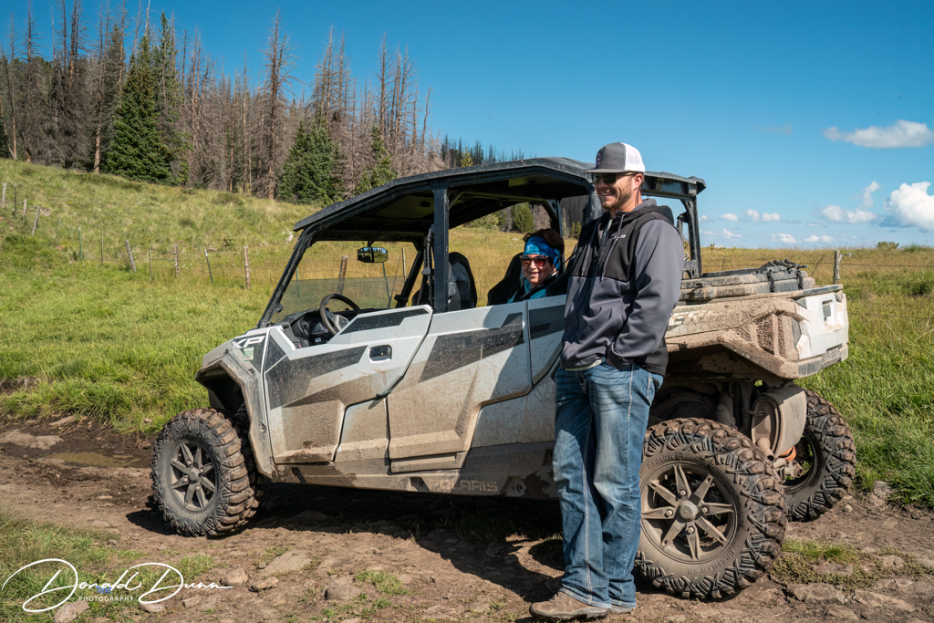
Today’s travels took us to South Fork, Colorado, for a guided Side by Side (SXS) or Utility Task Vehicle (UTV) trip. So what is a Side by Side or UTV, you might ask. Side by Sides or UTVs are simply off-road vehicles in which two people sit beside each other. The seating configuration is the same as in a car or truck. You have a steering wheel, pedals and a gear shift just like a vehicle. The UTV is larger than an ATV and typically costs a little bit more. Today these vehicles are made for utility/work uses, sports, and a mix of both work and fun! A SXS often comes with similar features to a car like a roll bar or cage, and wind protection that creates an enclosed look. Designed with a sturdy protective exterior, these vehicles are a top choice for recreational adventuring outdoors.
Kay and Logan at the Side by Side
Our guide today was a young, talkative Logan, some 21 years old. He trailered about a mile east of town to start the trip in the Willow Park area. With Kay driving, the route started on a smooth road and then we got on a fun and rocky trail within a couple of miles. This rocky trail started out in some huge aspen tree groves and worked its way up to Willow Park.
Along the trail
From there we continued on a rocky trail that wound its way up to a great view at about 11,500 feet.
Willow Park
The trail continued down through a variety of woods and open meadows until intersecting with a well maintained smooth road. We then followed the smooth road down towards Beaver Creek Reservoir. A few miles above the reservoir we intersected with another fun trail that wound back to our original trail at Willow Park, and then back to the vehicles. Of note is that Kay was “cautioned” twice about speeding! She drove about half the trip, and Logan drove the other half.
Neither Kay nor I would do the trip again, and the scenery was underwhelming as we were in aspen groves or logging operations much of the time. A mule deer doe was the only large animal seen. The sound of the SXS motor was deafening, even for someone with hearing issues. It was not our cup of tea.
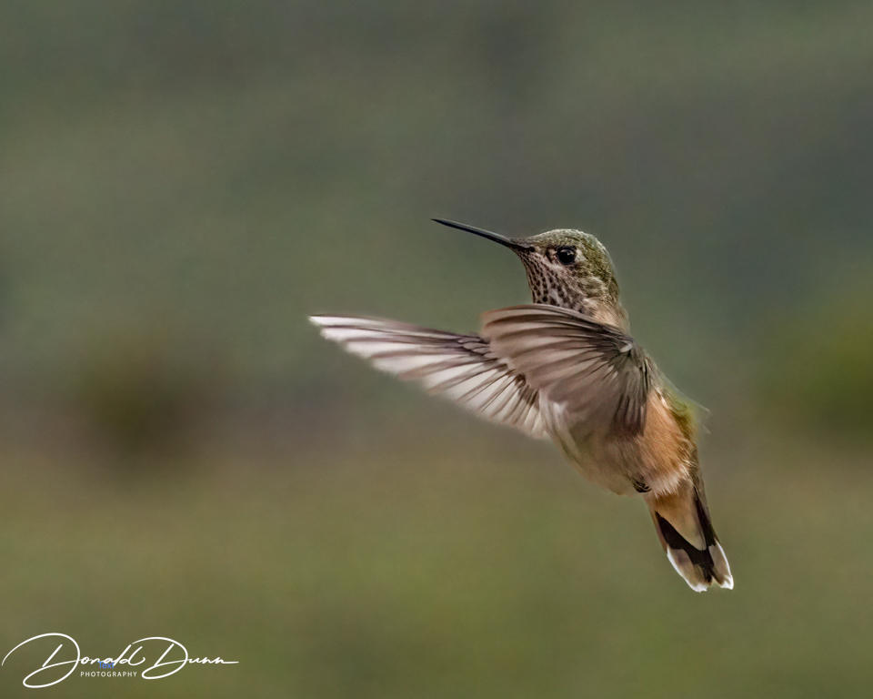
On the return to the cabin, we stopped in Creede for lunch, and ran a couple of errands. At the cabin, it began to lightly rain—it has rained everyday here—but a few Rufous Hummingbirds nectared at the feeders and a few photos were made.
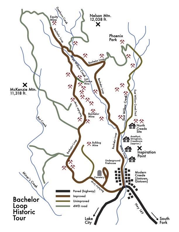
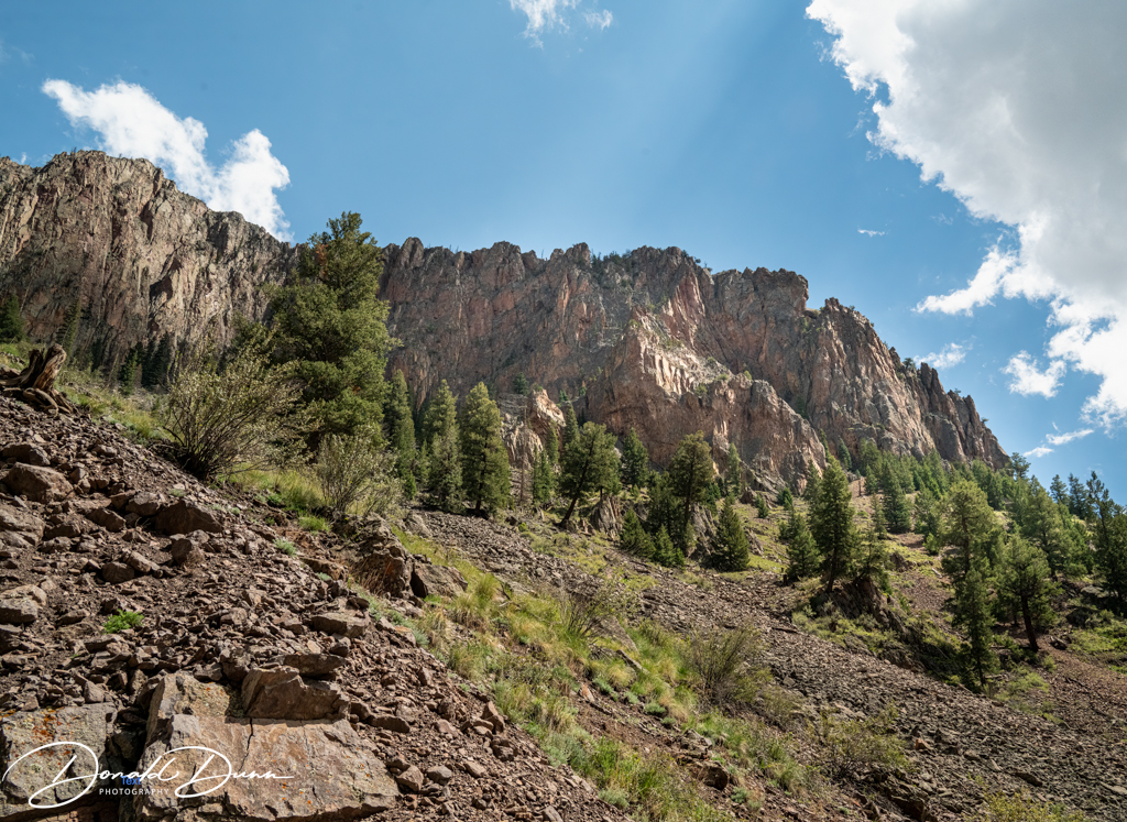
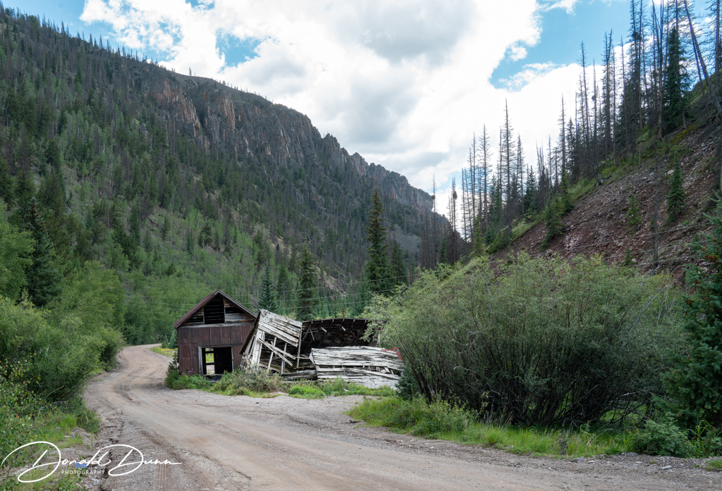
Departing the cabin at 11 o’clock Tuesday morning, we drove into Creede and began traversing the Bachelor’s Loop in a counter clockwise direction.
The route preferred by most is the more challenging east route that follows East Willow Creek for the majority of the terrain, then turns to the west in a steep climb to converge again with the main road of the Bachelor’s Loop. While it is open to non-4×4 vehicles, it is a hard pack gravel mine road that can be a little rough and has several very steep points just past the north end of Creede.
The main route follows West Willow Creek to top out with the aged forests of Bristle Cone pine trees. It climbs gently for four miles to slightly over 11,000 feet before traversing gentle ups and downs and then weaves its way up through the canyon north of Creede descending under ragged cliff sides.
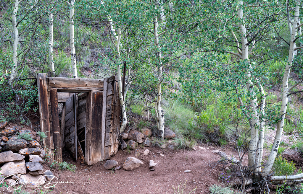
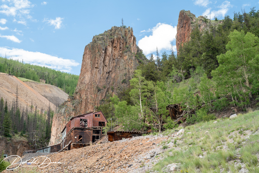
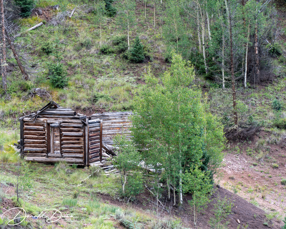
The drive took us past mine locations from the 1890s and abandoned ghost towns that once rivaled Creede in size.
Wednesday was a “down” day for rest and catching up on social media. We began the day playing pickleball in Creede, and the last couple of matches were among the most competitive in which I’ve played—fun!
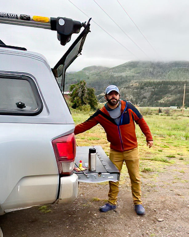
We were up early this morning, the car was packed with fly fishing gear, and we drove into town to the Rio Grande Fly Shop to meet our guide for the morning, Ben Newman. I had asked Ben to fish a mountain creek, and he came through with private waters on North Fork Clear Creek, west of Creede, Colorado.
Ben Newman, fly fishing guide
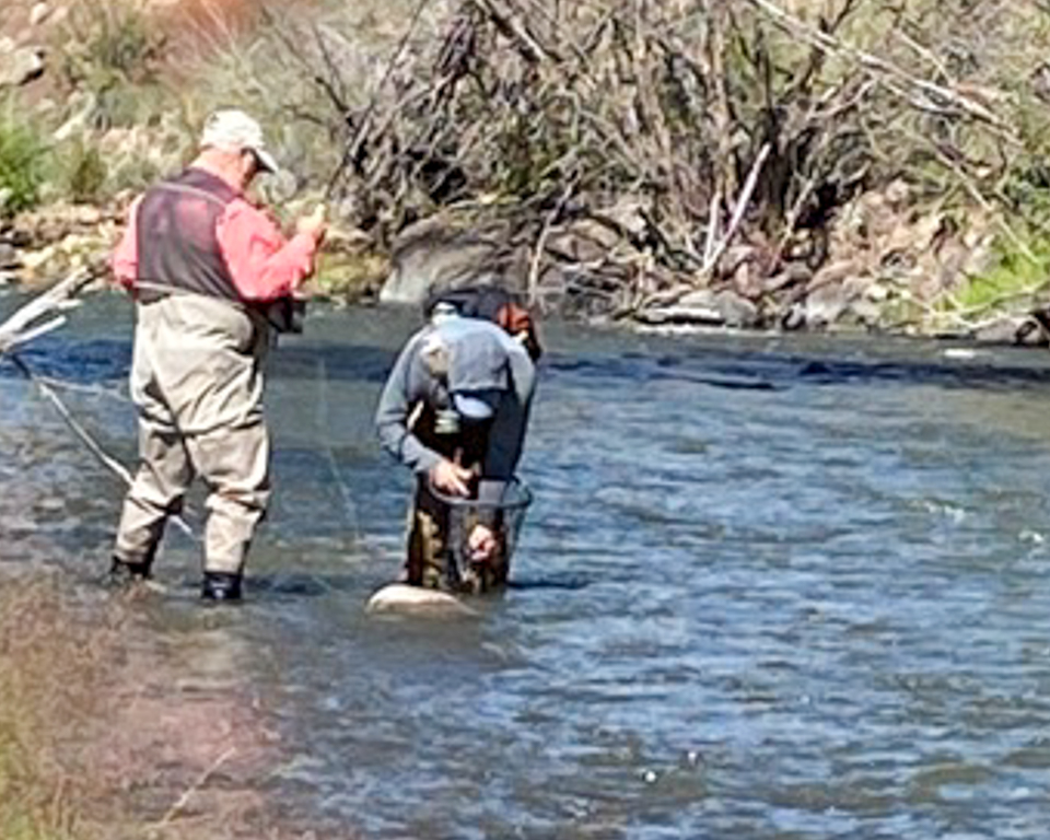
Suited top in waders, boots, and fly rods and reels, we walked to the 15-foot wide creek, crossed, and began fishing upstream. Fishing was tough! Kay had the first hookup, a small trout, and experienced a long distance release. We continued fishing upstream, changing flies regularly. Ben was gracious enough to spend essentially all of his time with Kay. We fished another couple hours without a strike. I dug into a vast assortment of “old” flies from my vest, and tied on a hopper with a #14 Flashback Pheasant Tail nymph dropped about 16 inches. Casting towards the far bank, the flies landed in the 3-foot slot between a bubble line and the bank, and the hopper disappeared. I yelled, “Fish on” and Ben came to net the approximate 14-inch Tiger trout.
A tiger trout is a cross between a brown and brook trout. I caught another couple of small trout on the “rig.” Despite fishing really hard, neither Kay nor I had any further success.
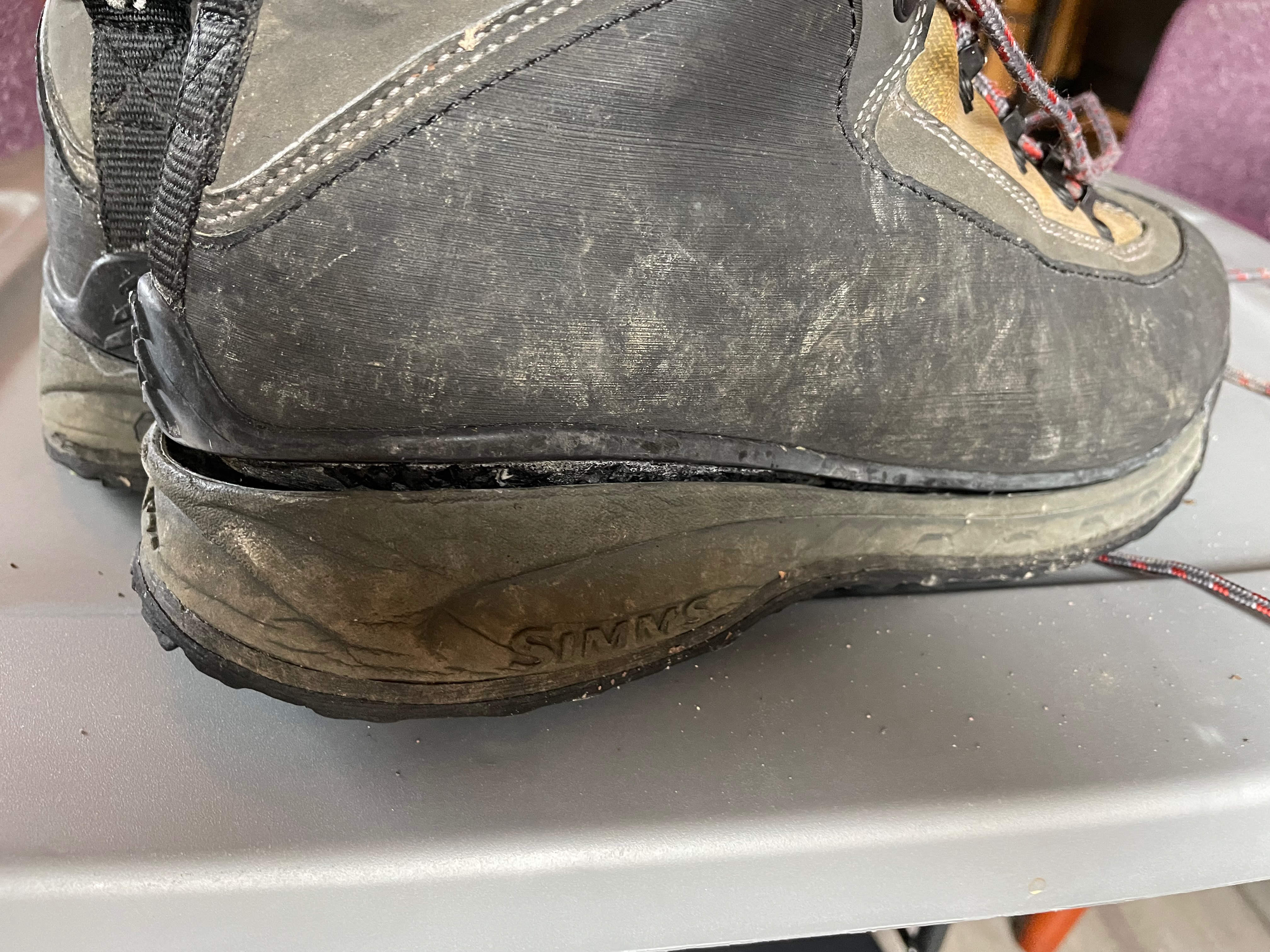
Walking out, Kay remarked that the soles of my practically unworn wading boots had delaminated. It had been 8 years since they were last worn, but they had been keep in an air conditioned dark closet; I expected better of Simms. Also, my slightly worn Simms Guide waders sprung a leak at the seem between the sock and the leg. Lots of repair work to be done.
Simms Guide wading boot delamination
We bought licenses for 5 days, and the guide promised to call regarding his success the next day, and for us to schedule another trip. He also asked for some “show” flies and said he’d send his address for me. He never called nor sent his address; consequently, I cannot recommend him.
We had no plans on Saturday, and enjoyed a quiet rainy day at the cabin, catching up on emails, blogs, photo editing, and clothes washing.
On Sunday, we drove north again on the Silver Thread Scenic Byway to see sights missed on Friday. Driving from near Creede, we traveled west about 26 miles, about halfway between Lake City and Creede, where we saw the sign for the North Clear Creek Falls. Turning right, we traveled for another half mile on paved Forest Road 510 to the Overlook. Because of the vertical drop into Willow Canyon, the observation area had been fenced. The area had new toilet and picnic facilities, and is considered handicap accessible. We first walked to the top of the hill to view Willow Canyon.
Willow Canyon
And then, we walked along the rim of the canyon until the falls came into view—my, oh my. North Clear Creek Falls is a 100+ foot waterfall carved into the landscape of southwestern Colorado!
North Clear Creek Falls
From North Clear Creek Falls, we drove east on the Silver Thread Scenic Byway about one mile to Forest Service Road 515 (Hermit Lakes Road), then 1 1/2 miles west (left) to the Brown Lakes State Wildlife Area. The parking area and trailhead for Rex Falls are straight across from the Troutvale Reservoir as you enter the Wildlife Area. While the short hike was not difficult, it was not without pain. There was a large yellow jacket nest about halfway up on the upper trail. About five feet before log across the trail, the nest was in or on the ground. It is partially exposed on the right side of the trail. I received a several stings on my left leg hiking to the falls, and a half dozen stings on my right leg hiking back to the trailhead. You’d think I knew better!
Back at the cabin, we showered and dressed for a play at the Creede Repertory Theater, Always…Patsy Cline. It was the true story of the fast friendship and two-year correspondence between Patsy Cline and Louise Everett Seger Zurbuchen, a huge fan and single mother from Houston, Texas. It was an outstanding play featuring most, if not all, the songs of Patsy Cline. An excellent live band accompanied the singer, who nailed the performance.
Before scheduling our trip to Creede, a check was made to determine if they had pickleball, and they did.
This morning we headed into town to the Virginia Christensen Multi Use Facility; several folks were waiting at the locked door, and it opened at 9 o’clock sharp. We paid $3 each, and walked into the “gym;” this “gym” serves multiple purposes and the floor was covered with line markings—full court basketball, half court basketball, volleyball, hockey, and pickleball. Portable nets were quickly set up to form two courts, with a barrier net between them. We all grabbed paddles, and began dinking (warming up.) Dividing into two groups of four, the games began. It was so much fun, and most of the people there were our age and from the local RV park. One gentleman, Robben, was 97-years old, and an excellent player. He couldn’t move very far or fast, but could place shots on a dime. At 12 o’clock noon, play ended as another group took over the court; they were from an RV park in Southpark, Colorado, between Creede and Pagosa Springs, and were very good.
Lunch was at a local eatery, and then it was back to the cabin to change clothes. We then drove north on the Silver Thread Scenic Byway to the South Clear Creek Falls trailhead. The short hike (1/2 mile roundtrip) starts in the Silver Thread Campground in an aspen grove.
Kay on the trail to the South Clear Creek Falls
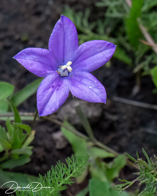
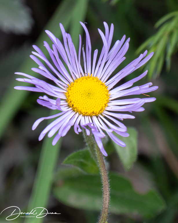
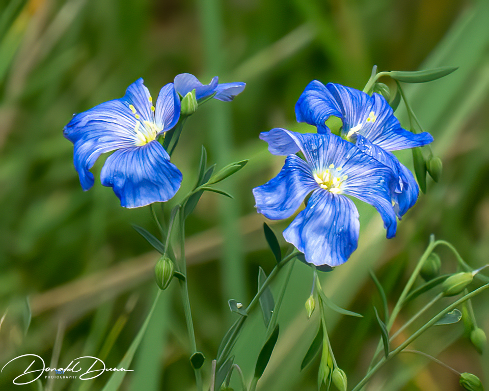
A couple of wildflowers beckoned for photos.
The trail then switchbacked down towering cliffs surrounding a forested bowl to a viewpoint with a metal railing. We then took a rather treacherous trail that lead down to the base of the falls and to South Clear Creek. Raspberries were plentiful along the trail to the base of the falls. South Clear Creek Falls is one of the most impressive waterfalls in Colorado. While not quite as tall as Bridal Veil Falls (Colorado’s tallest waterfall) or neighboring North Clear Creek Falls, it is a powerful waterfall and the trail allows you get up close and personal.
South Clear Creek Falls as seen from its base
Along the trail and in the campground parking lot, wildflowers were seemingly blooming everywhere. Here are a few photos.
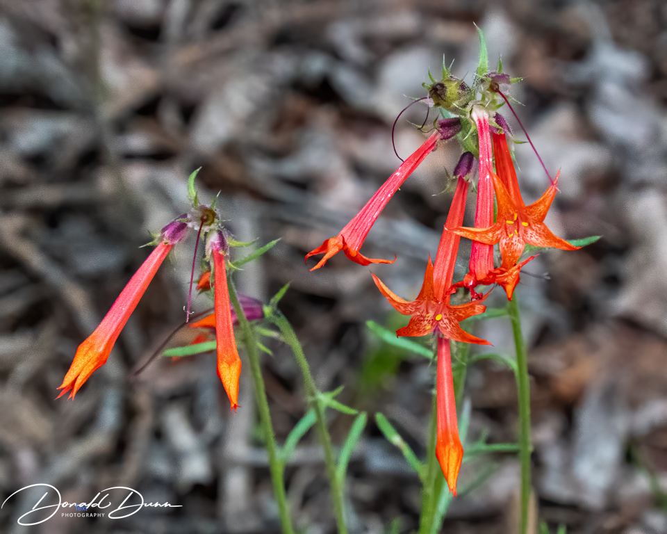
Scarlet Gilia
It began to lightly rain, putting a kibosh on our other afternoon plans. It was back to the cabin to again change clothes before heading into Creede for a performance at one of the two theaters in town. Just as we finished changing clothes, the electricity went out. Apparently, the whole area was without power. Nevertheless, we drove into the unlit town, but the lack of electricity prevented the performance. It was back to the cabin. We dug out portable power banks from the car, for our CPAPs, plugged in a table lamp, and then the power came back on, ending an exciting day!
After awakening this morning, I experienced intense vomiting. We decided the intestinal problems I had been experiencing were the result of some new medication!
Anxious to explore the high country near us, we opted to drive the Silver Thread Scenic Byway, at least to Lake City. Points of interest included the mighty Rio Grande River for flyfishing on gold medal waters, Wagon Wheel Gap, the Historic Bachelor Loop and Creede Mining District, the spectacular and unrivaled North Clear Creek Waterfalls, scenic Slumgullian Pass that cuts through a natural earthflow, and Colorado’s second-largest natural lake – Lake San Cristobal—more about these in future blogs.
Lunch was at Southern Vittles in Lake City. We both had chicken strips, and they were delicious. We would definitely eat there again. After lunch, we continued north on the Silver Thread Scenic Byway to the ranching community of Powderhorn, then back south on County Road 50 to Colorado Highway 149 (Silver Thread Scenic Byway.)
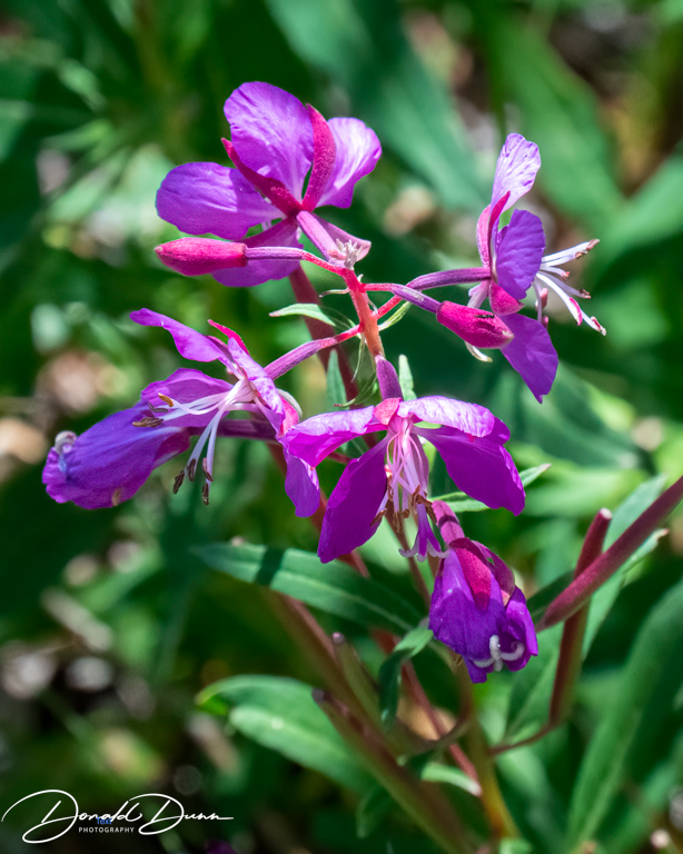
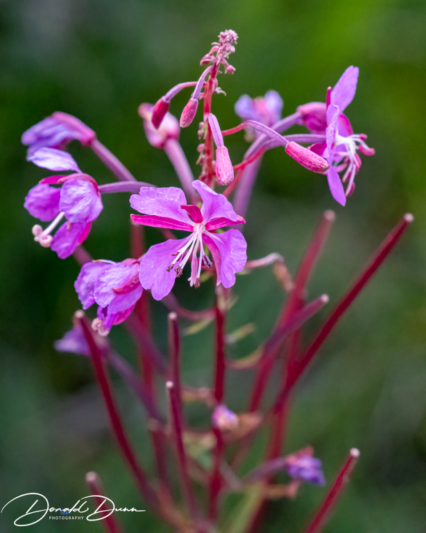
The scenic beauty along the way was breathtaking—mountain vistas at every turn, creeks and streams, small high country lakes, and lush valleys. Make no mistake, County Road 50 was rough in places, almost necessitating a 4X4 while the Honda Pilot was only front wheel drive. Near the junction of County Road 50 and Colorado Highway 149, we stopped at a small lake and watched rise after rise, vowing to return to fly fish this lake. Wildflowers were plentiful, and made for a few decent photographs.
Fireweed
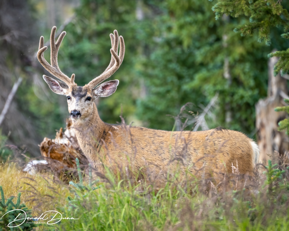
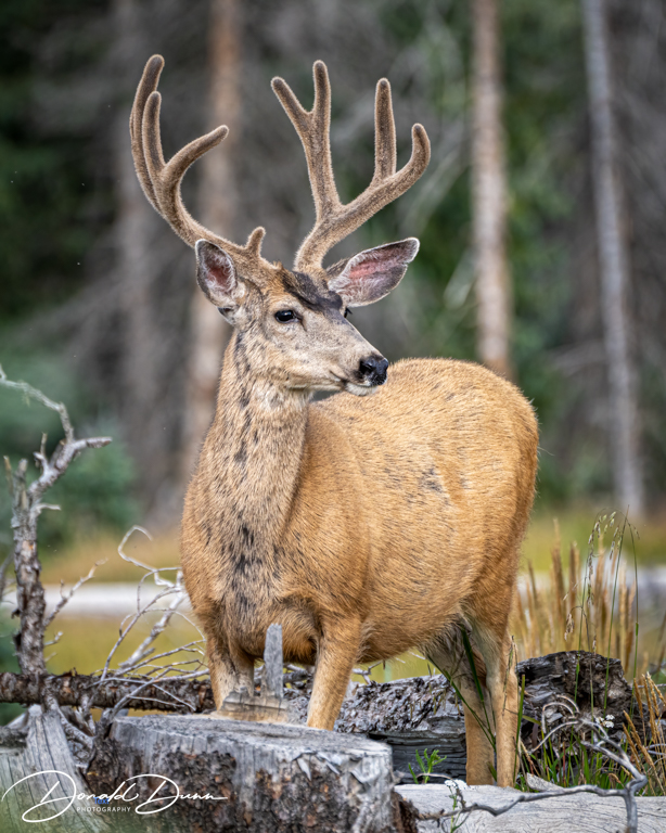
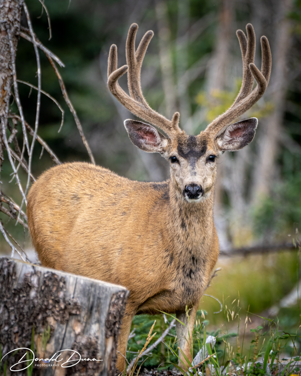
And then, continuing a couple hundred yards, we spotted a group of male mule deer working their way uphill toward us. We patiently waited, and all of the velvet-horned bucks posed. The largest was especially photogenic and offered three portrait photos.
Mule deer in velvetMule deer in velvetMule deer in velvet
We returned to the cabin near dark, and watched television for a while before bedtime.
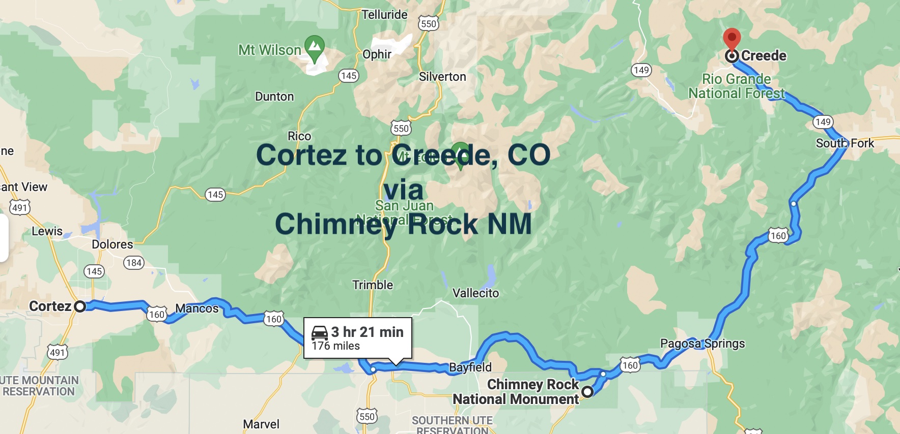
Wednesday morning we departed Cortez, and drove east to Chimney Rock National Monument.
There are many “Chimney Rocks” in the US, including the more famous but perhaps of less historical significance Chimney Rock National Historic Site. It has become one of the most notable landmarks in the American West, largely due to its stop along the Oregon Trail (see our blog entry
There’s also Chimney Rock State Park in North Carolina which we visited in 2000 (see blog entry for August9, 2020.)
And then, there is Chimney Rock National Monument. The monument represents one of the largest Pueblo II (900-1150 AD) communities in southwestern Colorado and is considered a Chacoan cultural “outlier.” The Chaco phenomenon was a complex system of dispersed communities bound by economic, political and religious interdependence centered in Chaco Canyon, New Mexico.
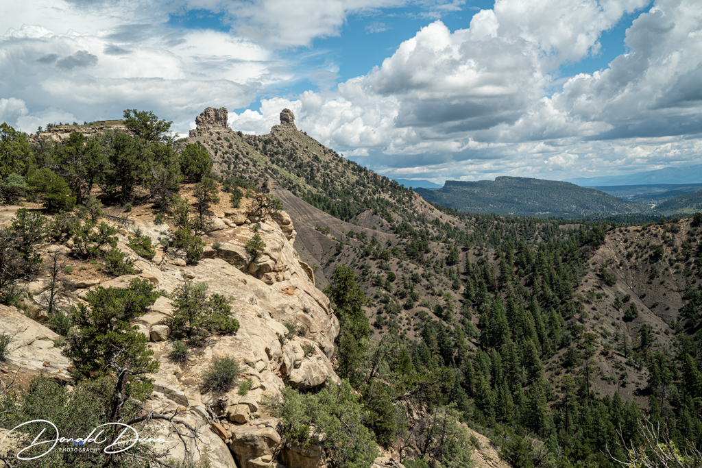
The pinnacles that give Chimney Rock its name frame multiple astronomical alignments. The Ancestral Puebloans incorporated their knowledge of astronomy into the design of their community. Today, Chimney Rock National Monument is one of the best recognized archaeo-astronomical resources in North America, with alignments with the northern lunar standstill, summer solstice, equinoxes and Crab Nebula.
Pinacles at Chimney Rock NM
The Chimney Rock National Monument encompasses 4,726 acres of the San Juan National Forest between Durango and Pagosa Springs, Colorado. Chimney Rock covers seven square miles and preserves 200 ancient homes and ceremonial buildings, some of which have been excavated for viewing and exploration: a Great Kiva, a Pit House, a Multi-Family Dwelling, and a Chacoan-style Great House Pueblo. Chimney Rock is the highest in elevation of all the Chacoan sites, at about 7,000 feet above sea level.
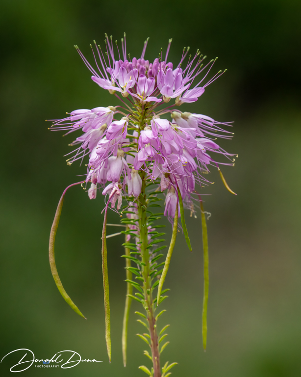
There were a bunch of wildflowers blooming at the Monument’s headquarters.
It began sprinkling as we were departing Chimney Rock National Monument. We continued east and north, in the rain, to our terminal destination, Creede, Colorado, where we will spend the next two weeks.
Not in a hurry, we departed Moab shortly before mid-morning, driving south on US Highway 191, and continuing southwest on US Highway 491 to Cortez, Colorado.
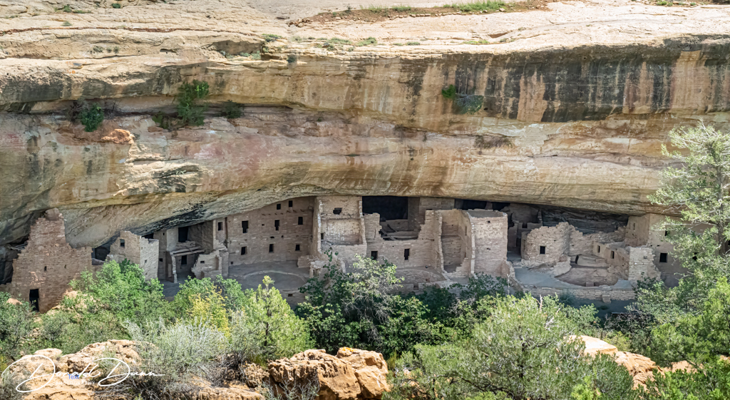
After checking into our “retro” motel, we drove to Mesa Verde National Park. Mesa Verde has always been a fascination for us. I visited once in the 1970s, and Kay and I visited in 2009 on our 2009 Southwest USA trip (see journal entry for Friday, September 26, 2009). Mesa Verde National Park is known for its well-preserved Ancestral Puebloan cliff dwellings, notably the huge Cliff Palace.
The Chapin Mesa Archeological Museum, having exhibits on the ancient Native American culture, was closed. Mesa Top Loop Road winds past archaeological sites and overlooks, including Sun Point Overlook with panoramic canyon views; regretfully, a significant portion of Mesa Top Loop Road was also closed. We did stop at a couple of the few overlooks that were open, and snapped off some photographs. Our first stop was at on overlook for Long House. Long House is nearly equal in size to Cliff Palace with about 150 rooms, 21 kivas, and a row of upper storage rooms. It may have been home to 150 to 175 people. Some of the architectural features in Long House suggest it was also a public place where people from all over Wetherill Mesa gathered to trade or hold community events. The formal plaza in the center of the site is larger than most villages and has some features not often found in other Mesa Verde archeological sites. For instance, the benches, vaults, and a raised firebox may indicate that this large open space was a dance plaza or great kiva, similar to Fire Temple on Chapin Mesa. The high number of rooms and kivas in Long House, plus the presence of the formal plaza suggest the community was a particularly significant place for Ancestral Pueblo people, perhaps serving both civic and ceremonial functions.
Long House at Mesa Verde NPLong House at Mesa Verde NP
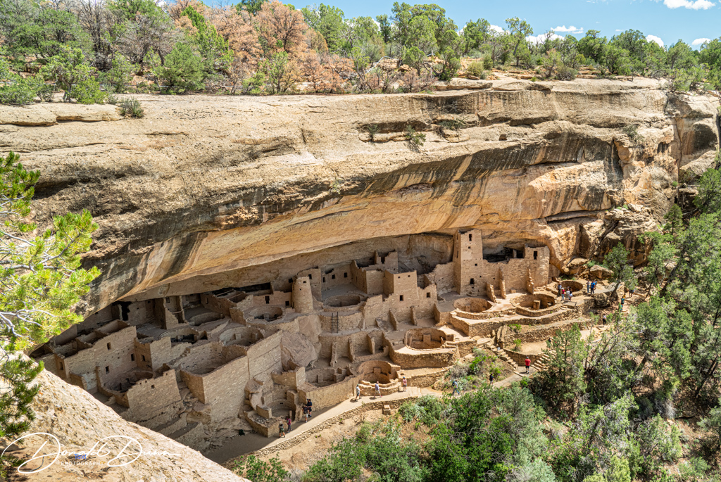
Our next stop was at an overlook for Cliff Palace. Mesa Verde Cliff Palace, the largest and most famous cliff dwelling in Mesa Verde National Park, has over 150 individual rooms and 23 kivas (rooms for religious rituals) with an estimated population of approximately 100 people. Because of so many closures, Mesa Verde National Park was a bit of disappointment, but fortunately our prior visit was thorough.
Collection of trails and greenway quotes, terms, acronyms, tools as well as trail publications and presentations and 100s of photos from my bicycle and hiking adventures. .
This journal was begun several years ago, and reflects an accurate record of each day fished. Please enjoy it, and remember that fish are too valuable to be caught just once, and the places they live are too valuable to be mistreated.