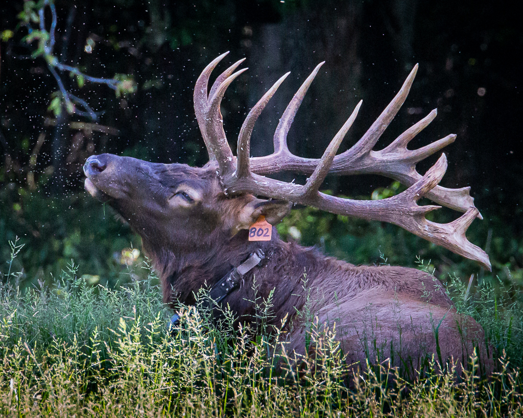
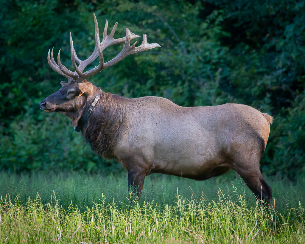
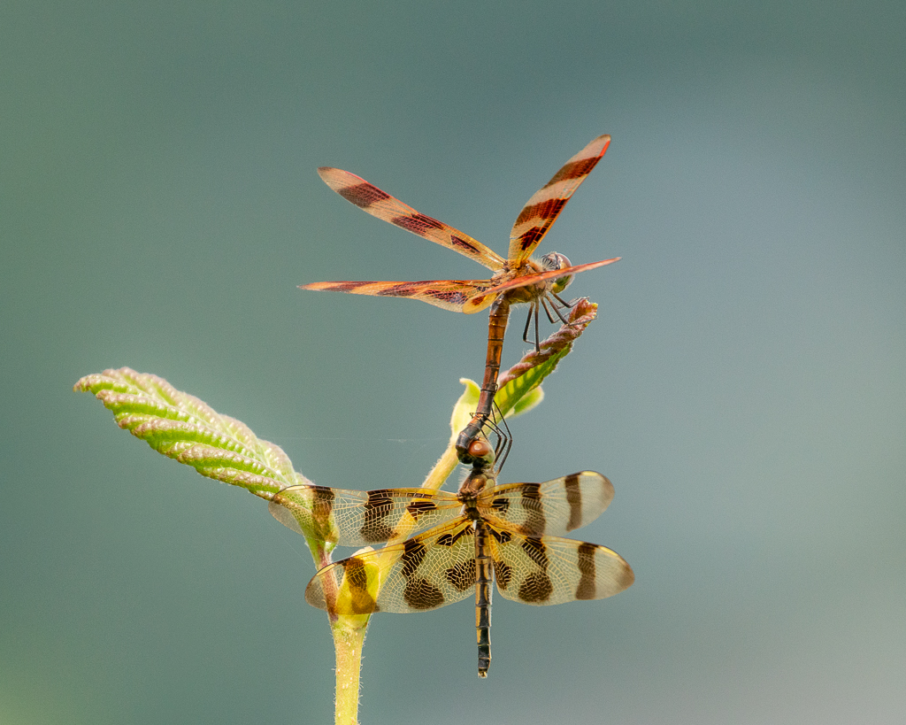
After the invigorating walk at Lake Junaluska, we drove the steep and crooked road to Cataloochee Valley, nestled in the far northeastern part of Great Smoky Mountains NP, hoping to get a glimpse of the elk that graze there in late afternoon; we were not disappointed. As we entered the Valley, we noted a car of two stopped along side one of the pastures, and sure enough, elk were observed in the woods. And then, a big bull stepped out of another section of woods and began grazing alone.After a short while, he laid down, and to our surprise began bugling. If you’ve ever heard one bugle, you know what a thrill it is. A few other elk joined him, and others were observed in a pasture about a half mile away. The big bull posed for photographs for all the stopper-bys, and while the gnats swarmed around him,, the flies ate on me!
A close look with reveal gnats swarming around his faceSuch a majestic beauty
Back at the motorhome, we watched British television before hitting the sack fairly early.
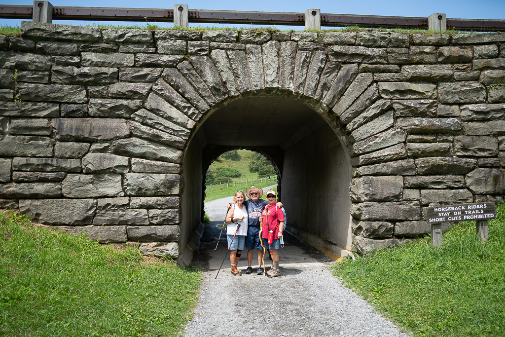
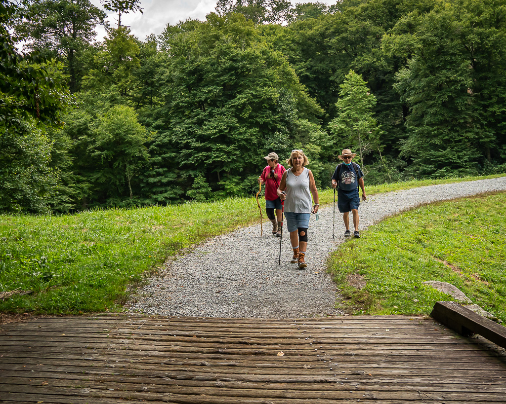
No rain was forecast for today, Sunday, an unusual occurrence this summer in the Smokies. Still tired from our road trip, I opted to edit photos and write updates for our blog, Dunngone, while Kay shopped for groceries. Consequently, we waited until late to venture out out for exercise and photos. Besides, crowds seem to be worse in the late mornings and early afternoons. Kay chose for us to walk the 2.4 mile trail at Lake Junaluska Conference and Retreat Center, followed by a trip to Cataloochee Valley hoping to see elk.
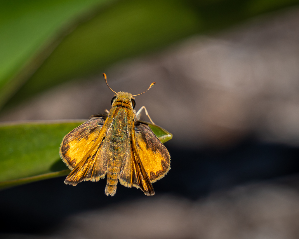
One of many Skippers seen along the trail
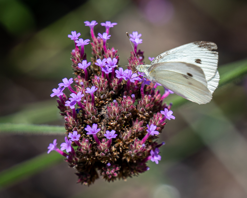
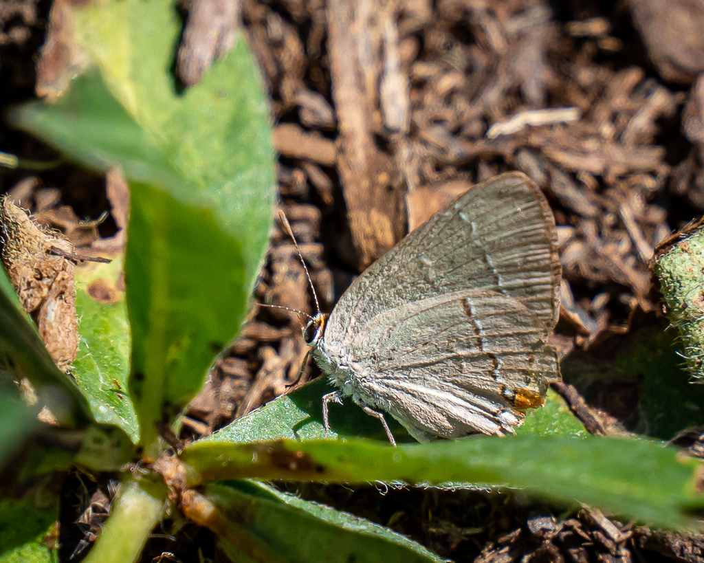
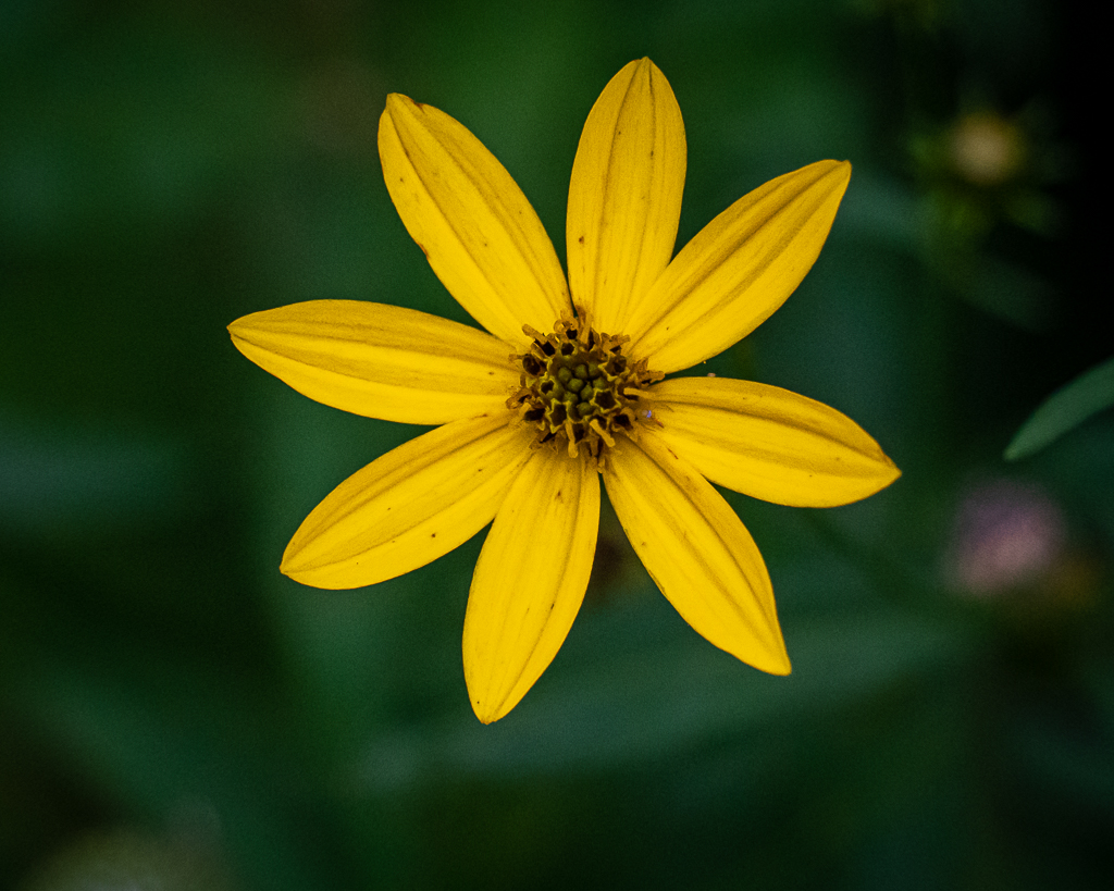
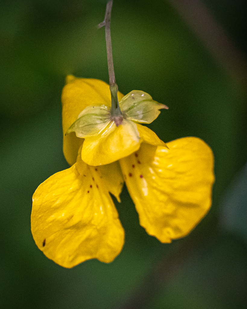
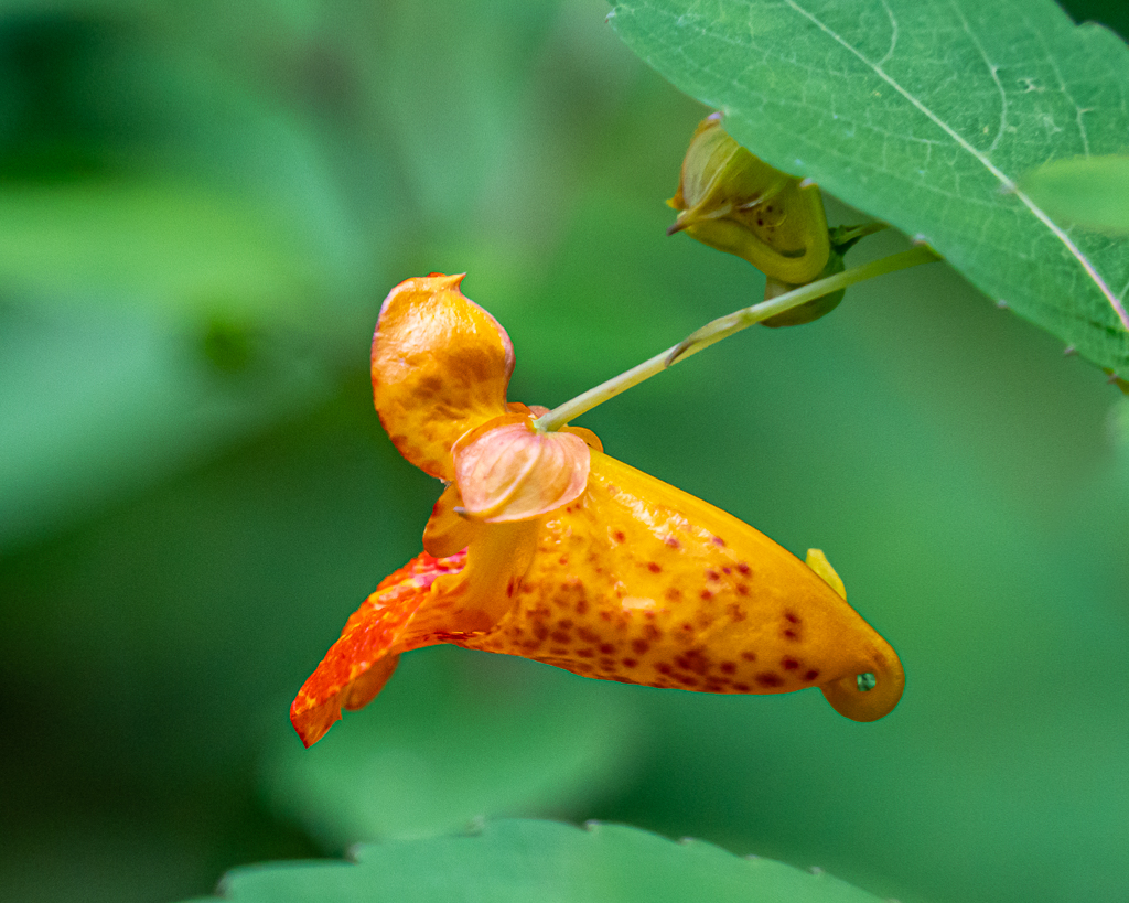
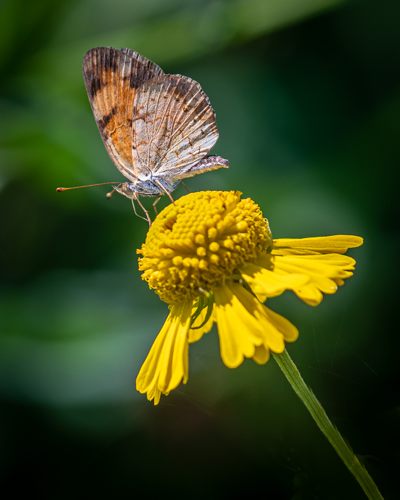
Lake Junaluska was dependable as always, offering a few blooms and butterflies.
This butterfly posed long enough for a photo
These occur mostly near the Kern Center. Sites along the trail are described as follows. Built in 1956, the Kern Center includes meeting spaces, a seasonal soda shop and a year-round fitness center. The Corneille Bryan Native Garden features more than 500 species of native plants and is a haven for birdlife. The Lake Junaluska Rose Walk was conceived in 1962 and features more than 200 hybrid tea, grandiflora and floribunda roses. The World Methodist Museum and Susanna Wesley Garden houses the largest collection of Methodist history, artifacts and memorabilia in the world. Named for John Wesley’s mother, the Susanna Wesley Garden is a place for prayer and meditation. The Terrace is a recently renovated hotel offering contemporary luxury and breathtaking views of the lake. The Harrell Center, built in 1960, houses meeting facilities, Lake Junaluska’s coffee and gift store “Junaluska Gifts & Grounds”, the SEJ Heritage Center, the Lake Junaluska library and public restrooms. Access to the boat dock is available at ground level. Stuart Auditorium, the first structure completed at Lake Junaluska in 1913, was originally an open-air construction with a dirt floor covered with sawdust. Later, the auditorium was enclosed with walls and was renamed in honor of George R. Stuart, a minister and strong supporter of the Southern Assembly. Memorial Chapel was built in 1949 as a memorial to southeastern United Methodist Church members who served in the armed forces during World War II. The Book of Memory, located in the SEJ Heritage Center, contains the names of 90,000 people who served during the war. The Room of Memory, adjacent to the chapel, houses the Lake Junaluska Columbarium. Constructed around 1930, the Francis Asbury Trail is named for Bishop Francis Asbury, one of the pioneering American Methodist ministers who passed through this area in 1810 while spreading John Wesley’s message of Methodism. The Lake Junaluska Dam was constructed between 1911 and 1913, and has a oneway road and sidewalk. Completed in 1921, the center section of the Lambuth Inn is on the National Register of Historic Places. It is named to honor Bishop Walter R. Lambuth, a notable missionary. Inspiration Point offers panoramic views of the lake and mountains, and it is a scenic destination for all to engage in quiet meditation, prayer and study. The Lake Junaluska Cross was constructed in 1922. The Amphitheater was built in 1988 and is now a popular location for vesper meetings, worship services and Lake Junaluska’s annual Easter sunrise service. Built in 1988, the Turbeville Footbridge enables visitors to complete the shorter 2.3-mile path that circles the lake. Next, and last, is the swimming pool and kayak/canoe/paddle board center.
Most butterflies were observed near the Harrell Center
Together with Nan and George, we left Zionville, NC, about 10 AM on Saturday, each going opposite directions. We drove the Blue Ridge Parkway south and west to Asheville, then the interstate to Waynesville, and local state highways to Maggie Valley. A short drive, just over 120 miles taking about 3-1/2 hours, wore us out, and we lollygagged the remainder of the day.
After coffee and a smorgasbord of breakfast foods, we set forth to Blowing Rock. Blowing Rock sits at 4,000 feet, dangling over Johns River Gorge located at 3,000 feet. Typically, a peculiar current of air flows upward from the rock caused by rocky walls of the gorge creating a flume which forcefully sweeps northwest wind. If one were to stand on the rock and throw a light object (say a handkerchief), the object would not fall but simply float or return to you.
Blowing Rock
There were a number of short nature trails among the boulders at this private tourist attraction. While we masked up anytime anyone was within about 10 feet, most of the crowd there did not wear masks.
Nan and Kay
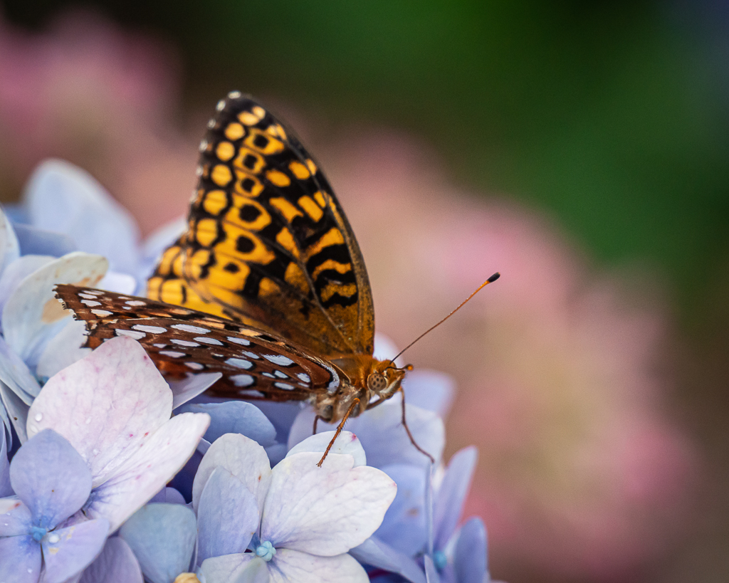
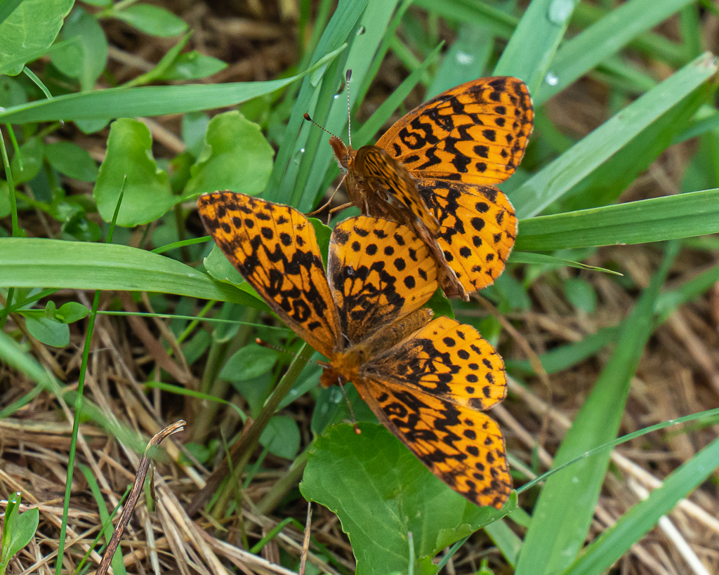
Variegated Fritillary
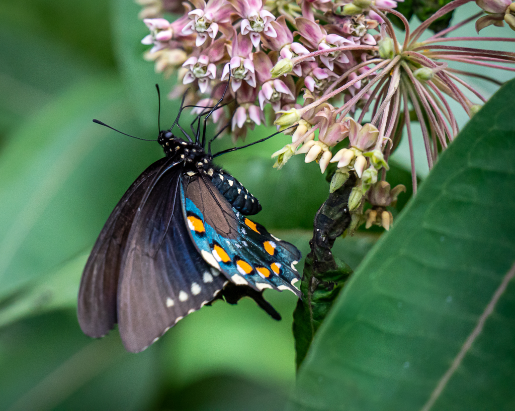
Pipevine Swallowtail
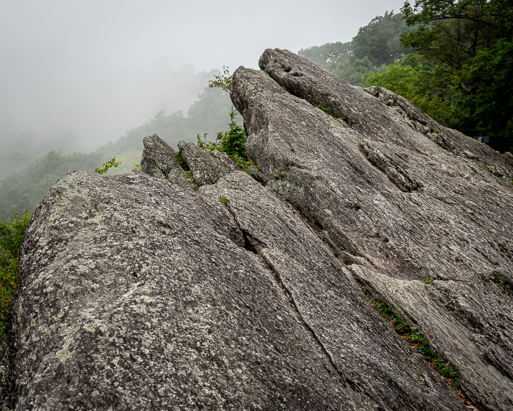
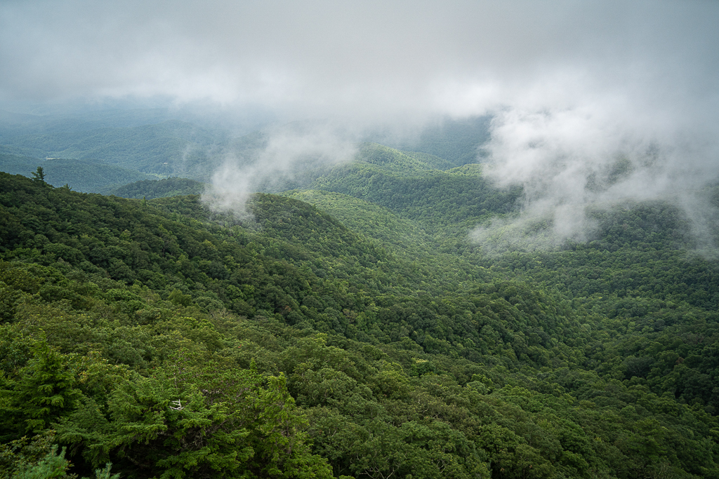
Great Smoky Mountains
Nan and Kay
Wanting a more substantial hike, we drove to Annie Cannon Park in the heart of Blowing Rock. Here, the Glen Burney Trail offers three majestic waterfalls along the trail adjacent to New Year’s Creek. Just as we began the hike, it started raining to the extent that we opted to turn back. It proceeded to rain all day, driving us to play bridge back at the cabin. Laughing and thinking at the same time proved to be a challenge, as we had a blast. It’s so much fun to enjoy time and laugh with family!
Kay was the primary dinner preparer, and the fish tacos and all the fixin’s were fabulous.
Up bright (actually, it was raining) and early Thursday morning, we packed the newly repaired car and secured the motorhome (awning in, water turned off, hot water heater turned off, shades pulled, etc.). And then we drove north on state and federal highways and I40 to join the Blue Ridge Parkway north of Asheville, NC; our destination was Zionville, NC, near the NC and TN state lines. There, we met Nan and George, Kay’s sister and brother-in-law, for a two-night getaway. It rained most of the three-hour drive, with low clouds enveloping the mountains. As we arrived at the quaint cabin, Nan and George were at the porch to greet us.
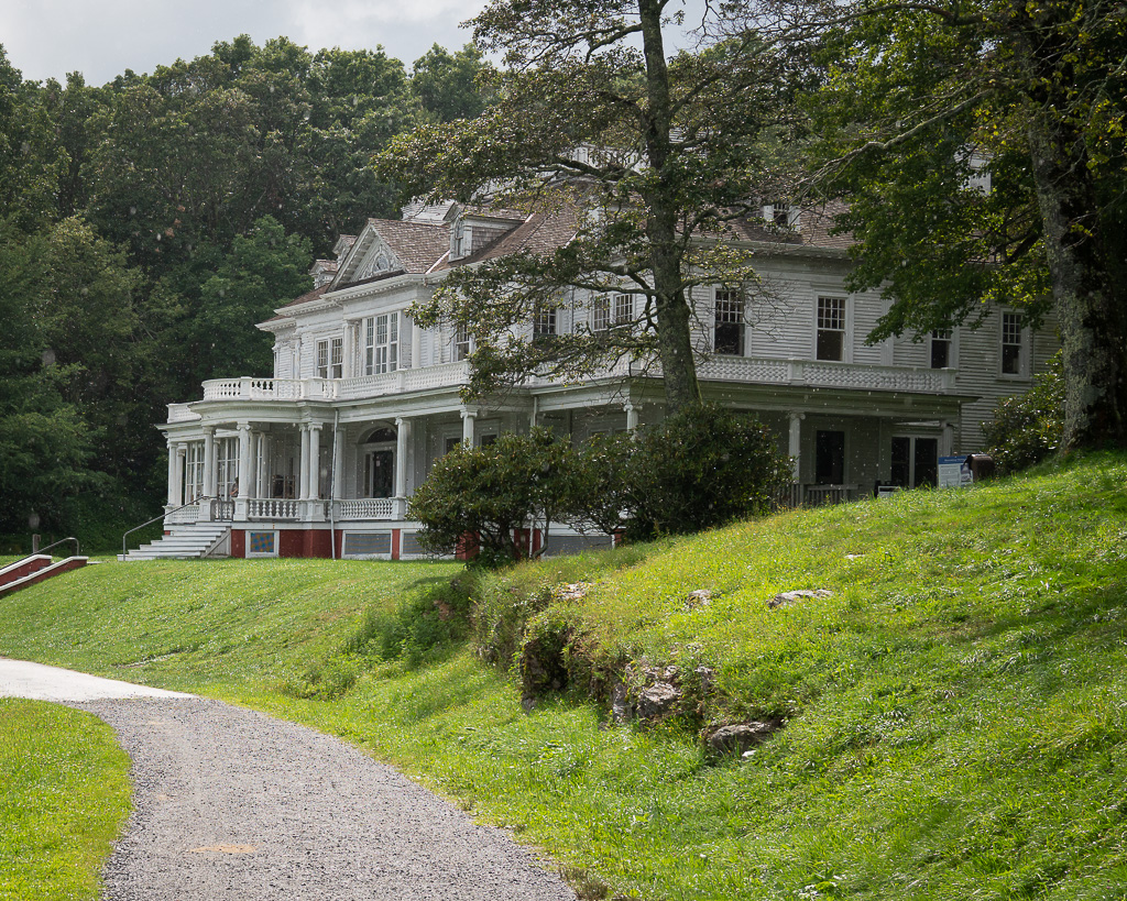
After unpacking food, clothes, and other paraphernalia, the four of us loaded back into the car for a drive to the Moses H. Cone Memorial Park.Moses H. Cone Memorial Park, on the Blue Ridge Parkway near Blowing Rock. The park preserves the country estate of Moses Cone, a prosperous textile entrepreneur (he and his brother cornered the market on denim), conservationist, and philanthropist of the Gilded Age. In 1901, he built Flat Top Manor, then a gleaming white 20-room mansion in the grand Colonial Revival style.
Flat Top ManorFlat Top Manor’s carriage house
Twenty-five miles of carriage trails wind through the fields and forests of the 3,500-acre estate. Moses Cone’s interest in nature and conservation led him to plant extensive white pine forests and hemlock hedges (at the advice of friend and noted conservationist Gifford Pinchot), build several lakes stocked with bass and trout, and planted a 10,000-tree apple orchard.
Nan, George, and Kay near the beginning of our hike
Our 3.5 mile carriage road hike took us on a loop descending to an unnamed lake.
L to R, Kay, Nan, and George on the carriage road trail
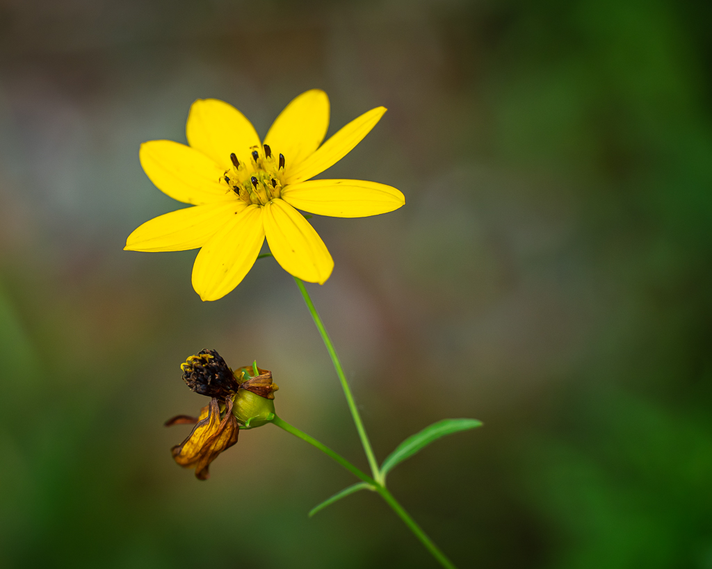
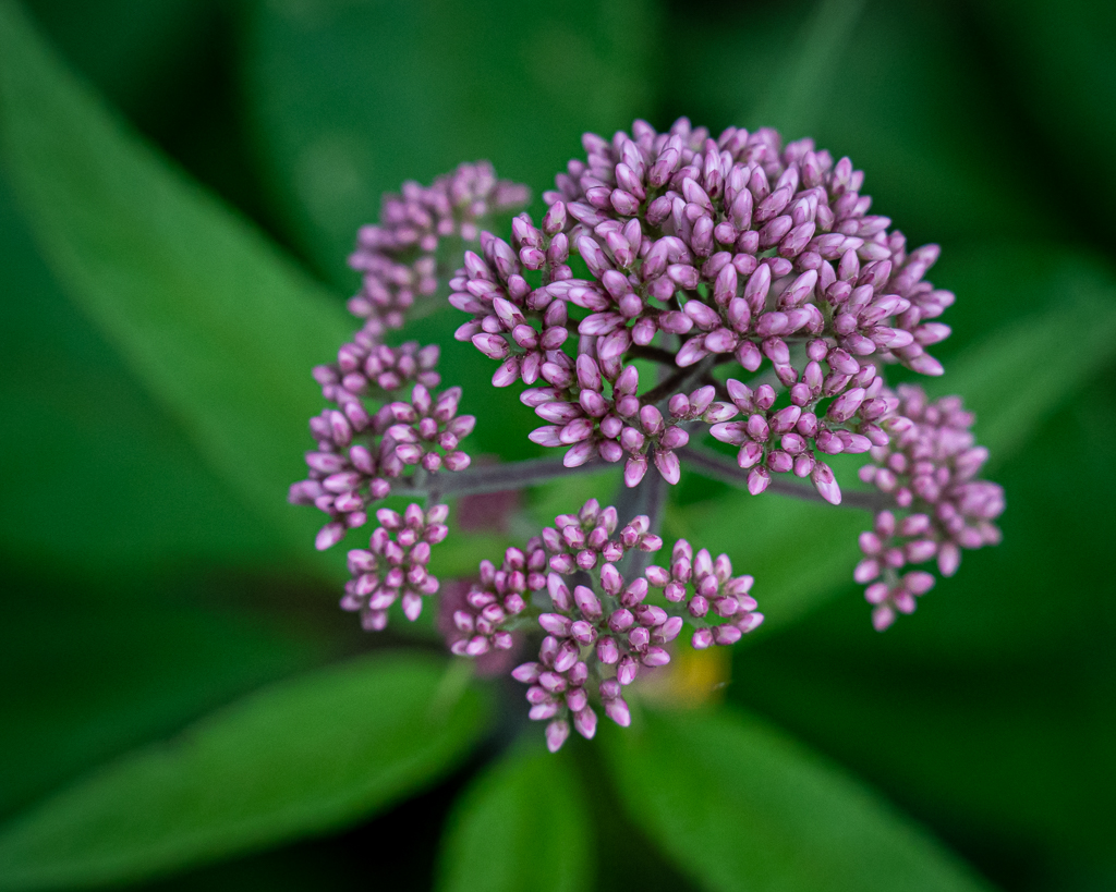
Rhododendrons lined the carriage road, and covered the forest floor—one can only imagine what it would look like in mid-June when the Rhododendrons are in full bloom. Scattered along the roadside among the Rhododendrons were beautiful wildflowers; Master Gardeners Nan and George identified them and provided some information about each species. It was like a guided tour! Even a few butterflies were observed nectaring on the blooms. Light rain accompanied us on the ascending half of the loop trail.
We returned to the cabin to enjoy happy hour after which Nan (and Kay) prepared a sumptuous dinner of salmon, broccoli, and Caesar salad (my favorite). Bedtime was early, after watching an episode of MI5 via Amazon video and a BritBox subscription.
Traveling mandates a degree of flexibility, particularly if one is in an RV. I am spending ALL of today at the Honda dealership in Asheville, NC, for right front wheel bearings, new brake pads and adjustments, tire alignment necessitated by new front wheel bearings, draining, flushing, and adding new fluids to the rear end (not mine, fortunately, but it probably needs it, too), other new fluids, etc. to the tune of about 3 car payments. This was unplanned and unexpected, but the car has almost 160,000 miles. Meanwhile, Kay washed clothes, packed for an upcoming road trip, and tidied up the motorhome. We would rather be hiking. However, we are truly blessed that we can afford the time and cost for the repairs, especially now with such high unemployment among the population.
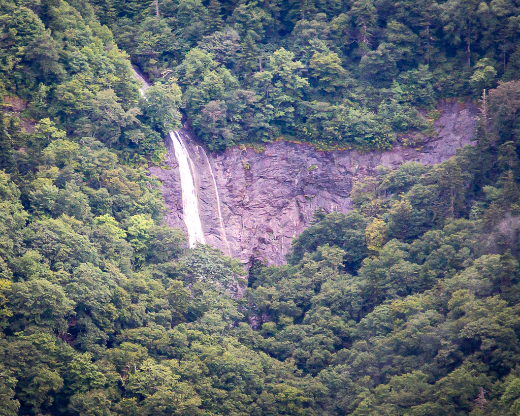
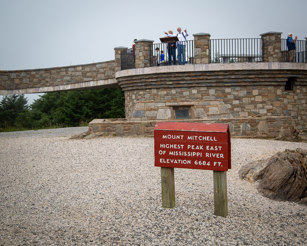
Trying to forget about the disappointment yesterday (Tuesday) of not hiking to the top of North Carolina’s Chimney Rock, we traveled the Blue Ridge Parkway north to return to Mount Mitchell (via NC Hwy 128 at MP 350) to walk to the summit (it was raining during our trip here last week). At Milepost 361.2, we stopped to view Glassmine Falls. While the sign at the overlook claims it is 800 feet tall, it is likely only about a 200-foot drop. This is the only view of Glassmine Falls, and you cannot hike to its base.
Glassmine Falls along the Blue Ridge Parkway
Just after beginning the short hike, the mountain became shrouded in light mist. Further up the trail, the mist became heavier, turning into a light rain. Though we brought raincoats, neither of us had thought to take them out of the car! By the time we returned in a full blown rain, we were soaked; thankfully, the camera and lens were water resistant.
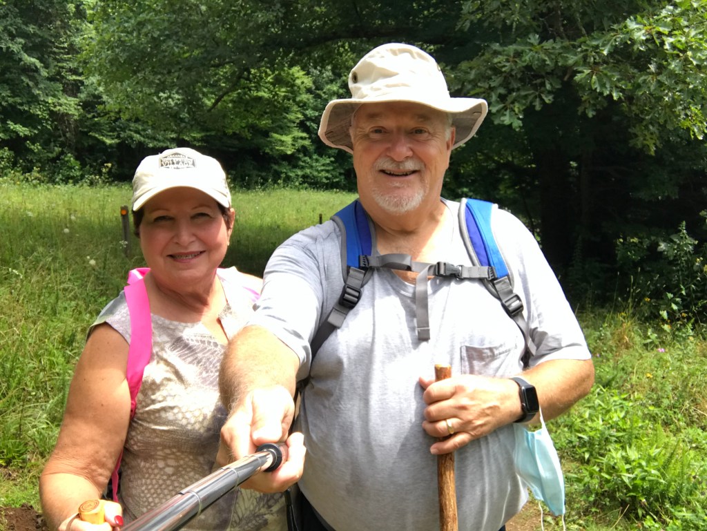
Cloudy, but dry, as we began the walk/hike to the top of Mount Mitchell, NCWe made it; it’s lightly rainingOur spectacular view amp Mount Mitchell, NC
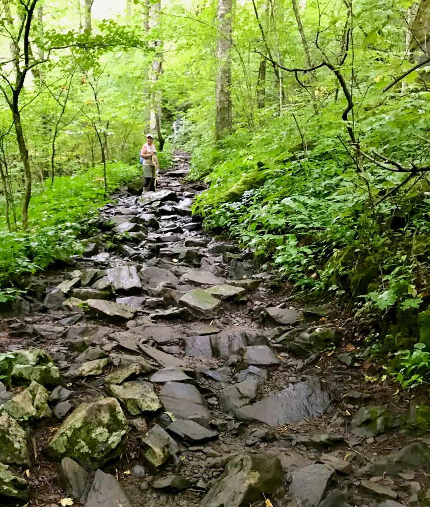
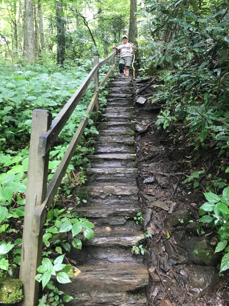
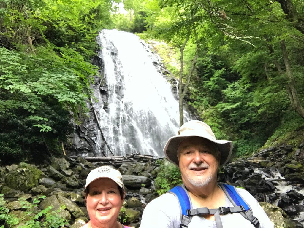
From Mount Mitchell, we continued north on the Blue Ridge Parkway to Crabtree Falls, MP 339.5. The Falls is accessible via a 3-mile woodland hiking trail, with a steady and sometimes difficult descent and return climb on craggy rocks and stone staircases. The 70-ft. waterfall was worth the trek! Once again, few people on the trail wore masks.
Beginning the hike from near the parking lotTough hiking over this craggy rubbleWe both used caution descending and ascending these stone stairsCrabtree Falls
On a roll, we continued north to Linville Falls, MP 316.3. Linville Falls is the most visited and photographed waterfalls in North Carolina. The Falls drops 90 feet into the 12-mile long Linville Gorge with cliffs towering above the river. We took the Erwin View Trail, an easy 1.0 mile roundtrip hike to the Upper Falls overlook. At the Upper Falls overlook, one can observe the cascades and watch the water rush into a narrow canyon before it plunges 45 feet over the lower falls. A quarter mile further, the Chimney View overlook offers an excellent chance to photograph both the upper and lower falls, along with the impressive cliffs. Because of the crowds and lack of “masking”, we did not do this segment. This falls reminded us of the Athabaska Falls between Banff and Jasper in Alberta, Canada.
Beginning the hike to Linville FallsKay at the Upper Falls overlook—double cascades behind her, falls in front and to her left,The narrow canyon just before the falls
On the two-hour return trip to the motorhome, we stopped at Walgreens in Waynesville to pick up an early birthday present for yours truly, a 28-200mm f/2.8-5.6 Di III RXD from Tamron to use on the Sony a7riii mirrorless camera. (Another thing 8 learned from a Getaway Couple (https://www.getawaycouple.com) was that each Walgreens has a delivery station for FedEx (a great asset for travelers). Back at the motorhome, we collapsed and thoroughly enjoyed an adult beverage before showers and bed.
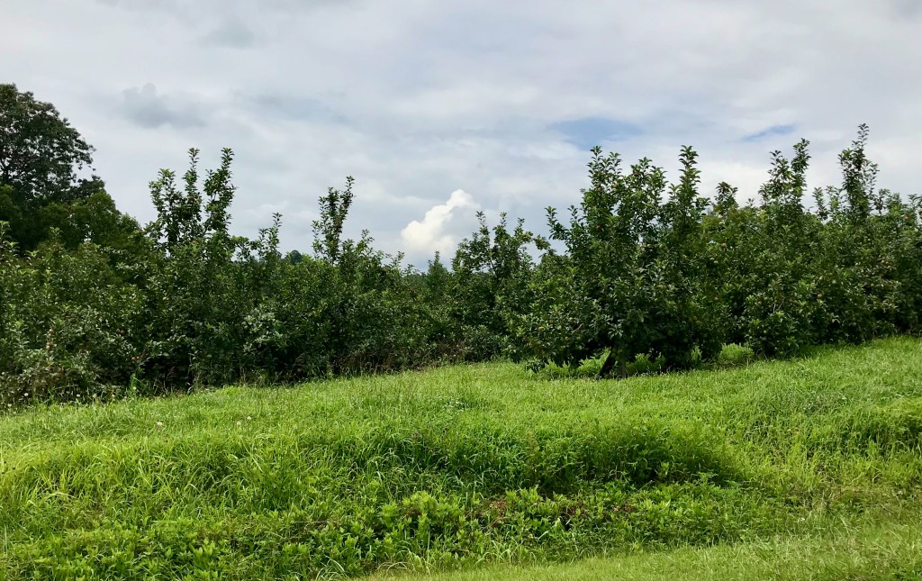
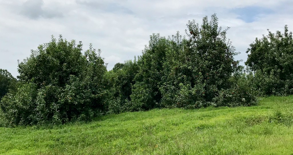
The older and “more retired” I get, the longer it takes to get started, particularly when I forget little tasks I plan to do! Consequently, it was just before lunch when we began driving towards Chimney Rock State Park, south and east of Asheville, NC. Our first stop was Camping World—it was the cleanest and most fully stocked Camping World we’ve seen. After purchasing an aluminum step and awning tie downs, we continued towards the state park. Regrettably to add to our delays, the Garmin GPS routed us to a dead end. The silver lining in this dark cloud was the numerous apple orchards along the hilly and curvy rural roads.
One of many apple orchards along the wayOrchard after orchard were seen along the road
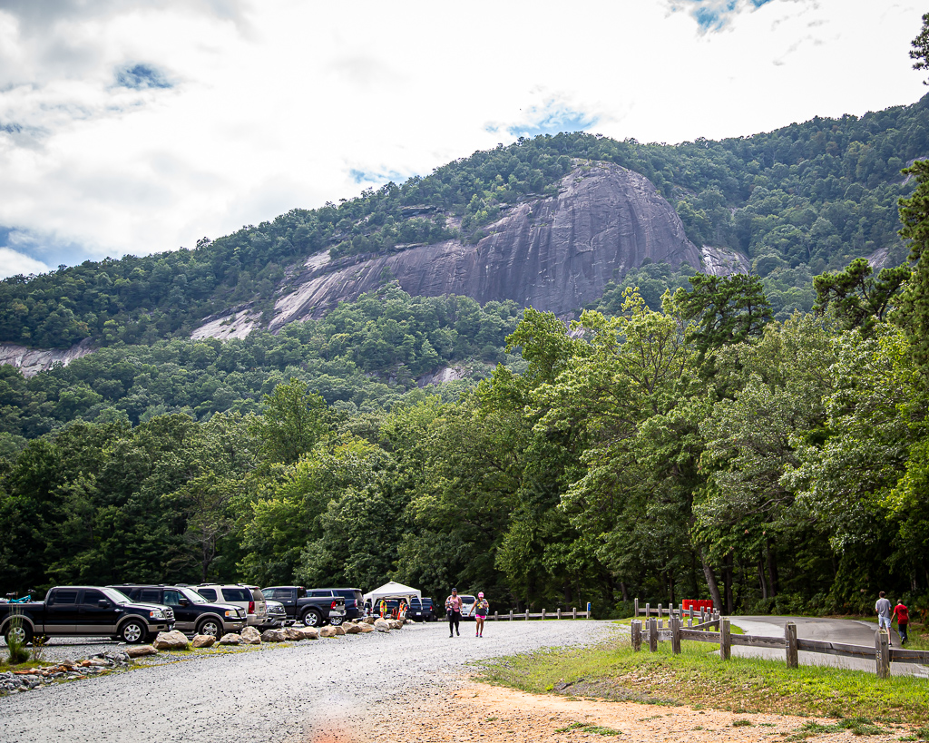
Some 45 minutes later, after rerouting using Apple Maps (I highly recommend this app), we arrived at Chimney Rock State Park, paid our $17 each, drove to the parking lot, and write for the buss to the trailhead. The bus was packed, and most riders did not have masks. With this and the already late hour, we turned away and returned to the motorhome. It is frustrating that “Practice social distancing” signs are posted all over, but this state park does not fully practice it. And, we are seeing so few people wearing masks.
Chimney Rock in North Carolina, a granite monolith
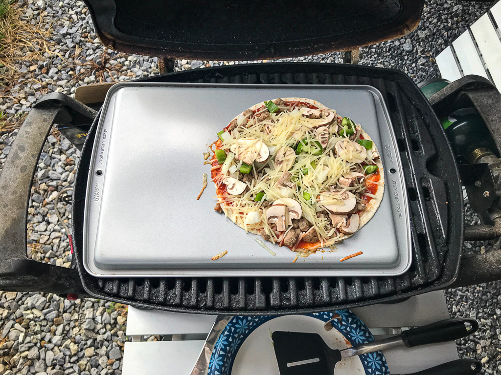
Having watched a VLOG entry on Getaway Couple (https://www.getawaycouple.com) where they had “pizza night”, the thought of having our own pizza night was quite appealing. However, we had to find an alternative to the calorie-rich entree. Using low carb tortillas, turkey sausage crumbles, green pepper, jalapeño pepper, onion, mushrooms, pizza sauce, and mozzarella and Parmesan cheeses, we gave it a try. With no pizza stone (we’ll remedy this next time we travel), we used an inverted cookie sheet, and cooled the pizzas 10 minutes on a HOT grill. OMG (oh my goodness), they were fantastic; this will become a regular on our trips.
Pizza ready to cook over an inverted cookie panPizza after cooking on/in the grill
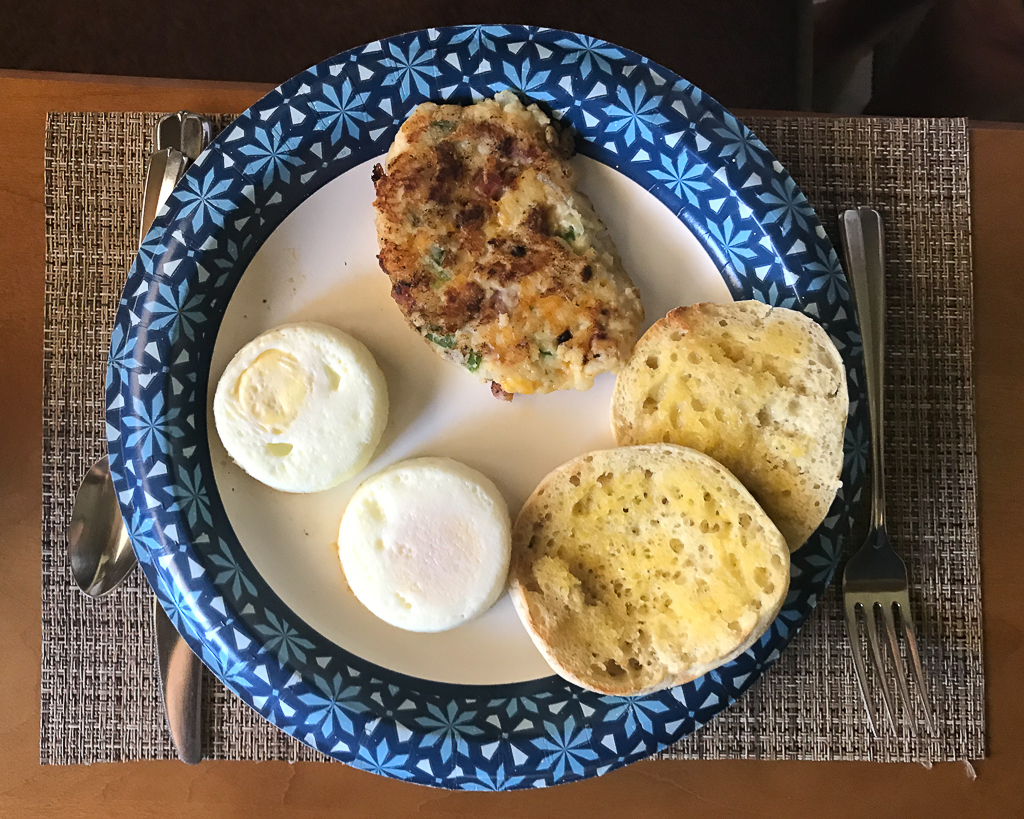
“If it’s rockin’, no knockin” is a humorous phrase used in the RV world intended to mean … well, you get my drift. This morning, as I was in the front of the motorhome working on the blog, Kay was in the back catching up on email and news. I felt the RV rockin’ as it does when someone jumps or otherwise makes a big move, and just assumed Kay was moving about on the bed to find the remote control or something. She thought I was moving about in the front of the coach. Except this time, the rockin’ went for several seconds longer than what we normally feel. About an hour later, Kay noted that there was a 5.1 earthquake in Sparta, NC, some 150 miles from us, as the crow flies. This is the third earthquake I’ve personally witnessed, all over 5 on the Richter scale, and it’s a weird feeling! After this jolt, we got an earlier start than usual preparing, eating, and cleaning up after breakfast.
Pancake Hashbrowns—Potato pancakes with ham, onion, green pepper, and cheddar cheese Baked eggs, pancake hash browns, and English muffin for breakfast
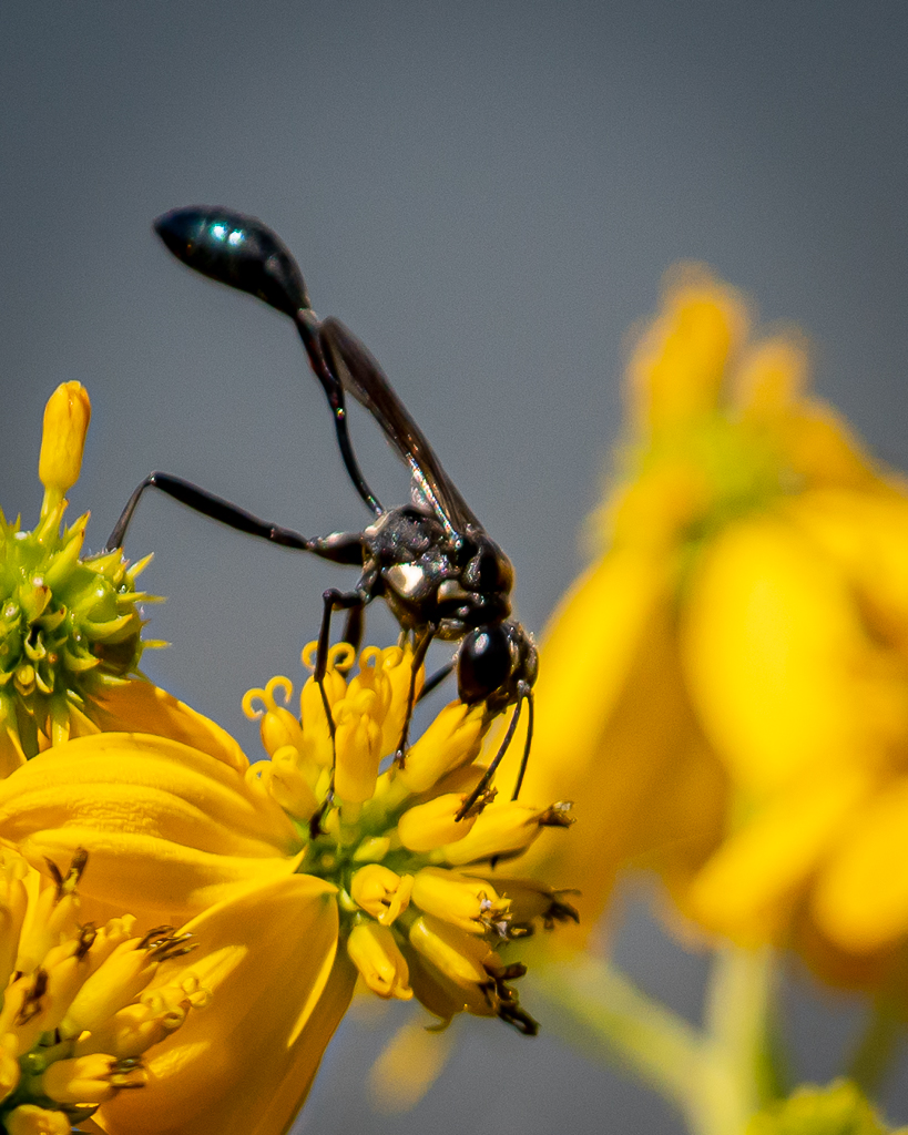
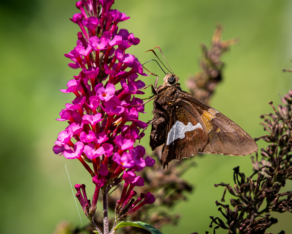
A second cup of coffee later, we drove to Junaluska. The wildflowers, butterflies, and two-mile walking path around the lake were too appealing to do only once (see blog post, Saturday, July 25). It was crowded, but about half the people were masked and most “socially distanced”. The area near where we parked had the best wildflowers and butterflies, but we walked the whole 2.1 miles, with the camera-mounted tripod (shy of 10 pounds) gouging holes in each shoulder—gotta remember to bring the padded tripod sleeve.
Silver-spotted Skipper
Eastern Tiger Swallowtail
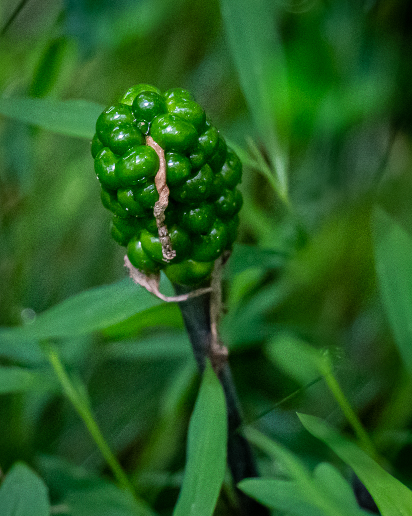
Blackberries
Dragonflies
Viceroy
For you dog lovers
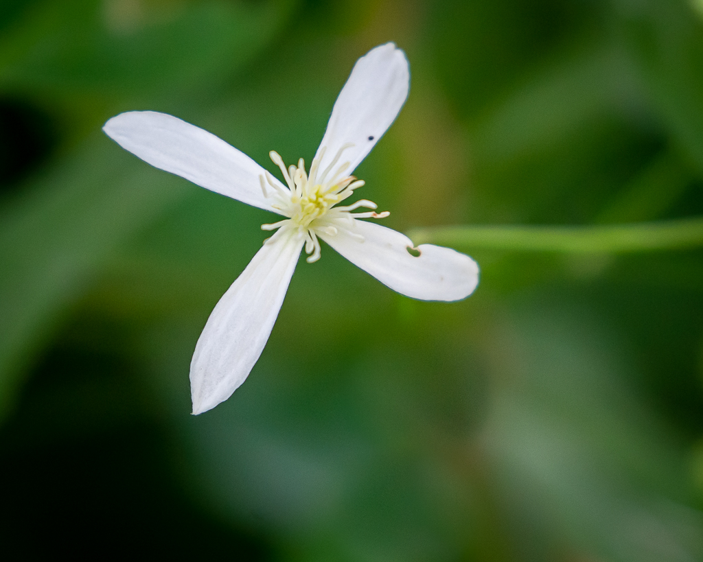
After the walk, we strolled through a natural garden filled with native plants, but it was too dark to attract pollinators, thus, few photos were made.
After a late start Saturday morning, we drove to Bryson City via Cherokee. Bryson City is a neat town, but was a bit too crowded for us. Consequently, we did not stop and walk around, but drove the main city streets. Except for it being larger, population wise, it reminded me of the town where I grew up, which is now only a shadow of what it used to be. Bradford, AR, was a vibrant country town in the 1950s when folks would come from their farms and rural places for all day shopping, mainly for groceries and visiting. The sidewalks were full and the main street was busy. Update to 2020, and you have Bryson City—except there was no pandemic and no need for masks in 1950s Bradford; only the fear of polio.
Bryson City, NC
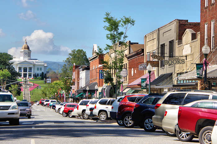
From Bryson City we drove to Sylva. With 2,500 people, Sylva was larger than Bryson City, and though considered an historic town, appears to be modern and thriving with small businesses and fast food restaurants.
Sylva, NC
Again, we drove the main city streets, and then departed for Maggie Valley. As is now the custom, it began raining in the late afternoon and rained hard for two or three hours, preventing sitting outside for adult beverages.
Collection of trails and greenway quotes, terms, acronyms, tools as well as trail publications and presentations and 100s of photos from my bicycle and hiking adventures. .
This journal was begun several years ago, and reflects an accurate record of each day fished. Please enjoy it, and remember that fish are too valuable to be caught just once, and the places they live are too valuable to be mistreated.