Wednesday, September 12, 2012—New Brunswick and the Bay of Fundy

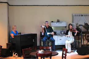
Today is Sandy’s birthday, and we celebrated by serenading her in the hotel lobby.

We departed PEI early this morning in order to see the high tide at Hopewell Rocks on the Bay of Fundy. We crossed the Confederation Bridge, the longest bridge in the world over ice-covered waters, paying our toll on the bridge approach. As an island, PEI is somewhat isolated, with only two ways in or out by automobile: the ferry and the Confederation Bridge. The toll is collected only on the way out! As soon as we crossed, we were in New Brunswick. We drove to near Moncton, where we stopped for breakfast and coffee, and continued towards the Bay of Fundy, surprisingly seeing a ring neck pheasant on the outskirts of Moncton.

120912-6The Bay of Fundy is famous for having the highest tidal range in the world with, reaching a differential as high as 53.5 feet between high tide and low tide.  Today, we experience a very moderate tidal differential of only 22.6 feet.  In just a few days, on September 19, it will be 44.0 feet

The Hopewell Rocks, also known as the Flower Pot, is a provincial park that provides an opportunity to view high tides, and then walk on the ocean floor at low tides.  We rushed to be there at high tide.  Kay at water's edge at high tide, Hopewell Rocks, Bay of Fundy, New BrunswickAfter paying our entrance fee, and walking down the trail to the observation point, there was only a narrow band of beach exposed; we were a few minutes late, but the high tide had only dropped a few inches. We walked among the rock formations, on the narrow beach, taking pictures to compare with the same area at low tide later in the afternoon. The reddish brown color of the water was surprising, but takes on the color of the soil along the New Brunswick coastline, and the ever-changing tide keeps the water and soil agitated, giving the water this unusual color.

Kay, John, and Sandy at one of many covered bridges we saw in New BrunswickLeaving Hopewell Rocks, we drove south through beautiful countryside, noting the predominance of old, beautiful Baptist churches; we’re not sure if they maintain the same mostly evangelical beliefs of Baptist churches back home, but they easily outnumbered all other denominations combined. Along the way, we saw our first of several covered bridges.

120912-36Continuing south along the Bay of Fundy coast, we "detoured" off the main highway towards Cape Enrage. All of us—Sandy, Kay, John, and I—really enjoy taking routes on roads less traveled. Even off this loop, we found still another one that took us to an historic shipbuilding town, a road across a tidal barrier dam, and another out-of-the way road through one of Canada’s national wildlife preserves. The sparse farms and small villages were all neat and clean, and all the buildings looked freshly painted. Again, we saw a multitude of old mostly white churches, with a vast majority being Baptist.

120912-62This out-of-the way drive took us to Cape Enrage Lighthouse, sitting on a large cape jutting out high above the Bay of Fundy. I hesitated to pay the fee to access this area, but am glad I did. Again, I took the stairs down to the sea "floor" to walk among the clumps of sea weed and fossil embedded rocks. We had a great lunch at their cafe. Cape Enrage was not on our itinerary, but proved to be one of the most scenic places we visited.  It had barely escaped closure, but a private, not-for-profit entity took control, opened the restaurant, and to assist in funding, built some zip lines, provided kayak tours, and developed some other outdoor entertainment.  We were there in the off season, and it was not crowded.

Arriving at Fundy National Park, we were confused by directions to scenic views, and the lack of road and highway signage, though this seems to be the rule rather than the exception in all the Maritime Provinces. Consequently, we drove the breadth of the park, missing what we thought was a lighthouse view.

120912_Edited-8Low tide was approaching, so we returned to Hopewell Rocks where we all walked among the many rock formations now exposed.  Walking on the ocean floor, and sea weed, did not seem like much of a feat, until one realized that only a few hours ago it was covered with water. Again, the tidal differential today is a mere 22.6 feet, but has reached as much as 53+ feet, the highest recorded in the world. 120912_Edited-14

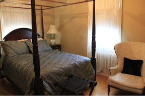
After seeing this "life list" item, we found our B&B, checked in, and relaxed in the spacious quarters and common areas. Dinner was at a dude ranch, and was good, wrapping up a long, but rewarding day.

– Posted using BlogPress from my iPad

Tuesday, September 11, 2012—Prince Edward Island

We crossed to Prince Edward Island on a ferry just like thisAfter our last breakfast at the Bell View B&B, we loaded our luggage and drove south and west to Caribou, Nova Scotia, to catch the ferry to Prince Edward Island (PEI). The ferry route was 14 miles, and with the effects of the just passed hurricane lagging behind, the seas were a bit rough.

None of us knew quite what to expect of PEI, but we were not prepared for its mostly rural nature and the extent of farming on the island. 120911-7We drove from the ferry landing northwest towards Charlottestown, then through this capitol city’s historic district (reminding us of Charleston, SC) of Charlottetown. We then drove to the northern coast, and along the Prince Edward Island National Park beaches.  Folks throughout the Maritime Provinces are really proud of these beaches; they are quite different from ours, particularly those idyllic white sand beaches along our Gulf of Mexico coast in Florida and Alabama.  I’m sure we take them for granted.

Large fox, Prince Edward IslandAs we were leaving the Prince Edward Island National Park, Sandy spotted a pair of foxes along the road.  We stopped just long enough to snap a few pictures.  The foxes are larger than those at home, and a different color.  They were, however, quite beautiful.

House on farm that was the basis of Anne of Green GablesAt Cavendish, we toured the Anne of Green Gables farm. Green Gables is a popular tourist destination. Each year hundreds of thousands of visitors from around the world visit the site which inspired the setting for L.M. Montgomery to create her beloved tale of a red-haired orphan, Anne of Green Gables. In addition to the Green Gables House, several museums and sites invite visitors to learn more about Anne and Montgomery.

One of many old churches we saw in the Maritime Provinces. This was on Prince Edward Island.It was then time to drive south for our overnight accommodations in Summerside, PEI.  As with the rest of the Maritime Provinces, we saw lots of old churches.  Most of them were white, and had tall bell towers.

After checking into our hotel, we rested briefly, had dinner at a restaurant near the hotel, and retired for the evening.

– Posted using BlogPress from my iPad

Monday, September 10, 2012—Alexander Graham Bell National Historic Site

We awoke to rain and wind as we were on the western edge of a major hurricane passing through the western part of the Northern Atlantic.  We were lucky with only lots of rain and wind, because the hurricane hit just north of us on the eastern coast of Newfoundland.

Today was a catch-up day, with time for shopping, hanging out, fishing, or any thing else that suited our fancy.

Alexander Graham Bell, most famous as the inventor of the telephone, chose to build his Canadian residence in Baddeck on Cape Breton. According to Bell, "I have travelled the globe. I have seen the Canadian and American Rockies, the Andes and the Alps and the highlands of Scotland, but for simple beauty, Cape Breton outrivals them all." The Alexander Graham Bell National Historic Site is a 25-acre park overlooking the Bras d’Or Lakes, a saltwater inland sea. This complex, with its three exhibit halls, contains the largest collection of Bell’s artifacts and inventions, including replicas of the first telephones and a full scale model of the HD-4 hydrofoil craft. Bell invented many, many things but considered the hydrofoil his most important. We spent a couple of hours visiting the complex, a good rainy day activity.

Kay and Sandy tried to shop in the wind and rain, while John visited with a local "guide" to find out more about trout and Atlantic salmon fishing in the Margaree Valley. He reported back that the guide said one prominent fisher had fished the area 27 years without catching an Atlantic salmon—glad we didn’t book a trip! We all had lunch at the Yellow Cello, a local hangout, and it was decent fare.

Lunch was followed by a drive to Cheticamp, where Kay and Sandy toured a hooked rug museum, and we all toured an old Acadian Catholic church. Cheticamp is a unique Acadian village on the west coast of Cape Breton. It is now a fishing community on the Cabot Trail at the western entrance of the Cape Breton Highlands National Park.  The downtown area overlooks a large protected bay on the Gulf of St. Lawrence.  It has about 4,000 residents, most of whom speak French as well as English.  It is absolutely Acadian in culture, and the largest French community on Cape Breton Island.  We returned to Baddeck, and had dinner at the Telegraph Inn. They had music, but it was more of a dinner type music.

120910_Edit_28We left there and attended a ceilidh in town. The young fiddler, Mike Hall, was a native of New Brunswick, and was extraordinary, providing lots of information about Celtic music and ceilidhs intermixed with his playing of reels, jigs, strathspeys, and waltzes, all Celtic music tunes. He said he had some 2500 tunes in his repertoire. Some of the more daring visitors were given a square dance lesson as the Celtic music played. This was one of many highlights of our time on Cape Breton Island.

– Posted using BlogPress from my iPad

Sunday, September 9, 2012—Fortress of Louisbourg

We keep getting up later and later as we acclimate to the Atlantic Time Zone—thank goodness, as I can’t get to sleep until early morning. By the way, the Atlantic Time Zone is two hours in front our Central Time, i.e. 8 AM in the Atlantic Time Zone is 6 AM in the Central Time Zone.

After another great breakfast at the B&B, we departed Baddeck, driving east to Sydney and then south to Louisbourg National Historic Site of Canada. It was foggy and misting rain, weather which would remain with us for the entire day. We arrived at the Fortress of Louisbourg shortly after 11 AM, presented our Canada Parks pass, and caught the shuttle to the Fortress grounds.120909_Edit_11
The Fortress of Louisbourg (French: Forteresse de Louisbourg) is a national historic site and the location of a one-quarter partial reconstruction of an 18th century French fortress at Louisbourg on Cape Breton Island, Nova Scotia. Its two sieges, especially that of 1758, were turning points in the Anglo-French imperial struggle for what today is Canada.

The original settlement was made in 1713, and initially called Havre à l’Anglois. Subsequently, the fishing port grew to become a major commercial port and a strongly defended fortress. The fortifications eventually surrounded the town. These walls were constructed mainly between 1720 and 1740. By the mid 1740s Louisbourg was one of the most extensive (and expensive) European fortifications constructed in North America. Fortress Louisbourg suffered key weaknesses, since it was erected on low-lying ground commanded by nearby hills and its design was directed mainly toward sea-based assaults, leaving the land-facing defences relatively weak. Captured by British colonists in 1745, it was a major bargaining chip in the negotiations leading to the 1748 treaty ending the War of the Austrian Succession, and was returned to French control from British in exchange for Indian city of Madras. It was captured again in 1758 by British forces in the Seven Years’ War, after which it was systematically destroyed by British engineers. The fortress and town were partially reconstructed in the 1960s, using some of the original stonework and providing jobs for unemployed coal miners in the effort. (Wikipedia)

120909_Edit_12We quickly made our way to the Governor’s Hall and parade grounds to observe firing of one of the cannons.  Only about one pound of powder was used, and it made a big bang—during the real battles, 6 pounds were used.  The photo shows the plume of smoke, and if one looks carefully, the cannon crew has their fingers in their ears.

120909_Edit2_01We toured the Governors Hall, and the many rooms used for living, cooking, meetings, business of the area, and essentially any other activities that would allow it to be self sustaining.

120909_Edit_15While this was a magnificent building, with lavish and luxurious amenities for the upper echelon, it was a real eye opener to see and hear how the young French soldiers lived, for they were ill fed, lack warm clothes, and worked long, hard hours—but it beat what they would have experienced back in France.

We then made our way through the other streets and alleys to the many buildings and their rooms making up the fortress.

120909_Edit_25Because this was a living museum, we were able to visit with the many characters in period dress, reenacting every day life in a mid-1700s French settlement in the new world.  They spoke to us as if we they were actually living in the These included cooks, officers, soldiers, blacksmiths, priests, engineers, sailors, and a full cadre of citizenry making up a village during that time period.120909_Edit_19


We even had lunch in the village, served on utensils that would have been popular during the period and by a waitress dressed in costume.  The food was mediocre at best.

Following our visit to Fortress of Louisbourg, we spent considerable time trying to find the Marconi historical site. Regrettably, this was apparently not an important site despite being designated a national historic site, and road work in the area made finding the site near impossible. Through John and Kay’s astute navigation abilities, we finally found the site, only to find it closed and the building empty. Apparently, Parks Canada has been undergoing severe budget cutbacks.  Nevertheless, we walked among the ruins where the towers had been built, and the first radio signals beamed.

Back at Baddeck, we had lobster dinner at Telegraph Hill and it was both very good and relatively inexpensive, two of my most important criteria for a restaurant.

– Posted using BlogPress from my iPad

Saturday, September 8, 2102—The Cabot Trail and Cape Breton Highlands National Park

120908_EB01After a good night’s sleep at the bed-and-breakfast, and a great breakfast in their dining room, we filled up with gas ($1.41 per liter, and almost 4 liters per gallon equals about $5.60 per gallon) and began our drive east and north to encircle Cape Breton Island. The coastal road around the top two-thirds of the island is known as the Cabot Trail, and the area is the Cape Breton Highlands National Park.

120908_EB02Our start was slow, as we stopped at a couple of shops, and were fortunate enough to see a bull moose just adjacent to the side of the road.

We finally made it to the park entrance where we bought a "group" Canada Parks pass, because it would be cheaper than individual passes to all the activities we plan to visit over the next several days. 120908_EB03We opted to drive in a counter clockwise direction, despite warnings that this would put us on the edge of the high cliffs along the ocean—these warnings proved to be unfounded. Even the drive at the beginning of the Cabot Trail provided awesome views, including a whale blowing in the distance. 120908_EB04

We diverted to a secondary road at Nell’s Harbour, enjoying one of the most scenic portions of our trip, including driving through a small fishing village tucked away on the coast, replete with boats and stored lobster traps. Sandy wants to import these to the US and sell them to antique stores as collectibles!  We saw some along side the road for $5, and they would sell easily in the US for $20.

120908_EB05At Cape North we diverted again, taking the sometimes paved and sometimes gravel road all the way to its end at Meat Cove, high above Bay St. Lawrence; we drove to the further most point north on Cape Breton Island! Meat Cove was a small village with only a few permanent residents, consisting mostly of a campground along the coast.

120908_EB06Driving south, we reconnected with the Cabot Trail and began driving southwest, stopping at Chulps Beulach Ban Falls, before turning west. Though not impressive at first, the falls was surprisingly high.

At Pleasant Bay we hit the west coast, at the Gulf of St. Lawrence. We stopped a couple of times along the road at parking areas seemingly hanging just atop the cliffs and looked hard for whales, but did not see any.

Further south we exited the Cabot Trail at Cheticamp where we had dinner at the Acadian Restaurant. Kay, Sandy, and I had fish cakes, and John had meat pie. For dessert we had blueberry pudding, butterscotch pie, and strawberry rhubarb pie. The food was awesome.

Following dinner we drove back to the bed and breakfast, read, and retired for the night after a super good day.

120908_EBB01This is awesome road trip, and is a must-see for anyone traveling to Nova Scotia. If we had unlimited time, it would have been great to do some bicycling, hiking, and kayaking.

Maybe next time…

And, despite warnings, we did not find the counterclockwise drive to be difficult or threatening in the least.  Of course, after the Going to the Sun Road and Beartooth Highway in Montana, this was pretty bland. 
– Posted using BlogPress from my iPad

Friday, September 7, 2012—Our First Day in Nova Scotia

We awoke really early this morning, about 5:30 AM—that’s 3:30 AM our time. After a cup of hotel room coffee, a shower, and re-packing, we caught up on email, read news from back home, and glanced at national and world news. John and I met in the lobby, and caught a shuttle back to the airport for a rental car. We returned to the hotel to pick up Kay, Sandy, and our luggage, and were on our way. Our first stop was just down the road at Tim Horton’s for coffee and a breakfast sandwich. Tim Horton’s is the coffee shop of choice in Canada. After breakfast, we continued northward, and about 11 AM we noted a sign for McLobster, advertising lobster rolls at McDonald’s. Of course we had to stop and give them a try.

We then drove east and further north another hour or so to the Celtic Music Centre at Judique, Nova Scotia, for lunch and a ceilidh (pronounced "cay lee"). Lunch was good, but the ceilidh was great, featuring two fiddle players and a pianist. In addition the young woman demonstrated the step dance, a Scottish dance. Both the music and the dance reminded me of Mountain View, Arkansas.

We continued our drive further north and again east to Baddeck, Nova Scotia, for dinner and our overnight accommodations, with occasional glances at the western coast of Cape Breton Island. Along the way, we saw old churches and small harbor towns in an otherwise undeveloped countryside. We also saw a single malt "scotch" distillery, but they cannot call it scotch because it is not made in Scotland. It is the only single malt whiskey made in North America, and no, we did not sample—too expensive!

We arrived at the Bell View Bed and Breakfast in Baddeck, our overnight accomodatons, squeezed luggage into the small, over furnished room (no room for luggage), and enjoyed some quiet time for about an hour.

We had dinner, lobster of course, at the recommended Bell Buoy restaurant, and the food was okay, but much too expensive. We wrapped up the evening catching up on our reading.

– Posted using BlogPress from my iPad

Thursday, September 6, 2012—Little Rock,Arkansas, to Halifax, Nova Scotia

After overnighting in the Holiday Inn Airport in Little Rock, we caught the shuttle to the airport. There were hardly any lines, and checking our bags and making it through the security barriers was fairly easy. Our travel today included 3 flight legs: Little Rock to Atlanta, Atlanta to New York, and New York to Halifax. We departed Little Rock at 10:30 AM, and briefly crossed paths with John and Sandy, with whom we are touring Nova Scotia, in Atlanta as they made an earlier flight from Atlanta to New York. We met up with them in New York, and together boarded our plane to Halifax.

Up until then we were on schedule, but the plane was overweight, and it took the crew an hour to sort it all out, offering compensation to several passengers who opted deboard and wait for a later flight. We did arrive in Halifax near our schedule, but we were all a bit frazzled, and the Canadian border agent Kay and I got (their equivalent of our border patrol) was not real nice, an experience we’ve had several times crossing from the USA to Canada, and vice a versa. Oh well, all’s well that ends well.


– Posted using BlogPress from my iPad

Wednesday, September 5, 2012—Off Again, Another Life List Trip

This marks our first blog entry for an 11-day trip to the Maritime Provinces—Nova Scotia, Prince Edward Island, and New Brunswick—another of our life list trips. We had intended to drive the RV and spend several weeks, but our schedule enabled us to fly, drive, and stay in B&Bs and hotels, and to be accompanied by good friends, John and Sandy from Memphis. And the cost for the trip is about equal to what the cost of gasoline alone would have been in the RV.

We packed, and because of all the stuff we’re taking (we over pack for every trip), we will have to check two bags at the cost of $25 each. I find this offensive, but a necessary evil of flying in this day and age. We departed Norfork this afternoon, driving to Maumelle to visit with Ridge and his parents. (Gasoline is over $.20 per gallon cheaper in central Arkansas than in Baxter County.) We watched him do all his new tricks, and Kay fed him rice and vegetable lasagna with a spoon–not bad for a 10 month old!

We must have the smartest grandkids–Kaden, Ridge, and Harper Ann–of all time. Imagine that! We kind of feel sorry for other grandparents. After a couple of playful hours, we left, had dinner ("healthy" tacos from Taco Bell that dripped all over my clothes) and drove to the Holiday Inn Airport for our overnight accommodations. By spending the night at the Holiday Inn, we are allowed to park our car there for the duration of our trip. The cost of the hotel room is more than offset by what would have been the cost of airport parking.

– Posted using BlogPress from my iPad

Wednesday, August 29, 2012—Kayaking the White River, Red’s Landing to Chesmond Access

120829_Erev01After loading the kayaks yesterday afternoon, we drove to Red’s Landing on the White River below Norfork, Arkansas, to meet Ed and Ellen for a float to Chesmond Access, just upstream of Calico Rock, Arkansas.  After unloading the kayaks, Ed, Ellen, and I drove to Calico Rock to leave two cars with kayak carriers, and the three of us rode back to Red’s Landing to meet back up with Kay.  We readied the kayaks with food, water, sun screen, PFDs, and other paraphernalia for the float. 120829_E01

The weather was awesome, with mild temperatures, cloudless skies, and little wind.  In addition, water conditions were just about perfect with enough depth and velocity to prevent dragging and allow a reasonable speed downstream.

We stopped at the confluence of Moccasin Creek for a break, eating a fruit snack and rehydrating. As we neared Chesmond Access, we saw the small creek, Mill Creek, on the right descending side of the channel that I had seen in a boat ride with Bill a few weeks earlier.  What grabbed my attention was a small rock bluff on the left descending side of the creek, barely visible from the White River, though not rocky areas were observed on the banks of the big river in the vicinity of the creek.  We paddled the kayaks into the canopied creek some 50 yards, exited them, and began wading upstream, examining the bluff, wildflowers, and ferns along the way120829_E04120829_E06120829_E03

120829_E05

120829_E07This side trip was awesome! The first two photos are of wildflowers along the creek bottom.  The next is of me, Ellen, and Ed, followed by a photo Ed examining the maidenhead ferns on the dripping bluff rock.  Finally, Kay is photographed on her way back to the kayaks.  After spending about 30 minutes here, we continued our paddle downstream to Chesmond Access.

Except for just upstream of Red’s Landing, we did not see another person until arriving at Chesmond Access.  This was a great trip with great friends, and everything was just about perfect.

Saturday, August 4, thru Tuesday, August 21, 2012—Camping Close to Home

This entry into our travel blog is long overdue.

120721-2We opted to stay home this summer, i.e. not travel, in order to enhance family relationships with our kids and grandkids, and be on hand to welcome the birth of our newest grandchild.

120721_E It has been a fun summer, spending time with Kaden and Ron, and with Ridge, Karyn, and Matt, and being present with Jenny and Brian for Harper Ann Riley Painter’s entrance into this world on July 30.

120813_E

120824_E


Over the course of the summer, I began suffering from a bout of severe depression for the first time since 1999. Neither Kay or I could put a finger on what caused this—I began second 120813-4guessing every important decision I had made since graduating from high school, and beating myself up for the not so good ones and not celebrating the great ones.  As a cure we opted to camp at Quarry Park, just up the road and river from where we live. It was a “spur of the moment” decision, but we were camped close enough to home to run back and forth for clothes, groceries, mail, newspapers, and other things to make the experience a fun one.

Our first afternoon was busy. Shortly after arriving, I called DishTV in an attempt to activate our “pay as you go” satellite service. After spending a couple of hours adjusting the dish, it took another call to get the service turned on. Also, it took a while for the refrigerator/freezer to cool down enough to make ice, but we brought ice from home. We were so ready for a break that we slept almost 10 hours our first night in the campground; it seems that the motorhome is darker than our bedroom at home, and consequently we always tend to sleep longer.

As the week progressed, temperatures plunged dramatically from the triple digits to the mid-to high 80s, with lows in the low 50s. What great camping weather!

For the first week we took a sabbatical from virtually everything—no Crossroads band practice and no 4+1 Quartet practice.  However, we did not take a sabbatical from grandkids; every time our phones would ping indicating a text message, we would quickly grab them to see new pictures of Harper Ann and Ridge. We just can’t get enough of these grandkids. Regretfully, Kaden is too old and too shy to send pictures.

120808-2We used the trip to “exercise” the motorhome, and perform some routine maintenance such as apply protectant to all the seals, particularly around the windows and slides. While doing this, we noted that the crack on the front windshield on the motorhome had lengthened significantly, probably because of the significant change in temperature from our really hot summer to air-conditioning. In order for the insurance company to cover the damage, the crack had to be at least 6 inches long, and it was just over that. A call to the insurance company and to Mountain Home Glass allowed us to schedule having the windshield replaced. Fortunately we only have to pay a moderate deductible. (We received this crack driving through Edinburg, Texas, on February 1, to our winter “home” in Mission, Texas.)

120808-6This camping trip, and cool weather, provided a great opportunity to resume an exercise regime. We walked around the campground twice each day—about 3 miles—usually first thing in the morning. And when we needed to run an errand, or got bored, we would ride our bicycles.120811_E-2

As the first week drew to a close on Friday, August 10, we were privileged to host Ridge and his mother for the weekend at our house.

We returned to the campground after church on Sunday, August 12, and continued rest and relaxation.

On Wednesday, August 15, we kayaked with Ellen and Ed from the confluence of the Norfork and White Rivers to Red’s Landing, a river distance of about 7 miles.120815-18 We met Ellen and Ed at the confluence at about 12:30 PM, unloaded our kayaks, and shuttled two vehicles downstream. It took approximately 45 minutes for the shuttle round-trip. Water levels were unusually low but we did not have to get out and drag the kayaks over any riffles. With lots of sunshine, it was quite warm.  The scenery was great and there was little boat traffic, making for a pleasant float. I was amazed at the river bottom, smoothed by eons of water flowing over the bedrock. Along the way we saw lots of shorebirds, a bald eagle, some deer, but no turkeys. The float took us slightly less than 3 hours. And, amazingly, it resolved the depression problem!

Upon returning home from kayaking, we spent Wednesday evening cleaning house, and Kay cooked and made other preparations for the upcoming visit of several of her old schoolteacher girlfriends.  She continued this on Thursday, August 16, and I enjoyed quiet time in the motorhome. After spending the night in the motorhome, Kay returned to the house on Friday, August 17, to await the arrival of her friends, while I remained at the motorhome. We are each fortunate to be able to enjoy "me" time without offending one another. On Saturday evening, I took the ladies for short ride in the pontoon boat on Norfork Lake. Sunday morning Kay and I left early for church, and were joined by Pam and JaneAnn for the Crossroads service. We said goodbye to the ladies after lunch on Sunday, and both of us returned to the motorhome.
We enjoyed a quiet Sunday evening—our last for this trip—but on Monday began making preparations to end the camping trip; our windshield had been scheduled to be installed on Tuesday, August 21. We packed all of our clothes, food, bicycles, and other paraphernalia, emptied the freezer and refrigerator, and returned to the house, leaving the motorhome at the campground. On Tuesday morning, we drove back to the campground, unhooked water and electricity, and left the campground, driving the motorhome to Mountain Home to have the windshield replaced. This ended our only trip of the summer—not too exciting, but we enjoyed nevertheless.