The return trip to Hot Springs Village was a quick one. Departing Apache Flats RV Park Wednesday morning, the day’s long drive took us through New Mexico to an RV park Midland, Texas. Despite watching the clock, arrival was after dark and directions were poor, at best. After driving on dark, small, deep pot-holed streets, we finally wormed our way to the park, only to go in the wrong gate—wondering what we had gotten ourselves into—as the place was filled with “permanent” not-so-neat campers. Finally finding our site, it was not too bad as we were only staying the night; Ugh!
Thursday’s travel was from Midland to Mandeville, Arkansas, just a few miles northeast of Texarkana, where we arrived and set up just before dark, cutting it close.
Taking our time to get rolling Wednesday morning, we were off by mid-morning, arriving at the motorhome storage bay just after lunch, glad to be home. Unpacking was uneventful, and over the course of the weekend we were almost back to normal.
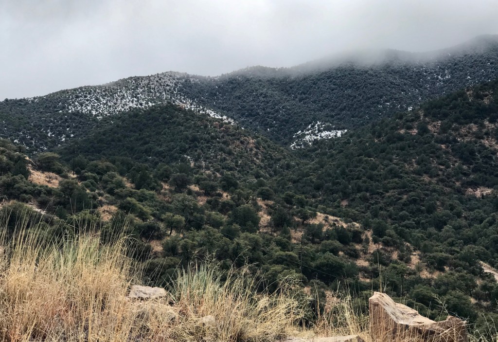
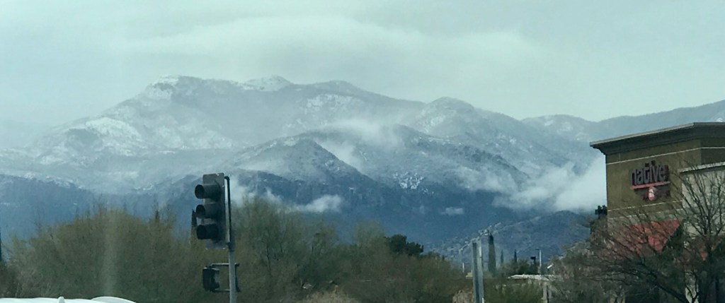
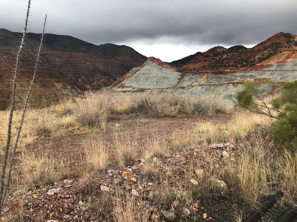
Today’s drive in cool, wet, and sometimes snowy conditions was to Bisbee, Arizona, a small city about 90 miles southeast of Tucson, and 11 miles north of the Mexican border. It is in the Mule Mountains and sits at an elevation of 5538 feet. In its heyday, Bisbee proved to be one of the richest mineral sites in the world, producing nearly three million ounces of gold and more than eight billion pounds of copper, not to mention the silver, lead and zinc that came from these rich lands. In the early 1900’s, driven by the booming mining industry, Bisbee had become the largest city between St. Louis and San Francisco. With a population of over 20,000 people by the beginning of the century, Bisbee was one of the most cultured cities in the west.
When the mines closed, a tremendous shift occurred in the local population. As many mining employees and their families left to pursue work elsewhere, an influx of creative free spirits found Bisbee’s historic district to be an attractive, inspiring, and inexpensive location to settle and pursue their artistic endeavors. Today, Bisbee is best known as an art colony. We found it to be underwhelming.
Enroute to BisbeeSnow in the mountainsEnormous Copper Queen Mine
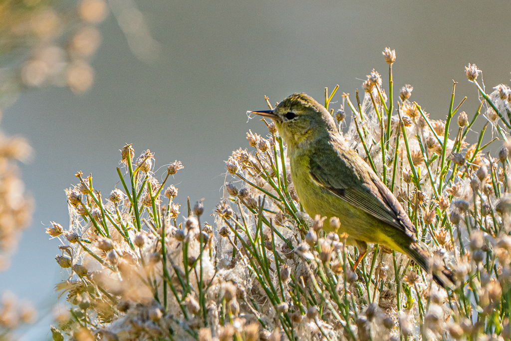
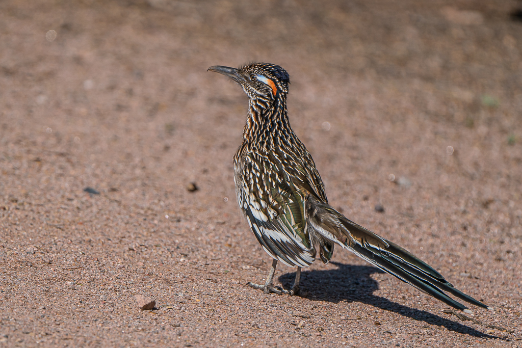
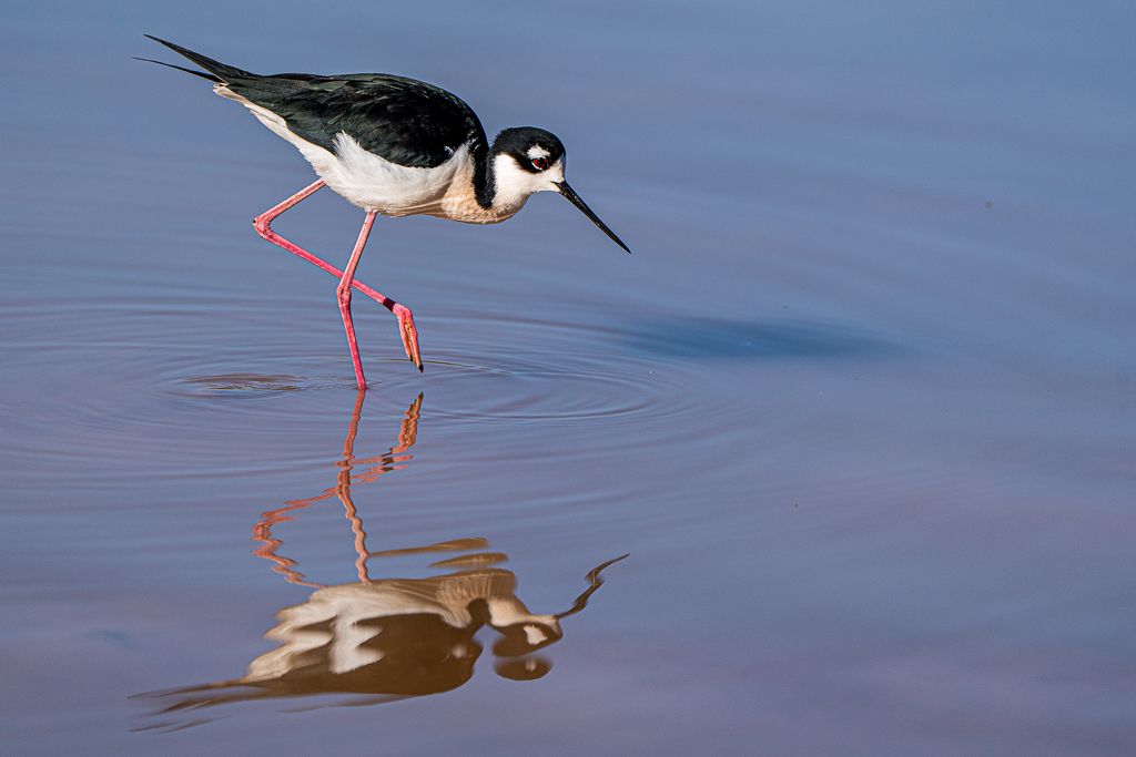
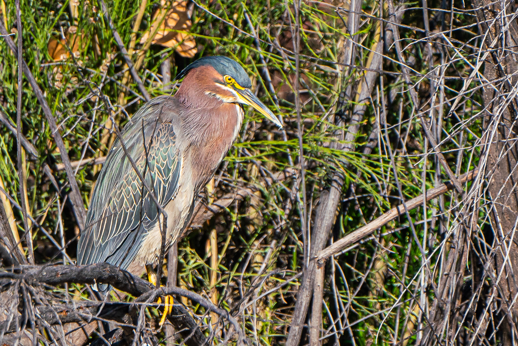
Sierra Vista, Arizona, and its surrounding area is truly a birder’s—and photographer’s—paradise. Sitting at an elevation over 4,600 feet, Sierra Vista is the hub of Southeast Arizona. It has an average of 275 days of sunshine and a temperate climate. Many think of Arizona a flat desert; this region is anything but flat—arid grasslands are hemmed in by the Huachuca and Chiricahua mountain ranges, with peaks as high as 9,763 feet. In between these mountain ranges, the San Pedro River is the last undammed river in the American Southwest. Filled with mountains, canyons, riparian areas and wetlands, these habitats provide an incredible home to wildlife—a plethora of tropical birds, countless dragonflies and hummingbirds, and even the extraordinary and rare jaguar and a huge range of plant life. This area is an eco-crossroad with five life zones within five miles. Habitats and species from the Sierra Madres of Mexico, the Rocky Mountains, and the Sonora and Chihuahuan deserts can all be found in these “Sky Islands.” The bird watching, wildlife viewing areas, and photography are world-renowned. With 15 species of hummingbirds passing through Sierra Vista annually, this is one of my happy places!.
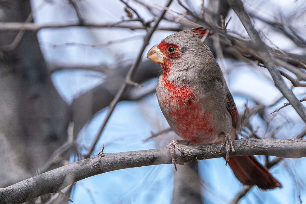
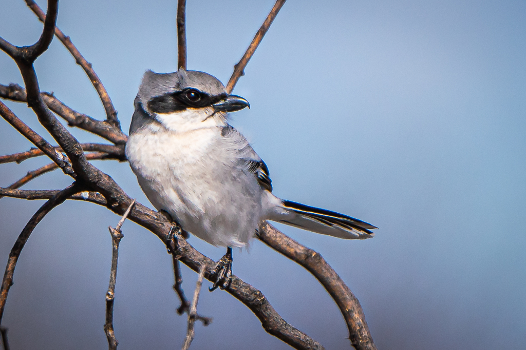
Our Monday travels took us to the San Pedro Riparian National Conservation Area where the winds were howling; a few birds posed for photographs. After hiking along the river for some distance, we returned to the San Pedro House Visitor Center where Kay astutely pointed out what I overlooked as a Northern Cardinal in one of the shrubs; it was a Pyrrhuloxia. Kay has become an invaluable asset to our birdwatching and photography.
Pyrrhuloxia Loggerhead Shrike
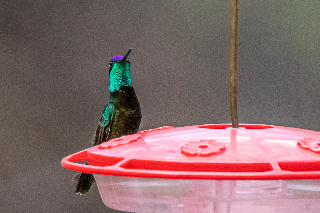
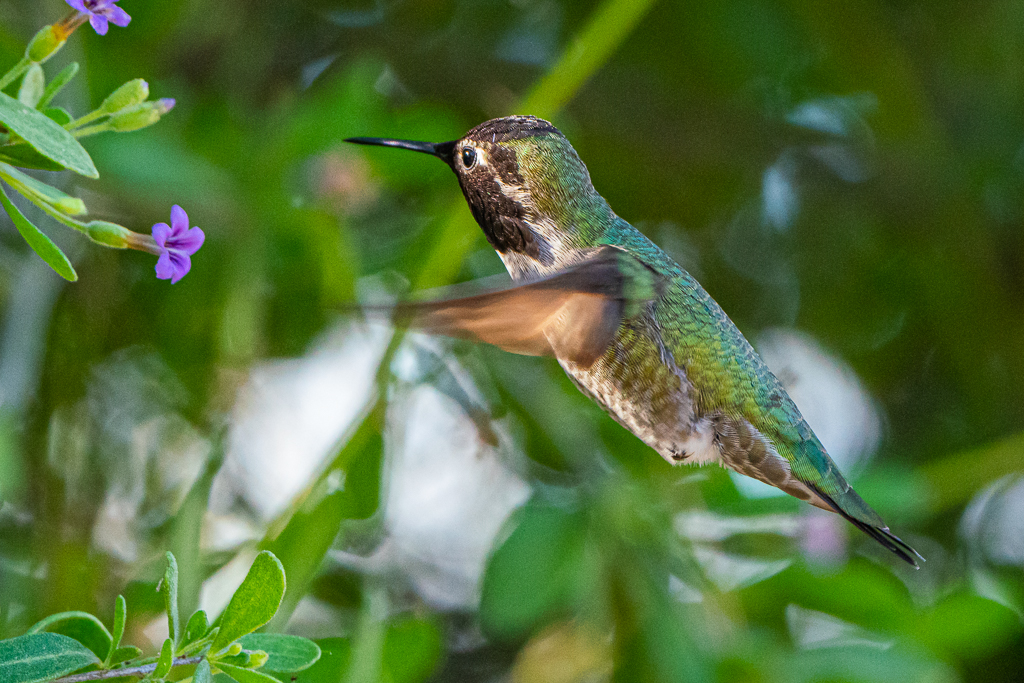
From San Pedro Riparian National Conservation Area, we drove to Ramsey Canyon, another sub “life list” item. The Nature Conservancy’s Ramsey Canyon Preserve is known among birders as one of the best “hummingbird places” in the US. We hiked much of the trail, and enjoyed watching the occasional hummingbird feed at one of the many feeders present. Even though August is the prime month, Kay and I were able to spot and photograph a Calliope Hummingbird in the cold, windy weather.
Along the trail, Ramsey Canyon PreserveRamsey Canyon Preserve (fungus on a tree)Calliope Hummingbird, formerly known as the Magnificent Hummingbird
Our plans were to drive to Davis Mountain and Big Bend National Park in Texas, and spend a few days exploring these “life list” places. Accommodations were full, so reservations were made almost 100 miles away. As we neared departure day and time, the weather forecast predicted winds gusting above 50 miles per hour; not too safe in a motorhome on a highway. Consequently we changed plans at the last minute, and opted to drive to near Sierra Vista to Fort Huachuca where I have privileges at the RV park, Apache Flats.
Fort Huachuca has a storied history. It is a US Army installation established in 1877 as Camp Huachuca to counter the Chiricahua Apache threat and secure the border with Mexico—some 15 miles south—during the Apache Wars. In 1882, Camp Huachuca was redesignated a fort. General Miles controlled Fort Huachuca as his headquarters and against Geronimo in 1886. After the surrender ofGeronimo in 1886, the Apache threat was essentially extinguished, but the army continued to operate Fort Huachuca because of its strategic border position. In 1913, the fort became the base for the Buffalo Soldiers, the 10th Calvary Regiment, which was composed of African Americans. It served this purpose for twenty years. It is now the home of the US Army Intelligence Center.
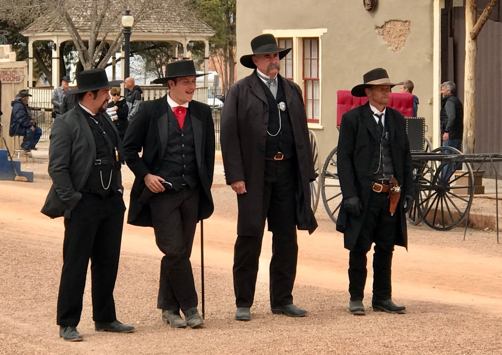
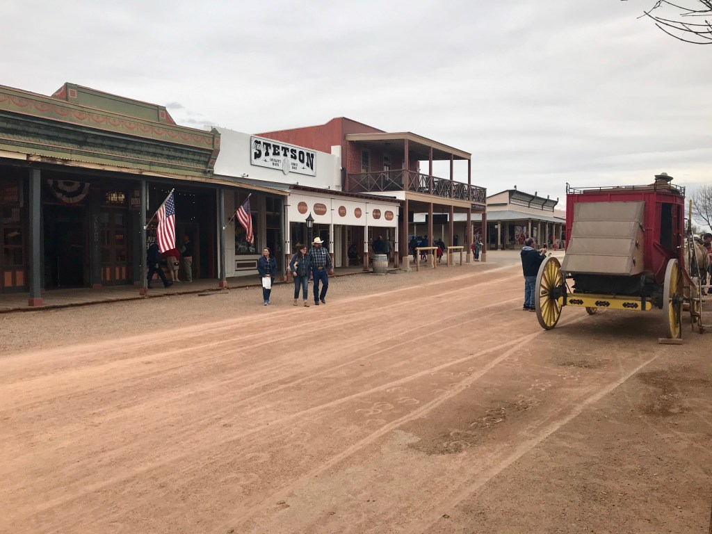
With several hours of daylight remaining, we drove to Tombstone in Cochise County, Arizona, famous for Wyatt Earp and the Gunfight at the O.K. Corral. It became one of the last boomtowns in the American frontier, growing significantly into the mid-1880s as the local mines produced $40 to $85 million in silver bullion, the largest productive silver district in Arizona. Its population grew from 100 to around 14,000 in less than seven years. Under the surface (play on words?) were tensions that grew into deadly conflict. The mining capitalists and the townspeople were largely Republicans from the Northern states while many of the ranchers were Confederate sympathizers and Democrats. The booming city was only 30 miles from the U.S.–Mexico border and was an open market for cattle stolen from ranches in Sonora, Mexico, by a loosely organized band of outlaws known as The Cowboys. The Earp brothers—Wyatt, Virgil, and Morgan, as well as Doc Holiday, arrived in December 1879 and mid-1880. The Earps had ongoing conflicts with Cowboys and cattle rustlers Ike and Billy Clanton, Frank and Tom McLaury, and Billy Claiborne. The Cowboys repeatedly threatened the Earps over many months until the conflict escalated into a shootout on October 26, 1881. The historic gunfight is often portrayed as occurring at the O.K. Corral, though it actually occurred a short distance away in an empty lot on Fremont Street. This is definitely a tourist trap offering so much potential, but falling far short in every category except souvenir shops.
Reenactment of the Gunfight at O.K. Corral One of the few attractions in TombstoneThis is it! Tombstone, AZA tourist trap with so much potential
The winter season was winding down for us—having seen all the sights time would allow, and inventorying those that will have to be scheduled for next winter—yes, we plan to come back next year. Our daily activities were pretty normal for ones staying in a RV resort for the winter: walking, cycling, attending concerts, dancing, eating, hot tubbing, golf, pickleball, and even water volleyball (what a hoot). I continued Thursday golf with the Hot Springs Village foursome, playing at Johnson Ranch in Chandler on Thursday, February 20, and back at Robson Ranch on February 27. Kay continued her quest at becoming a pickleball player; she has really improved her golf game!
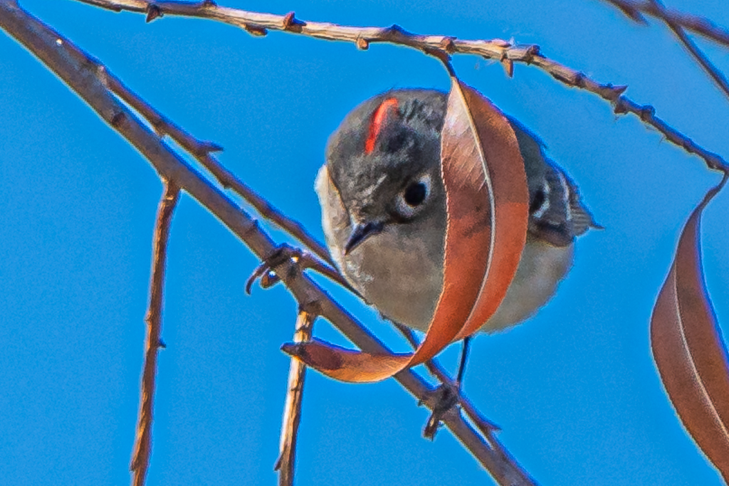
Spotted Towhee
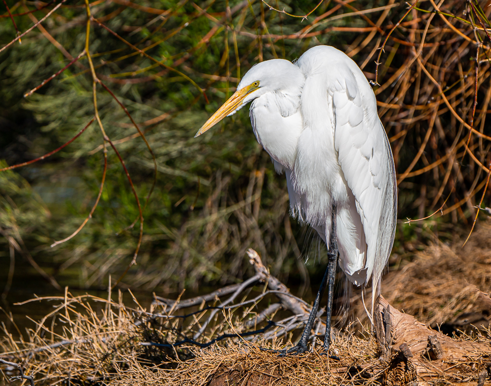
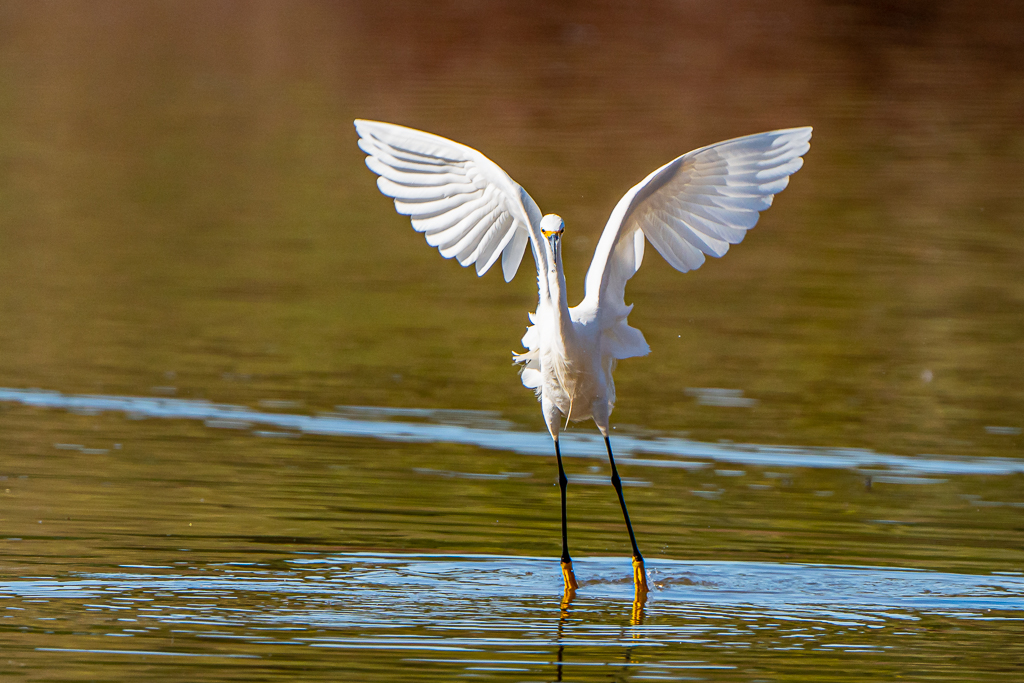
Great Egret
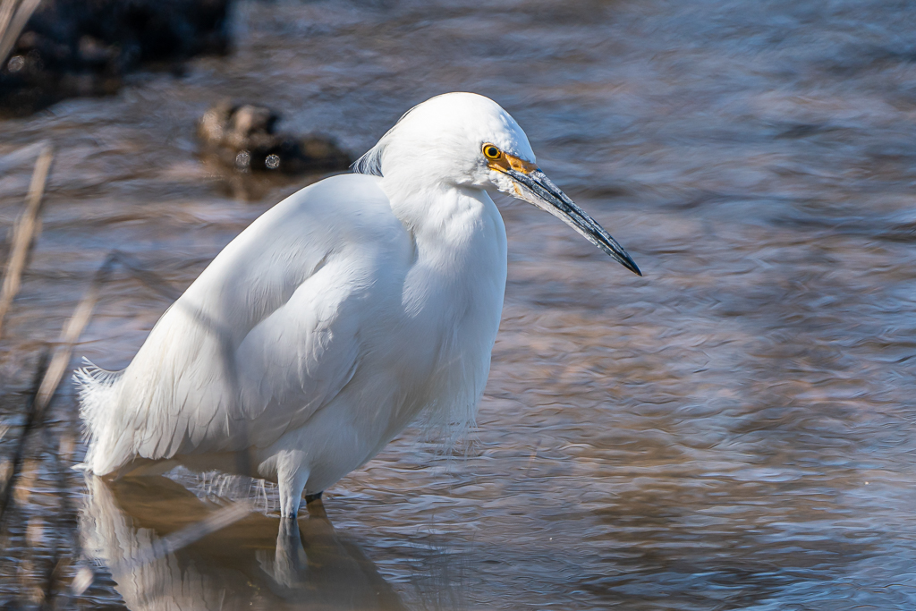
Snowy Egret
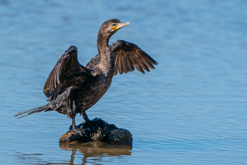
Double-crested Comorant
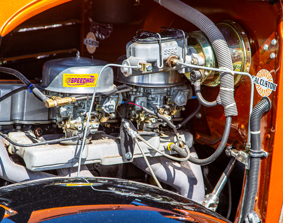
An auto show occurred our last Saturday, and last full day, at Palm Creek. The time and money to restore these beauties exhibited is unimaginable.
Today, Friday, February 14, is Valentines Day. Our only scheduled activities were the Hot Springs Village pickleball round-robin and the Palm Creek Valentines dinner and dance. It was a great evening as dinner was prime rib and all the sides followed by a delicious slice of cheese cake, and the band was very good forcing us to dance the night away, at least until 9 PM.
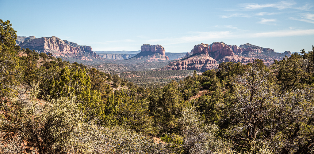
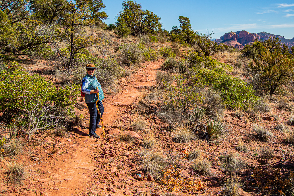
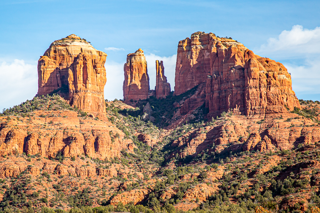
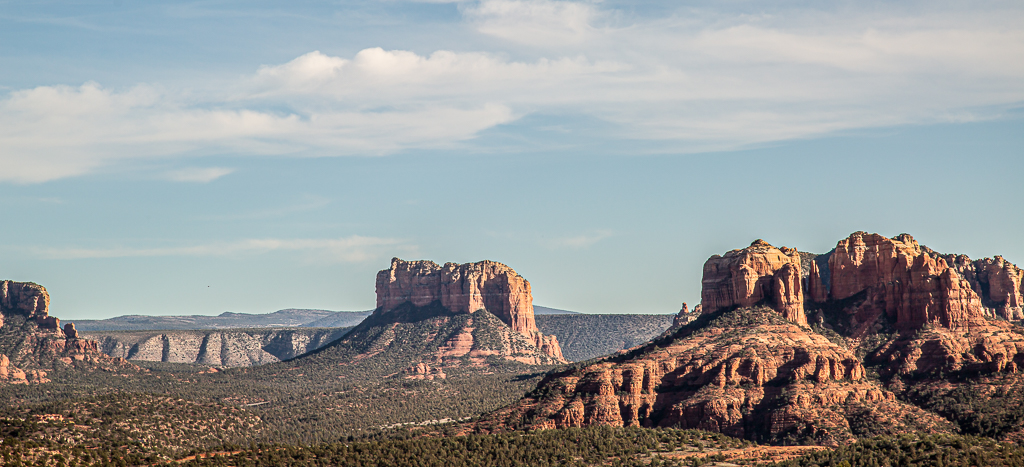
Visiting Sedona, Arizona, has been on Kay’s secondary life list for some time. With great weather forecast for the weekend, we drove north into the mountains of north central Arizona. Apparently, Valentines Day weekend is the busiest weekend of the year in Sedona; traffic was horrendous, taking hours to move just a few miles into the small city. Fortunately, a volunteer at the National Forest Service Visitors Center told us of a short cost that save countless time. The red rock mountains surrounding Sedona were quite spectacular. We hiked a couple of short trails to make photographs. Kay really enjoyed Sedona while I thought it was just okay. Neither of us has a desire to return. Since all lodging accommodations were full, we stayed in an overpriced motel in Camp Verde, south of Sedona.
Near Sedona, AZ
Near Sedona, AZ
Near Sedona, AZ
Near Sedona, AZ
Near Sedona, AZ
Near Sedona, AZ
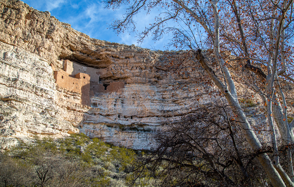
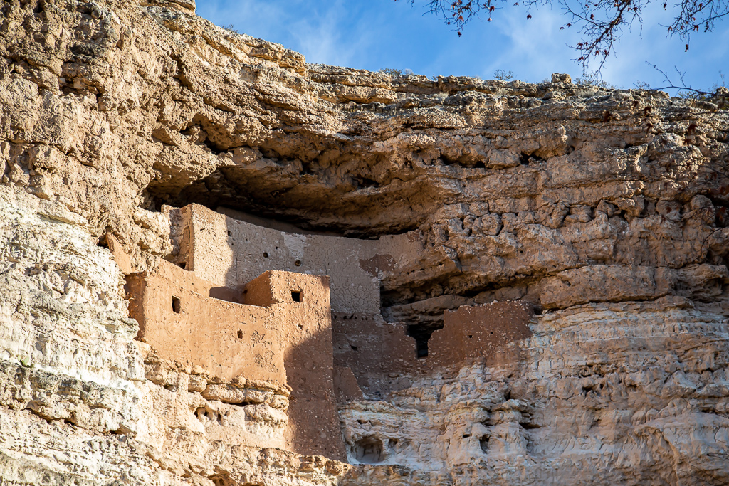
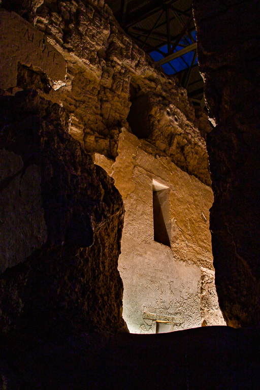
We opted not to return to the Sedona area on Sunday, and instead visited Montezuma Castle National Monument near Camp Verde. We arrived just after the doors were opened, avoiding any crowds that might venture a visit. Montezuma Castle National Monument protects a set of well-preserved dwellings located in Camp Verde, Arizona which were built and used by the Sinagua people, a pre-Columbian culture closely related to the Hohokam and other indigenous peoples of the southwestern United States, between approximately 1100 and 1425 AD. As one of the best preserved cliff dwellings in North America, this 20 room high-rise apartment, nestled into a towering limestone cliff, tells a story of ingenuity, survival and prosperity in an unforgiving desert landscape.
This week’s “Big Boy” golf course was at Crooked Tree Golf Club in Tucson. Crooked Tree is a wonderful, traditional layout with generous fairways, small greens and ample chipping areas that surround the green complexes. The course sits alone among the ironwoods, mesquites and saguaros of the Sonoran Desert. There are no homes lining its fairways—only the rugged beauty of the desert southwest. Lee Trevino and Dave Bennett, ASGCA, designed Crooked Tree Golf Course. Thus far, it is one of my favorites.
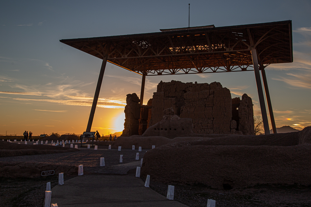
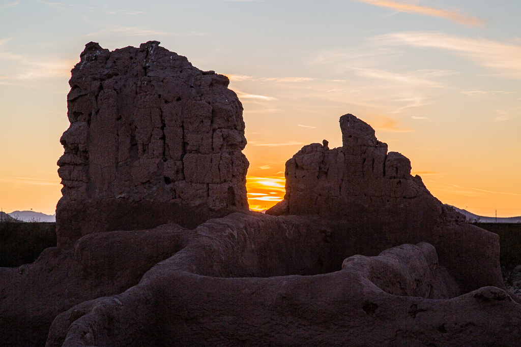
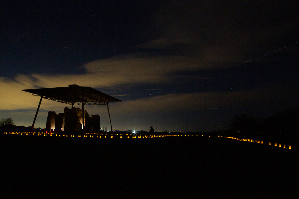
Departing early in the morning, I drove to Veteran’s Oasis Park in Chandler for one last visit this winter. A few birds posed as I walked the trails. I returned to Palm Creek, and then left before sunset to visit the normally closed Casa Grande National Monument for a luminary ceremony honoring the birthday of its first caretaker. There were a number of people there, many with children, making slow-speed photography (nighttime) difficult at best. I left there driving to the Tucson International Airport to pickup Kay returning from Arkansas. The airport provides a “cell phone” parking area near the gates for cars waiting on incoming passengers; after having arrived, the passenger may phone their pickup in the parking lot—neat and handy. Kay was glad to be back to great weather in Arizona.
I took advantage of the alone time to bird and photograph extensively. I visited GWR on Friday and Monday while participating in pickleball and golf with the Hot Springs Village group and editing photographs over the weekend. Of course, I used today (Tuesday) to tidy up and neaten the RV before Kay returns tomorrow.
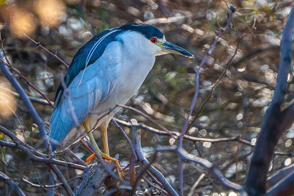
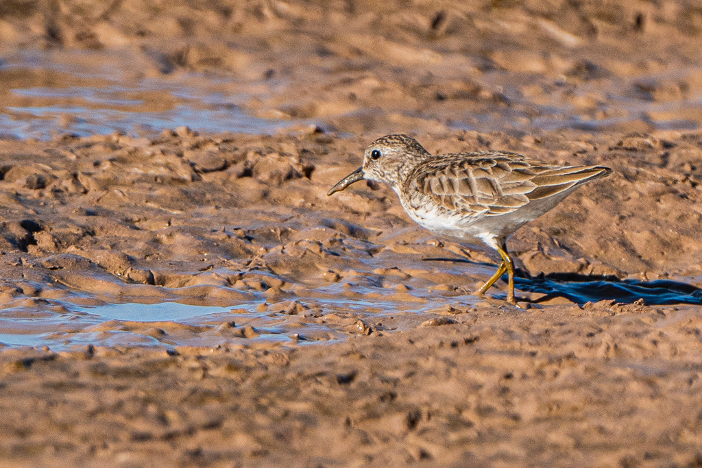
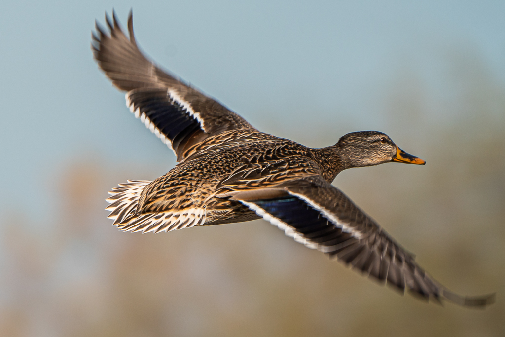
Kay caught a flight out of Tucson today to return home to assist in the post op care of BFF Pam. This gave me the opportunity to bird and photograph extensively (hogging the only car we have in Arizona). First on the list was the Sweetwater Wetlands in Tucson. The Sweetwater Wetlands is one of the most important functional, environmental, and educational components of the City of Tucson’s reclaimed water system. The facility was originally constructed in 1996 to handle backwash filter water from the reclaimed water plant. The wetlands now uses reclaimed water exclusively, helping treat secondary effluent and backwash from the reclaimed water treatment system at the now-closed Roger Road Wastewater Treatment Plant. Sweetwater Wetlands serves as an environmental education facility and habitat for a wide variety of wildlife. Paths, both paved and unpaved, visit all the ponds and give a view to the large detention basins to the south, which when containing water attract wading birds and shore birds. Rarities seen at Sweetwater over the years include Groove-billed Ani, Least Grebe, Chestnut-sided Warbler, Baltimore Oriole, and many others. The area consists of several ponds surrounded by cattails, willows, and cottonwoods. Ducks visit the ponds while Red-winged, Yellow-headed, and Brewer’s blackbirds frequent the cattails. Thick stands of saltbush provide cover to Song Sparrows, Abert’s Towhees, wrens, and many other species. While I enjoyed walking around the facility, it did not have as much to offer today as those we visited near Phoenix.
Ruby-crowned KingletThis isn’t a bird!Ruddy DuckCommon Yellowthroat
Collection of trails and greenway quotes, terms, acronyms, tools as well as trail publications and presentations and 100s of photos from my bicycle and hiking adventures. .
This journal was begun several years ago, and reflects an accurate record of each day fished. Please enjoy it, and remember that fish are too valuable to be caught just once, and the places they live are too valuable to be mistreated.