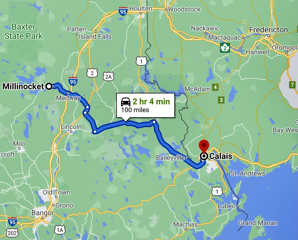
We intentionally turned a short drive into a long one, at least time wise, as we drove from Millinocket to Seal Harbor, Maine. The drive was mostly east to Calais, Maine, through small towns and rural highways; Calais is on the border of the US and New Brunswick, Canada. We regretted not being able to cross the border to visit friends nearby in Canada, but the crossing is one-way from the US to Canada, and attempting to cross back in the US would impact our travel plans for September.
Millinocket, ME, to Calais, ME
At Calais, we stopped at Saint Croix Island International Historic Site. The tide was out; it is not too far from the Bay of Fundy which has the largest tide in the world. Saint Croix Island was the beginning of a permanent European presence in northern North America. A French expedition led by Pierre Dugua spent a cruel winter there in 1604-1605. Iced in by freezing temperatures and cut off from fresh water and game, 35 of 79 men died. As spring arrived and native people traded game for bread, the health of those remaining improved. Although the expedition moved on by summer, the beginning of French presence in North America had begun.
Saint Croix International Historic Site
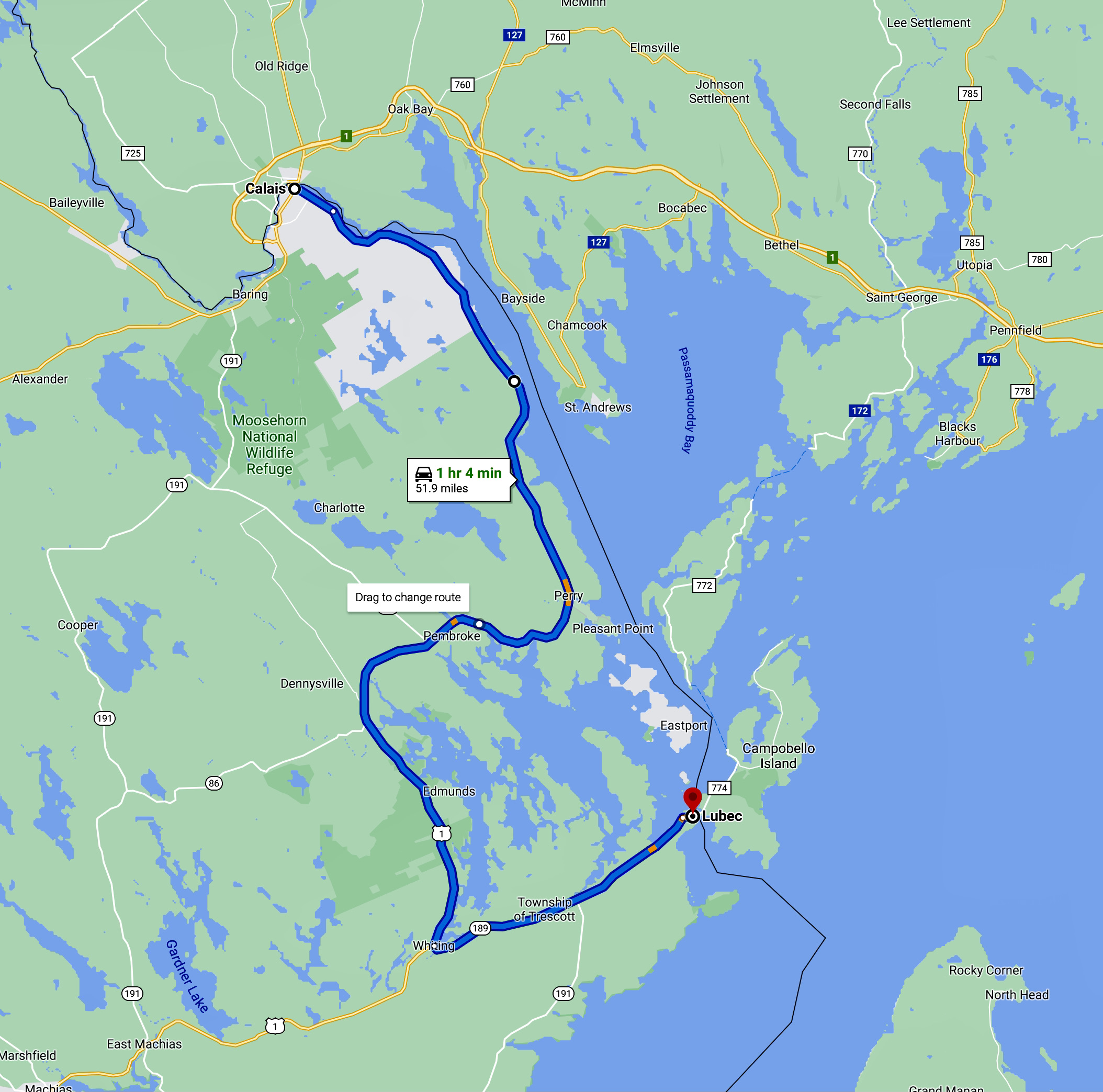
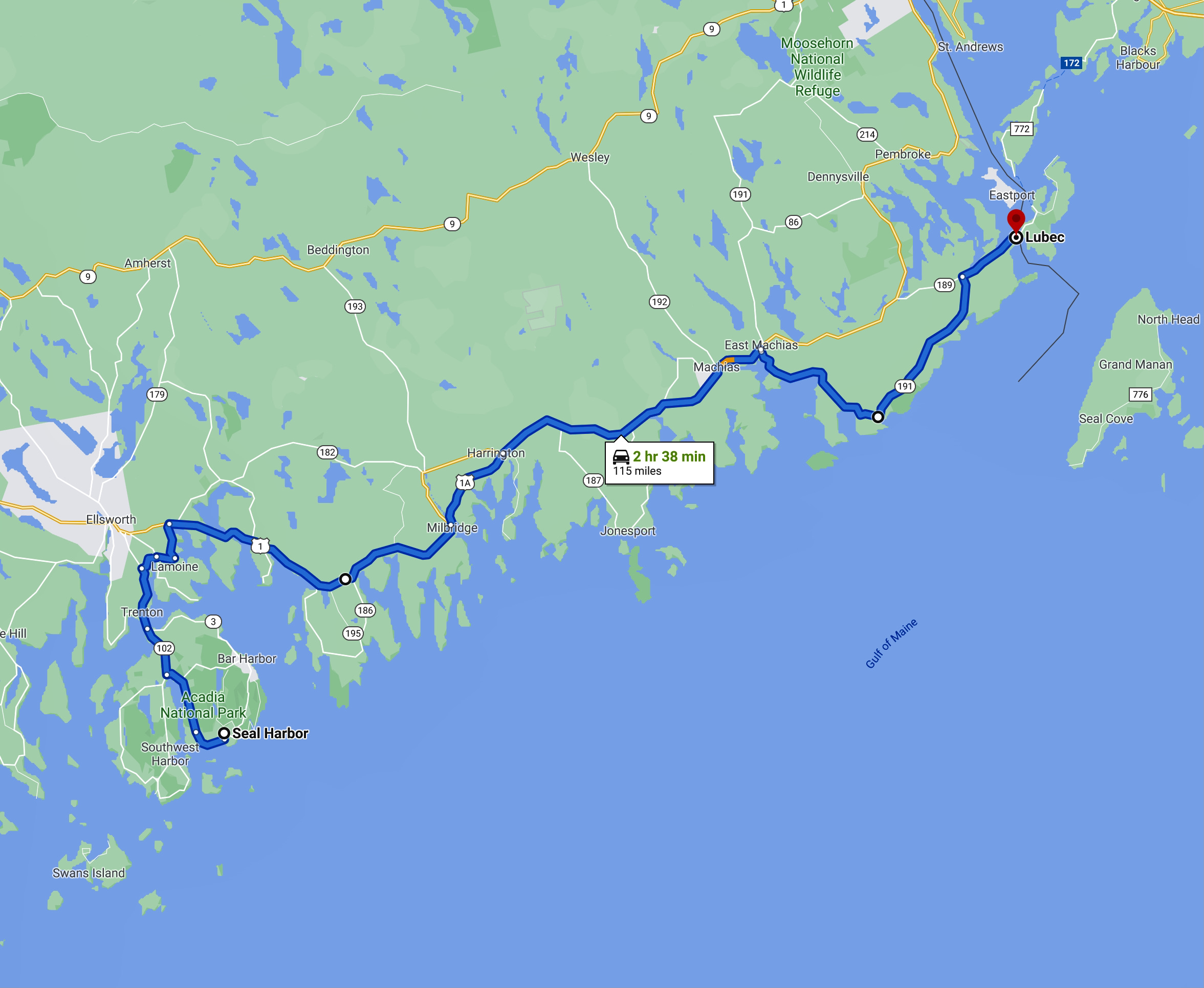
From Calais, we followed the US/Canada border southward to the coast, and visited both towns claiming to be the easternmost cities in the US, Eastport and Cutler.
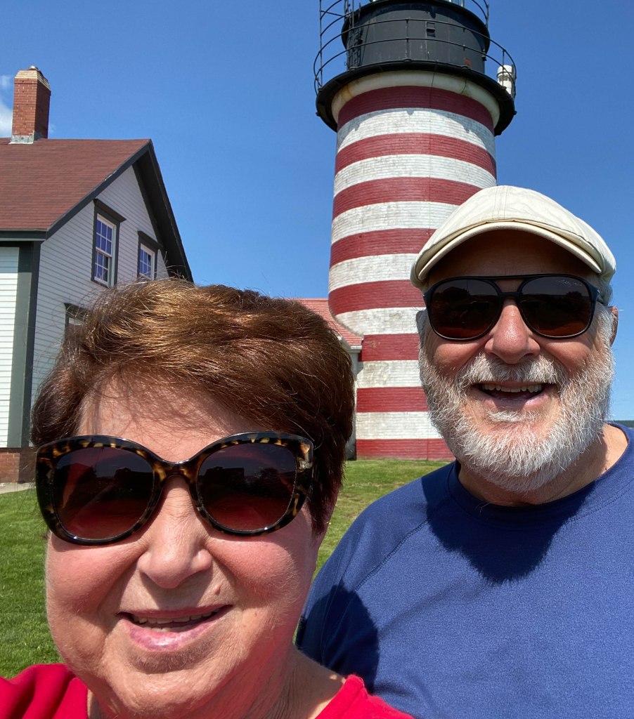
Located on the most eastern point of the continental United States, West Quoddy Head Lighthouse is a stunning spot to see the first rays of sun in the country. The lighthouse tower that stands today was built in 1858.
West Quoddy Head Lighthouse
We then followed US Highway 1 down the coast, stopping occasionally at points of interest.
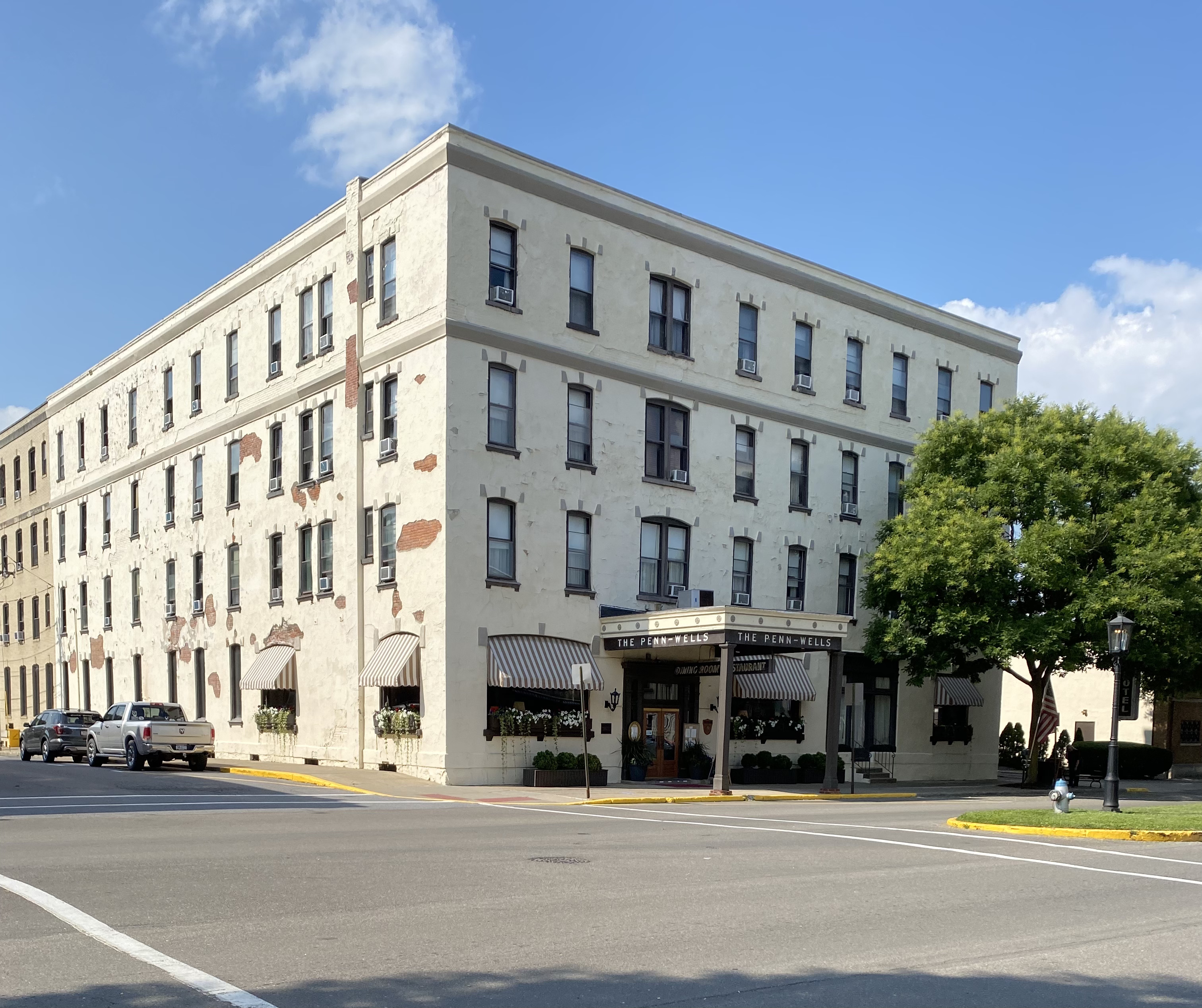
We arrived at our final New England destination on this trip, Seal Harbor, where we checked into our “suite”—and I use that term quite loosely!
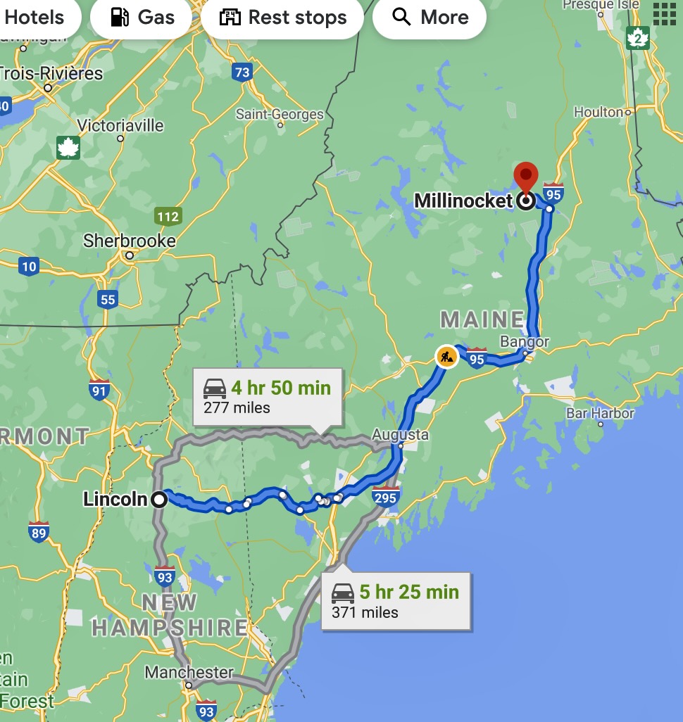
After an early start from near Lincoln, New Hampshire, on Friday the 13th, we drove a combination of scenic roads and interstate highways to our tenth state on this trip, Maine. Our first destination in Maine was Millinocket, a small town near Baxter State Park where we planned to hike. We arrived at our motel in the early evening—suffice to say that motel ads don’t alway paint the most accurate description!
Lincoln, NH, to Millinocket, ME
Saturday, we awoke to a questionable weather day with thunderstorms and scattered showers forecast to occur off and on most of the day.. Our plans were to drive to Baxter State Park to view Mount Katahdin, the northern terminus of the Appalachian Trail, and to hike a trail that would give us the best chance to see and photograph a moose. However, before we traveled too far, a big sign pointed us in the direction of Katahdin Woods and Waters National Monument. It is a US National Monument spanning 87,563 acres of mountains and forestland in northern Penobscot County, Maine, including a section of the East Branch Penobscot River. The monument is located on the eastern border of Baxter State Park. We had intended to drive the Katahdin Loop Road circumnavigating the monument, but there was really nothing to see except woods and water, and a number of anti-monument signs.
After the attempt to tour the national monument, we drove to Baxter State Park. Baxter State Park is different in that it is devoid of significant infrastructure. The roads are generally unpaved, and the buildings are old, and g built of logs. It is a carry in/carry out park, meaning that anything that is carried into the park must be carried out, including ALL trash.
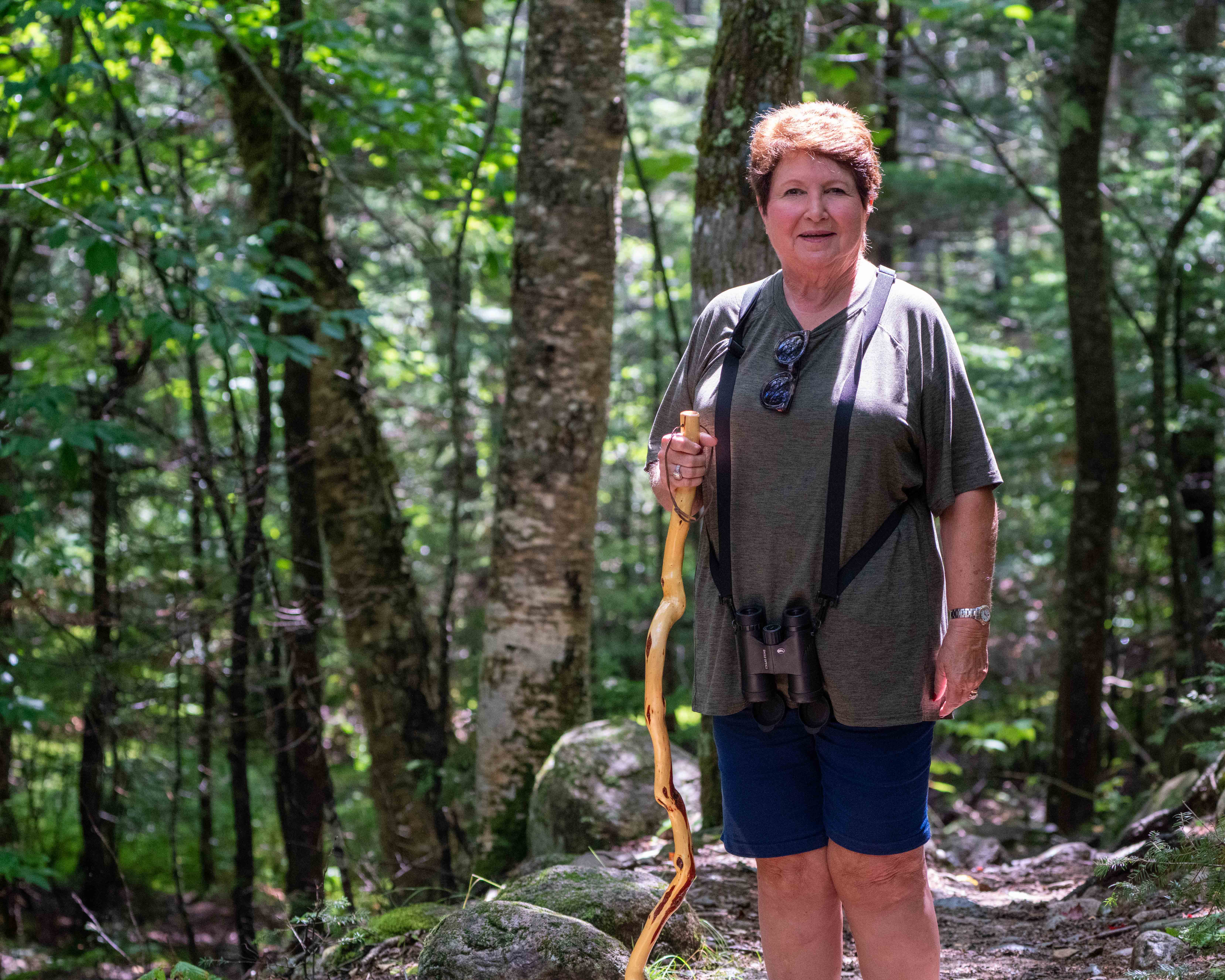
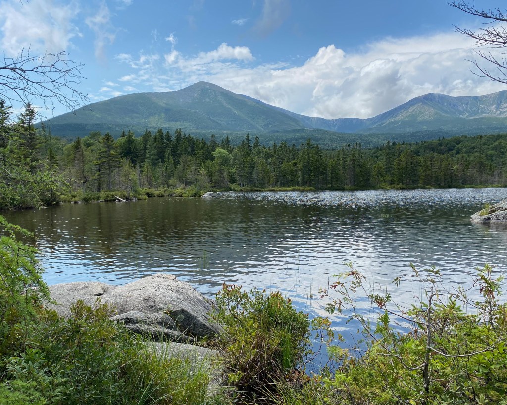
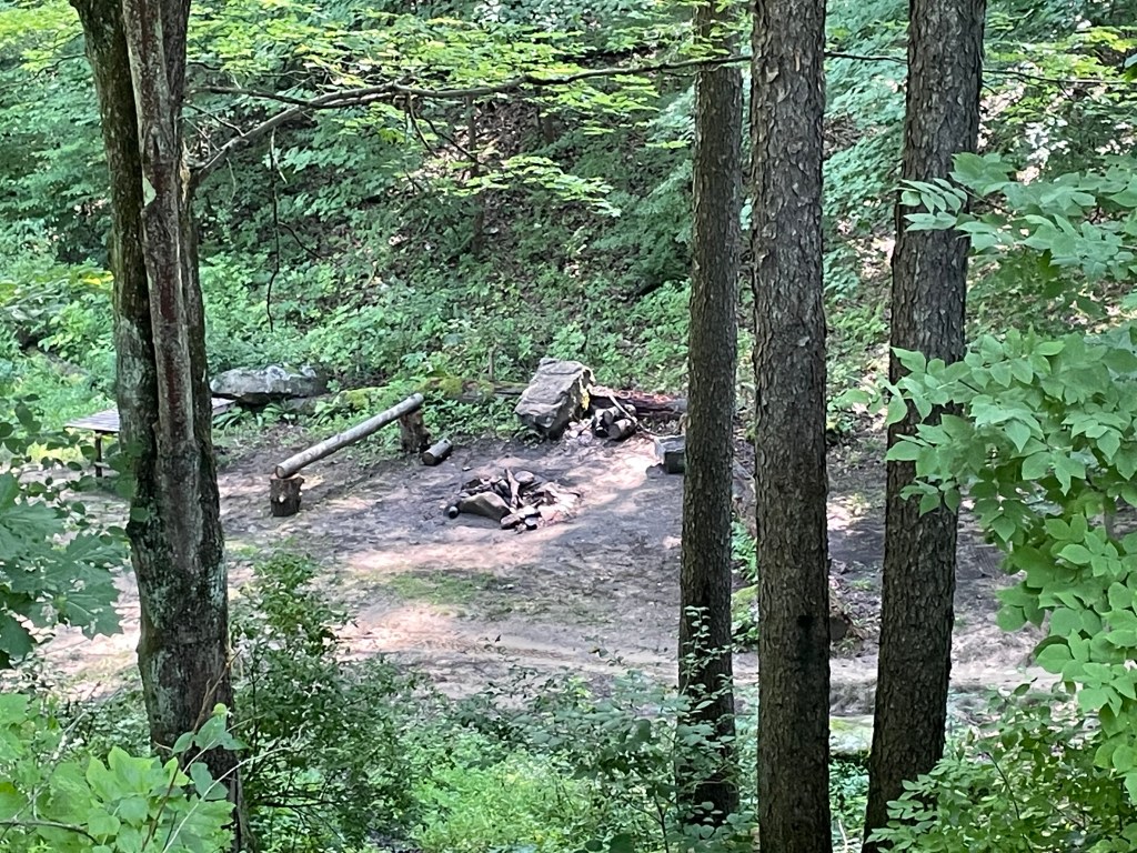
At the tiny visitors center, Kay was advised that the best trail option was to hike to Sandy Stream Pond, but that only 5 permits were issued at a time for that trail. She was given some alternate choices for hikes in the likelihood that no permits for Sandy Stream Pond were available. We were not optimistic while waiting in a long line at the ranger station, but when we asked if permits were available, he affirmed that they were. Our was for 3 hours, but considering the drive was almost 30 minutes, the remaining 2 1/2 hours was consistent with what we had been told. The gravel road to the trailhead was a bit muddy, but when we arrived, it was virtually cloudless with bright sunshine. We lightly filled a day pack with water, required flashlight, camera, etc. and began the o.6 mile walk through the Maine woods along Sandy Stream Pond.
Chasing moose at Baxter State ParkDiamond Willow hiking staff made by Kay gets lots of admiration
About halfway, we came to an observation area which offered great views of Katahdin while a couple of Cedar Waxwings were chased insects nearby.
Cedar Waxwings
After another 0.3 miles we came to the “big rock”, where moose sightings were frequent. There were dragonflies (which never lit) and damselflies, but no moose.
We waited for about 30 minutes until it began to rain (we packed light—NO raincoats), and visited with a couple of other hikers.
The hike out was brief, and the road out was muddy. However, on the way back to Millinocket to find a car wash, it rained hard, and washed away most of the mud. We ate great dinners at the motel restaurant before calling it a night.
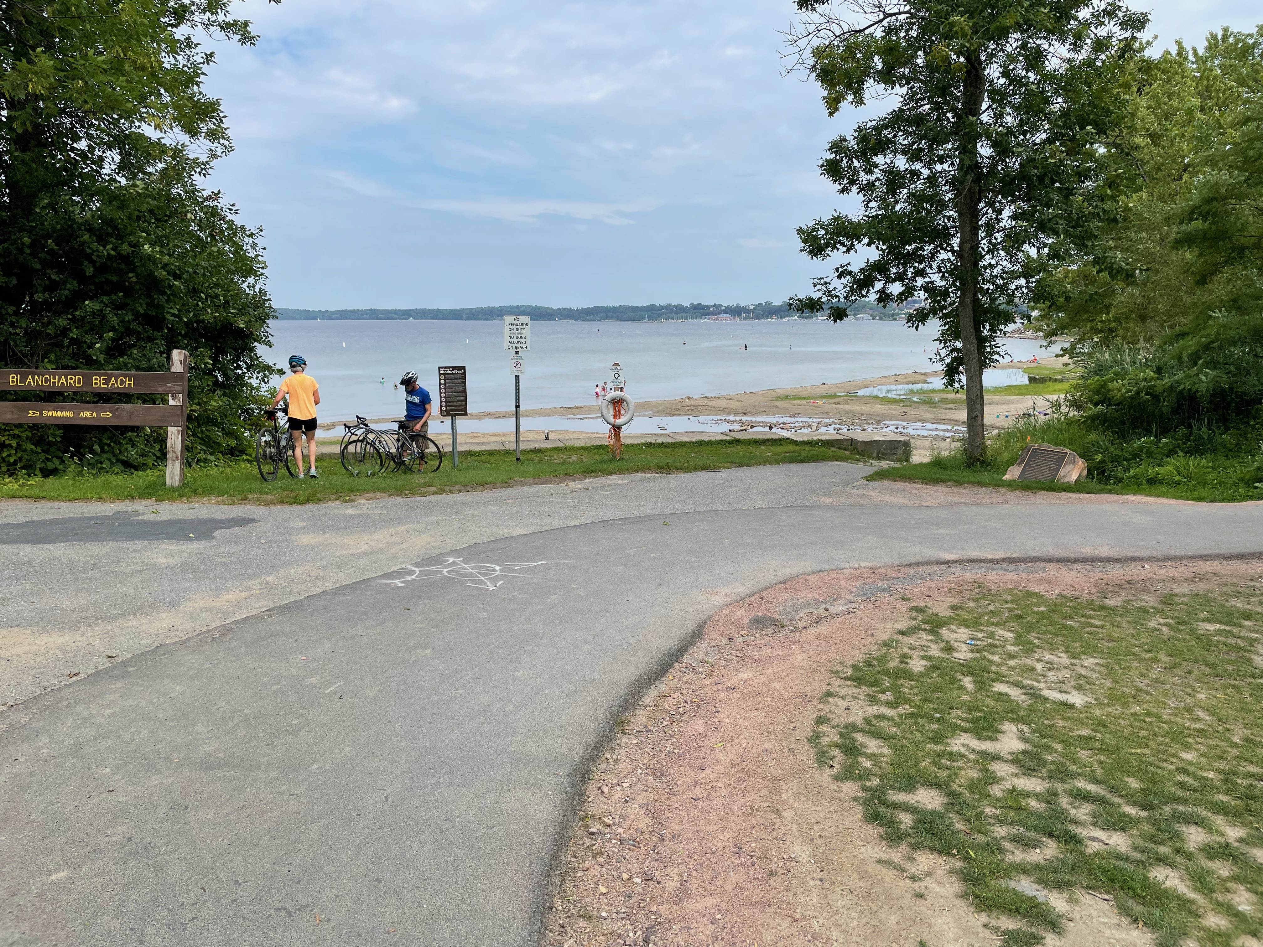
Burlington, Vermont, Monday, August 9: Kay’s Shopping & Exploring Day I dropped Donald off at the trail head that he was going to ride this morning around 11 am. He was expecting his ride to last about three hours.
I headed to Lake Street in Burlington which borders Lake Champlain.
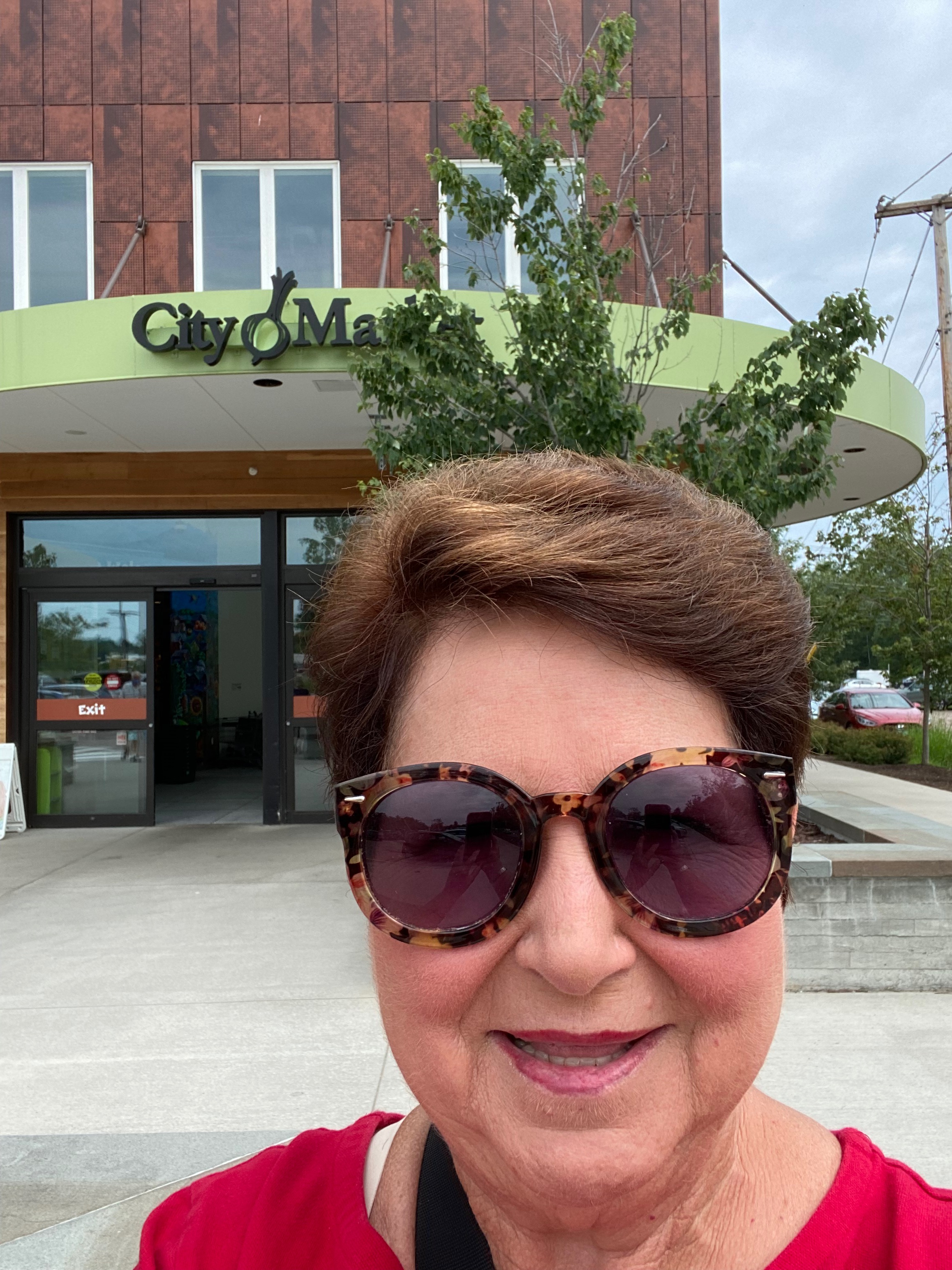
On the way I stopped at city market to check it out. It was a lovely medium size grocery store with a lot of specialty items, beautiful fruits and vegetables, meat, a lot of wine, and quite a bit of prepared food for sale. I was looking for water and didn’t find any. It reminded me of Ucrops in Richmond Virginia, a specialty grocery store that my sister and BIL loved.
Back on the road I found my way to downtown and Lake Street. Couldn’t find any parking spaces so I circled a couple of blocks. I decided to pull into a parking deck that said it was for the general public. There was no one to give me a parking sticker or a ticket. Everything was done through an app. I called the help number because I didn’t want to download another app. I parked my car and went down to the office and entered my information in the machine.I charged two dollars on my credit card to park for two hours..
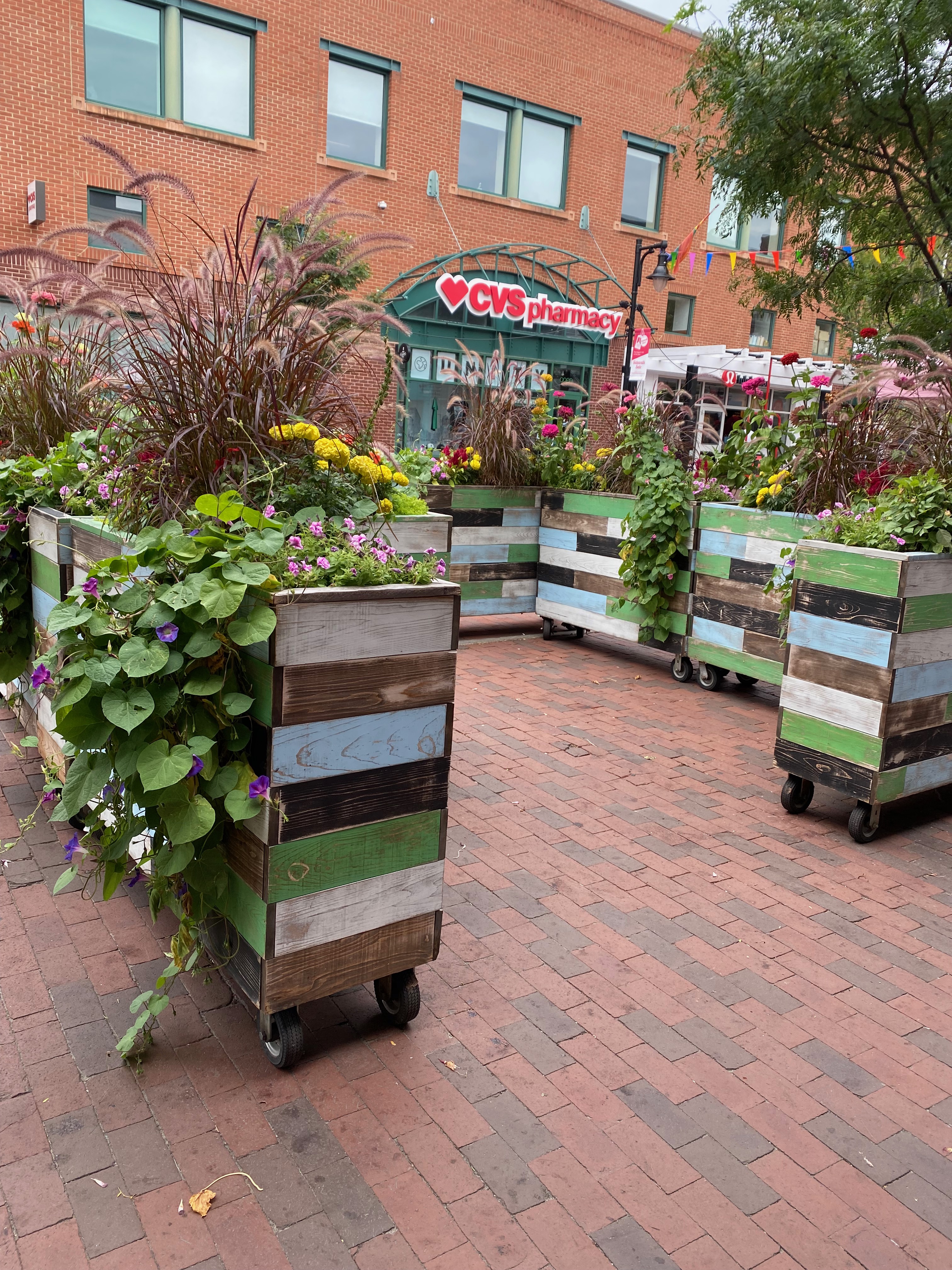
I followed a long breezeway to Church Street that appeared to be very busy.
The street was closed off to traffic and was a brick street. All the shops were open, there were many kiosks and tents with things for sale. Many of the restaurants had outside seating. It reminded me a lot of European cities where streets were limited to foot traffic only. There were lots of young people and older people walking and shopping, eating lunch and visiting. Many people were walking their dogs, too.
I wandered up and down the street, browsing through some of the shops and I enjoyed the gentle breeze off Lake Champlain. It was a bustling crowd and I finally picked a place for my lunch. It was called POKE. I had a child’s poke with green noodles, edamame, chicken, corn, cilantro, tortilla strips, green onions, sesame seeds, mandarin oranges, and a sweet & spicy chili sauce. It was delicious and just the right size for a light lunch.
I almost weakened and nearly went next door for a Ben & Jerry’s ice cream, but I decided that I was full. Ben & jerry’s corporate offices and plant are in Vermont. We passed by it yesterday as we were driving Highway 100 north and south touring Vermont.
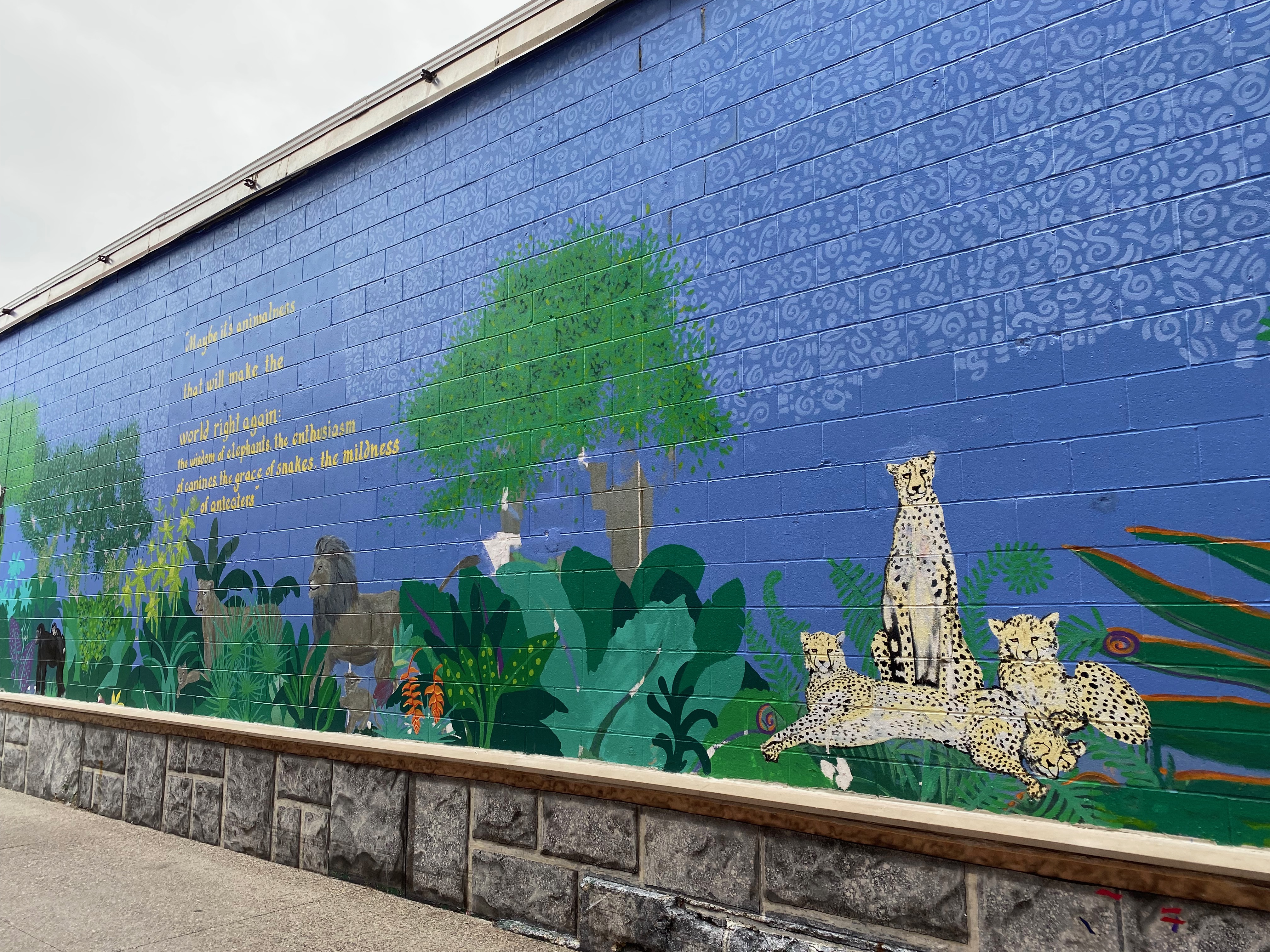
I took several pictures of murals that were around the area of church Street.
There were many cultures represented in this area. Burlington appears to be a very diversified area. I imagine the proximity of the University of Vermont has something to do with that. I’m guessing that school hasn’t started yet either here.
I went back to the parking garage and drove to the pick up zone where Donald would be completing his bike ride. I just opened my iPad to begin reading my book and lo and behold if he doesn’t appear. He had a first today! He took a bike ferry from the mainland to an island. The temperature was around 80° with a lovely breeze. We drove to Costco to pick up some supplies and an early birthday present for Donald before returning to our hotel. I had a good time exploring today and I think Donald enjoyed his ride on this rail trail. We say goodbye to Vermont tomorrow and head to New Hampshire. Our New England adventure continues…..
Thursday, August 12: Lunch with an Old Friend in New Hampshire We had lunch today (Thursday) at Woodstock Inn & Brewery in Woodstock, New Hampshire, with Chris Laux, a cousin of my brother-in-law, and a native of my hometown of Morrilton. He lives on Newfound Lake in New Hampshire now. His dad and my dad were best friends when we were growing up. We had a great visit, but I forgot to get a picture!
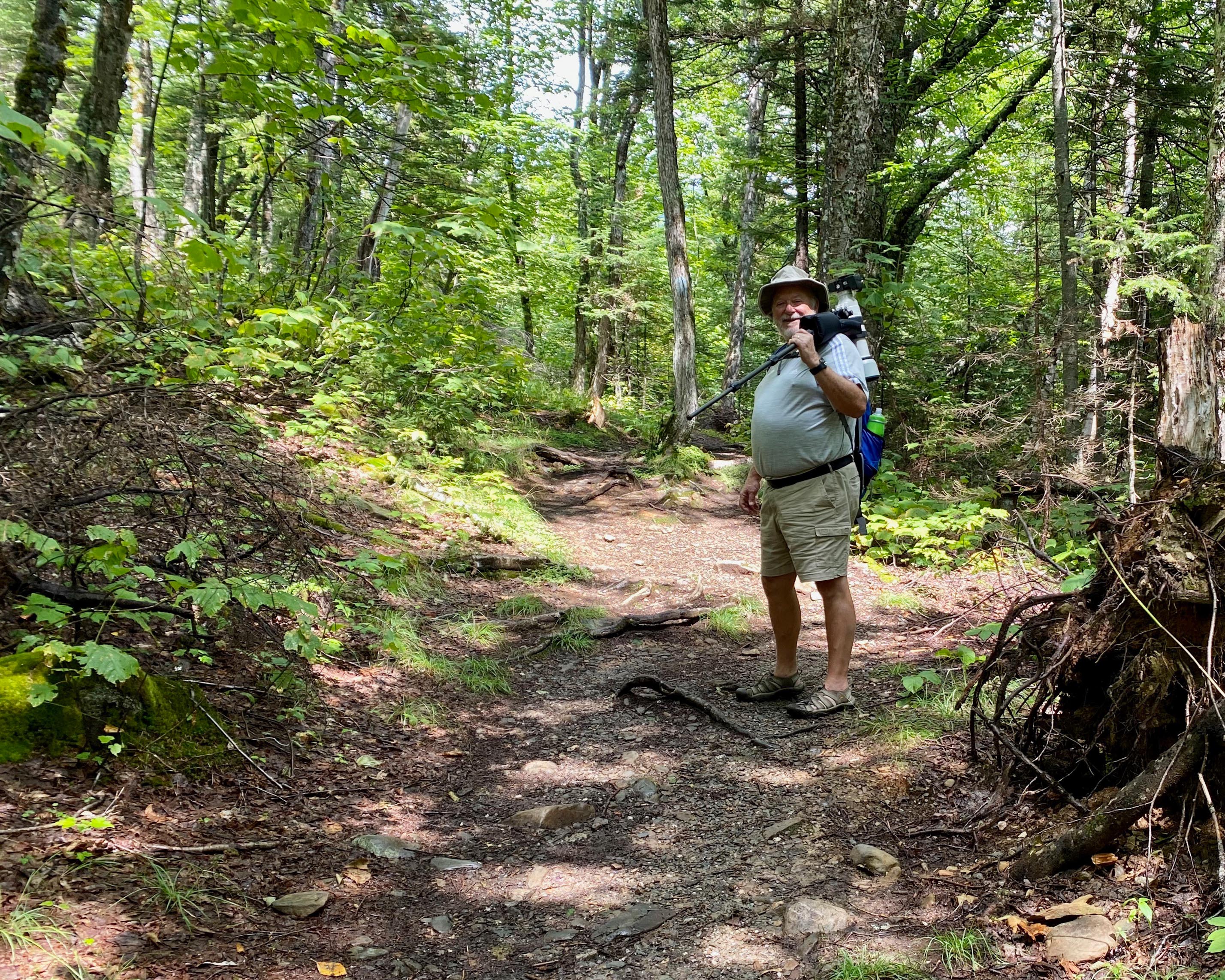
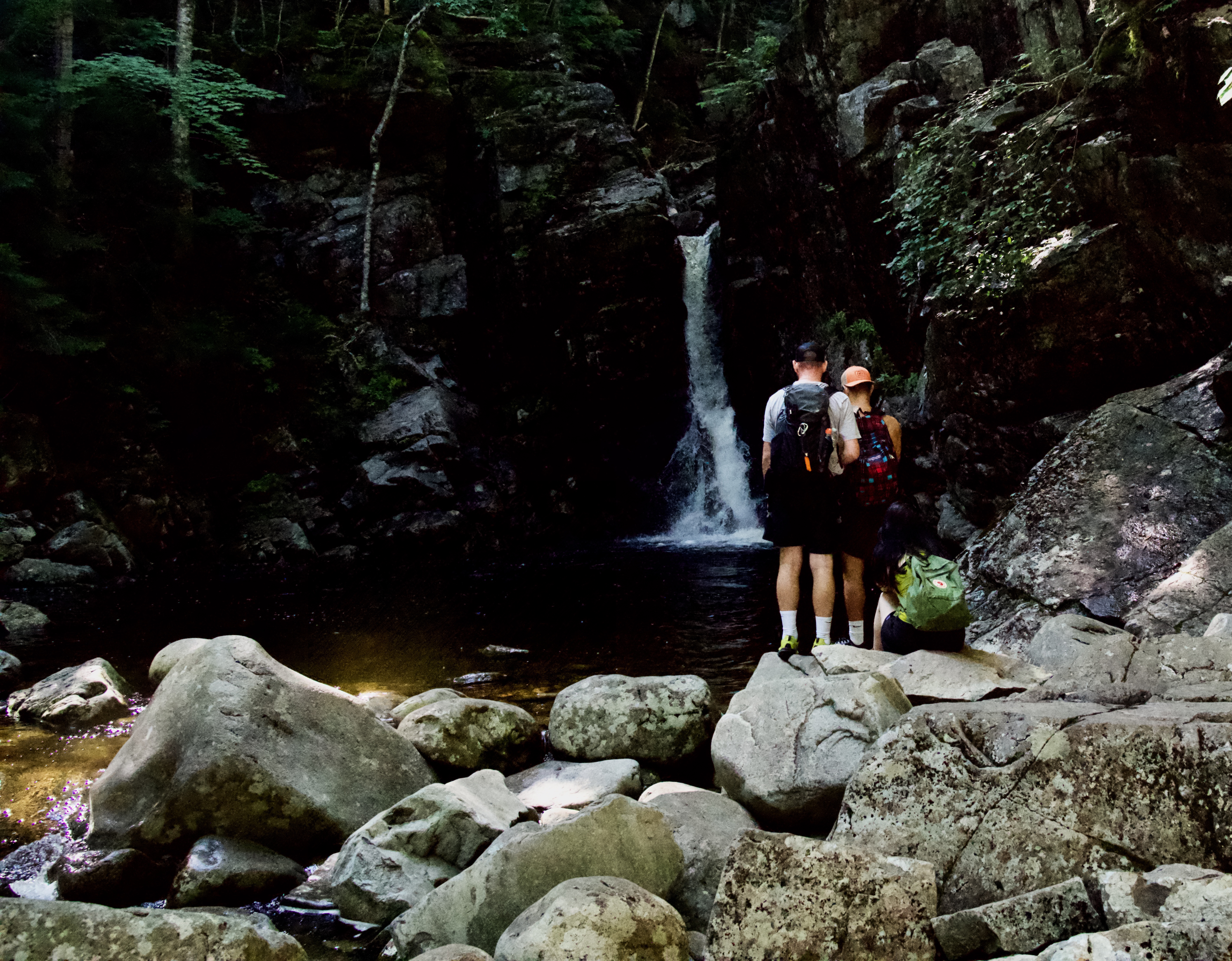
Despite overcast skies and occasional rain, we hiked Flume Gorge Trail in Franconia Notch State Park near Lincoln, NH.
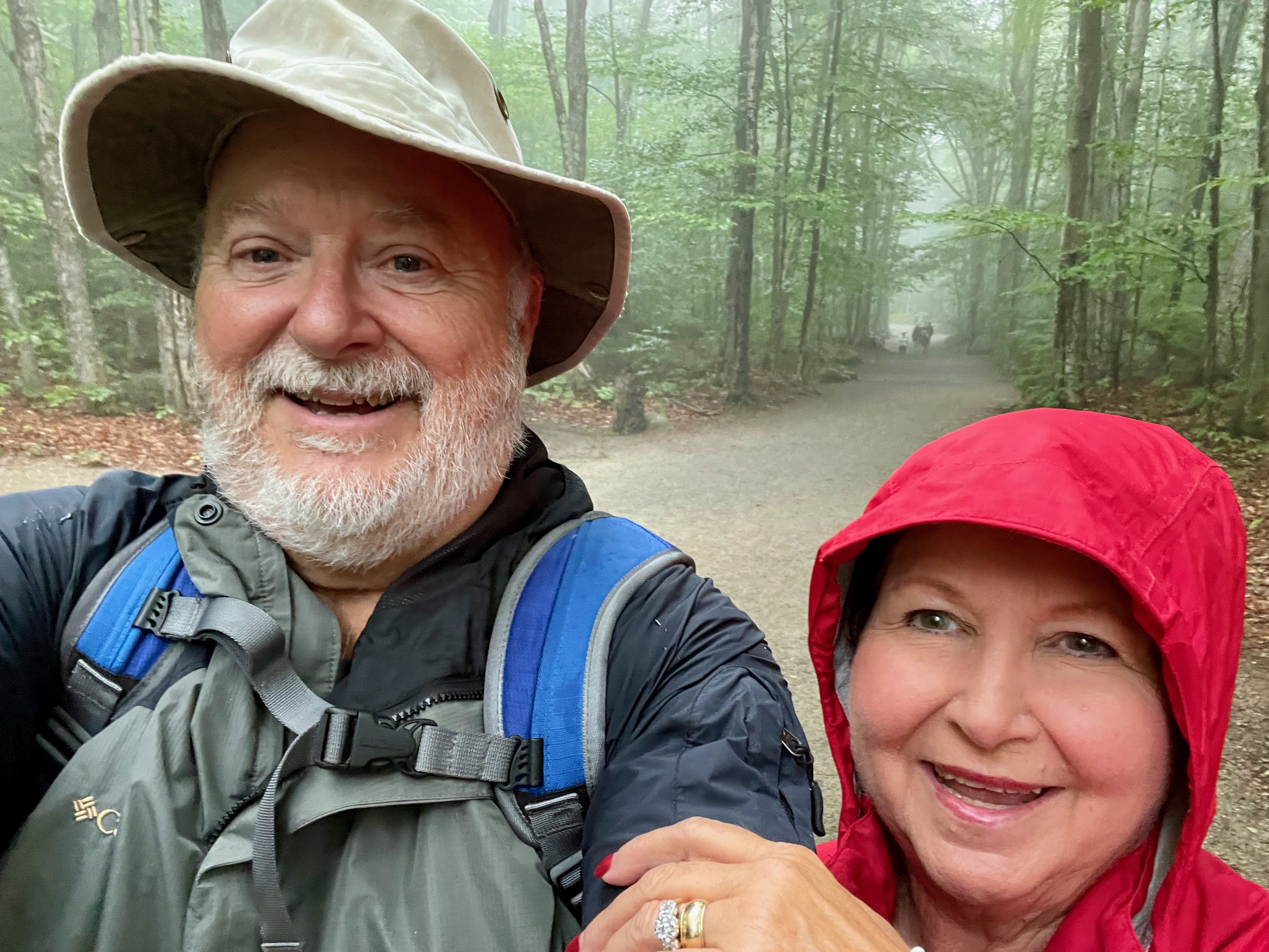
A bit of rain didn’t stop us
According to New Hampshire State Parks the Flume is a natural gorge extending 800 feet at the base of Mount Liberty. The walls of Conway granite rise to a height of 70 to 90 feet and are 12 to 20 feet apart. The Flume was discovered in 1808 by 93-year-old “Aunt” Jess Guernsey when she accidentally came upon it while fishing. She had trouble convincing her family of the marvelous discovery, but eventually persuaded others to come and see for themselves. At that time, a huge egg-shaped boulder hung suspended between the walls. The rock was 10 feet high and 12 feet long. A heavy rainstorm in June of 1883 started a landslide that swept the boulder from its place. It has never been found. The same storm deepened the gorge and formed Avalanche Falls.
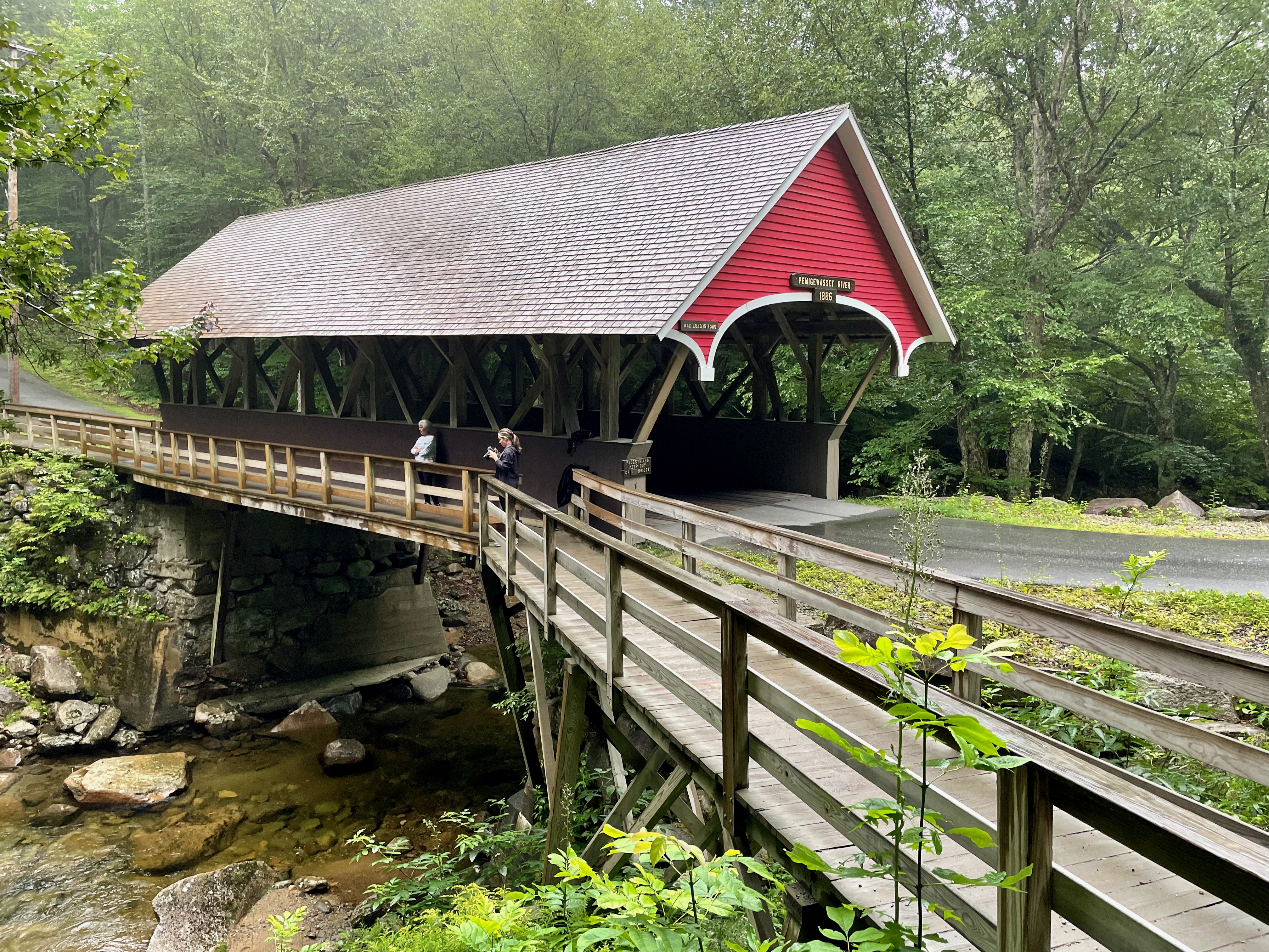
The Flume Trail is a one-way, 2-mile loop, and those hiking it must complete the full 2-mile loop in one direction. Interestingly, reservations and payment ($18 per person) have to be made online before experiencing the Flume Gorge. Just after beginning the hike, the picturesque covered bridge, Flume Covered Bridge, comes into view; it is one of the oldest in the state. It was built in the 1886 and has been restored several times. Such bridges were often called “kissing bridges” because of the darkness and privacy they provided. This bridge was built across the scenic Pemigewasset River. Pemigewasset means “swift or rapid current” in the Abenaki Indian language.
Flume Covered BridgeFlume Covered Bridge
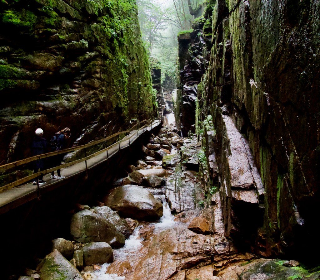
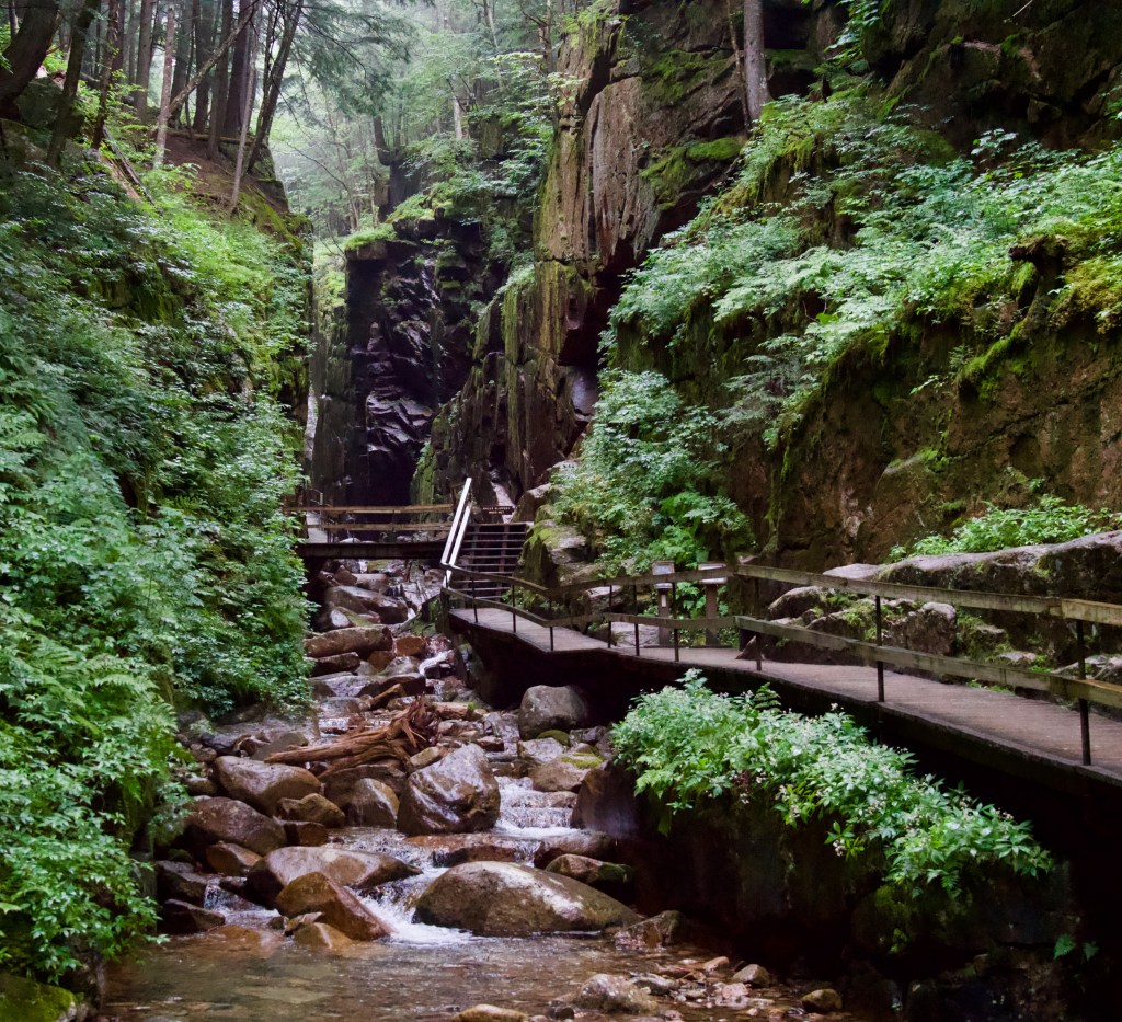
Further along the trail, we entered the actual flume, with uphill walking and lots of stairs, and huge crowds of people, including many families with young kids.
Flume Gorge
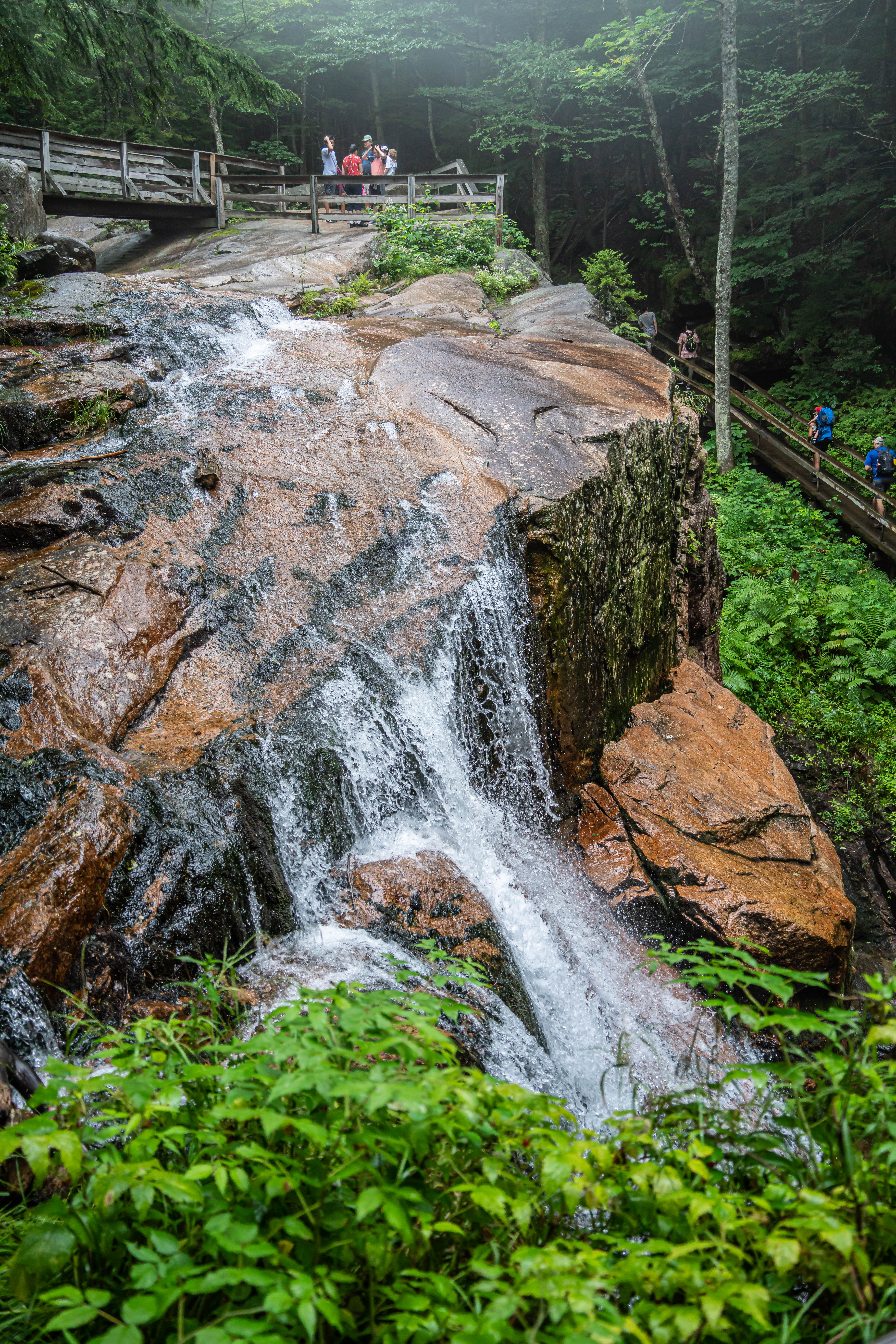
At the top of the Flume we came upon Avalanche Falls. The 45-foot waterfall creates a roaring sound as the Flume Brook enters the gorge. The falls were formed during the great storm of 1883, which washed away the hanging boulder described above.
Avalanche Falls
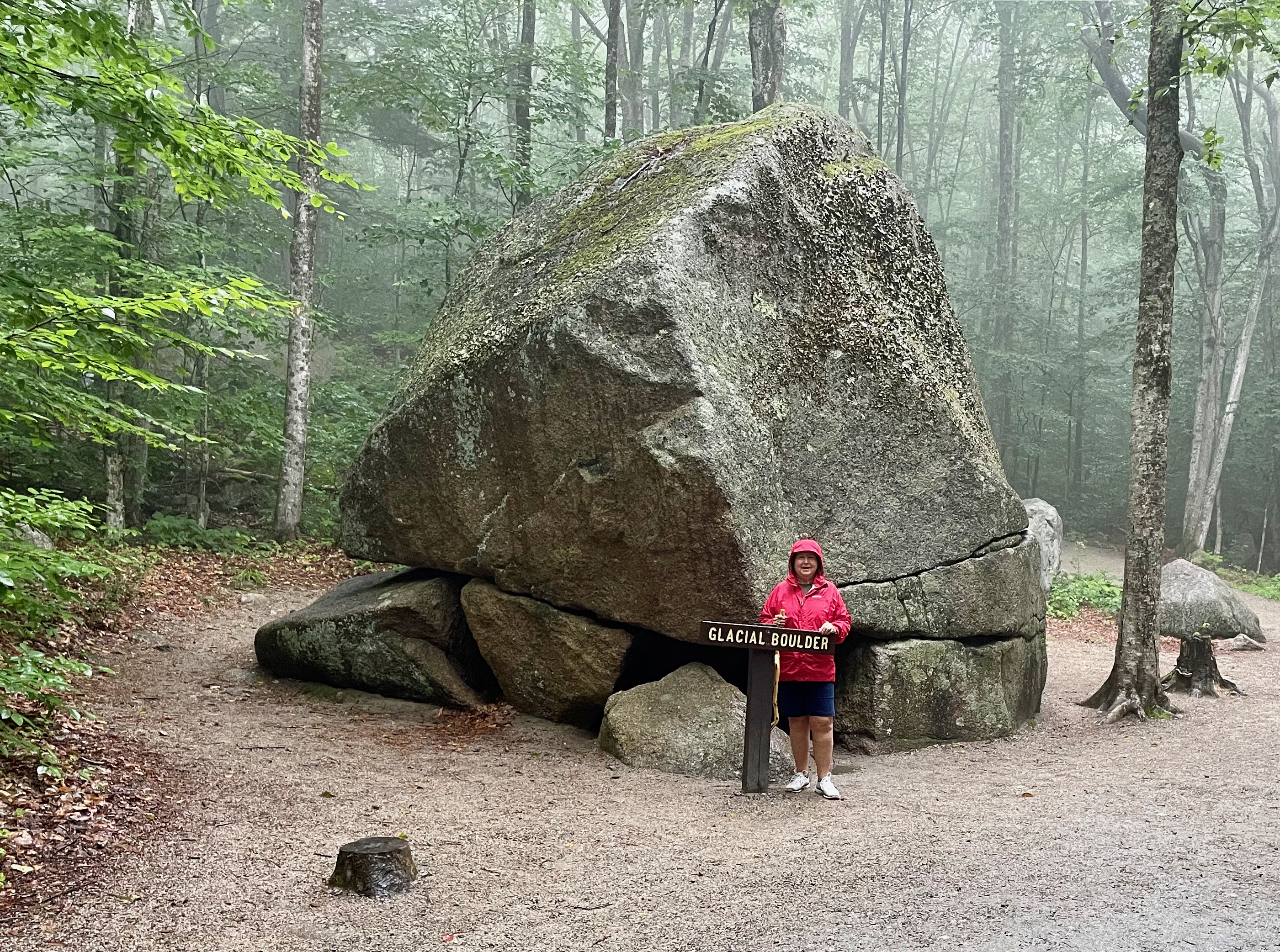
As we walked through this area, many isolated boulders were lying beside the trail; many had roots of trees encapsulating them. Some were quite large, and all were rounded. As glaciers from historic times retreated, these boulders were left behind; they are called glacial erratics.
Glacial Erratic
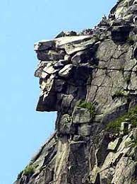
Following the Flume Gorge hike, we drove to a nearby trailhead and hiked a short trail to view Profile Lake and Old Man Historic Site. The Old Man of the Mountain, also called the Great Stone Face and the Profile, was a series of five granite cliff ledges on Canon Mountain in the White Mountains of New Hampshire, that appeared to be the jagged profile of a human face when viewed from the north. The rock formation is 1,200 feet above Profile Lake, was 40 feet tall and 25 feet wide. The first recorded mention of the Old Man was in 1805. It collapsed on May 3, 2003
After that short hike it was time for a late afternoon nap.
Today’s travel took us across Vermont to Lincoln, New Hampshire, where we’ll spend the next three nights. Lincoln, New Hampshire, is ideally located for the activities we wanted to pursue. Regrettably, the weather is unseasonably hot and humid. After checking into our motel, we sat out behind our room along the babbling river, relaxing after the short 118 mile drive into the White Mountains of New Hampshire.
Colchester, VT, to Lincoln, NH
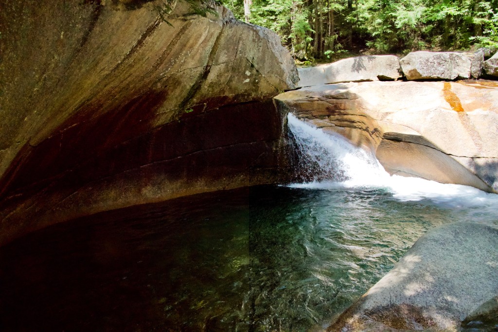
We opted to hike to Kinsman Falls in Franconia Notch State Park this afternoon; we were fortunate to get a parking spot at the trailhead as all the facilities in the state park were packed with people.
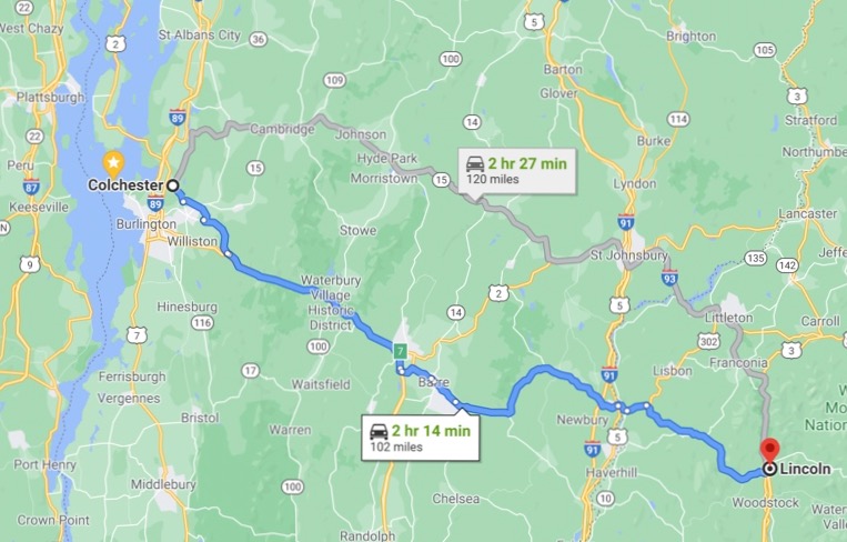
Near the beginning of the trail was the Basin, a granite pothole, 20 feet in diameter, located at the base of a beautiful waterfall.
The Basin
It is believed to have been eroded 15,000 years ago while the North American ice sheet was melting. The Basin has been smoothed by small stones and sand, whirled around by the Pemigewasset River. There were, seemingly, people everywhere.
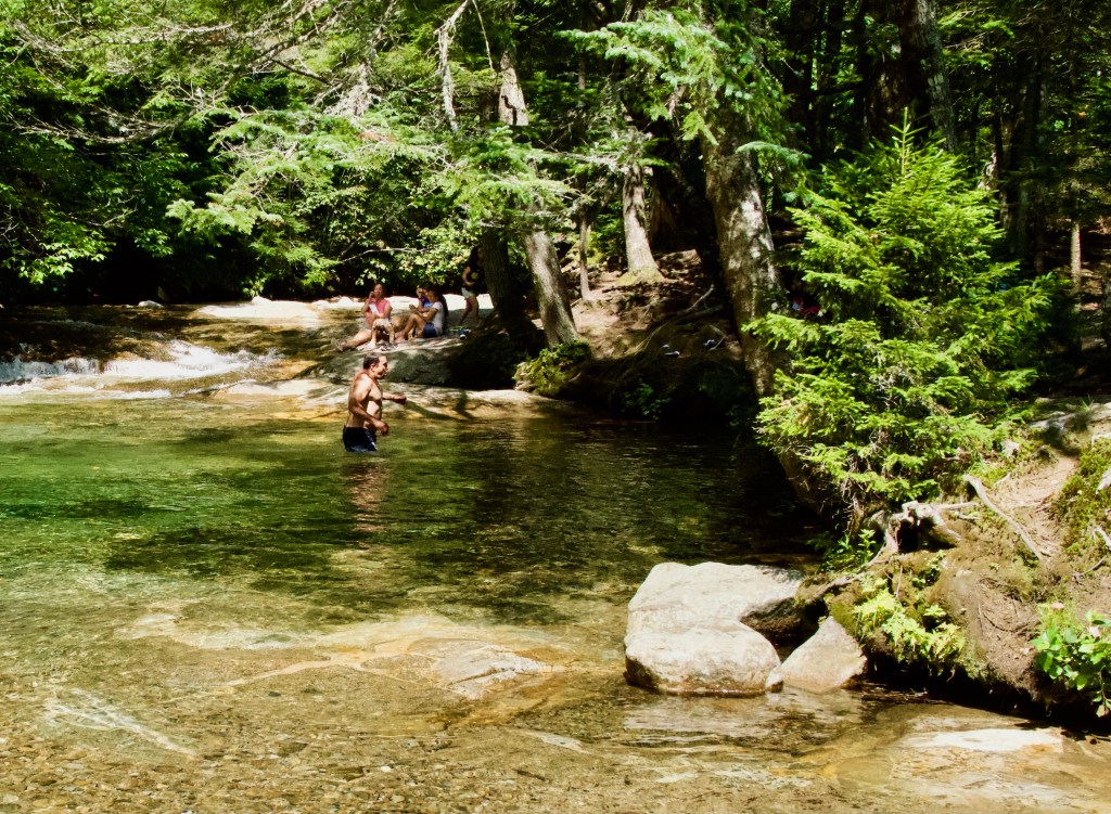
Waterfalls and smooth granite were adjacent to the trail for the entire hike. The trail follows the stream the entire hike up the mountain, so there were many other unnamed cascades and waterfalls along the trail in the White Mountain National Forest.
Along the trail
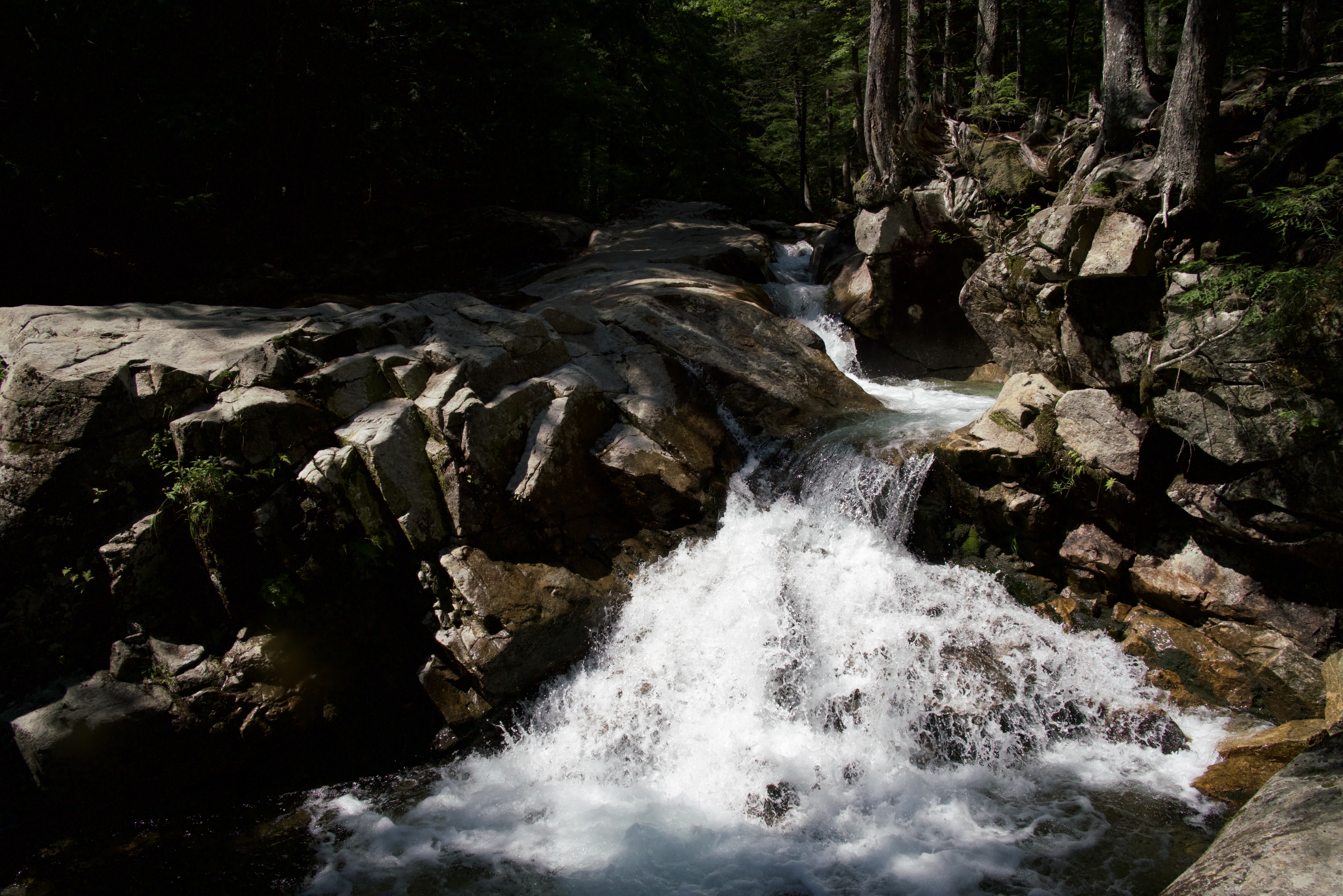
The hike to Kinsman Falls is supposedly a relatively easy hike at only .6 mile, and a 297′ elevation gain. However, root “ladders” predominated the trail and made hiking very difficult for those of us with bad ankles, knees, and hamstrings.
Kay waiting to climb a root ladder
Kinsman Falls has a 22′ total drop, the water source is Cascade Brook. Along the trail, a small sign “Kinsman Falls” is hung from a tree and we found ourselves suddenly standing along a steep hill looking down at the waterfall. I managed to get close by taking a small switchback route to the base of the falls.
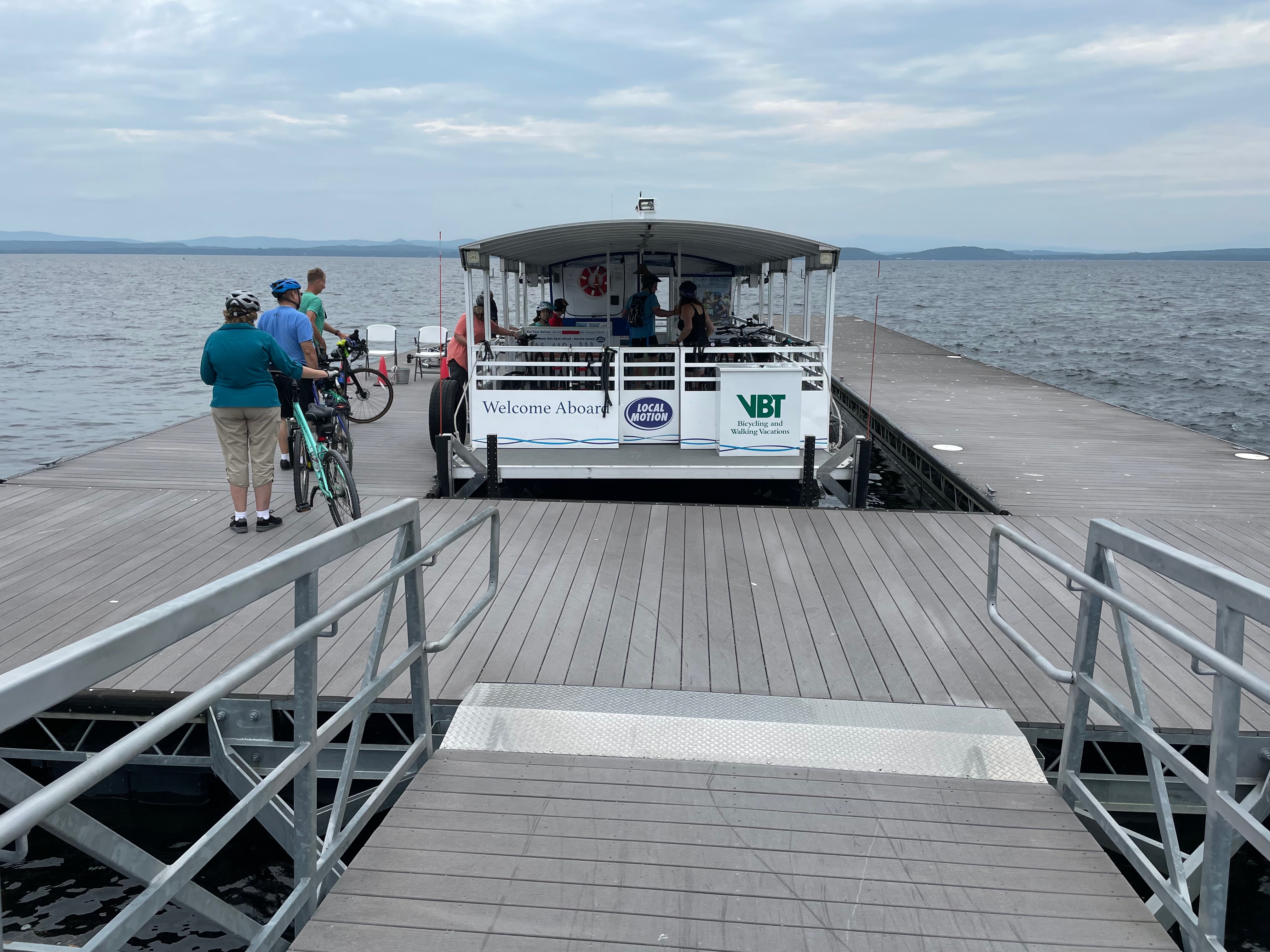
It seems as if our “lazy” mornings are lasting longer and longer. It was mid-morning today before we were up, about, and out the door. We have fulfilled all our must-see items, but cycling the Island Line Rail Trail remained. Kay and I drove to the trailhead where she was to pick me up, and entered the address in the GPS. And then, we drove to the trailhead where she dropped me off. Today’s ride would be from Leddy Park Trailhead to Hero Island and return to Causeway Bike Path Parking Trailhead, a total of about 17 miles.
The Island Line Rail Trail, a Rail Trail Hall of Fame trail, also known as the Colchester Causeway, is a 14-mile rail trail in and near Burlington, Vermont. It comprises the Burlington Bike Path, Colchester Park, and the Allen Point Access Area on South Hero Island. The trail follows the route of the Island Line railroad, built by Rutland Railroad in 1901. Passenger service on the Rutland’s Island Line (and on the entire Rutland RR system) ended after a strike by employees in late June, 1953. A second set of strikes, in 1960 and 1961, brought about the complete closure of the Rutland Railroad. The final trains ran on September 25, 1961. In 1963, the state of Vermont purchased the abandoned, but not torn-up, Rutland Railroad lines from Burlington to Rutland, Bennington, Hoosick Junction and Bellows Falls, leasing them to the Vermont Railway and the Green Mountain Railway to resume freight service, but the state chose not to acquire and reopen the Island Line. Ultimately, all three swing bridges on the route were removed, but the roadbed on the heavily-built crushed granite causeway across the lake survived. The alignment along the shores of Lake Champlain from Burlington Union Station north to the causeway was converted to form the Burlington Bike Path, and later took the Island Line name when the causeway was reopened, with a seasonal bike ferry replacing the swing bridge in the northern portion of the causeway alignment.
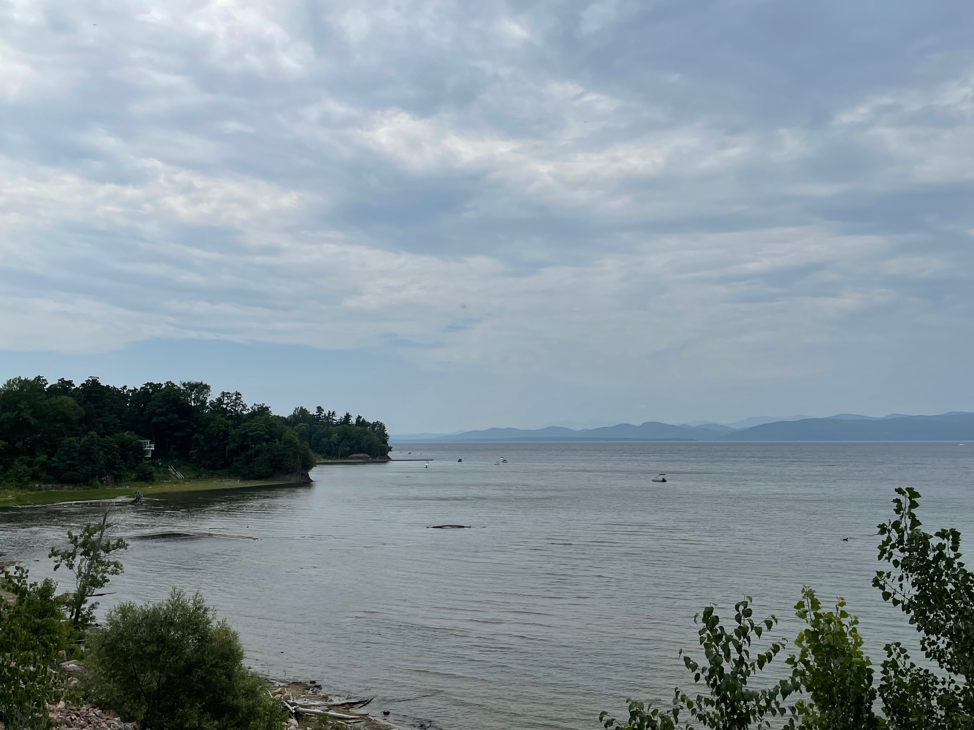
The trail was heavily used today, and signage in the developed area was poor to non-existent, mainly because of construction and accompanying detours, reminding me of all the detours of the Razorback Greenway in Bentonville, Arkansas. The mostly finely-crushed granite surface made for excellent cycling. Views of Lake Champlain and moored sailboats were almost constant, except for the short segment of trail through a natural area.
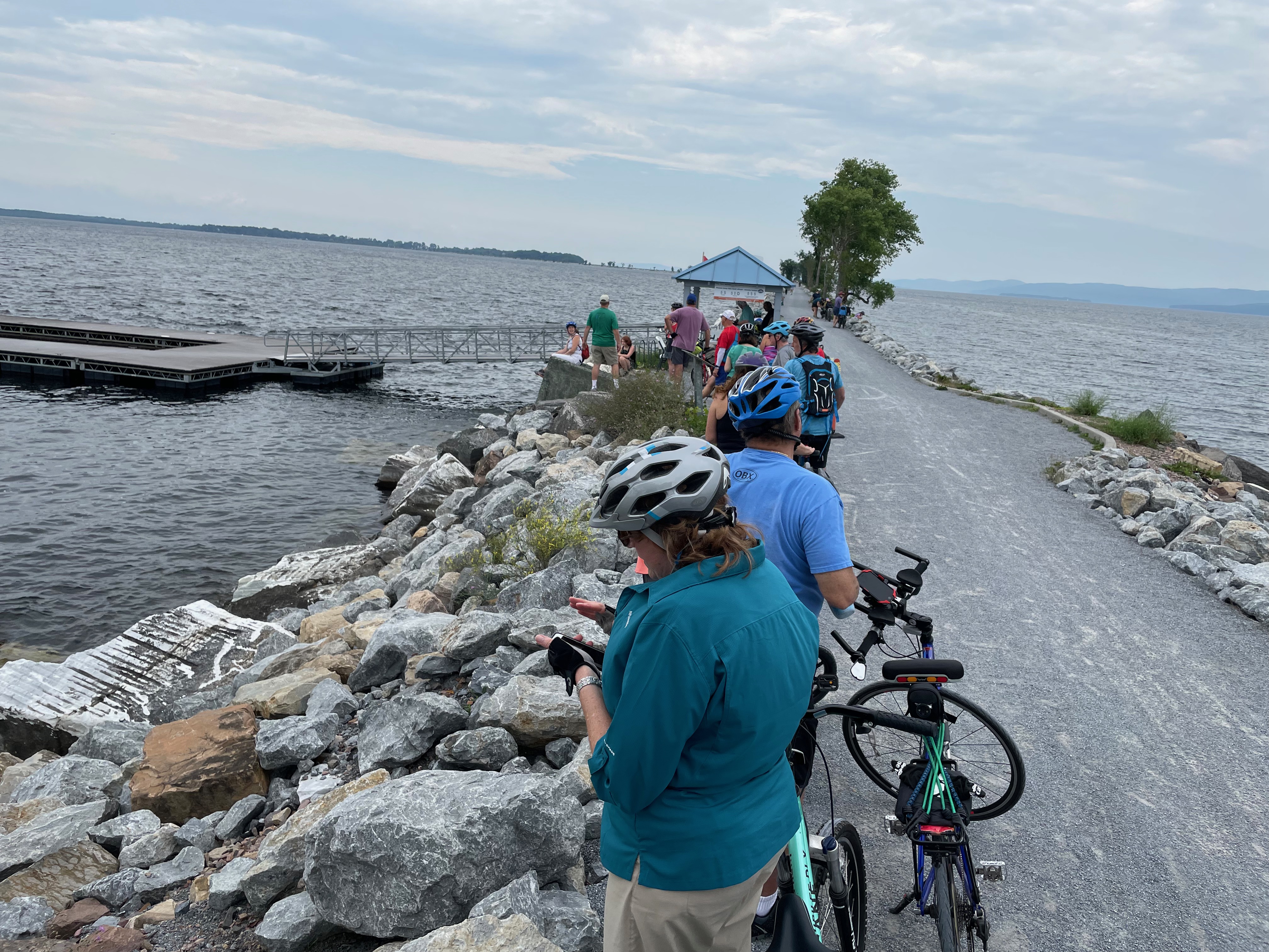
Once on the actual causeway, there were surrounding breezes and lapping waves from Lake Champlain.The gap on the northern portion of the causeway resulted in a necessary stop, or turnaround point. However, the seasonal bike ferry was unloading passengers and bicycles for the short ferry around the gap. Because it was lunch time, there was a waiting line, and it took two more ferry trips before I was near the beginning of the queue. A $10 donation secured a roundtrip ticket on the oversized pontoon boat. Due to a 200-foot gap in the causeway, the organization Local Motion operates the Island Line Bike Ferry to shuttle cyclists across the gap, thus the “donation.” The return trip to meet Kay was into the breeze from Lake Champlain, and the headwind was a bit stronger than expected.
Kay was kindly waiting for me in the overflowing parking lot. had an adventurous morning herself exploring many of the shops in the waterfront area, filled with young families and college students from the University of Vermont.
A visit to Costco and a quiet evening in the hotel room watching the Great British Baking Show wrapped up our last full day in Vermont.
After a late start Saturday morning, we began driving east and north towards our next destination, Colchester, Vermont. The drive took us from northern Pennsylvania, through mid-New York State, and then to northwestern Vermont along Lake Champlain’s eastern shore. We will spend three nights here.
Wellsboro, PA, to Colchester, VT
Surprisingly, there are not many things for traveling tourists to see or do in Vermont, at least as far as we’re concerned. It is known for its vivid fall colors, maple syrup, cheese, and winter snow skiing. The countryside abounds with pastured farms, and almost all have a red barn. Interestingly, many of the old buildings have been preserved (not necessarily restored), but with relatively new additions. Thus, it is odd to see a somewhat modern building attached to an old one, and there were many.
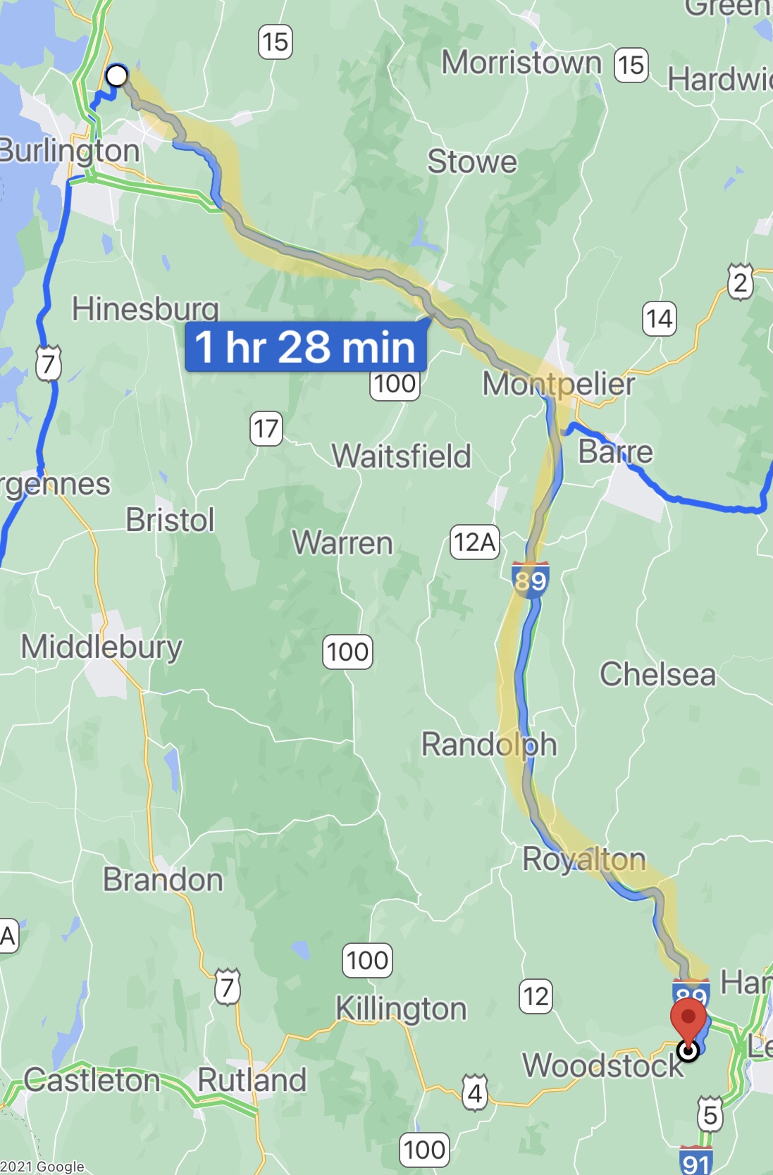
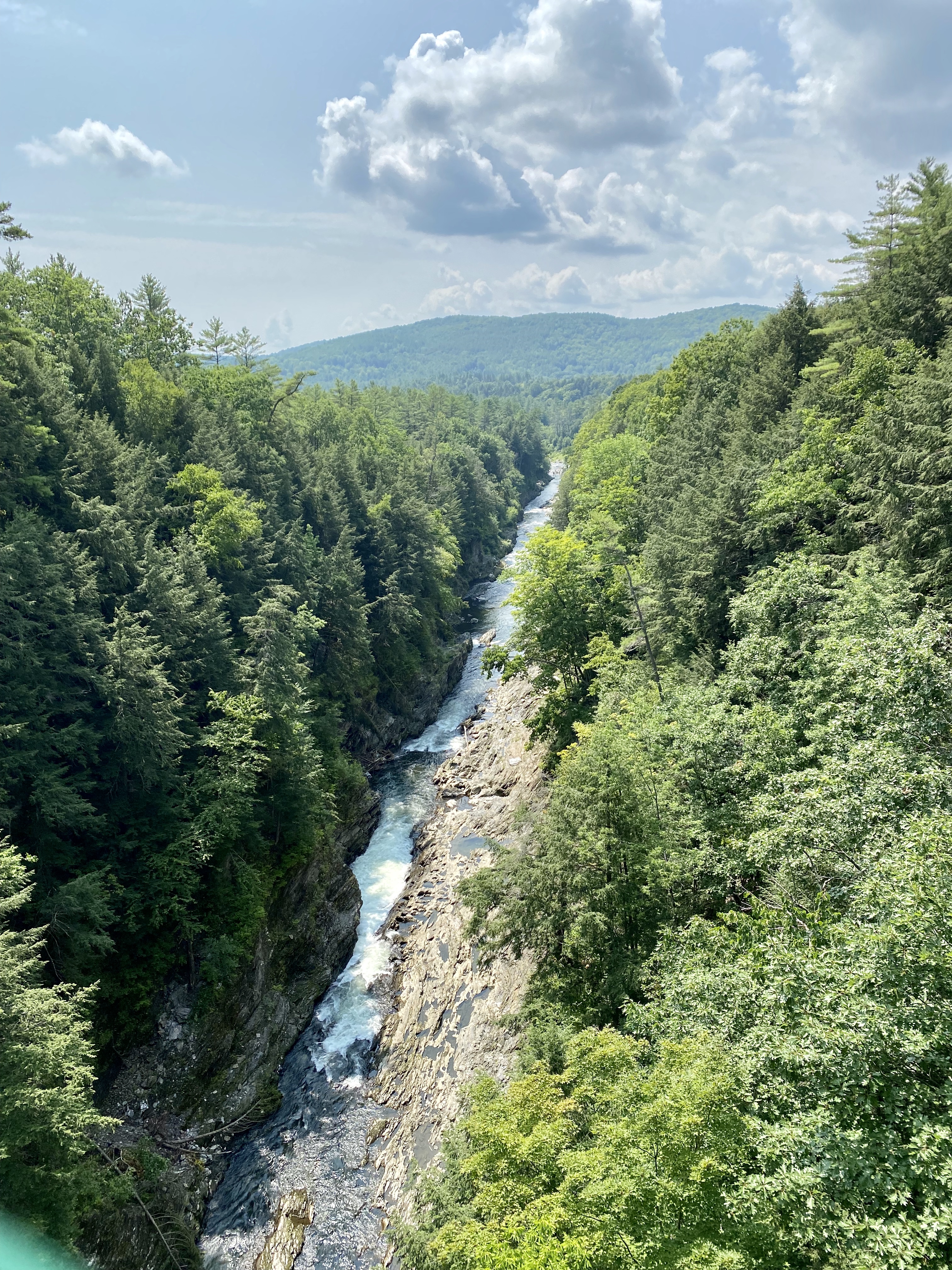
Our Sunday drive began about 11AM, with a main objective of traveling Vermont Highway 100, a “must do” according to Vermont travel websites. Our first stop was all the way across the state to the Quechee Gorge, located in Quechee, Vermont, along U.S. Route 4 near Woodstock, Vermont. The gorge is 165 feet deep and is the deepest gorge in Vermont. It serves as a popular tourist attraction in Quechee State Park, offering kayaking and fishing, plus other water sports. We viewed it from the U.S. Route 4 bridge, and it was pretty awesome.
Quechee Gorge
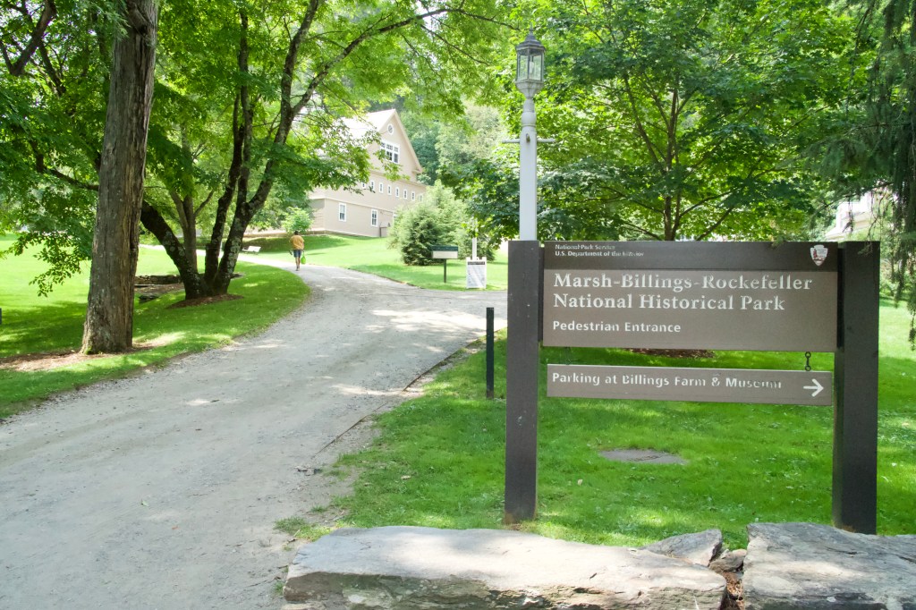
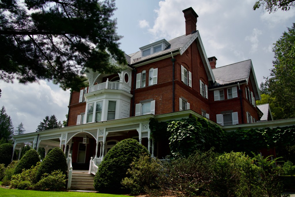
After Quechee Gorge, we briefly visited the Marsh-Billings-Rockefeller National Historical Park. It was dedicated to the public by benefactors Laurance and Mary Rockefeller with a vision to preserve 550 acres of delicate woodlands surrounding the town of Woodstock. Accompanying the nature preserve are the historic homes and art collections of the Marsh, Billings, and Rockefeller families, whose environmental stewardship helped shape the ethic of American conservation, and some 20 miles of carriage roads and hikeable trails that meander throughout the property.
Marsh-Billings-Rockefeller National Historical Park
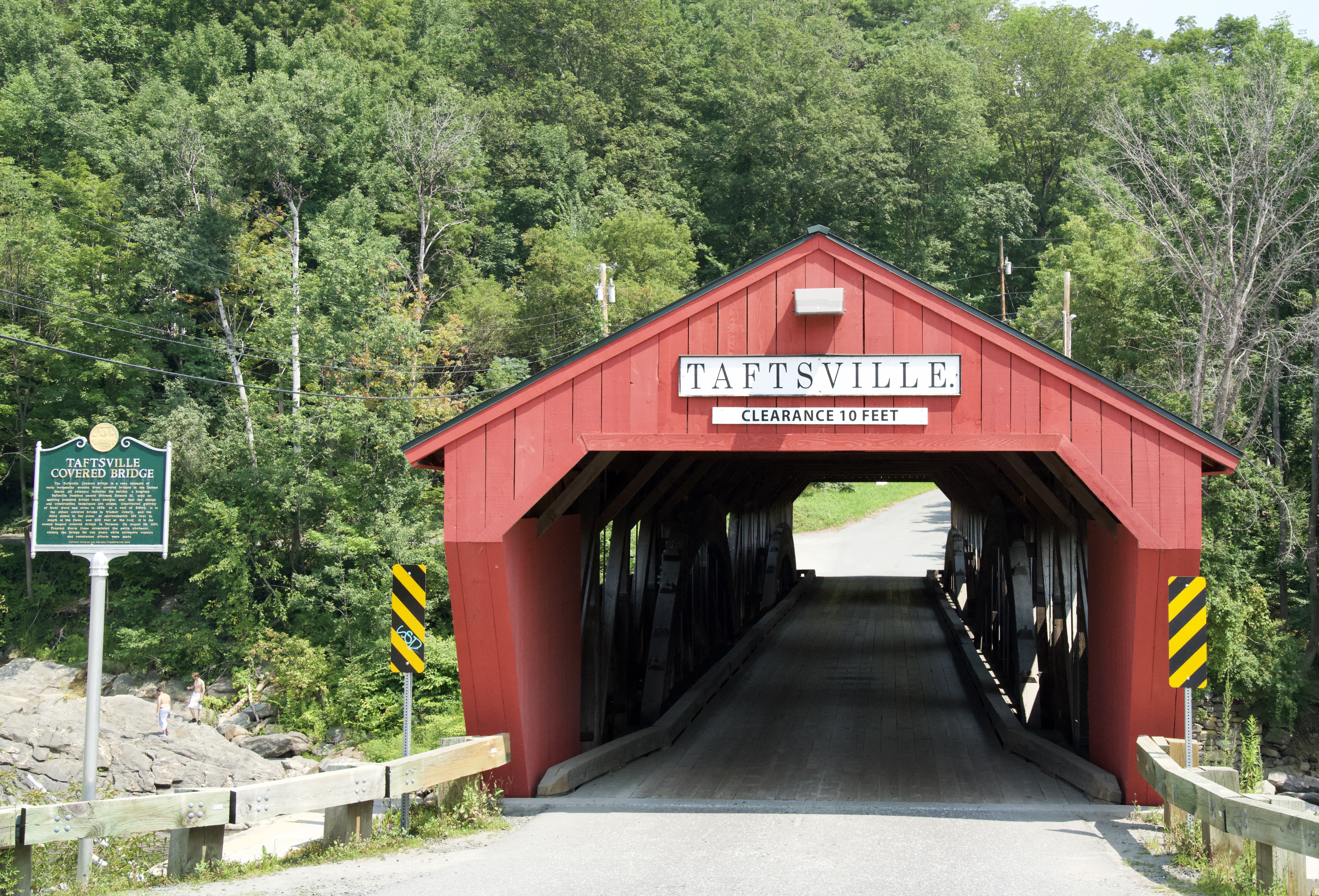
Next was the affluent village of Woodstock. Woodstock is a quintessential New England village with three covered bridges and the Marsh-Billings-Rockefeller National Park, Its charming colonial character is enhanced by the local artists and craftsmen along its streets. A collection of country stores, boutiques, bookstores, and art galleries line the village streets, enticing the many Sunday afternoon visitors to wander its charming streets.
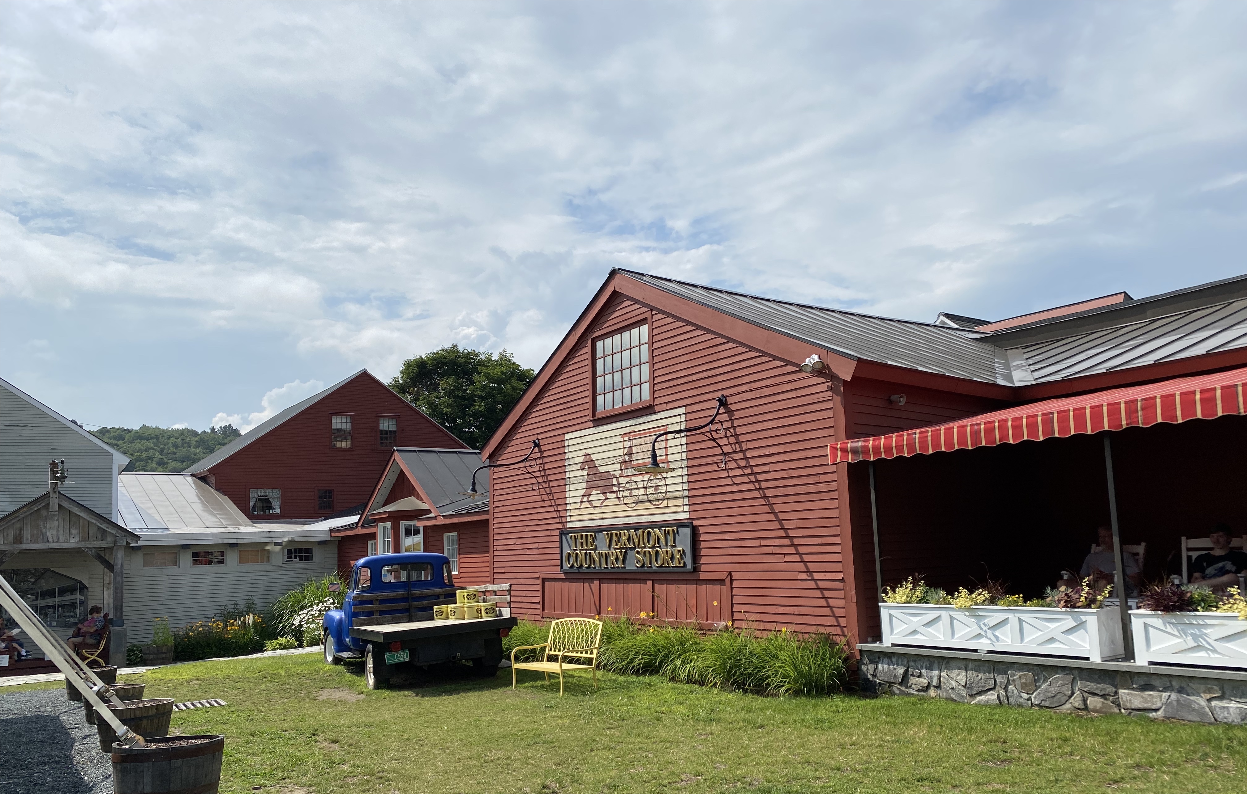
We then traveled south through the picturesque New England country side, in sporadic heavy rain, to the Vermont County Store in Weston, Vermont. The Vermont Country Store, Inc. is one of the original New England catalog, retail, and e-commerce businesses (think LL Bean) and is based in Vermont. The company was established in 1946 and is operated by the Orton family. Kay enjoyed shopping there and bought a few “can’t do without” items.
The Vermont Country Store
From Weston, we began driving north on Vermont Highway 100. Though the forecast was for 30% chance of rain for a couple of hours, it rained, sometimes very hard, most of the rest of the afternoon. The drive north took us through the ski resort town of Killington north to the ski resort town of Stowe (remember the Von Trapp family in Sound of Music), and then back to Colchester to our hotel.
Despite the often heavy rain, we enjoyed driving through the New England countryside. We’re glad we did it but wouldn’t do it again.
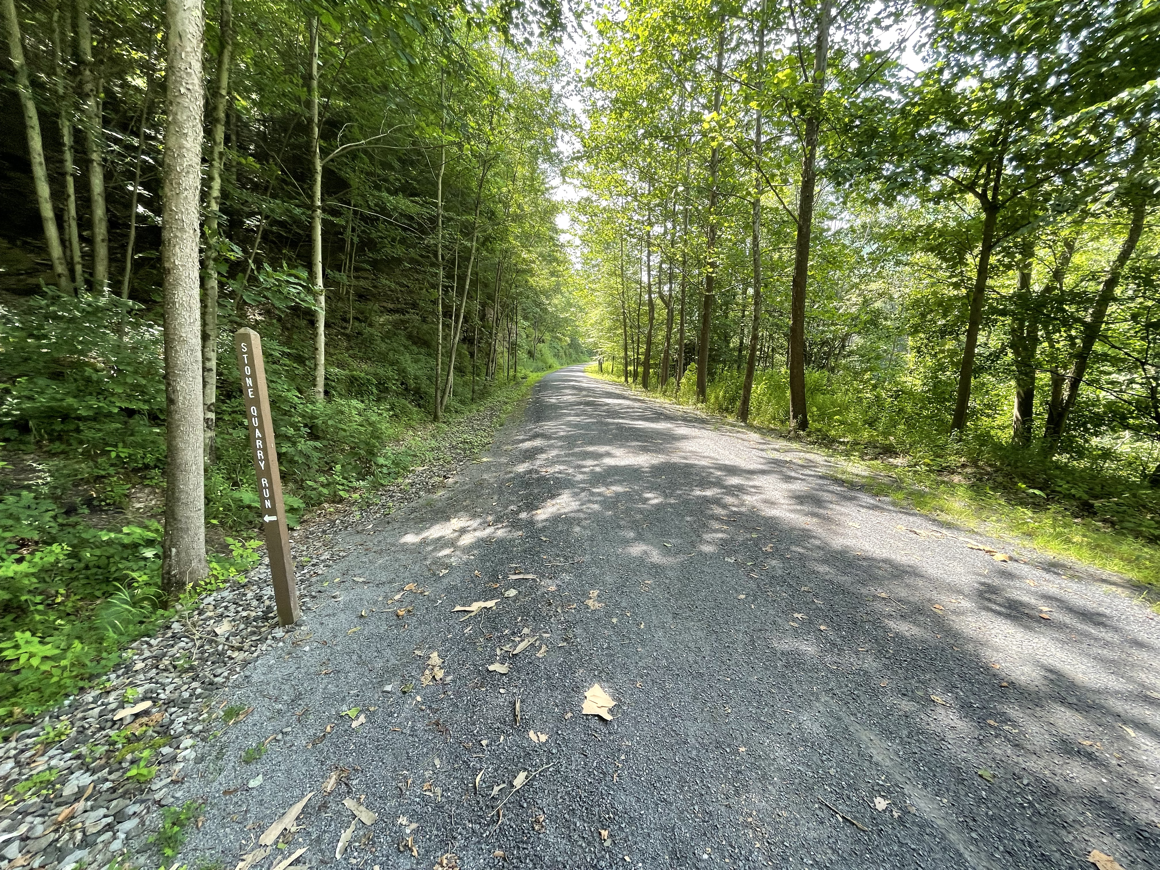
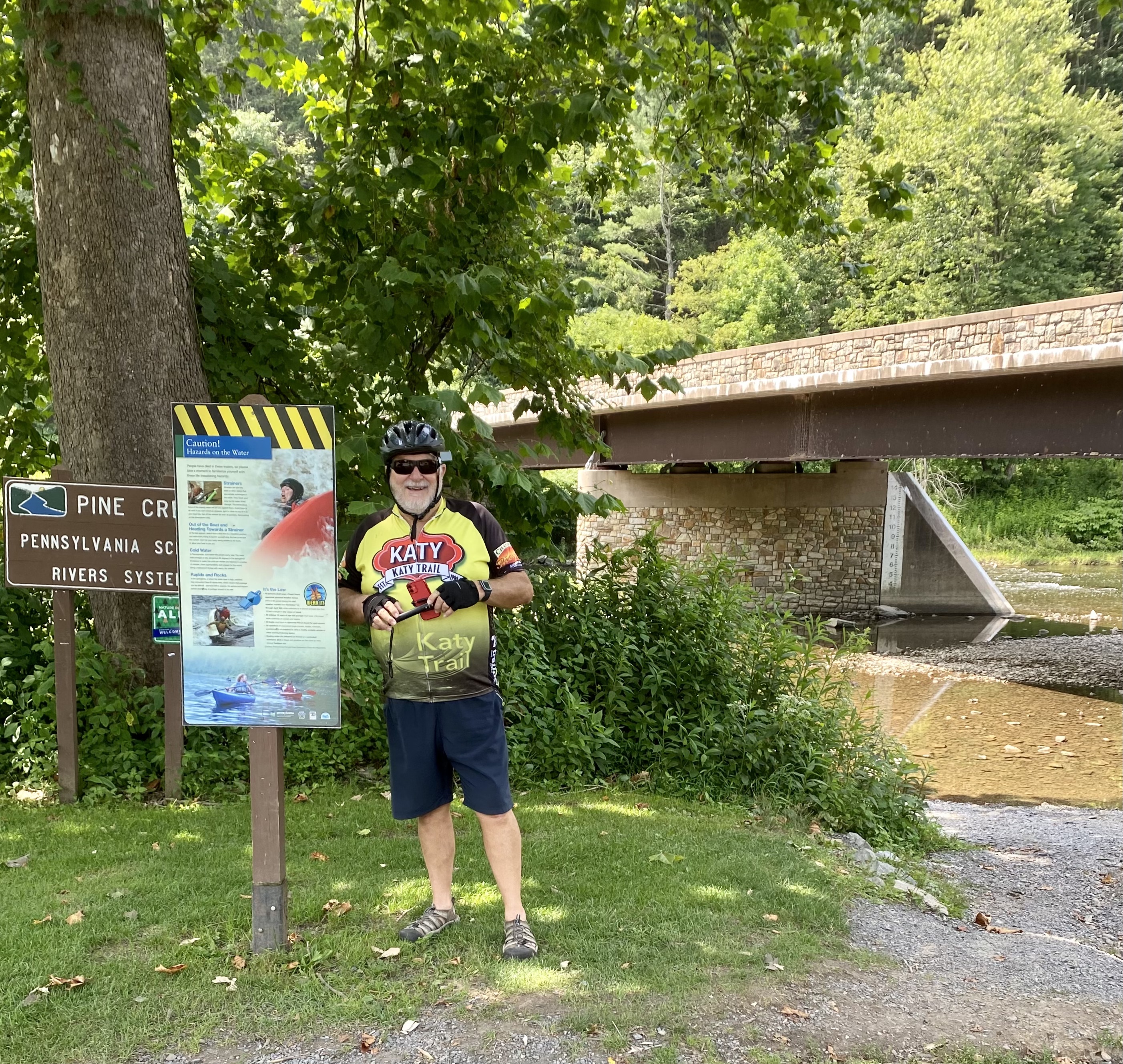
After a lazy early Friday morning catching up on news, etc., we drove to Darling Run access for the Pine Creek Rail Trail near Antonia, Pennsylvania. This is also the official start of Pine Creek Gorge, known locally as Pennsylvania’s Grand Canyon. Pine Creek Gorge is a 47-mile gorge carved into the Allegheny Plateau by Pine Creek in north-central Pennsylvania. It sits in about 160,000 acres of the Tioga State Forest. The canyon begins south of Ansonia, near Wellsboro, along U.S. Route 6 and continues south. Its deepest point is 1,450 feet at Waterville, near the southern end, and the distance rim-to-rim is about 4,000 feet.
The trailhead parking area was almost at capacity.
Darling Run Trailhead
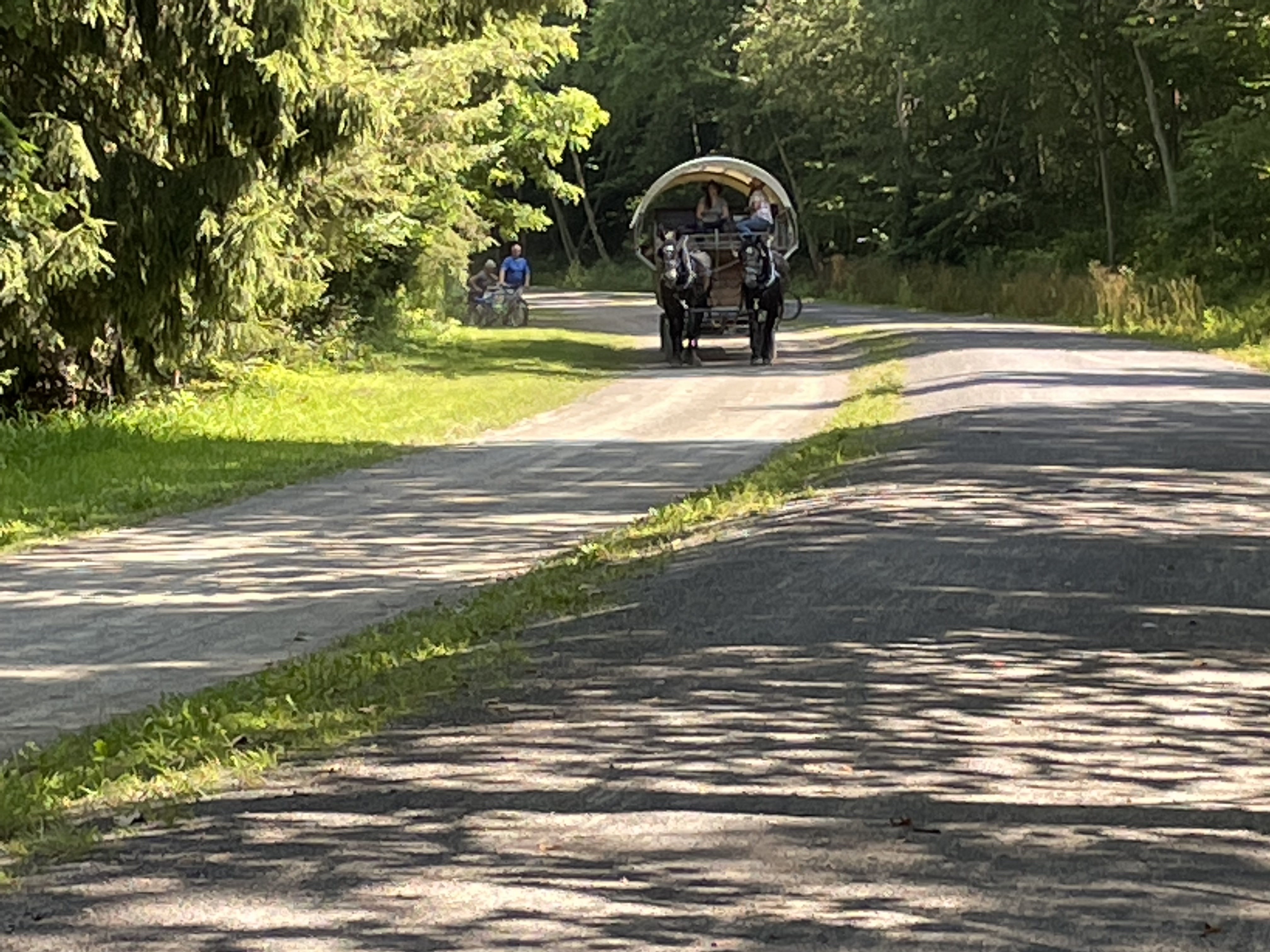
Just before entering onto the trail, a mule-drawn wagon full of sightseers passed. The early part of the trail was heavily used, but posed no problems.
Mule-drawn sight-seeing wagon
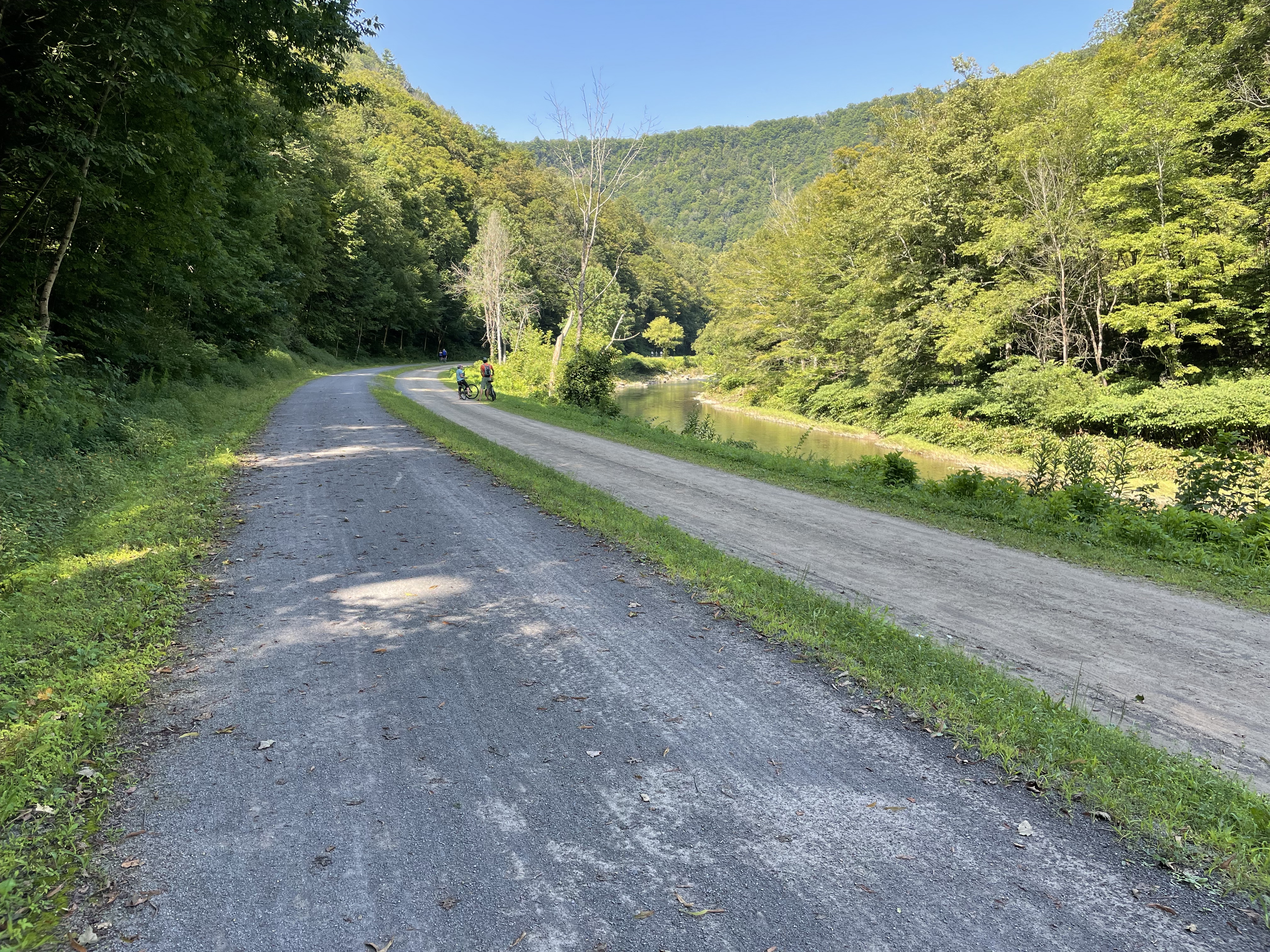
State forests lined much of the trail, with steep slopes on the left and Pine Creek on the right (cycling downstream).
Left side is for cyclists and hikers, right is for horsesPeace and tranquillity
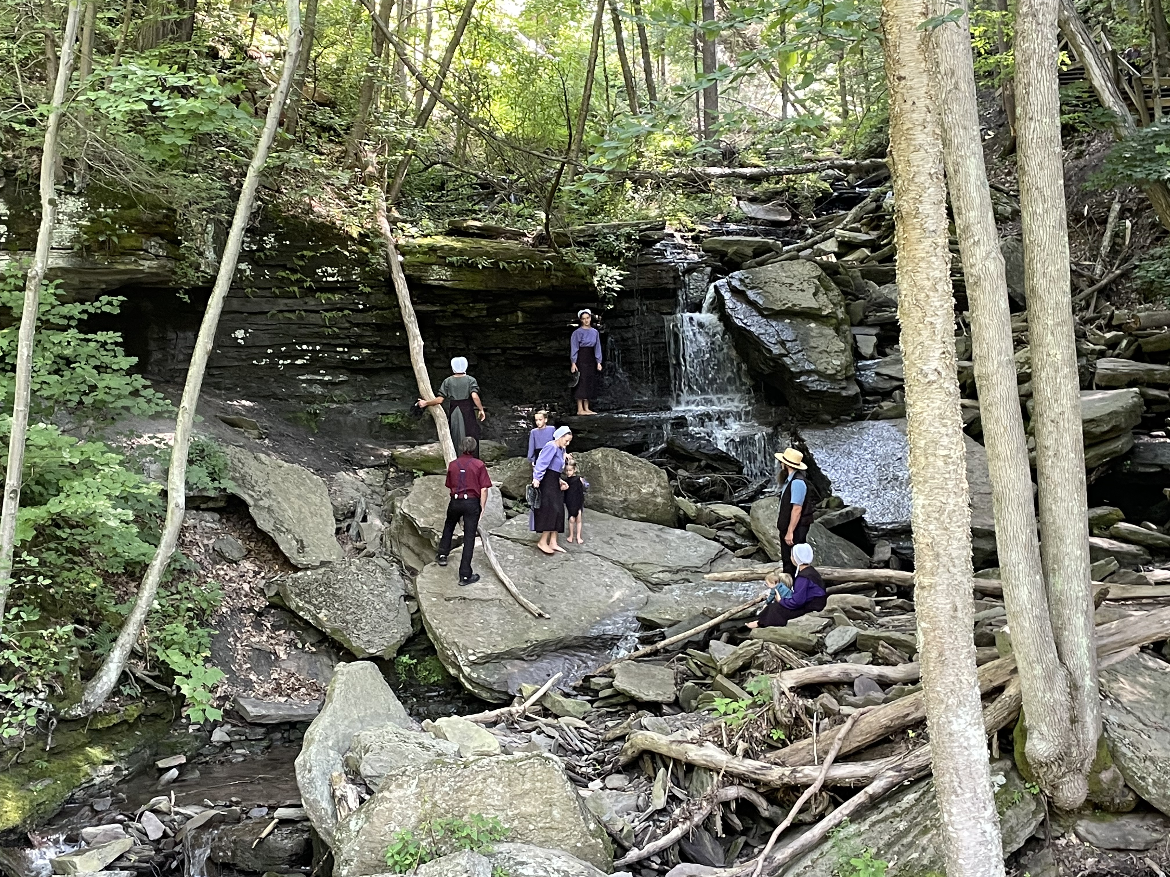
While casually admiring the awesome scenery, a slight roar of a waterfall could be heard and the tiered waterfall of Fourmile Run, came into view. There, a supervised group of Amish or Mennonite teens were frolicking in the falls.
Lower portion of Four Mile Run
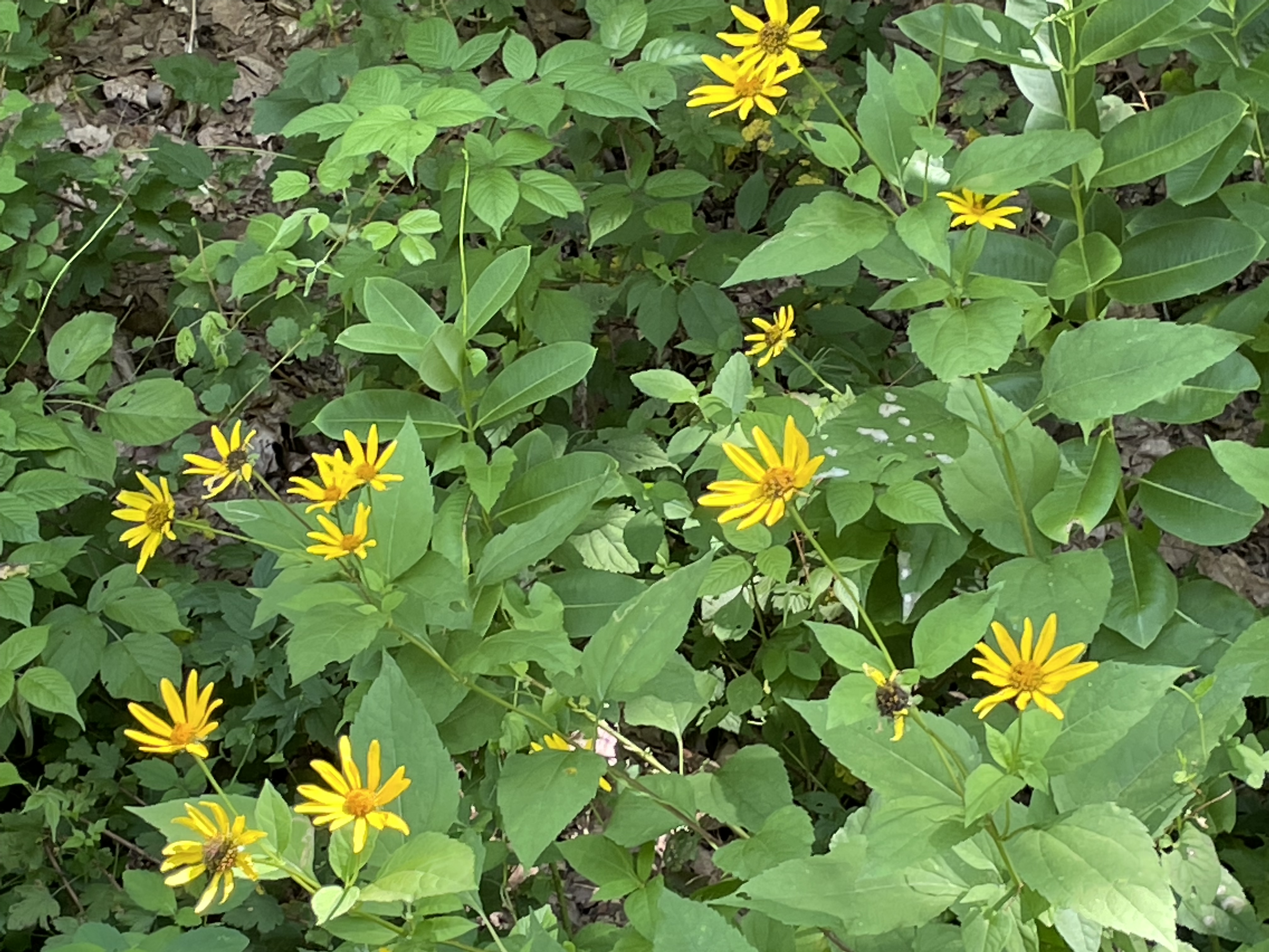
There were many waterfalls further down the trail, but all were either dry or just a trickle. An abundance of wildflowers bloomed alongside the smooth packed, finely crushed limestone trail.
Wildflowers line the trail
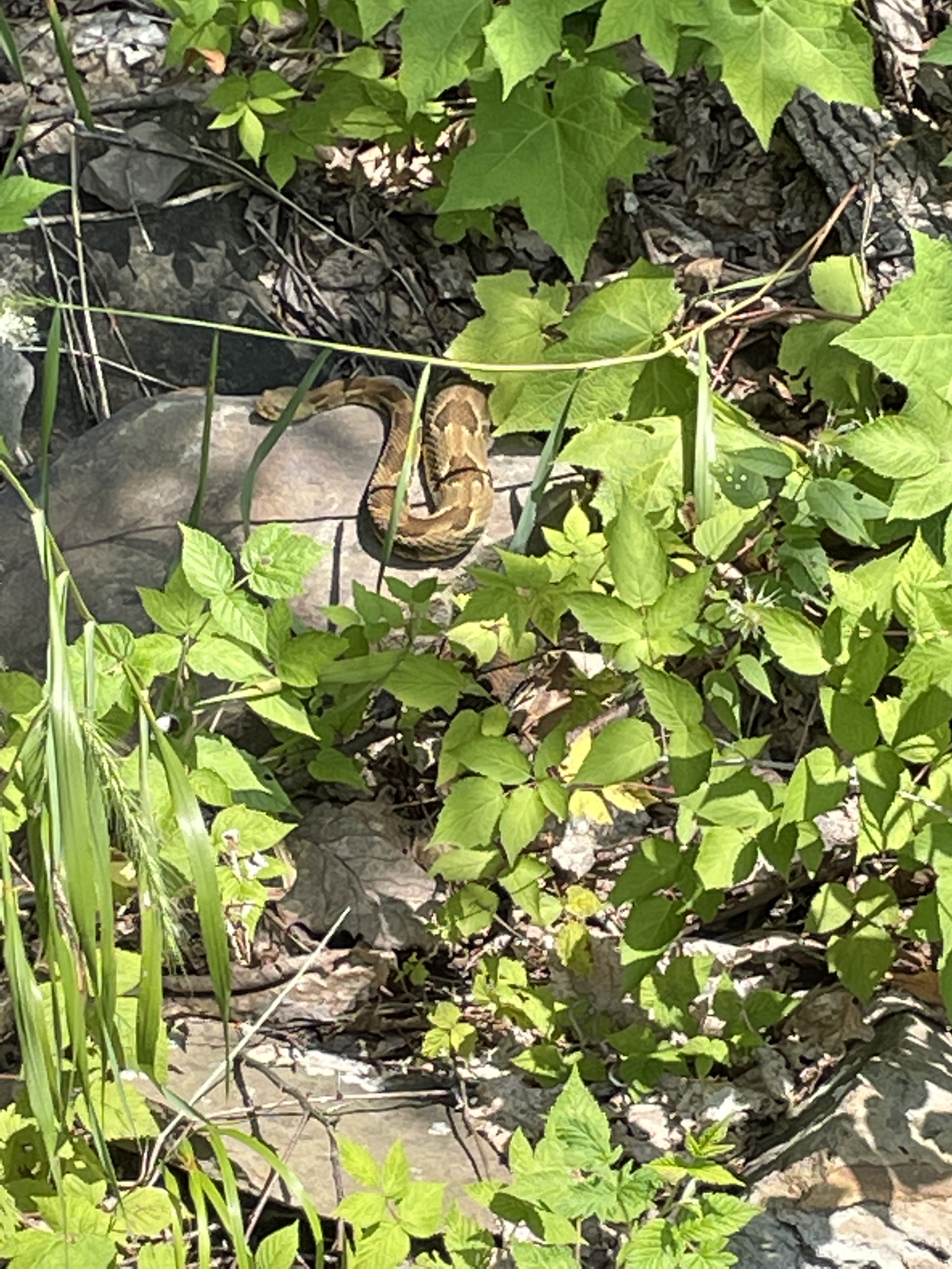
There were also a couple of “friends” along the trail. Here’s Slim, a timber rattle snake.
Looks like Slim has just had lunch
I was a bit reluctant to see trail’s end, but it was an awesome ride, over way too quickly. I’m not sure why this is not a Hall of Fame trail ad it was one of the “best” I’ve ridden. Today’s ride was about 18 miles.
Trail’s end, Pine Creek Trail
Meanwhile, Kay was up to no good in Wellsboro! Here’s her take on the turn of events.
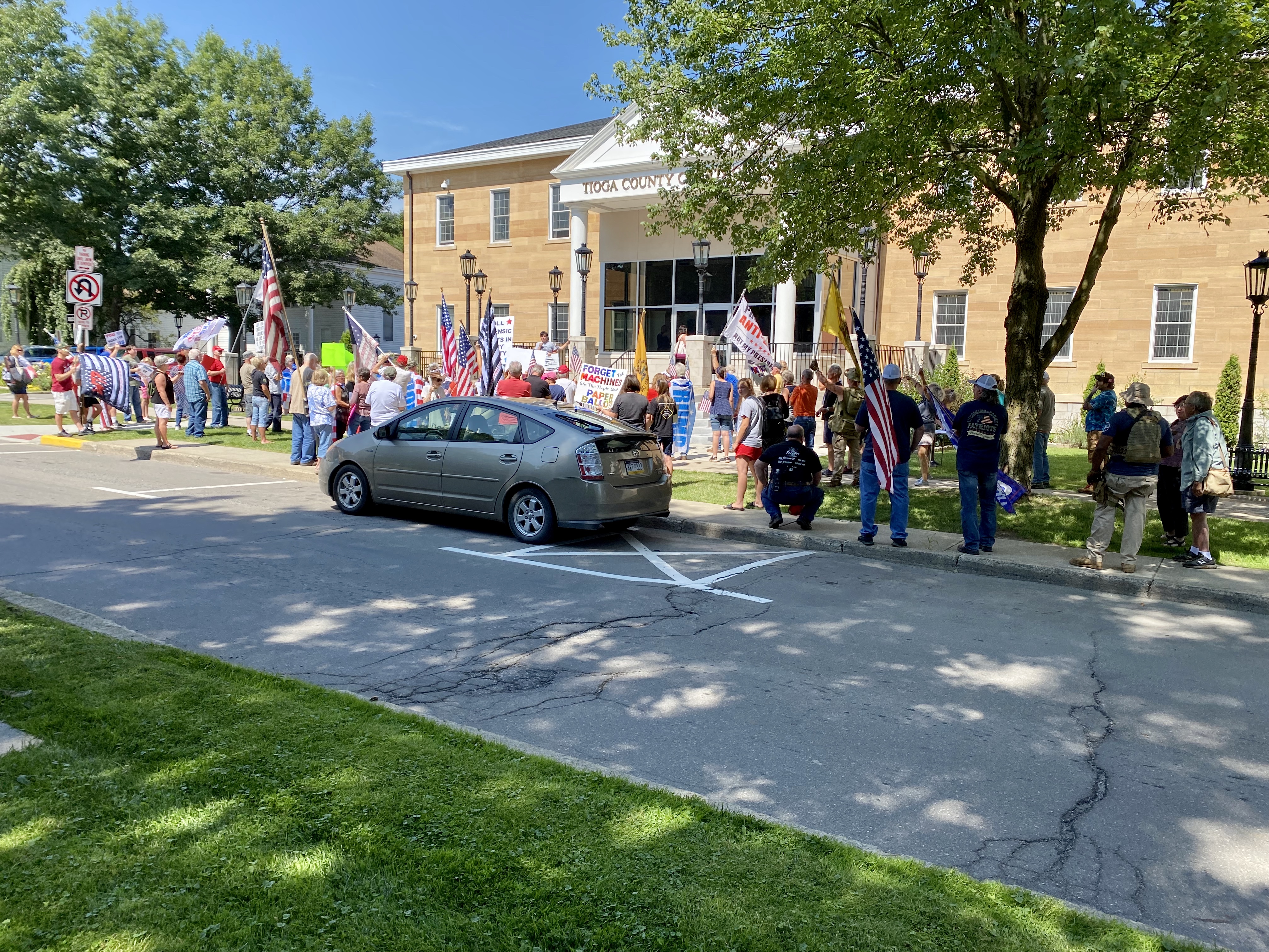
We are in Wellsboro, PA for two days/nights. Today after I dropped Donald off at the bicycle trail head, I came back to town to explore Main Street shops and take some pictures. Much to my surprise, there was a crowd gathered on Main Street right in front of the county courthouse. There appeared to be more Republicans than Democrats and they were protesting because they want an audit of Tioga, York, and Philadelphia counties because they believe the count was inaccurate – Tucker Carlson’s name was shouted as an ‘expert’. I didn’t hear or see any support explicitly for ex-President Trump. Most appeared to feel Democracy is threatened when the vote is considered flawed. Their request for an audit has been denied and that is what had them ‘hopping’ mad. No explanation was given for the refusal, according to a bystander. There was some chanting by both sides, but for the most part their demonstration was peaceful. The following article may explain what all the furor is about. A State Representative Doug Mastriano is behind the audit and is fighting for support. He has been a staunch supporter of the former President. The “Lies” are behind these efforts to destabilize the voting systems and possibly change elections. There would be substantial costs to replace voting systems because they would be decertified if turned over to a third party audit. https://www.forbes.com/sites/alisondurkee/2021/07/14/pennsylvania-audit-pushback-intensifies-as-gop-county-refuses-to-turn-over-election-materials/
Election protest
After the protest, she ventured around town to make a few photos.
The drive yesterday took us from Indiana east into Ohio, overnighting in Franklin, Pennsylvania, just north of Pittsburgh.
After waking up, we followed much the same routine as yesterday.
Kay dropped me off at the trailhead, and while I cycled she walked around the historic oil town of Franklin. Franklin sits on French Creek and the Allegheny River, which was a great spot for Native Americans to build shelter. In 1740, Scottish fur trader John Fraser built a trading post in Franklin. Once the trading post was abandoned, British fur traders planned to reconstruct it. George Washington was sent to Franklin to warn the French that they were trespassing on British land. The French did not leave; instead they created Fort Machault, where they amassed large forces to attack Fort Pitt (now Pittsburgh) in an effort to reclaim Fort Duquesne. The French then had to rescue Fort Niagara, but before leaving they burned Fort Machault to the ground. In 1760, the British erected Fort Venango. In 1763, Native Americans killed many British. The American Colonial Forces then constructed Fort Franklin named after Benjamin Franklin. Once oil was discovered in nearby Titusville, Franklin became a booming oil town. Once oil companies moved west, Franklin created machinery companies. Franklin was ranked in America’s Top Ten Streets in 2019.
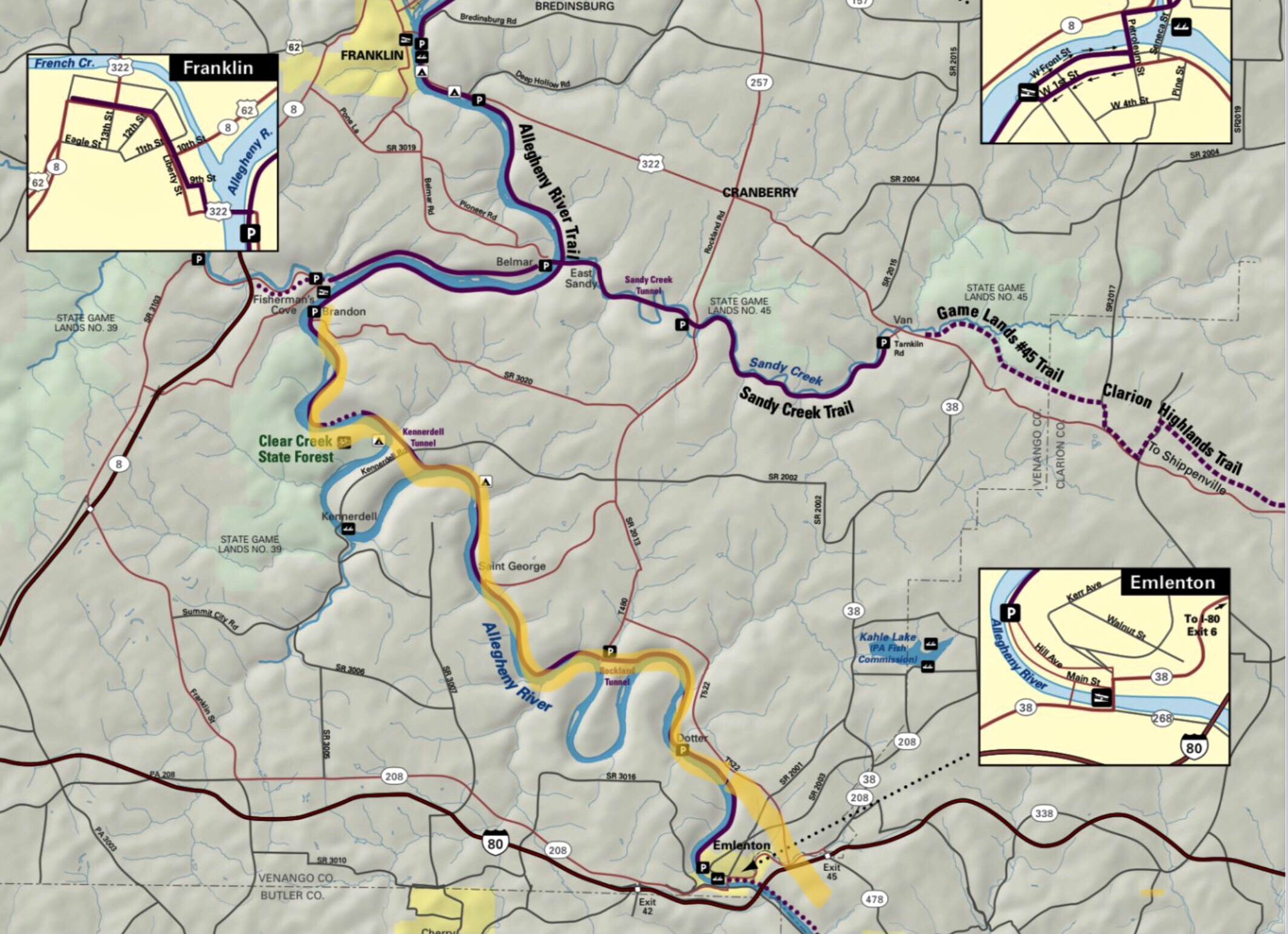
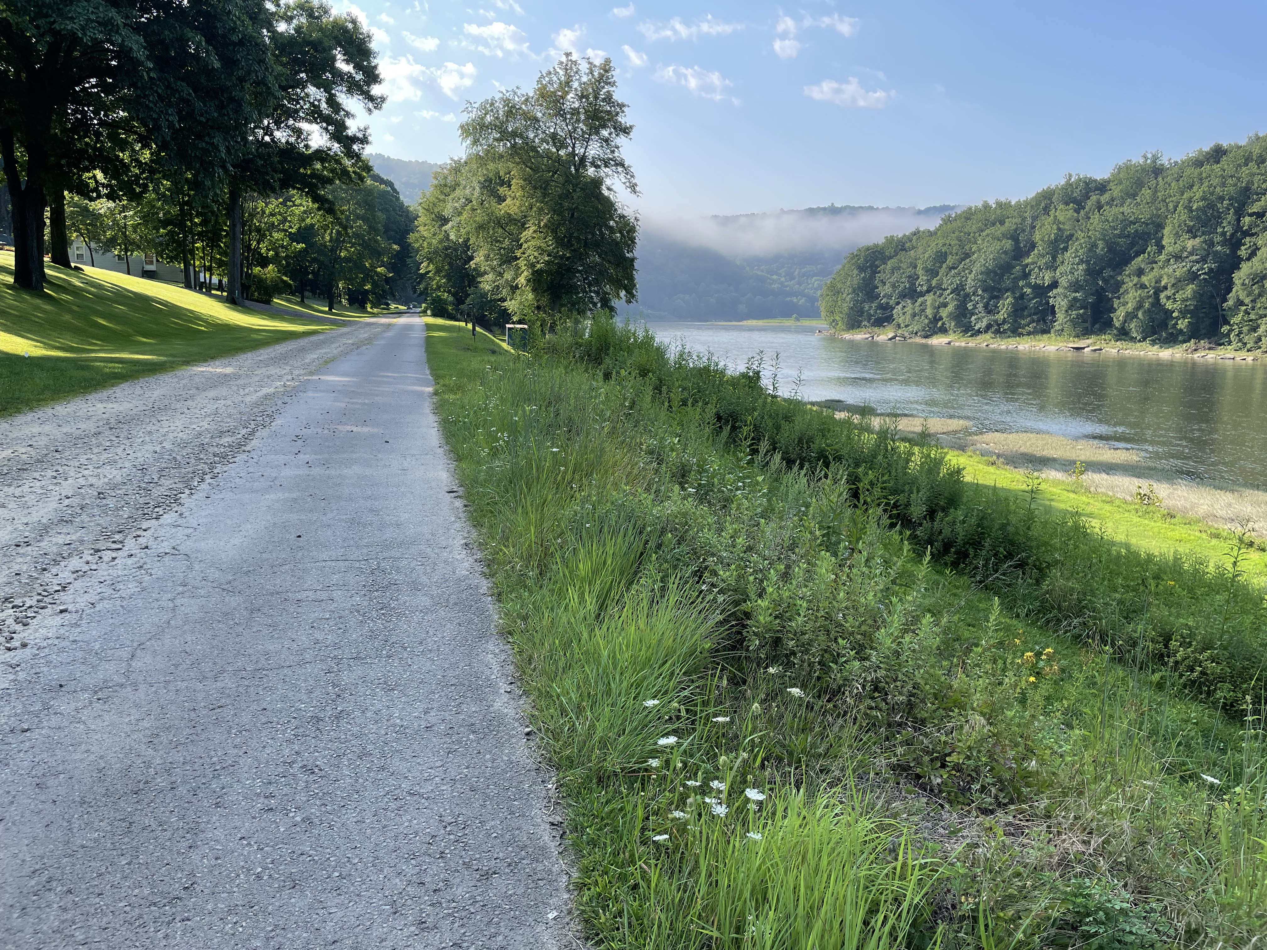
Back to the Allegheny River Trail. The trail follows the route used by the Allegheny Valley Railroad, later the Allegheny Division of Pennsylvania Railroad, to haul oil. The Scrubgrass Generating Company subsequently acquired it in 1984 and donated it to the nonprofit Allegheny Valley Trails Association. I cycled from the Brandon Trailhead to Emlenton.
Brandon to Emlenton
After Kay dropped me off at the Brandon Trailhead, adjacent to the Allegheny River, I began cycling south on the paved Allegheny River Trail.
Near Brandon TrailheadGood paved trail
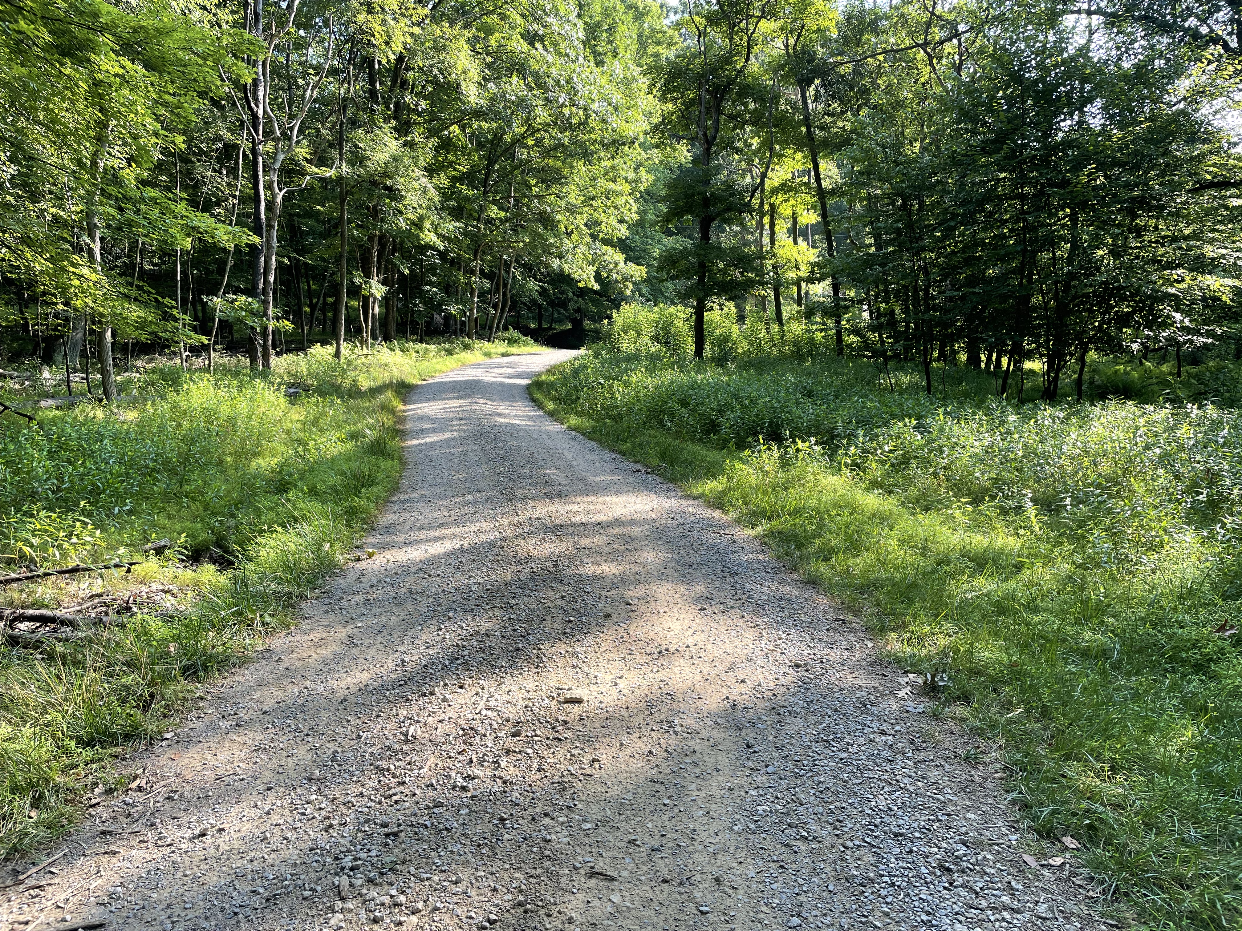
The paved trail soon veered onto gravelly North Kent Road for 0.75 mile through the Sunny Slopes community, with large limestone gravel loudly caroming off the bicycle tires.
Gravel made for difficult cycling
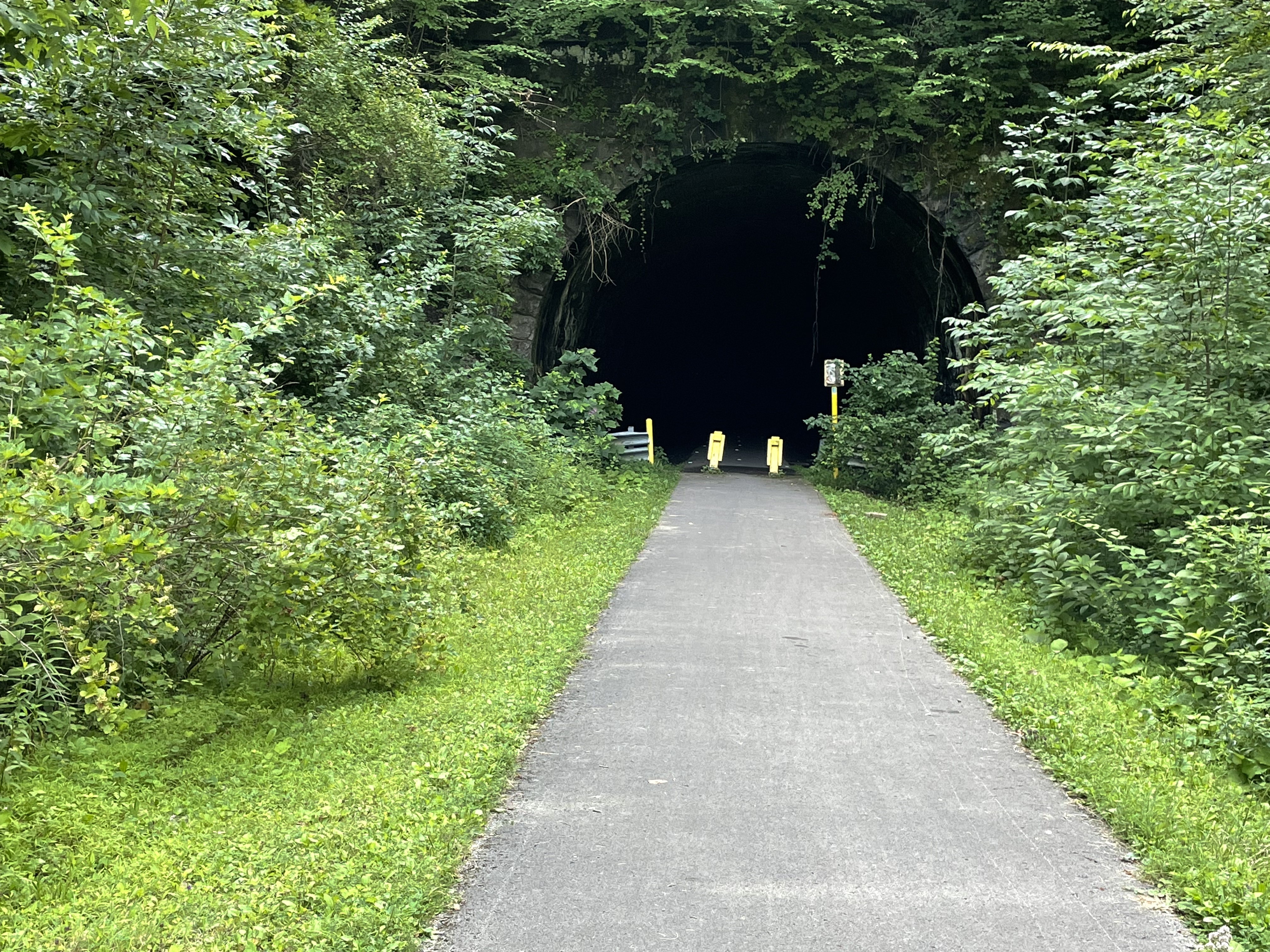
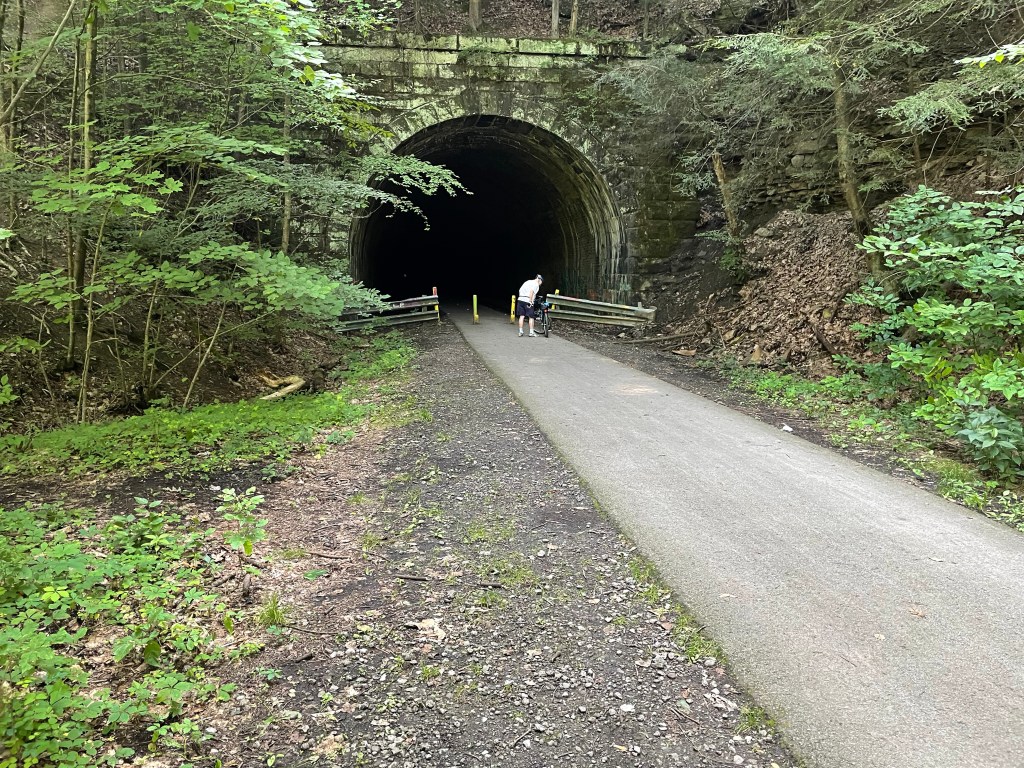
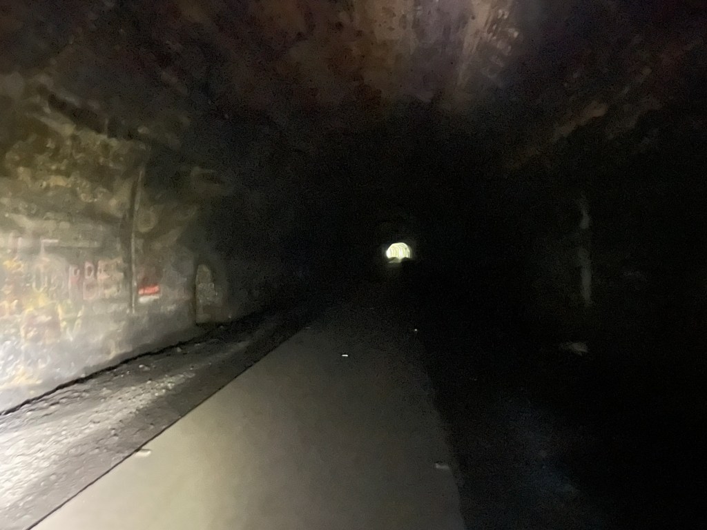
Back on an asphalt section of trail, the opening of the 3,300-foot-long Kennerdell Tunnel barely came into view on the foggy, canopied trail. This was a really dark tunnel, but the handlebar mounted LED provided sufficient light to safely pedal through the tunnel.
Kennerdell TunnelKennerdell Tunnel
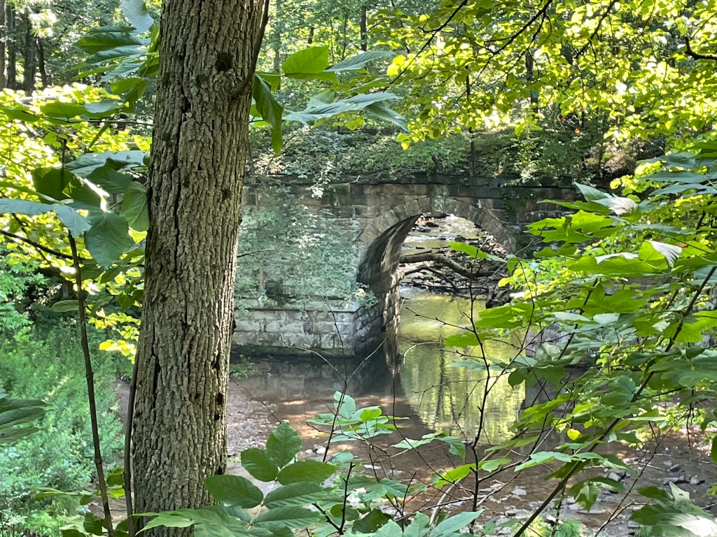
About here, the trail became quite washboarded from roots growing under the asphalt, often to the point that it felt like riding a bucking bronco. Continuing on the heavily tree shrouded trail, a waterfall could be heard, and then came into view.
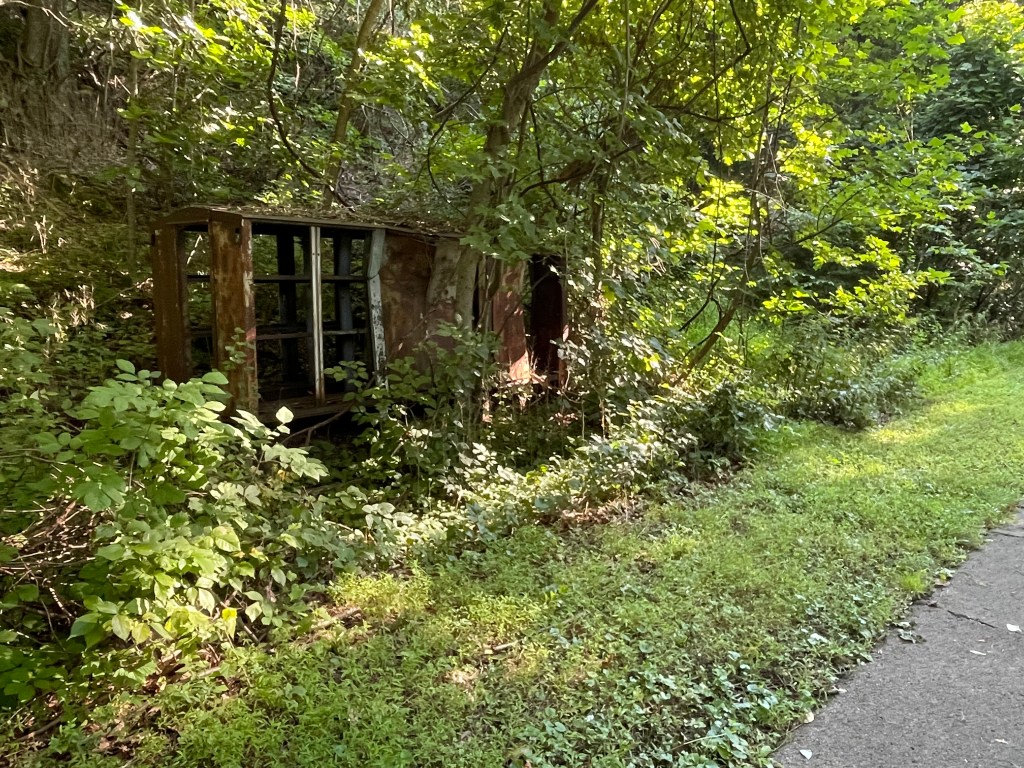
Further down the trail, a derelict train car from many years ago was nearly hidden by vegetation.
Derelict rail car and canopied trail
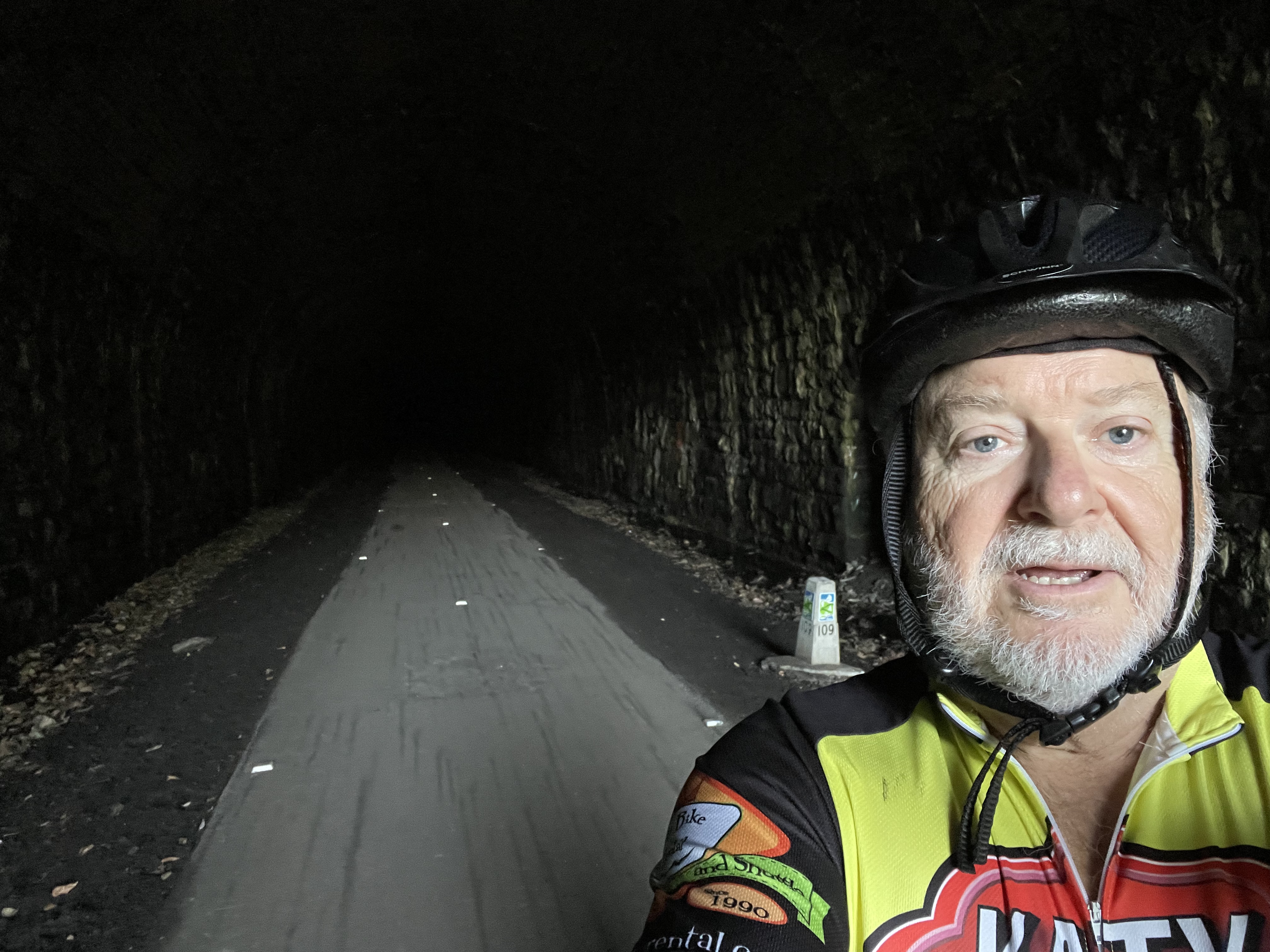
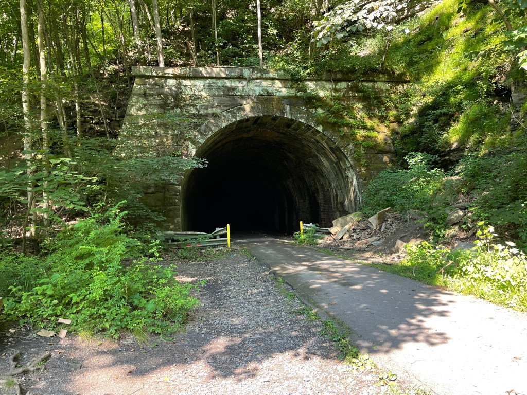
After a few more miles, the Rockland Tunnel, 2,868 feet long, came into view. As with the Kennerdell Tunnel, this tunnel’s dogleg resulted in total darkness, but no problems.
Rockland Tunnel
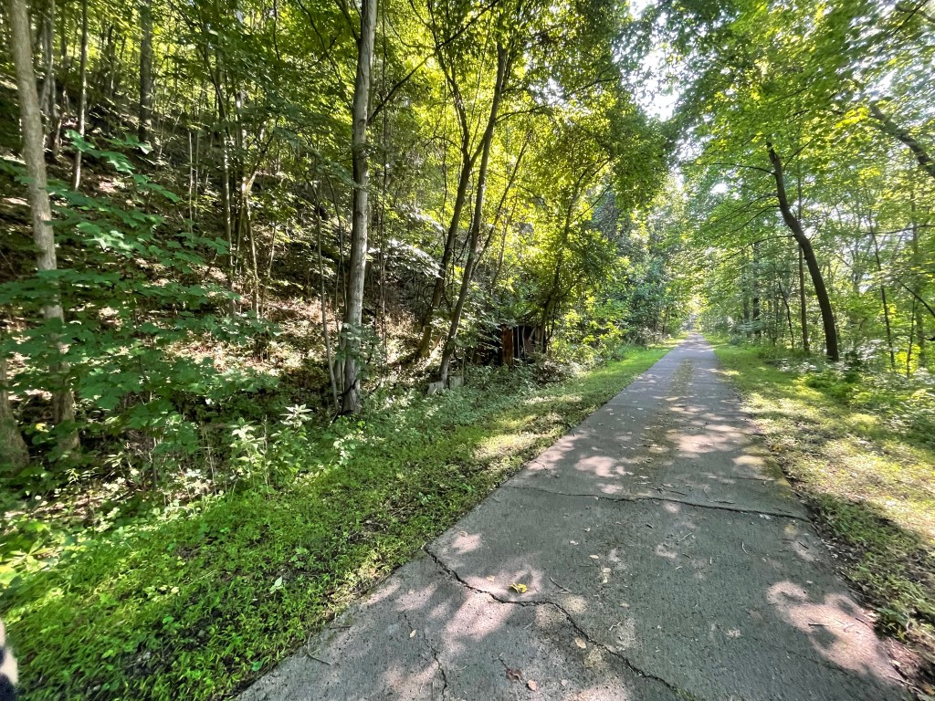
Much of the remaining trail was surrounded by a protected natural area.
And then, near Emlenton where Kay was waiting, the trail was heavily fenced as an old hazardous industrial site had been abandoned.
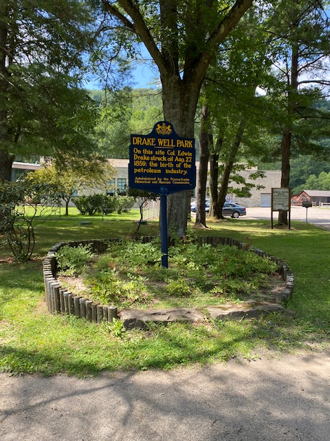
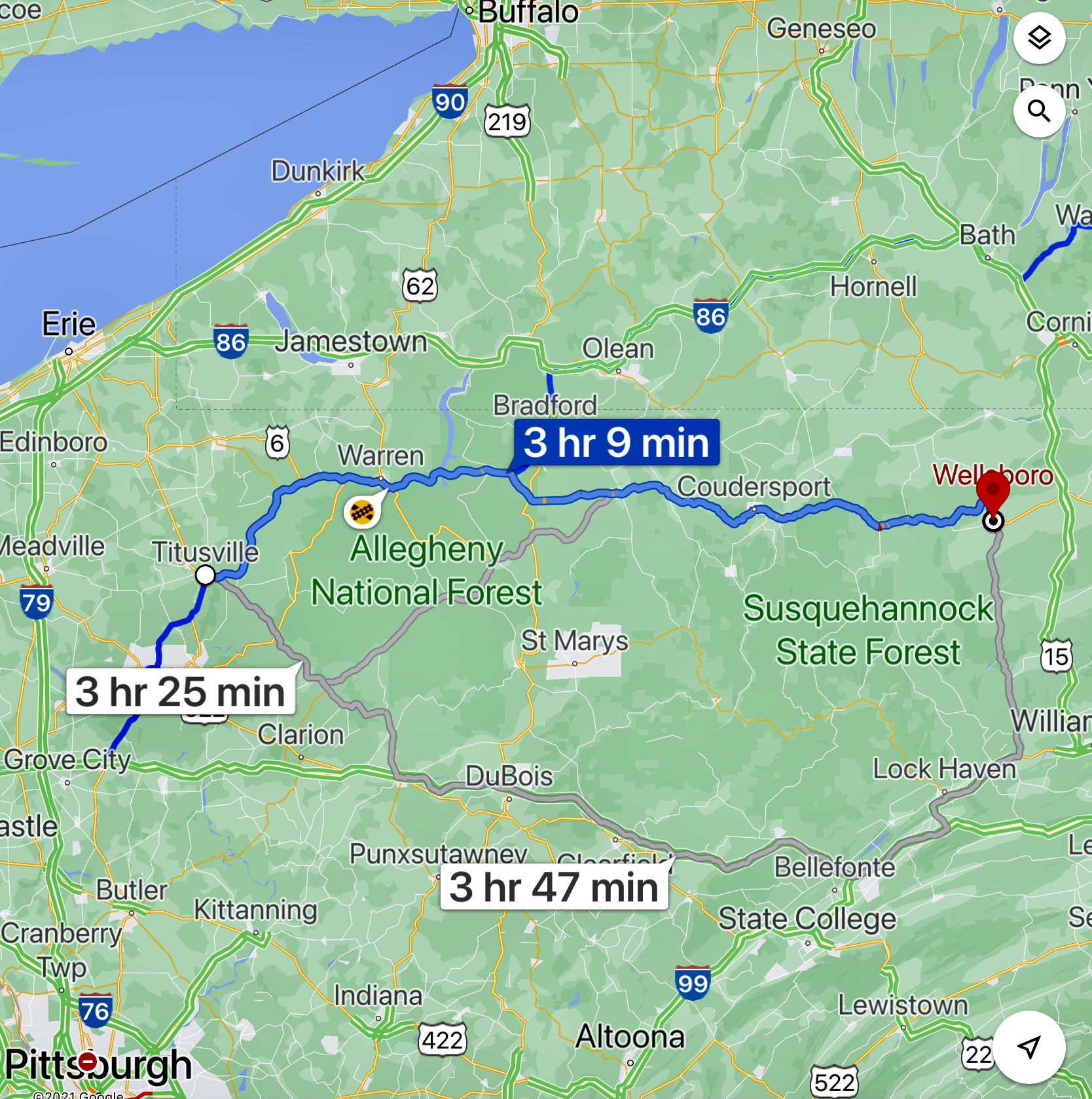
From Emlenton, we drove north to Titusville, site of the first oil well in the US. Much of the area in this part of Pennsylvania was heavily dependent on the oil industry, and some industry, such as a huge refinery, remains to this day.
After Titusville, our trip took us to Wellsboro, Pennsylvania, where we would overnight Thursday and Friday.
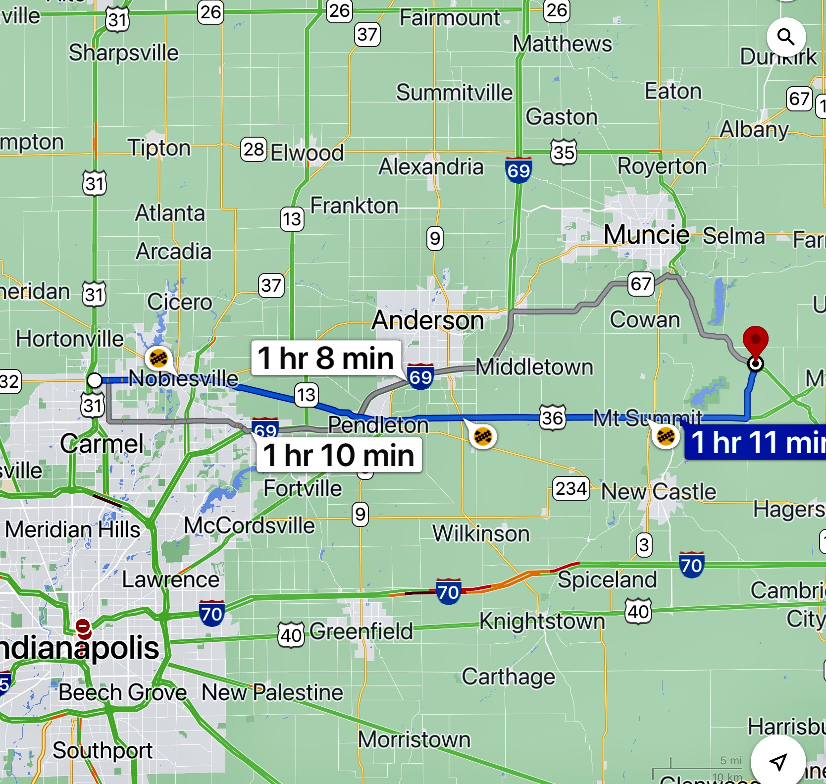
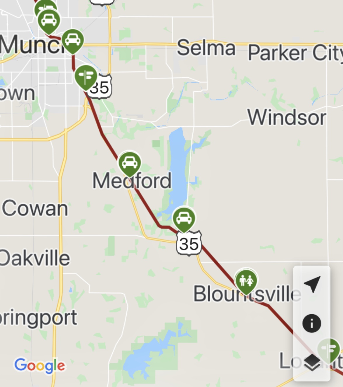
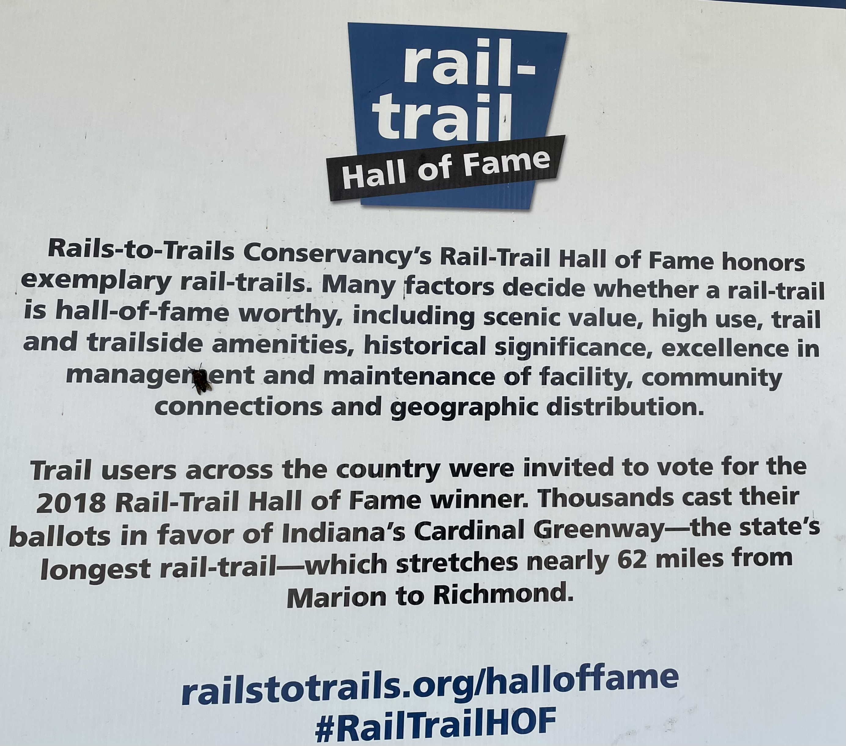
After getting up, catching up on news, mail, and social media, and having a good breakfast (complimentary Hampton Inn), we drove about 60 miles east to Blountsville, Indiana, to cycle the Rail Trail Hall of Fame Cardinal Greenway. Driving along the countryside, I casually mentioned that if we see a round barn, I wanted to stop and make a photograph. We obviously didn’t see one along the rural road.
Westfield east to Blountsville
The Cardinal Greenway is the longest rail-trail in Indiana and spans 62 miles from Marion through Muncie to Richmond in East Central Indiana, with a road section from Gaston to Jonesboro that is approximately an additional 15 miles. The greenway was designated a National Recreational Trail in June 2003, and in 2018 was named to the Rails-to-Trails Conservancy’s “Rail Trail Hall of Fame.” It had been a goal of mine to ride the Greenway since having seen it named to the Rail Trail HOF. The ride today was from Blountsville to Muncie.
Blountsville north to Muncie
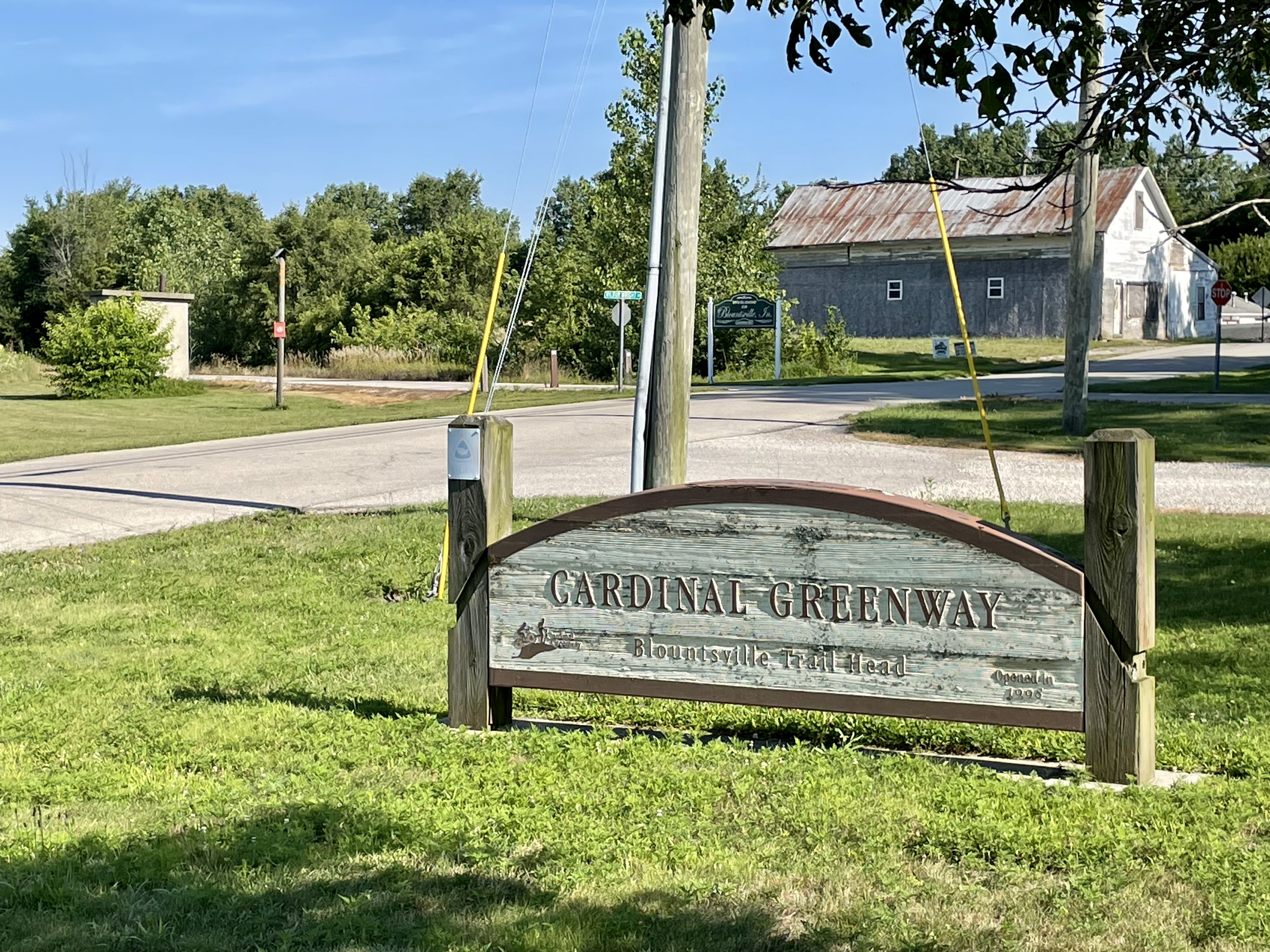
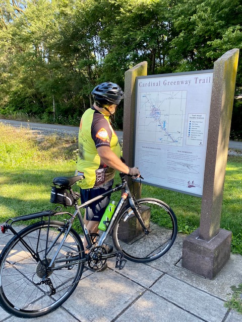
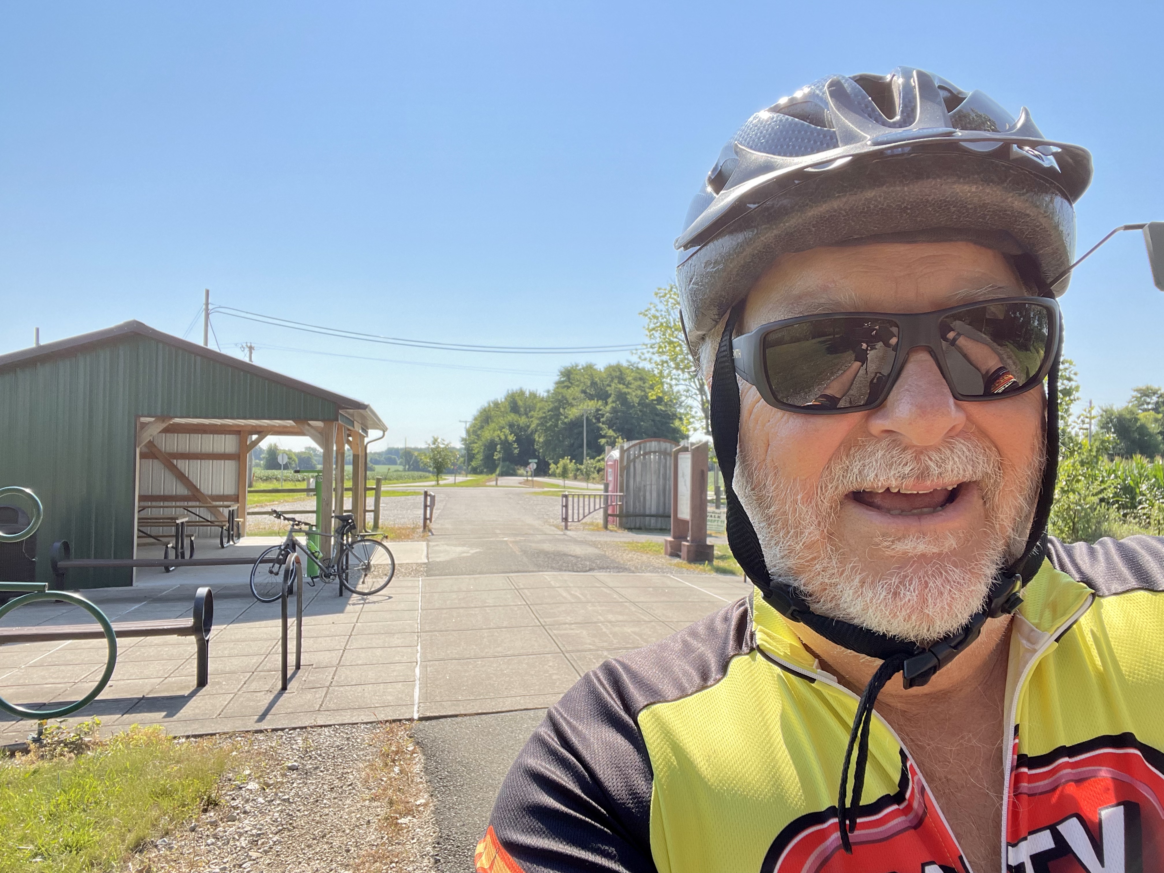
Kay dropped me off at the Blountsville trailhead.
Blountsville trailhead
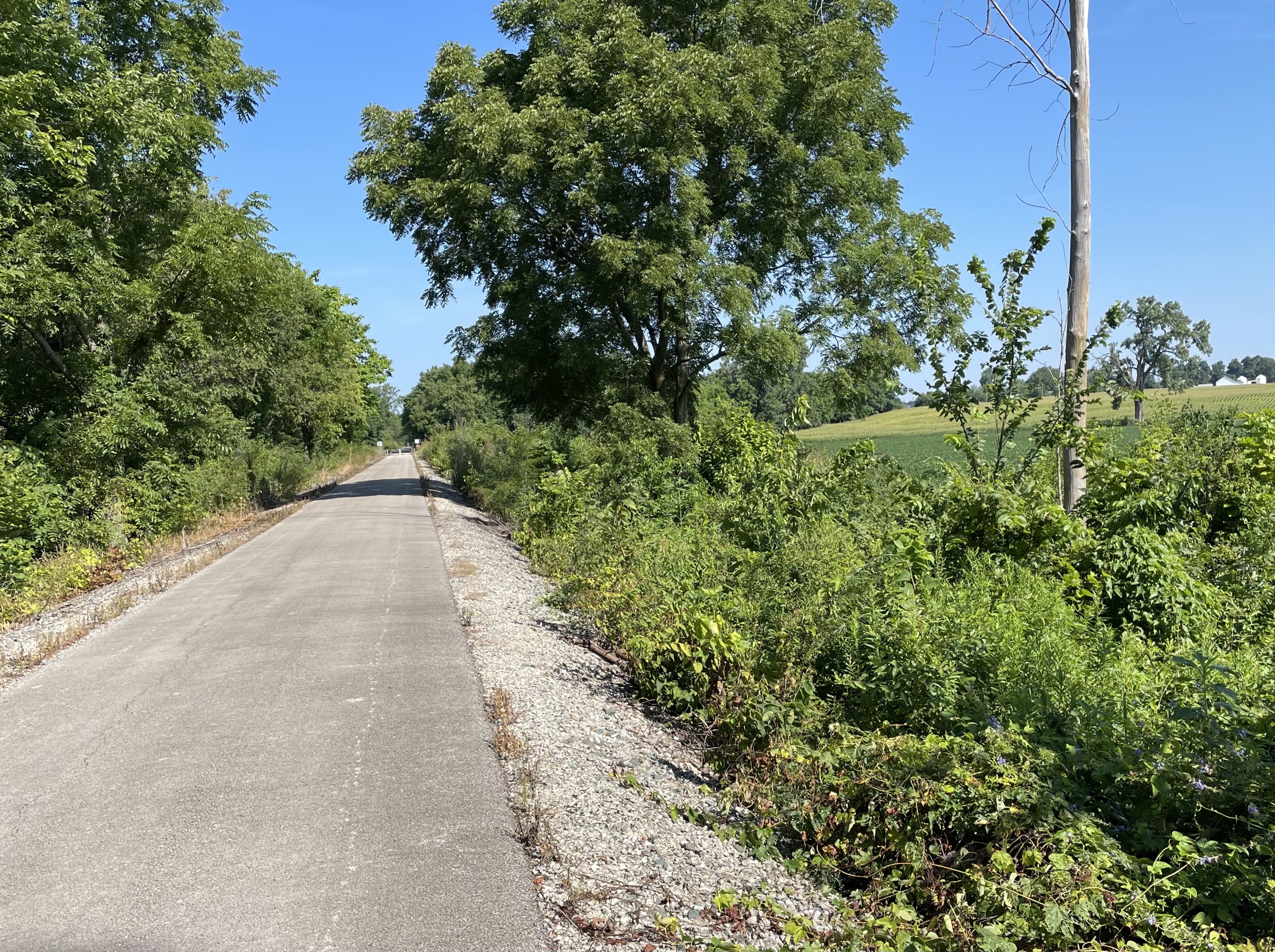
From there I pedaled south, before Kay texted that I was going the wrong direction! After turning around, the old TREK FX6 headed north. Agriculture land, primarily for row crops, could be found adjacent to the trail for most of the lower portion.
And, even a round barn came into view; is that weird or what! We would see it again on the drive out.
The asphalt trail was easy to ride, but for me, at least, did not have any distinguishing features— tunnels, waterfalls, unusual adjacent scenery, viaducts, etc.—that would warrant it being named a Hall of Fame trail. Of course, I did not ride the portion through Muncie.
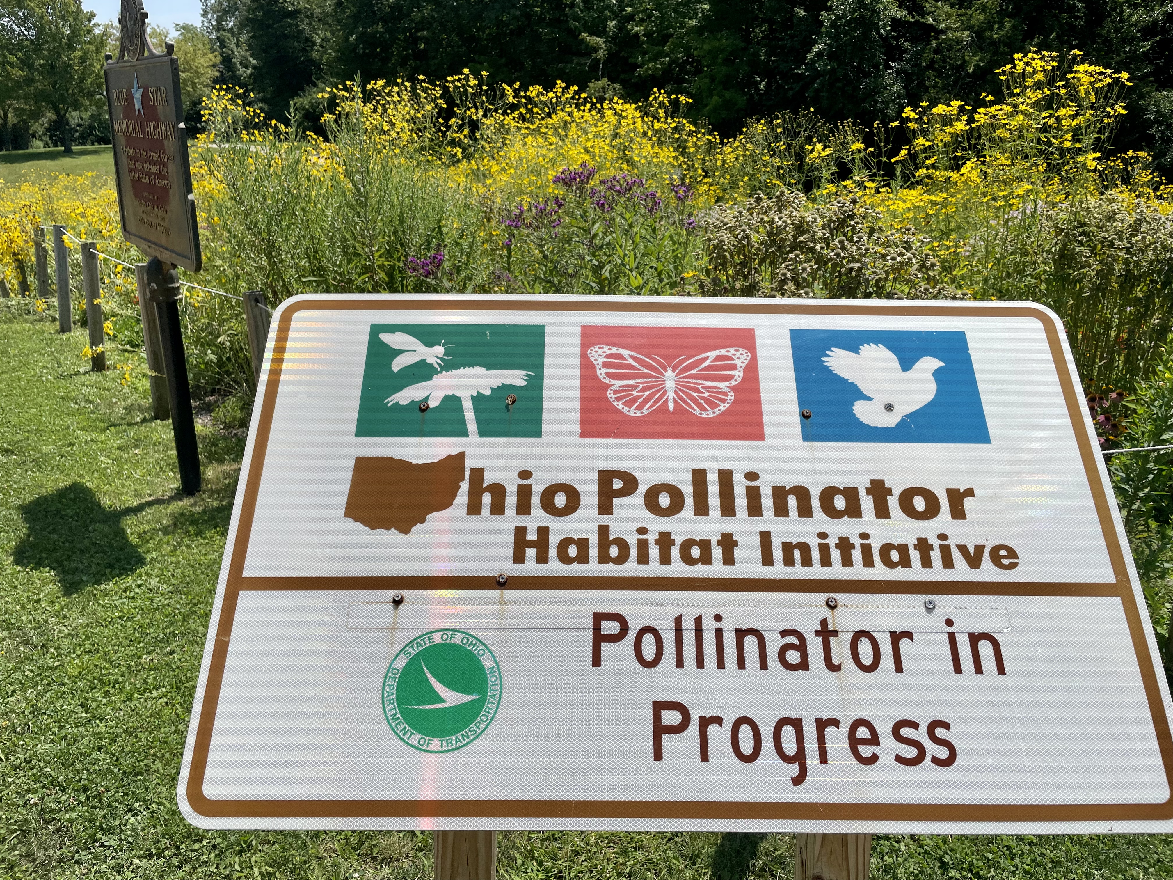
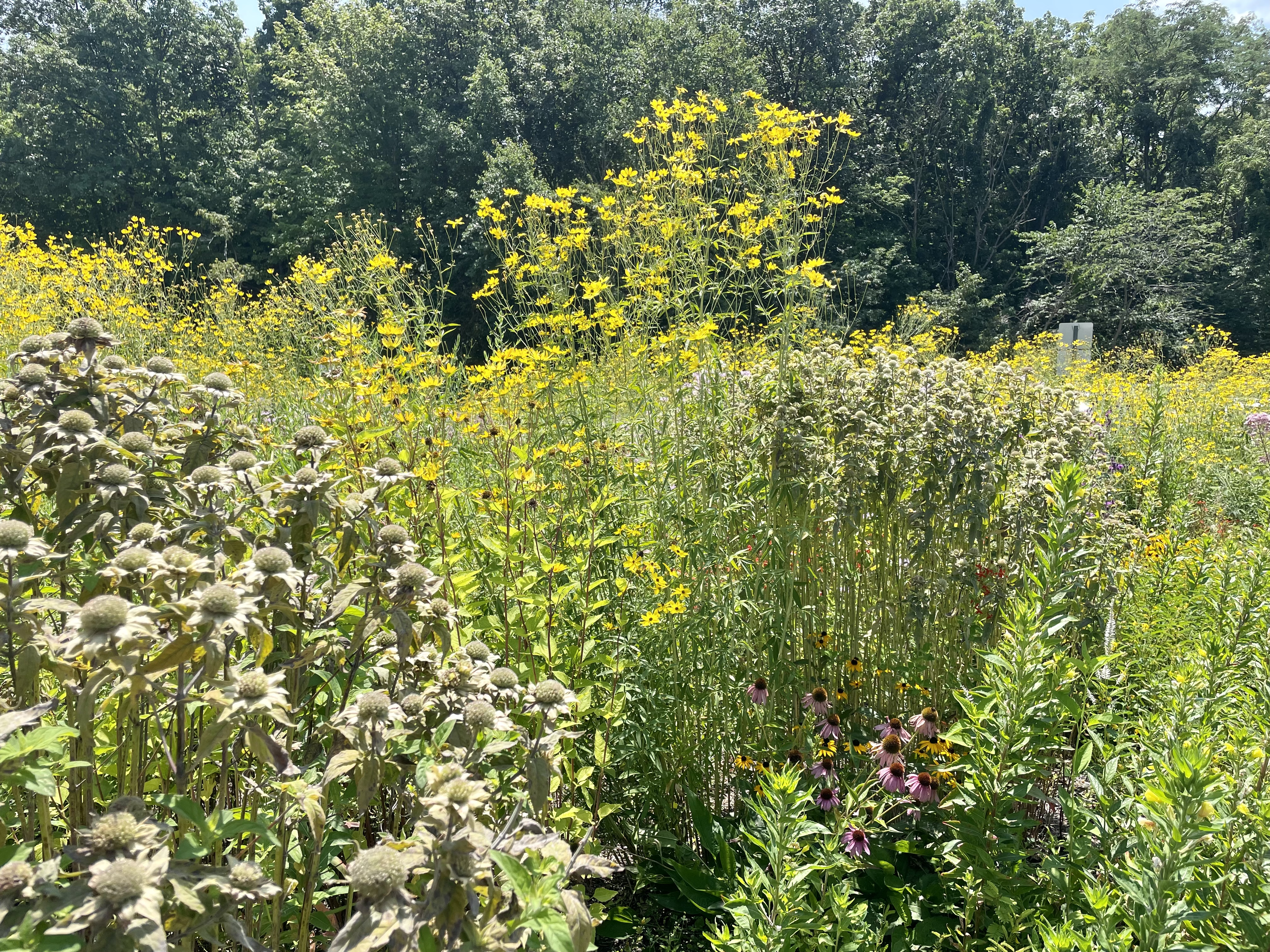
Kay met me in Muncie, I changed out of cycling clothes, stowed the bicycle, and drove towards Franklin, Ohio. At one of our rest stops, a pollinator garden had been planted and bees, butterflies, and birds were numerous.
We arrived at our hotel in Franklin where we overnighted after some 370 miles.
Collection of trails and greenway quotes, terms, acronyms, tools as well as trail publications and presentations and 100s of photos from my bicycle and hiking adventures. .
This journal was begun several years ago, and reflects an accurate record of each day fished. Please enjoy it, and remember that fish are too valuable to be caught just once, and the places they live are too valuable to be mistreated.