
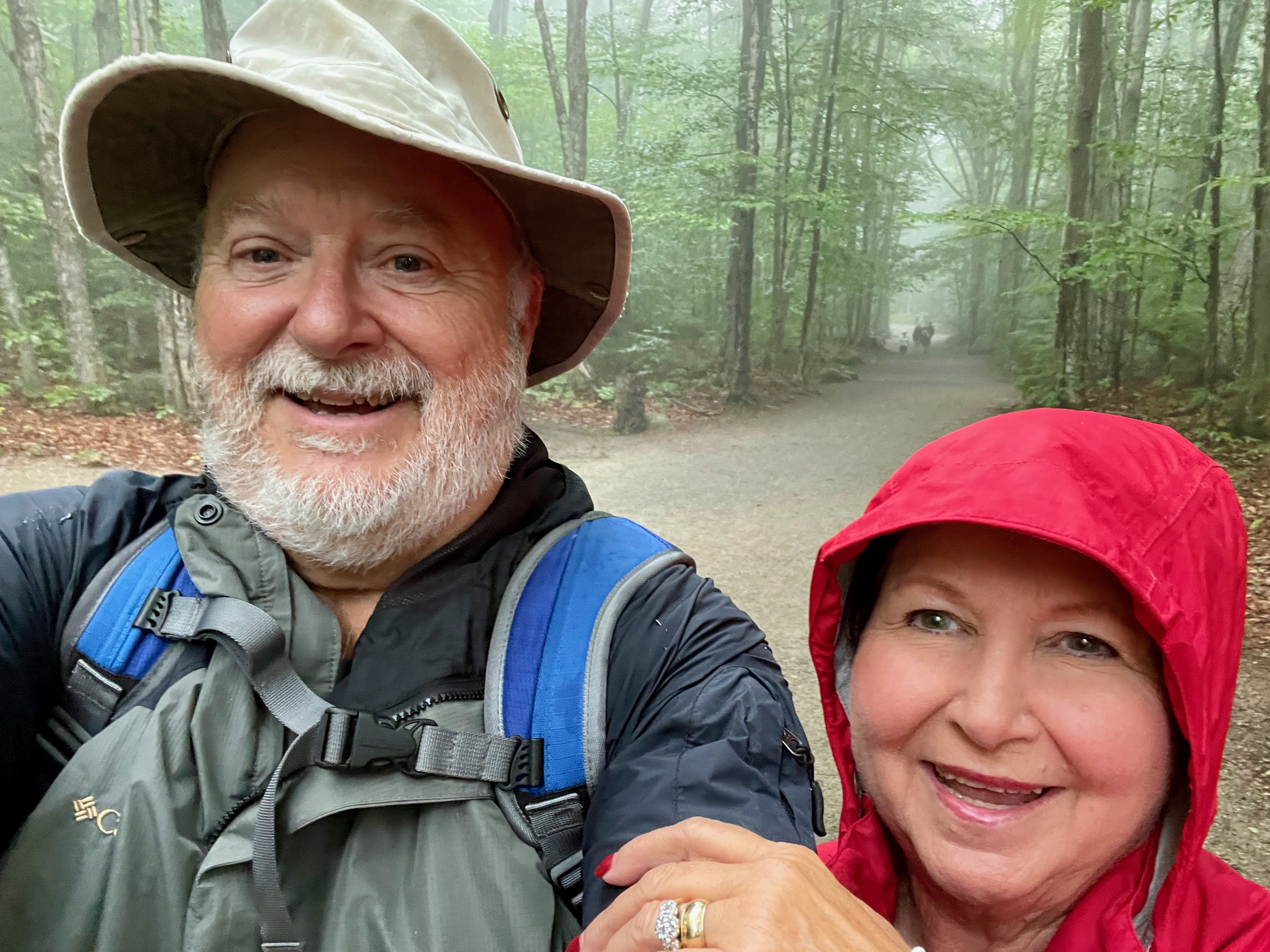
Despite overcast skies and occasional rain, we hiked Flume Gorge Trail in Franconia Notch State Park near Lincoln, NH.
According to New Hampshire State Parks the Flume is a natural gorge extending 800 feet at the base of Mount Liberty. The walls of Conway granite rise to a height of 70 to 90 feet and are 12 to 20 feet apart. The Flume was discovered in 1808 by 93-year-old “Aunt” Jess Guernsey when she accidentally came upon it while fishing. She had trouble convincing her family of the marvelous discovery, but eventually persuaded others to come and see for themselves. At that time, a huge egg-shaped boulder hung suspended between the walls. The rock was 10 feet high and 12 feet long. A heavy rainstorm in June of 1883 started a landslide that swept the boulder from its place. It has never been found. The same storm deepened the gorge and formed Avalanche Falls.
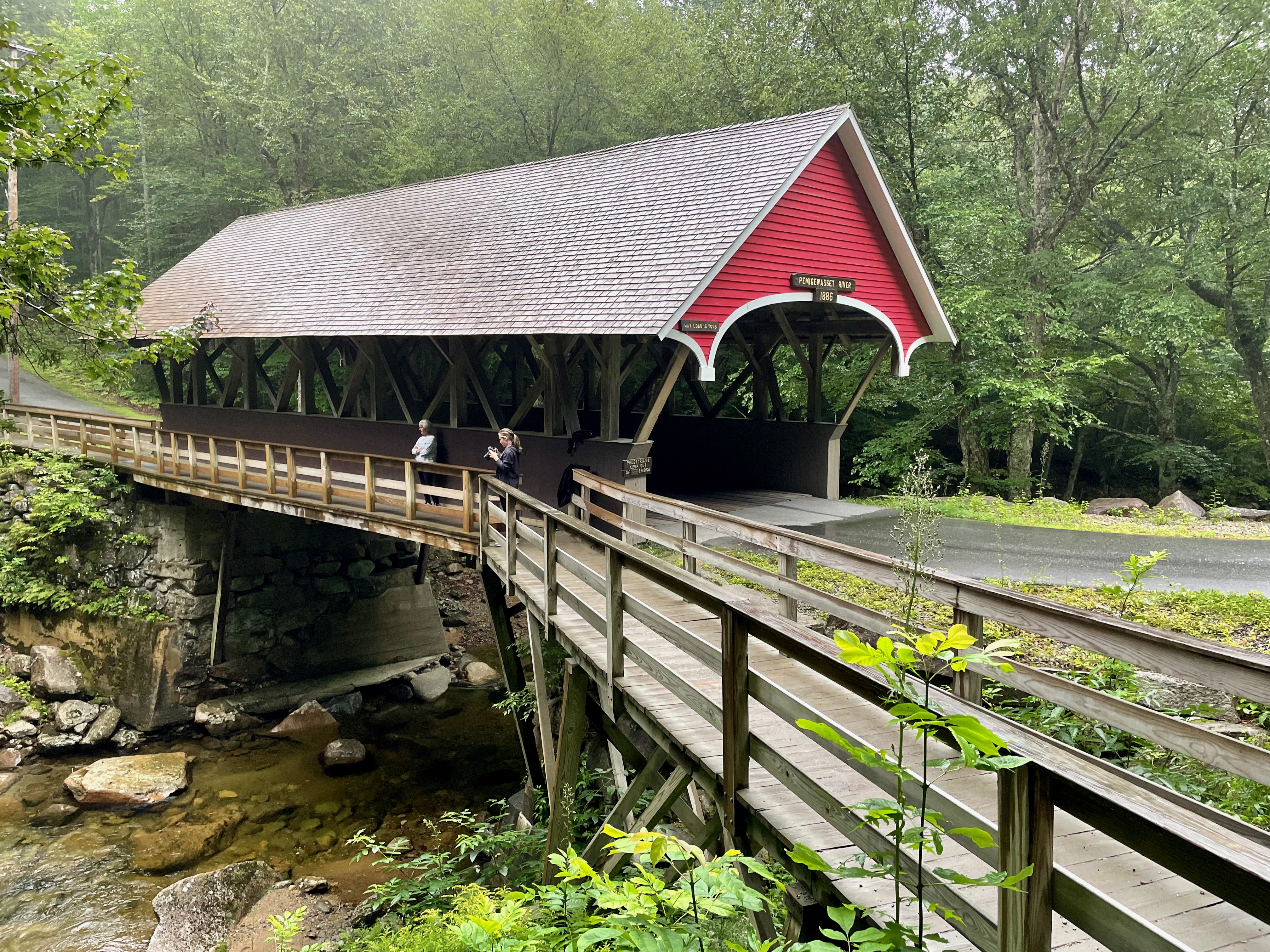
The Flume Trail is a one-way, 2-mile loop, and those hiking it must complete the full 2-mile loop in one direction. Interestingly, reservations and payment ($18 per person) have to be made online before experiencing the Flume Gorge. Just after beginning the hike, the picturesque covered bridge, Flume Covered Bridge, comes into view; it is one of the oldest in the state. It was built in the 1886 and has been restored several times. Such bridges were often called “kissing bridges” because of the darkness and privacy they provided. This bridge was built across the scenic Pemigewasset River. Pemigewasset means “swift or rapid current” in the Abenaki Indian language.

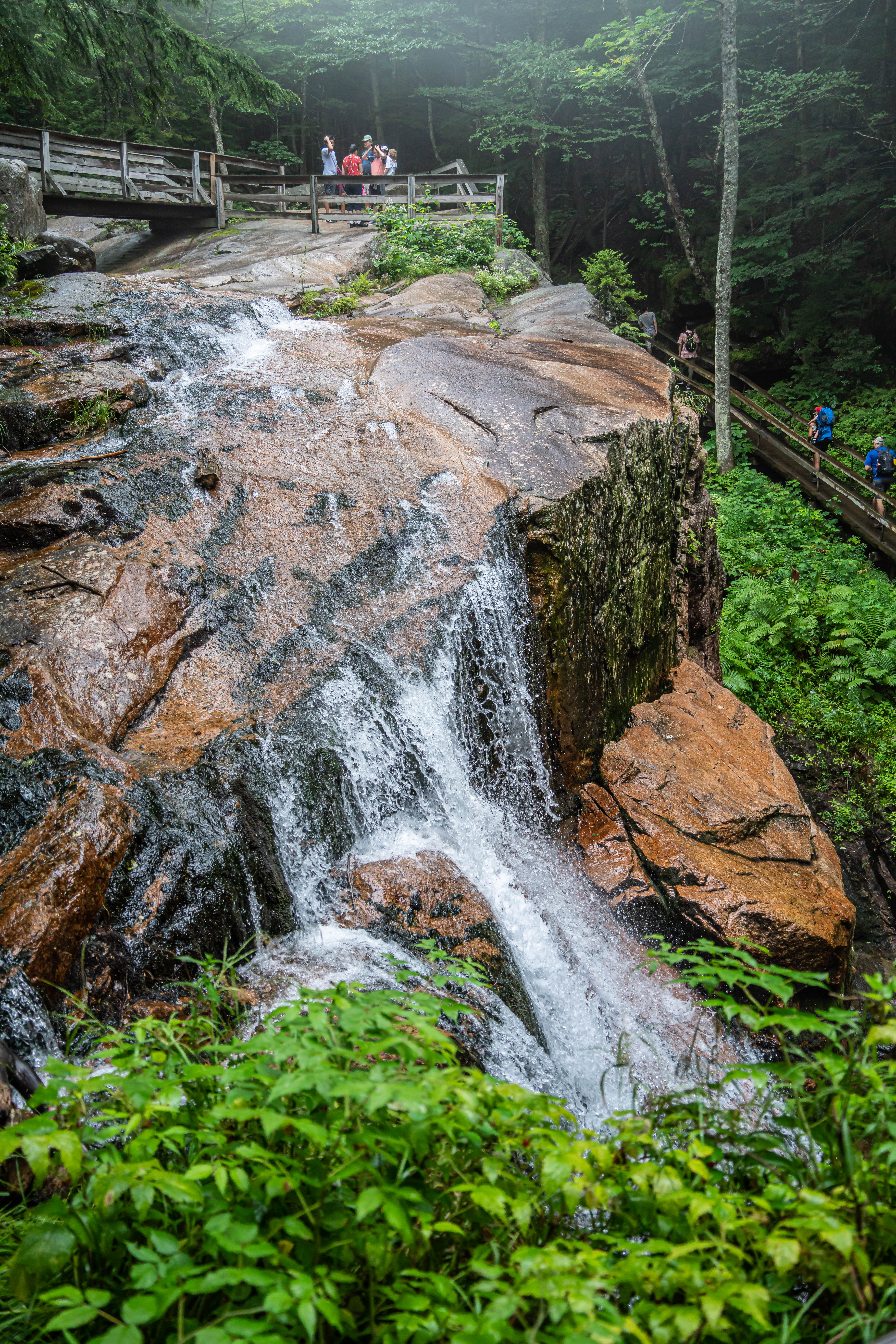
Further along the trail, we entered the actual flume, with uphill walking and lots of stairs, and huge crowds of people, including many families with young kids.


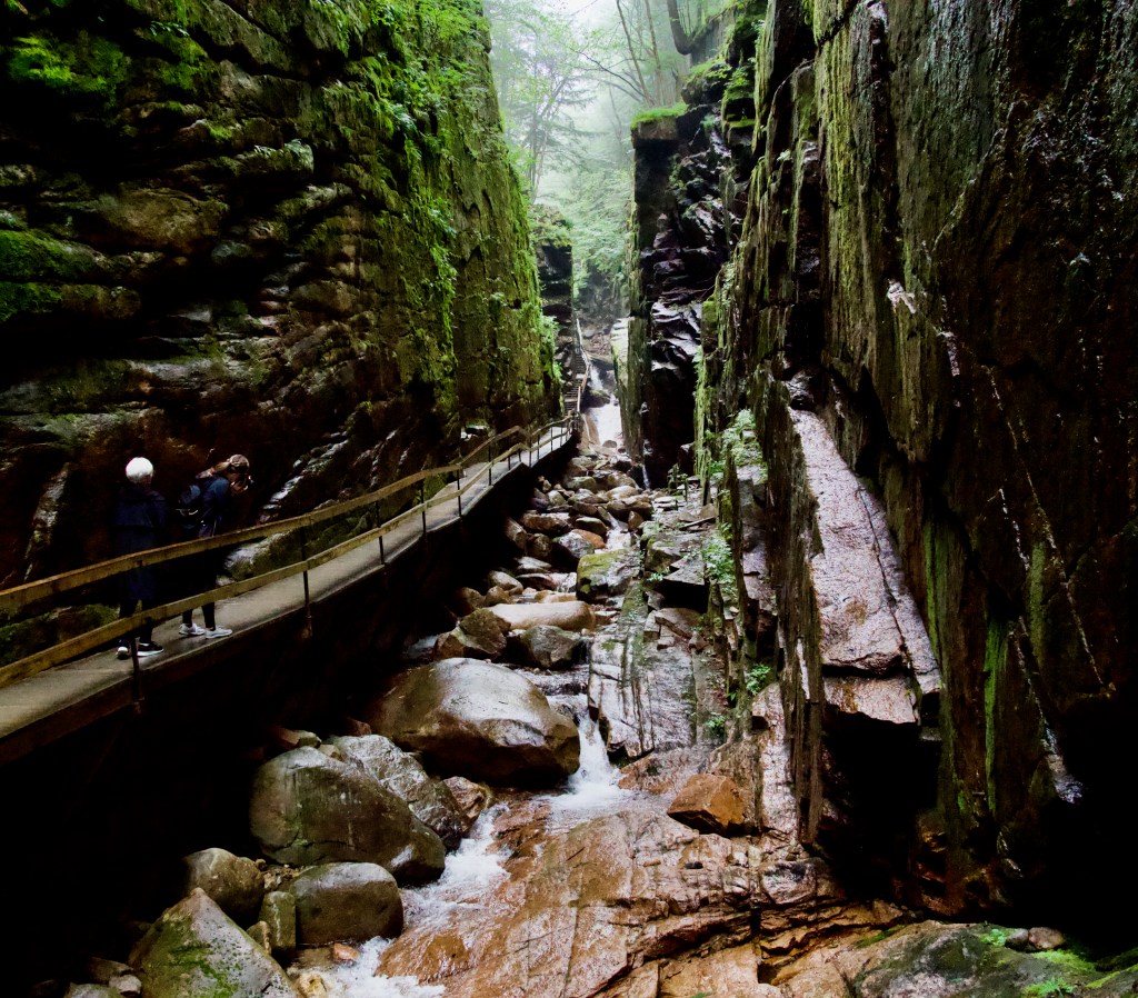
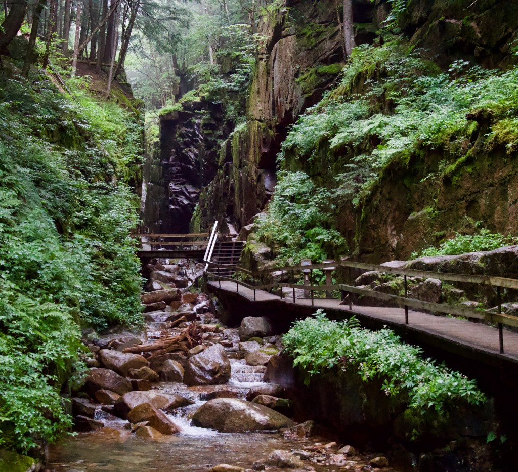
At the top of the Flume we came upon Avalanche Falls. The 45-foot waterfall creates a roaring sound as the Flume Brook enters the gorge. The falls were formed during the great storm of 1883, which washed away the hanging boulder described above.
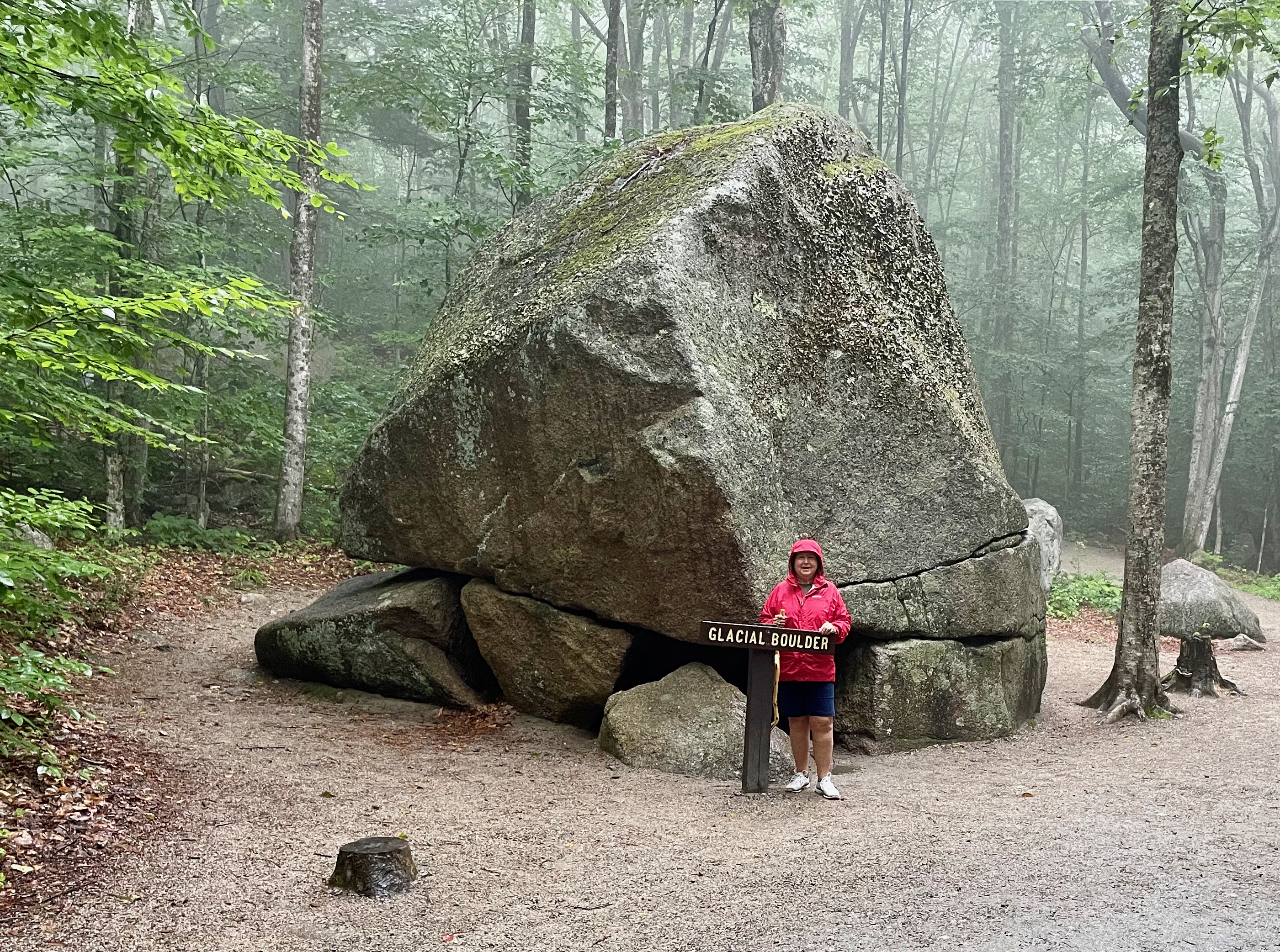
As we walked through this area, many isolated boulders were lying beside the trail; many had roots of trees encapsulating them. Some were quite large, and all were rounded. As glaciers from historic times retreated, these boulders were left behind; they are called glacial erratics.

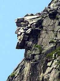
Following the Flume Gorge hike, we drove to a nearby trailhead and hiked a short trail to view Profile Lake and Old Man Historic Site. The Old Man of the Mountain, also called the Great Stone Face and the Profile, was a series of five granite cliff ledges on Canon Mountain in the White Mountains of New Hampshire, that appeared to be the jagged profile of a human face when viewed from the north. The rock formation is 1,200 feet above Profile Lake, was 40 feet tall and 25 feet wide. The first recorded mention of the Old Man was in 1805. It collapsed on May 3, 2003
After that short hike it was time for a late afternoon nap.

Enjoying your travels so much. This is best stop so far to me. We did do that gorge in 2003, but don’t think we paid. This is going to make me get my photos back out. I think we did Robert frost home that day also. I suggest you go to Barre Vermont to see the granite quarry and tour the cemetery. Photographers delight. Keep having fun!