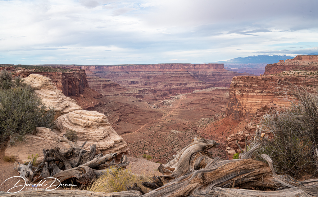
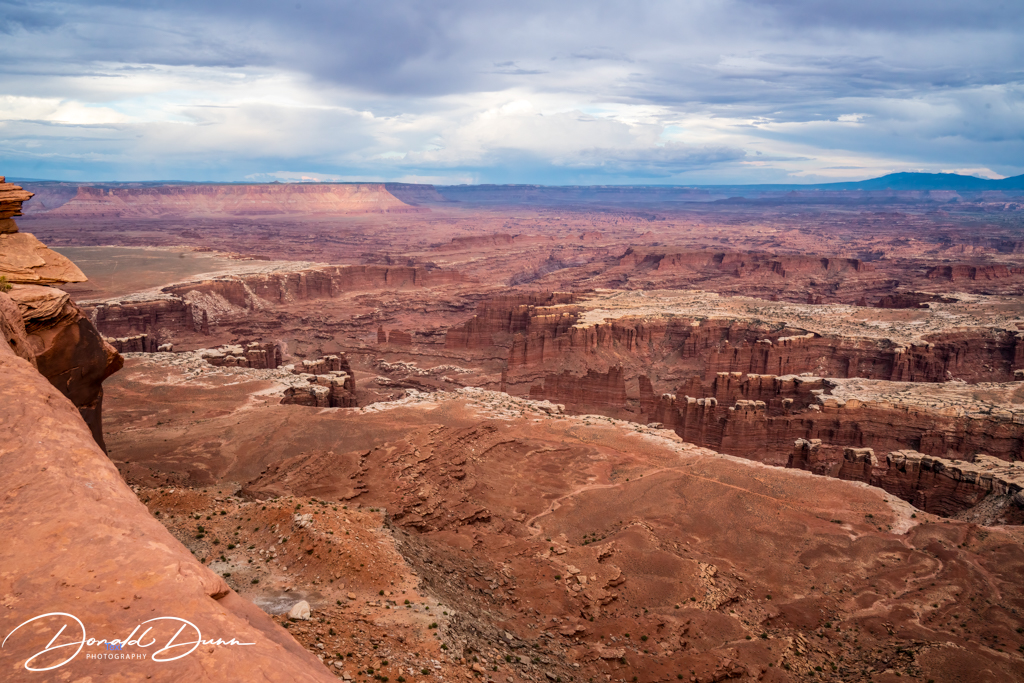
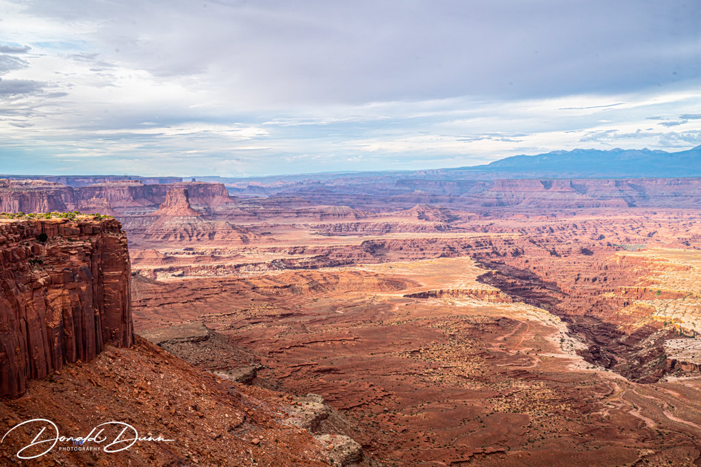
After checking into our motel and grabbing a “take away” bite to eat, we drove north to the Island in the Sky District of Canyonlands National Park. I visited there briefly in the mid 1970s, but did not take enough time to smell the roses or take many photographs; Kay had never been there. At Grand View Point Overlook, the majesty of the canyons spread to the horizon. Grand View Point is the southern-most spot on Canyonland’s high mesa, the Island in the Sky. This whole area of the mesa has a 1,000 foot vertical wall, and the trails go right up to the edge—just a little gust of wind, and camera equipment and photographer are over the edge! Laid out below the Grand View Point is a complex network of canyons carved by the converging Colorado and Green Rivers.
Canyonlands NP, from Grand View Point Overlook Canyonlands NP, from Grand View Point OverlookCanyonlands NP, from Grand View Point Overlook Canyonlands NP, from Grand View Point Overlook
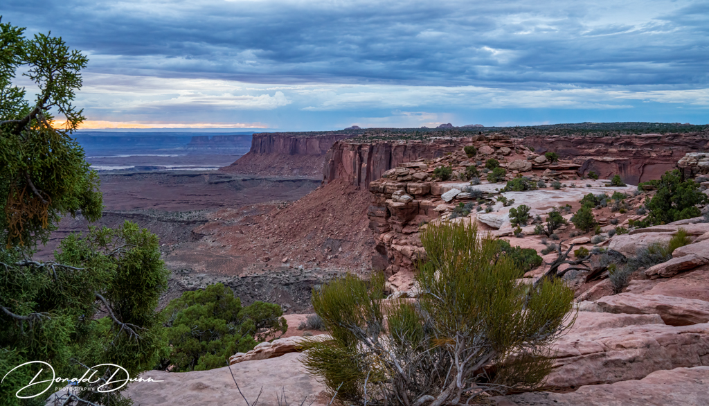
From Grand View Point, we began chasing the sunset despite very cloudy conditions. Our final stop was at Orange Cliffs Overlook, but we were unable to see the sunset.
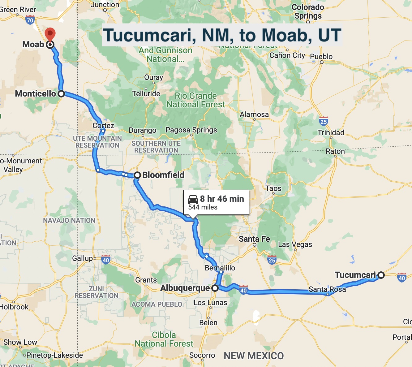
We were awake early, having switched time zones when crossing into New Mexico. We brought coffee beans, grinder, and French press from home, making a great home brew for the road. After stowing overnight items, we continued west from Tucumcari on I-40. At Albuquerque we left the interstate in favor of US Highway 550 northwest to Bloomfield, New Mexico, where we stopped for a picnic lunch on the banks of the San Juan River. From there, it was off through Farmington to Shiprock, New Mexico, where we stopped briefly for photographs. Shiprock is a monadnock rising nearly 1,583 feet above the high-desert plain of the Navajo Nation in San Juan County, New Mexico. Its peak elevation is 7,177 feet above sea level. Shiprock is a point of interest for rock climbers and photographers and has been featured in several film productions and novels. It is the most prominent landmark in northwestern New Mexico. In 1975, Shiprock was designated as a National Natural Landmark by the National Park Service.
Shiprock National Natural Landmark
From Shiprock we traveled northwest, crossing into Colorado, and then north and west into Utah. Driving northward through Monticello, Utah, the topography and scenery changed dramatically with the appearance of numerous monoliths such as Church Rock. Church Rock is a three-tiered solitary column of sandstone in southern Utah along the eastern side of US Route 191 north of Monticello. There is a 16 by 24 foot opening chiseled slightly into the rock. Interestingly, we were in a traffic stop there as the highway had just opened after being temporarily closed due to flash flooding.
Church Rock
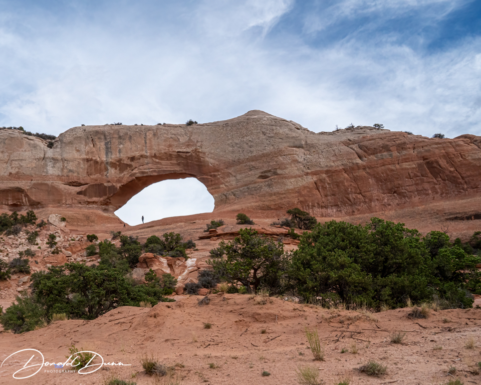
After the brief delay and just past Church Rock, Wilson’s Arch appeared roadside east. The “structure” is a natural sandstone arch just off US Route 191, some 24 miles south of Moab. It has a span of 91 feet and height of 46 feet. The elevation of Wilson’s Arch is about 6,150 feet.
Traveling further northward, we stopped in Moab, our terminal destination for a couple of days before proceeding to our ultimate destination.
Collection of trails and greenway quotes, terms, acronyms, tools as well as trail publications and presentations and 100s of photos from my bicycle and hiking adventures. .
This journal was begun several years ago, and reflects an accurate record of each day fished. Please enjoy it, and remember that fish are too valuable to be caught just once, and the places they live are too valuable to be mistreated.